Appendix
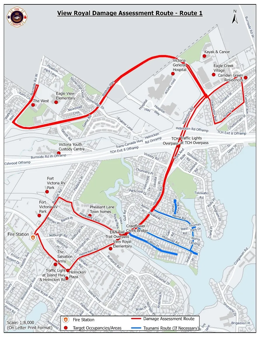
View Royal Damage Assessment Route - Route 1
December 14, 2021Page 351 section
Map illustrating the designated Route 1 for damage assessment and tsunami evacuation within the Town of View Royal.
Route 1Designated Tsunami RouteTarget assessment areas identified
Report to Committee of the Whole
Re: CAO Update
Meeting Date: December 14, 2021
RECOMMENDATION:
THAT the report dated December 9, 2021 from the Chief Administrative Officer titled “CAO Update” be received for information.
SUBMITTED BY:
K. Anema, Chief Administrative Officer
Page 35
Extracted from: 2021 12 14 Committee of the Whole Agenda - Agenda - Pdf