VICTORIA CITY PARKS SIGNAGE
Technical guidelines and design standards for park signage from the City of Victoria, serving as a primary reference for the View Royal strategy.
VICTORIA CITY PARKS SIGNAGE
Addendum to City of Victoria Wayfinding Strategy December 17, 2018

PUBLISHING INFORMATION
Title: Victoria City Parks Signage Guidelines Author: Status: Publishing Date: December 17, 2018 Disclaimer: This Guideline may be subject to periodic updates and amendments. Please contact the City of Victoria Planning and Development Department for up to date information. Additional Copies: The City of Victoria Sustainable Planning and Community Development Department Victoria City Hall, 2nd Floor T 250.361.0382 Electronic versions (in PDF format) available on the City of Victoria website at www.victoria.ca/
ACKNOWLEDGEMENTS
This document was created by and for City of Victoria in association with:
PUBLIC: ARCHITECTURE + COMMUNICATION WAYFINDING DESIGN SPECIALISTS
CONTENTS.
01 ABOUT THIS PROJECT ......................................................................................2 1.1 What is this Document?.................................................................................. 2 1.2 Additional References.................................................................................... 2
02 SIGNAGE IN PUBLIC PARKS ..............................................................................4 2.1 Key Differences............................................................................................... 5 2.2 Regulatory Signs..............................................................................................6 2.3 Wayfinding........................................................................................................ 7 2.4 Interpretive Signs ............................................................................................8 2.5 Maps..................................................................................................................9
03 CITY PARK SIGN SYSTEM................................................................................ 10 3.1 Typography..................................................................................................... 12 3.2 Colours & Finishes.......................................................................................... 13 3.3 Sign Types........................................................................................................14 3.4 Park Identification Sign..................................................................................16 3.5 Directory Sign ................................................................................................ 20 3.6 Directional/Regulatory Post........................................................................ 24 3.7 Regulatory Marker Post ...............................................................................28 3.8 Interpretive Signs .......................................................................................... 32 3.9 City Wayfinding Sign Types .........................................................................36
04 MAPS...............................................................................................................38 4.1 Map Styles......................................................................................................40 4.2 City Park Map Elements ............................................................................... 42
01 ABOUT THIS PROJECT
1.1 What is this document?
This document functions as an addendum to the City of Victoria Wayfinding Strategy. It describes recommended practices for adapting the city wayfinding strategy and signs to the specific context of public parks.
This document is intended to be used as a reference for anyone working on wayfinding and regulatory signage for display in public parks within the City of Victoria.
Sign construction drawings are provided to a level of detail that should allow City Works and associated consultants to produce signs to a consistent appearance and hierarchy of information.
1.2 Additional References
The following guidelines are intended to be understood within the context of the Citywide Wayfinding Strategy and other existing regional signage standards.
A number of standards exist which will apply to signs that may be used in public parks within the City of Victoria. It is important to understand the context for each sign to determine what standards are most applicable in a given situation. The following documents should be referred to for standards beyond the sign types described in this manual:
Standards for traffic management as determined by the Ministry of Transportation and Infrastructure will take priority wherever applicable. These may be under the heading “Traffic Signs & Pavement Marking” at www2.gov.bc.ca.
This document refers to and extends the “City of Victoria Wayfinding Strategy”. Where that system has been adjusted for use in City Parks this document will take priority. For general information about the construction and messaging hierarchy of signs within that system refer to the Citywide Wayfinding document: www.victoria.ca/
02 SIGNAGE IN PUBLIC PARKS
2.1 Key Differences
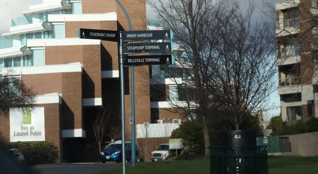

Introduction
The City Wide Wayfinding Strategy considers a visitor’s journey through the city and the factors which determine the quality of that journey. Within that system, city parks are considered a single destination. However, when a visitor arrives in a park there is a mental shift from the pathways and barriers defined by sidewalks and streets, to an open field of options and amenities. In most cases the majority of a park, if not all of it, is visible from any point in the park. Therefore, presenting regulatory information and identifying amenities in a clear and welcoming fashion is a more common concern than directional wayfinding. These guidelines focus on presenting a hierarchy of regulatory messaging which can be absorbed at a glance with space for more detailed information as needed. Where additional wayfinding is required, guidelines for adapting the City Wayfinding Strategy to city parks are discussed.
What we heard
The consensus among stakeholders is that main arrival points are the most critical areas for wayfinding and regulatory signage in most parks. For small and medium size parks, regulatory/directional signs should be designed to also function as Park ID signs. Current Park ID signs are over-built for this purpose with a lot of unused space. Small parks in particular need not be identified with signage intended to be legible to passing traffic.
Beacon Hill, Topaz Park and select medium sized parks, would benefit from maps posted at arrival points and to delineate on-leash, off-leash, and off limits areas for dog owners. Additional map styles for showing topography, pathways, lightly and densely forested areas will be required for these maps. In addition, styles for dog-off-leash and ecologically sensitive areas will be required in some cases. First Nations place naming should be included in key elements of the park signage as it is within the Citywide Wayfinding Strategy.
2.2 Regulatory Signs
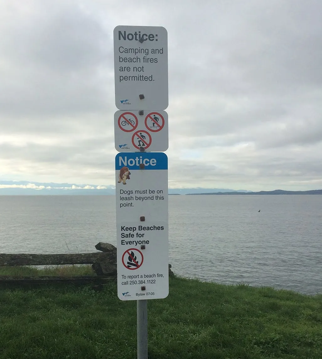
What we Heard
Regulatory signage in city parks is intended to provide information about how best to enjoy the park respectfully and to notify visitors about any particular restrictions to the use of the space. These signs are often installed on an as-needed basis, and those needs are often subject to change as social expectations evolve over time. The effectiveness of any particular messaging can be difficult to assess and more than one iteration may be required to produce the desired change in behaviour.
What We Saw
The majority of regulatory signage is concentrated at key arrival points such as parking lots or major pathways. The remainder is typically site specific indicating, for instance, on and off-leash areas for dogs or marking ecologically sensitive areas. While new signage follows some guidelines for appearance and layout, the end result lacks a clear visual hierarchy and can appear visually confusing. In some cases the amount of information may interfere with a visitor’s ability to absorb it accurately.
Some signs, are very profusely displayed (CRD No-Smoking signs, for instance) or seem to have become unsuited to their location as the environment around them has been updated.
Proposal
Create a modular sign type that allows for simple metal plates to be added and removed as needed. The sign frame may involve some custom fabricated or extruded components, but will allow for city works to easily produce and install new signs and remove any existing ones that become outdated.
Develop a visual hierarchy that can be consistently applied to the both the modular sign panels and individual signs posted throughout city parks in order to create a predictable, legible and recognizable appearance for signs in parks. Non, park-specific signage, such as parking signs and other traffic regulations should maintain the same standards as elsewhere in the city.
2.3 Wayfinding
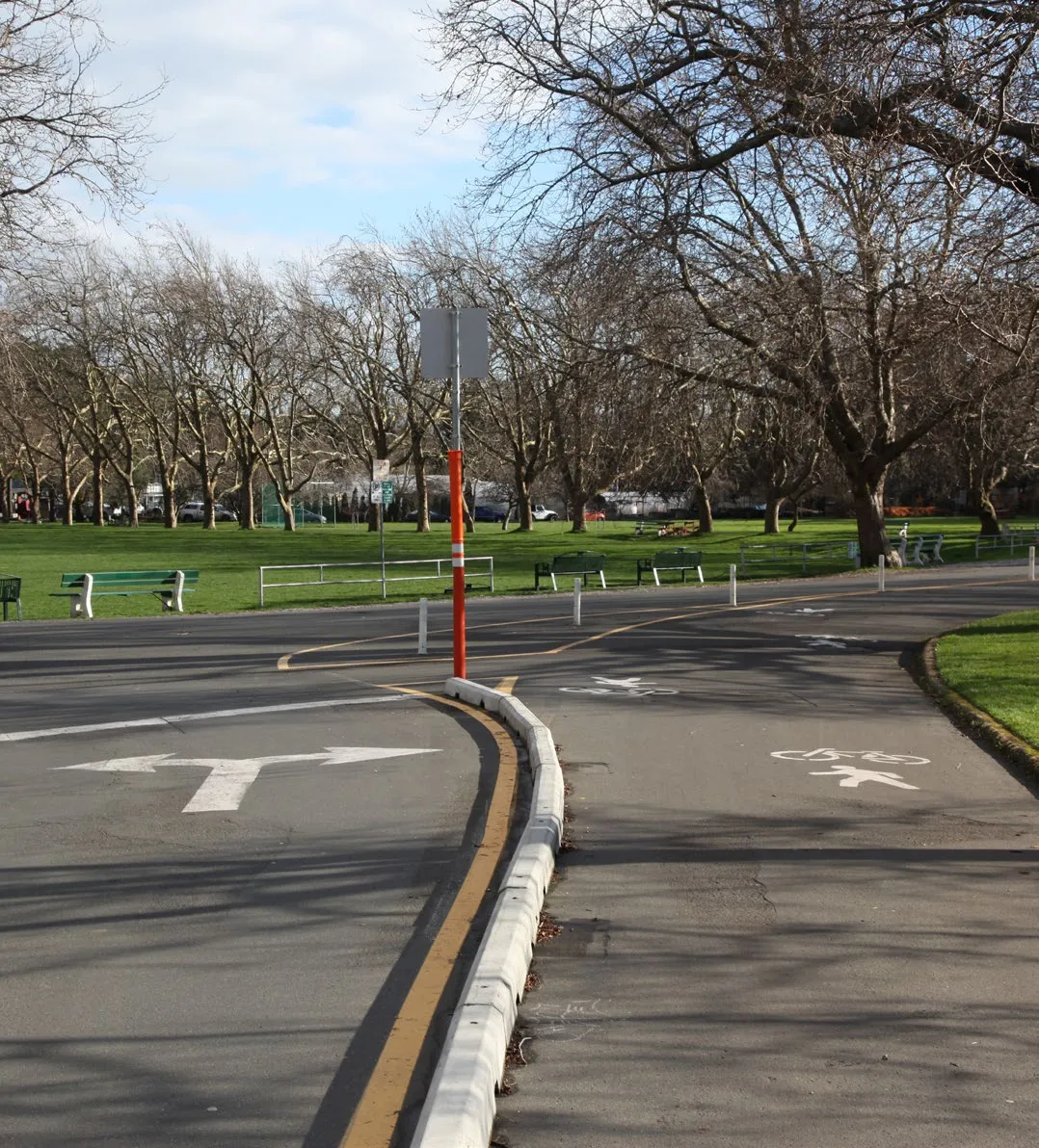
What We Heard
The wayfinding needs within city parks are significantly different from those of the wider city. Whereas wayfinding routes through city streets and pathways aims to create an unbroken chain of directional queues, wayfinding and other signage needs in city parks tend to be clustered around arrival points and 1-3 other key points of interest. To avoid visually interfering with the natural appeal of open parks and green spaces, the aim of wayfinding for city parks will be to identify key points of interest within each park and use those to orient visitors within the space without necessarily trying to guide them every step along the way.
What We Saw
Wayfinding is currently very sparse in city parks, limited primarily to identification of amenities. In general this is appropriate as, with the exception of a few of the larger parks such as Beacon Hill and Topaz Park, all park amenities are often visible from any point in a park. Additional wayfinding could be of use to orient visitors at key points. Some small and medium sized parks are also related to one another via public pathways which pass through multiple parks and green spaces.
Proposal
Maintain a light touch to wayfinding through maps and directional signs at key locations without trying to create an unbroken visual chain of sign locations. This will minimize visual clutter while giving visitors to city parks information to orient themselves within the space from points of interest. The primary recommended tools for wayfinding in parks will be the finger post sign and the fingerboard.
There will be two primary options for park identification signs: One for parks which have significant road access and/or a parking lot, and one for medium and small parks accessed primarily by pedestrians. Some locations may warrant a unique, large format sign such as the ‘Anchor Sign’ for Beacon Hill Park, located at the intersection of Douglas St. and Superior St.
2.4 Interpretive Signs
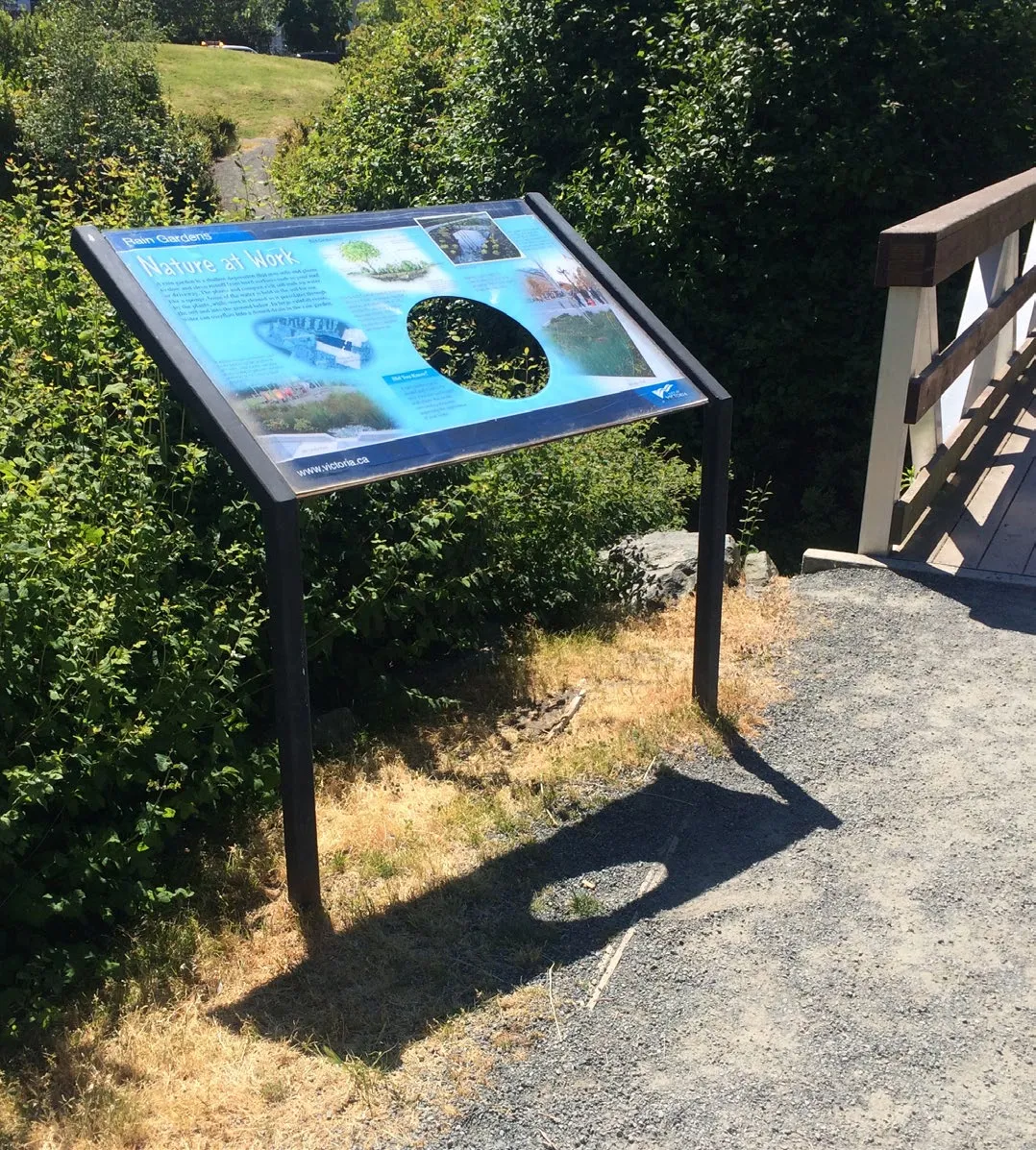
What We Heard
Interpretive signs are a common feature in parks and provide insight into the shared ecological, historical or social narratives of public spaces. While those narratives may remain, both their style of delivery and the media on which they are reproduced tend require maintenance to remain relevant over time. To that end, interpretive sign bases should be designed to easily accommodate standard panels which can be removed and replaced with updated ones as needed.
What We Saw
There are a number of existing examples of interpretive signage in public parks in and around Victoria. Key features of these signs are simplicity and durability. The ability to change sign content without removal of the entire sign or on-sight removal and reapplication of printed vinyl is critical requirement for any new design. Existing precedents seem to indicate that interpretive panels do not invite improper removal and simple tamper resistant fasteners should be enough to prevent such vandalism while greatly simplifying maintenance for city works.
Proposal
Develop a standard sign base, in keeping with the colour and materials of CoV wayfinding, that will allow panels to be installed and removed for maintenance and updates as needed. This design should allow for the production of signs of varying heights and widths without any significant changes in design. Several standard configurations of the sign base will be developed to accommodate existing formats as specified by the City of Victoria’s “Interpretive Signage Guidelines”.
2.5 Maps
What We Heard
Most parks do not require a map to navigate or find amenities within the park, however better park maps would be useful in a number of other ways. Most maps displayed in parks are used to identify off-leash and off-limits areas for dogs. Providing clearer landmark cues on those maps will assist in dog owners in determining where the boundaries of such areas actually fall. In addition, updating existing maps with the Citywide Wayfinding style will further integrate parks with the wider wayfinding strategy.
What we Saw
Topography is a significant factor for parks in a way that it is not when navigating streets and sidewalks. In situations where visual information on maps is not very developed. An open field of whitespace on a map may include trees, pathways or other natural barriers in reality, making such maps difficult to interpret.
Some areas have chains of small and medium parks linked by public walkways. While these parks might not require mapping individually, displaying maps there could connect visitors to local public pathways or nearby amenities within the community.
Proposal
Develop subset of map styles based on CoV wayfinding standards which show park specific details such as relative topography, light and dense woods, pathways, and dog-off-leash or off-limits areas.
Allow for the possibility of displaying City Wayfinding maps on park directory signs that show connections to the wider area around a small or medium sized park.