This site is in beta — data may be incomplete and features are still being added.
Committee of the Whole/Documents/Attachment 1 Site Location Plan
Appendix

Attachment 1 Site Location Plan

December 14, 2021Page 1791 section

A map illustrating the geographic location of the subject properties (167, 169, and 171 Island Highway) relative to Portage Park and surrounding streets.

2. APPROVAL OF AGENDA (motion to approve)
167, 169, 171 Island HighwayPortage ParkEsquimalt Harbour

Attachment 1

Site Location Plan
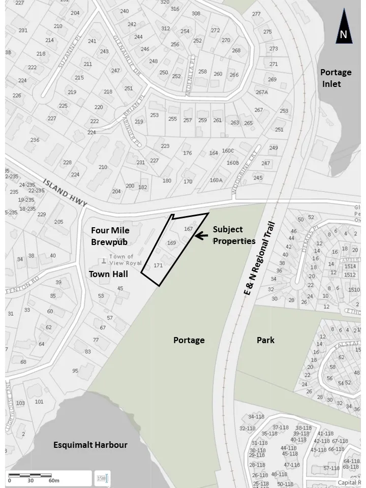
Site location plan map showing subject properties at 167, 169, and 171, located between Island Highway and Portage Park, with nearby landmarks including Four Mile Brewpub, Town of View Royal Town Hall, E & N Regional Trail, Esquimalt Harbour, and Portage Inlet.
Page 179
Extracted from: 2021 12 14 Committee of the Whole Agenda - Agenda - Pdf