Presentation: REZONING 2021/01 - 167, 169, 171 Island Highway
Visual presentation slides summarizing the rezoning application, site changes, development concept, and community amenity contributions for the Island Highway project.
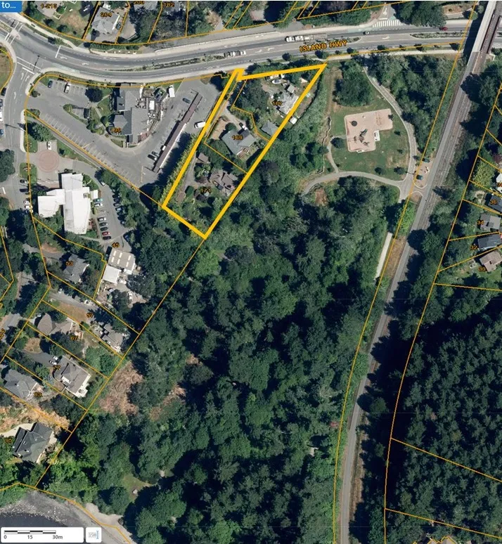
REZONING 2021/01
167, 169, 171 Island Highway
Rezoning from R-1B: Detached Residential (Medium Lot) to a new CD zone to permit apartment residential use
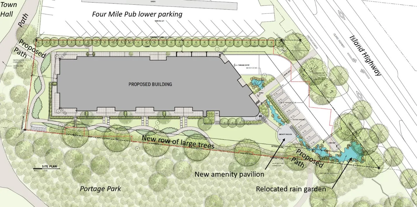
Summary of Site Changes
- Number of units reduced from 86-82
- Increase in number of three-bedroom units from 1 to 3
- New on-site amenity pavilion for residents of the property
- Relocation of rain garden closer to Island Highway
- Visitor spaces increased from six to nine
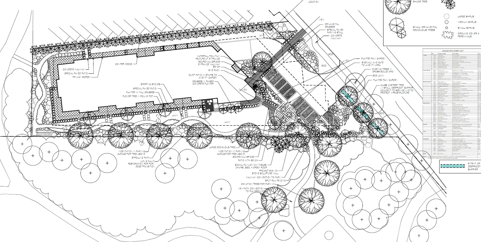
- New row of trees along park boundary
- Two trees in park to be replaced with four new trees
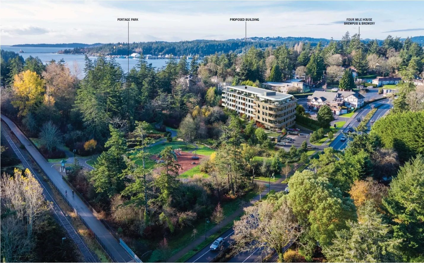
Development Concept (development permit stage)
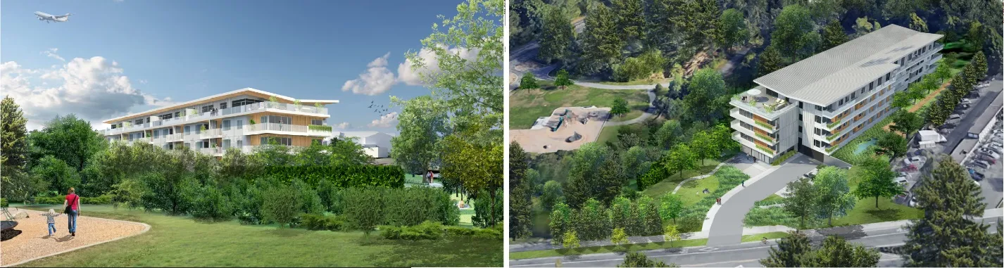
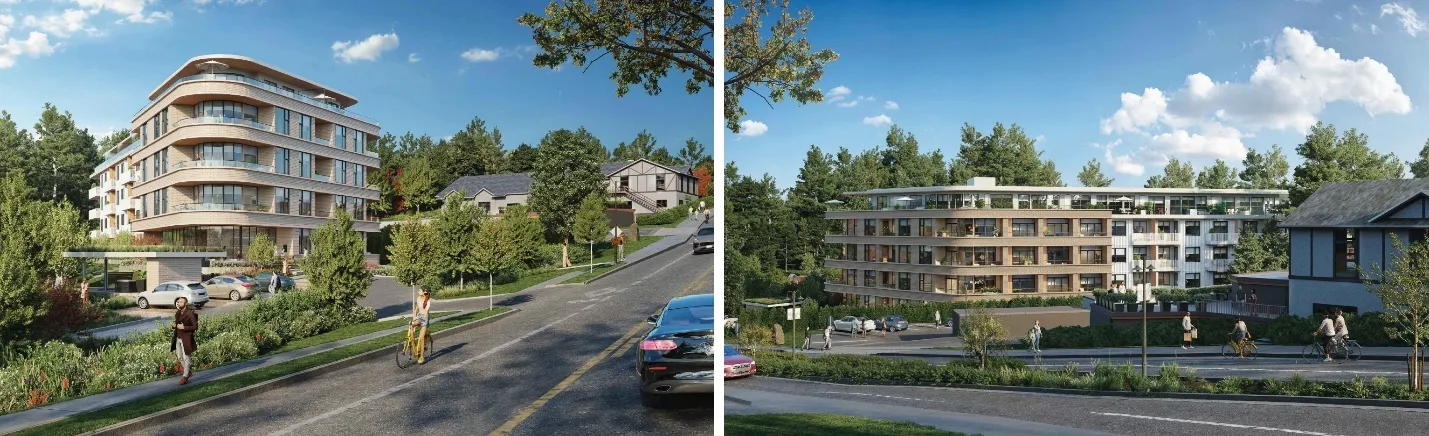
- Five-storey building with the fifth storey set back
- Two levels of underground parking.
- 82 Units
- 65 one-bedroom units
- 14 two-bedroom units
- 3 three-bedroom units
| Lot Size | 3780 m² | Previous |
|---|---|---|
| Floor Area | 5900 m² | |
| Floor Space Ratio | 1.6:1 | 1.54:1 |
| Units/Hectare | 217 | 227.5 |
| Building Height | 17.8 m | 17.7m |
| Storeys | 5 | |
| Site Coverage | 34% | |
| Units Proposed | 86 | 86 |
| Vehicle Parking | 103 (95 required) | 103 (91 required) |
| Secure Bike Parking | 86 (86 required) | 82 (82 required) |
Density
| Development | Address | Units | Lot Area | Units per hectare |
|---|---|---|---|---|
| Current proposal | 167-171 Island Highway | 82 | 0.3780 ha | 217.0 |
| Royalle (DP stage) | 298 Island Highway | 54 | 0.1853 ha | 291.4 |
| Lions Cove | 288/290 Island Highway | 66 | 0.8275 ha | 80.0 |
| Maija London | 280 Island Highway | 37 | 0.1677 ha | 220.6 |
| Skyeview (construction) | 242-244 Island Highway | 37 | 0.1860 ha | 198.9 |
Changes from Initial Submission in Response to July 2021 Council Comments
| Item | July 2021 | September 2021 | Current |
|---|---|---|---|
| Units | 87 | 86 | 82 |
| Floor Space Ratio | 1.6:1 | 1.54:1 | 1.6:1 |
| Parking spaces* | 105 | 102 | 103 |
| Front Yard setback | 7.0m | 18.8m | 18.8m |
| West side yard (pub) | 4.0m | 4.0m | 4.0m |
| East side yard (park) | 4.0m | 8.4m | 8.4m |
| East side yard (park) | New amenity pavilion 4.0m | ||
| Rear yard | 7.5m | 8.6m | 8.6m |
| Rain garden | North of building | South of building | Southeast corner |
Design comment (for Development Permit)
- Stepping back the upper floor of the building reduces the massing and add visuals interest to the roofline.
- Building would not loom over the Four Mile Brewpub building
- uphill and more than 27 metres away.
- The large front yard setback (18 metres) would preserve views to Four Mile Brewpub from Island Highway in both directions.
- Line of cedar trees the shared lot line with Four Mile Brewpub would be removed to accommodate underground parking.
- Replacement with a more extensive hedge of smaller coniferous trees to buffer the development from Four Mile Brewpub and soften the view from Island Highway inbound traffic.
Community Amenity Contribution
- The Community Amenity Contribution Policy target is $4000 per unit.
- $328,000 based on 82 units
- Community amenity contribution provision to be secured in a covenant.
Possible community amenities
- BC Transit: Add second shelter eastbound transit stop on the high volume 14 UVic and 46 Dockyard routes on Island Highway.
Transportation Demand Management Strategy (new)
- To provide more sustainable transportation choices and lessening the burden on the public transportation system
- Not zoning requirements as the current development concept complies with parking standards.
Options to be considered at the development permit stage:
a. Provision of 5-7 e-bikes for a bike share program to reduce residents’ vehicle demands b. Vehicle space to support ride-hailing and home delivery of meals/goods c. Enhanced security for bike storage such as self-contained lockers and video surveillance d. Accommodation for cargo bikes, which are larger than standard bikes
RECOMMENDATION
THAT the December 9, 2021 report from the Senior Planner titled “Rezoning Application 2021/01 – 167, 169, 171 Island Highway” be received for information.
Document Images
(1)