Appendix
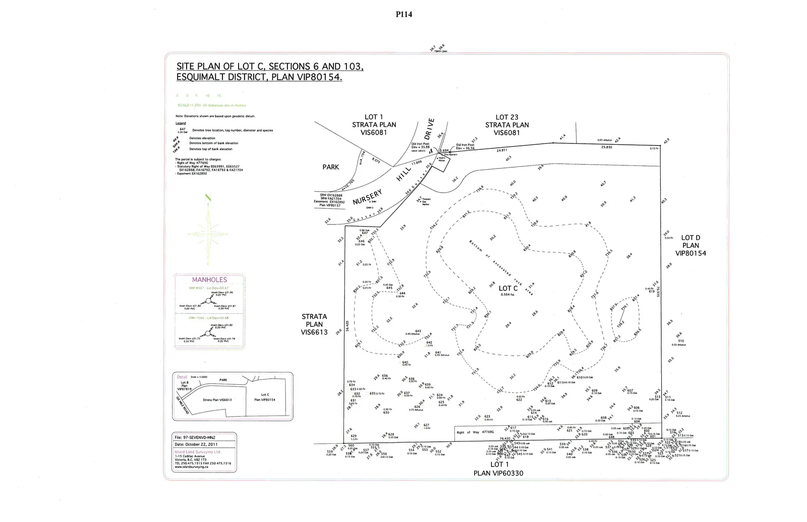
Site Plan of Lot C, Sections 6 and 103, Esquimalt District
June 14, 2016Page 1191 section
Legal site survey showing existing topographic conditions and site boundaries.
October 22, 2011Island Land Surveying Ltd.
SITE PLAN OF LOT C, SECTIONS 6 AND 103, ESQUIMALT DISTRICT, PLAN VIP80154.
SCALE = 1:250 All distances are in metres.
Note: Elevations shown are based upon geodetic datum.
Legend
- 647 0.30 Oak: Denotes tree location, tag number, diameter and species
- 30.2: Denotes elevation
- 30.2 (with bar under): Denotes bottom of bank elevation
- 30.2 (with bar over): Denotes top of bank elevation
The parcel is subject to charges:
- Right of Way 47769G
- Statutory Right of Way ED63991, EE65527 EX162888, FA16792, FA16793 & FA21704
- Easement EX162892
Manholes
- SMH #567 - Lid Elev=33.67
- Invert Elev=31.86 0.20 PVC
- Invert Elev=31.80 0.20 PVC
- Invert Elev=31.87 0.20 PVC
- DMH #564 - Lid Elev=33.58
- Invert Elev=31.80 0.20 PVC
- Invert Elev=31.77 0.30 PVC
- Invert Elev=31.78 0.30 PVC
Detail Plan
Scale = 1:2000
Project Information
- File: 97-SEVENVD-MN2
- Date: October 22, 2011
- Island Land Surveying Ltd.
- 1-15 Cadillac Avenue
- Victoria, B.C. V8Z 1T3
- TEL 250.475.1515 FAX 250.475.1516
- www.islandsurveying.ca
Page 119
Extracted from: 2016 06 14 Committee of the Whole Agenda