This site is in beta — data may be incomplete and features are still being added.
Committee of the Whole/Documents/Subject Property Map - Lund Rd Properties
Appendix

Subject Property Map - Lund Rd Properties

June 14, 2016Page 1351 section

Aerial map of Lund Road development phases.

2 APPROVAL OF AGENDA
Thetis Vale Phase 6

Lund Rd Properties

Subject Property Map
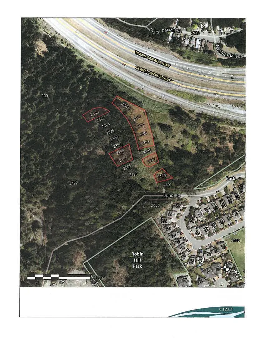
Aerial subject property map showing a series of parcels along Lund Road and adjacent to the Trans-Canada Highway. Highlighted parcels include numbers 2380, 2382, 2384, 2385, 2386, 2387, 2388, 2389, 2390, 2391, 2392, 2393, 2394, 2395, 2396, 2397, 2398, 2399, and 2401. Surrounding landmarks include West Park Lane, Robin Hill Park, and a residential neighborhood with various numbered addresses.

Important

This map is for general information purposes only. The Capital Regional District (CRD) makes no representations or warranties regarding the accuracy or completeness of this map or the suitability of the map for any purpose. This map is not for navigation. The CRD will not be liable for any damage, loss or injury resulting from the use of the map or information on the map and the map may be changed by the CRD at any time.

Intramap 2.0 Capital Regional District gis@crd.bc.ca http://www.crd.bc.ca

Page 135
Extracted from: 2016 06 14 Committee of the Whole Agenda