Other
Hospital Precinct - OCP Discussion Map
June 14, 2016Page 2671 section
Aerial map illustrating the area of interest for the Hospital Precinct OCP discussion.
Area: 10831.50 m2Location near Victoria General Hospital
Aerial Site Map
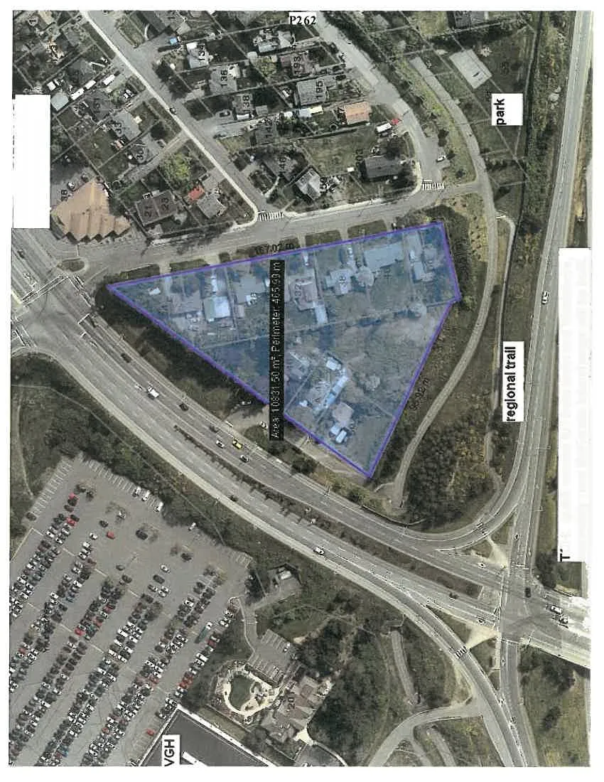
Map Annotations:
- Site Area: 10831.50 m²
- Site Perimeter: 465.99 m
- Boundary Dimensions: 167.02 m; 96.92 m
- Regional Infrastructure:
- TCH: quick access to / from town and Westshore, especially now McKenzie Interchange will be built.
- regional trail
- Local Amenities and Landmarks:
- convenient shopping and food services
- park
- VGH (Victoria General Hospital)
- P262
- Property/Building Identifiers: 21, 23, 38, 136, 146, 193, 195, 203
Page 267
Document Images
(1)
Extracted from: 2016 06 14 Committee of the Whole Agenda