Presentation
DEVELOPMENT PERMIT 2022/04 - 53 Knollwood Road (Presentation)
May 10, 2022Pages 144–1508 sections
Presentation slides summarizing the slope stabilization project and requested variance.
Variance for wall height (up to 2.0m)Native planting area: 425-485 m2
DEVELOPMENT PERMIT 2022/04
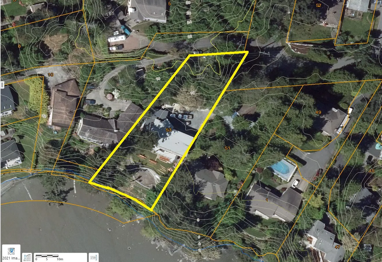
53 Knollwood Road
Page 144–150
PURPOSE
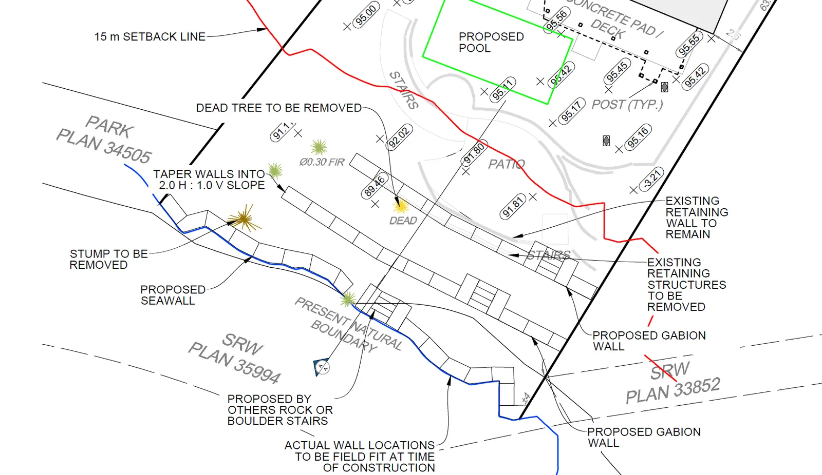
- Development permit application to install retaining walls and landscaping to stabilize a slope within the Natural Watercourse and Shoreline Development Permit Area
- A variance to the height of retaining walls is requested.
Page 144–150
Background
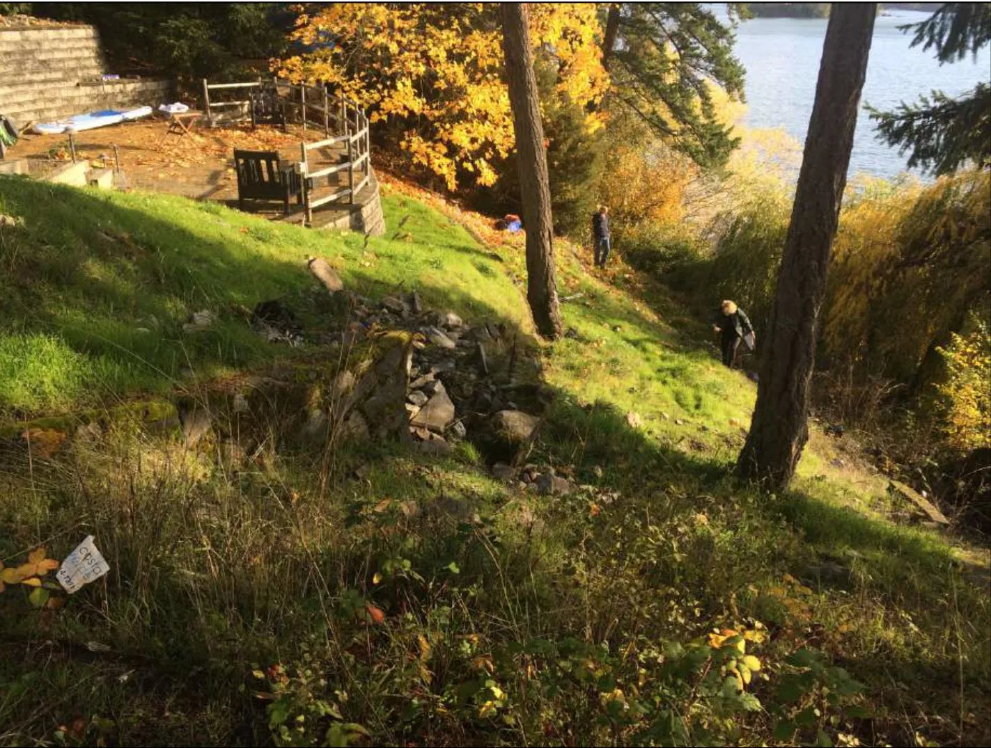
- Land slip 1995
- A variance to the height of retaining walls is requested.
Page 144–150
VARIANCE
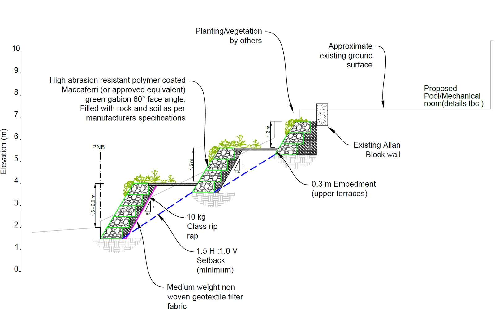
- Height of retaining walls from 1.2m to up to 2.0m tall.
- The variance can be supported, given that:
- Geotechnically engineered for slope and provides some flexibility against a moving slope that a rigid wall cannot
- Plants to soften and strengthen wall
- Sea wall is in a mudflat environment with low wave energy erosion impacts even with sea level rise
Page 144–150
BIOLOGIST’S REPORT
The Biologist’s report provides recommendations to be incorporated into the development permit, including:
- Work to be conducted during the summer Reduced Risk Fisheries Window for marine shorelines (July 1 to October 1)
- The work will be conducted is such a way to minimize the impact to the shoreline and no permanent structures or land alteration are proposed below/past the Present Natural Boundary.
- The patch of Lyngbye’s sedge on the west end of the shoreline will be protected during construction.
Page 144–150
CONCLUSION
The proposal can be supported for the following reasons:
- Total area of native plantings will increase. Approximately 425-485 m2 of native planting is proposed. This is roughly 85% of the DPA, exceeding the guideline target of 50%
- The works will include invasive species removal
- No large-scale negative impacts are expected to the marine environment
- Gabion walls are low on the list of preferred soft-to-hard measures for stabilizing shorelines but are recommended by the project biologist and geotechnical engineer as the least invasive approach given the site context
Page 144–150
NEXT STEPS
Notification of a Council meeting to consider the application can be conducted once the following has been provided:
- Legible copies of the landscape plans
- Landscape cost estimate for hard and soft landscaping
Page 144–150
RECOMMENDATION
THAT the May 4, 2022 report from the Senior Planner titled “Environmental Development Permit No. 2022/04 – 53 Knollwood Road” be received for information
Page 144–150
Document Images
(1)
Extracted from: 2022 05 10 Committee of the Whole Agenda - Agenda - Pdf