Town of View Royal OFFICIAL COMMUNITY PLAN DRAFT MAY 2022
Complete draft of the new Official Community Plan, including thematic policies, land use designations, and implementation strategies.
Town of View Royal OFFICIAL COMMUNITY PLAN
DRAFT MAY 2022
TABLE OF CONTENTS
PART 1: INTRODUCTION................................................................................
- OVERVIEW ............................................................................................................................6
- PLANNING PROCESS ............................................................................................................8
- ABOUT VIEW ROYAL ...........................................................................................................11
- COMMUNITY VISION STATEMENT.......................................................................................18
- UNDERSTANDING VIEW ROYAL’S LOW-CARBON FUTURE .................................................21
- REGIONAL CONTEXT STATEMENT......................................................................................22
PART 2: THEMATIC POLICIES................................................................... 42
- 1| LAND USE AND URBAN DESIGN.......................................................................................43
- 2 | TRANSPORTATION AND MOBILITY ...............................................................................79
- 3 | HOUSING ............................................................................................................................80
- 4 | ECONOMIC DEVELOPMENT .............................................................................................90
- 5 | NATURAL ENVIRONMENT, ENERGY AND CLIMATE CHANGE....................................102
- 6 | PARKS AND RECREATION .............................................................................................120
- 7 | COMMUNITY INFRASTRUCTURE AND SERVICES........................................................130
- 8 | COMMUNITY FACILITIES AND WELLBEING..................................................................144
PART 3: DEVELOPMENT PERMIT AREAS.............................................. 148
- JUSTIFICATION AND AUTHORITY ..................................................................................... 160
- FORM AND CHARACTER OF DEVELOPMENT .................................................................... 162
- DPA: MIXED RESIDENTIAL ................................................................................................ 167
- DPA: INTENSIVE RESIDENTIAL ......................................................................................... 172
- DPA: NEIGHBOURHOOD MIXED USE................................................................................. 172
- DPA: INTENSIVE MIXED-USE ............................................................................................ 178
- DPA: COMMERCIAL ........................................................................................................... 183
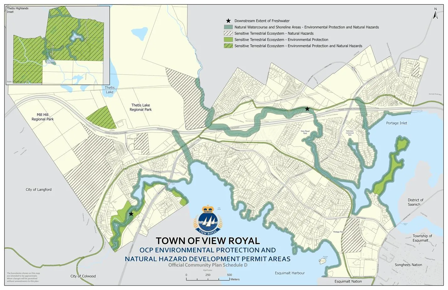
- DPA: NATURAL WATERCOURSE AND SHORELINE AREAS............................................... 187
- DPA: SENSITIVE TERRESTRIAL ECOSYSTEMS................................................................. 196
- DPA: NATURAL HAZARD INTERFACE ZONE ...................................................................... 201
PART 4: IMPLEMENTATION ..................................................................... 202
- PLAN IMPLEMENTATION OBJECTIVES AND POLICIES...................................................... 203
- GLOSSARY OF TERMS............................................................................................. 218
- APPENDIX.................................................................................................................. 229
- SCHEDULES.............................................................................................................. 236
PART 1: INTRODUCTION
1. OVERVIEW
WHAT IS AN OCP AND WHO IS IT FOR?
This Official Community Plan (OCP) is the culmination of a year of work with community members across View Royal. The OCP sets a course of what View Royal will be like in 10 years and beyond, and the steps that will be taken to get there. The OCP also sets the stage for the continued evolution of View Royal, as the community transitions from a suburban community to a more urban future that adapts to change and protects what is cherished. This plan recognizes that there will be a need to rise to the significant challenges and opportunities of our time and is grounded in realistic climate actions for View Royal’s future. A commitment to long-term action is reflected in this plan.
THE OCP INFLUENCES HOW RESIDENTS LIVE, WORK, SHOP, PLAY, ACCESS SERVICES AND MOVE AROUND THE COMMUNITY, AND WITHIN THE REGION. THE OCP REFLECTS VIEW ROYAL’S DESIRED FUTURE DIRECTIONS, AND ITS GREATER REGIONAL CONTEXT IN THE CAPITAL REGION.
The OCP is a bylaw, prepared and adopted by Town of View Royal Council in compliance with the Local Government Act. It is a long-range policy plan that guides View Royal’s decision-making related to growth and development approvals, as well as other community interests such as housing, transportation, climate change and infrastructure. The plan takes into account that View Royal is expected to be home to 4,000 more residents – from today’s population of ~11,000 to ~15,000 by 2036 (BC Stats Population Projections, 2016).
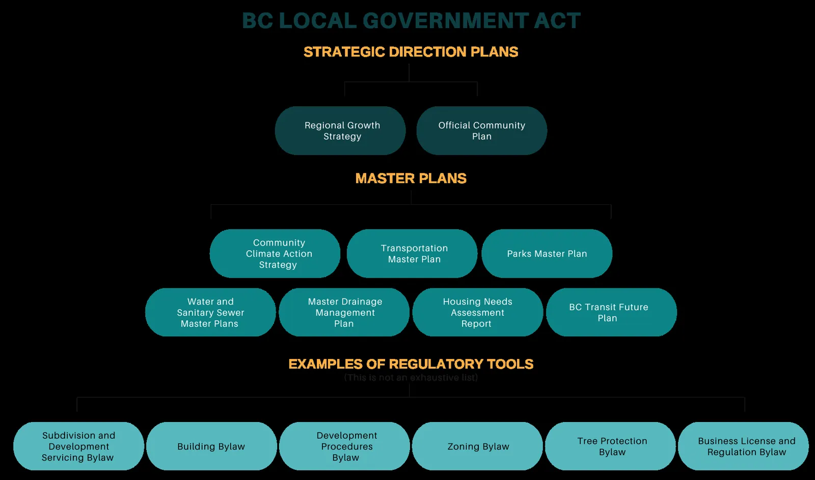
HOW DOES THE OCP FIT INTO THE TOWN OF VIEW ROYAL PLANS AND REGULATORY TOOLS?
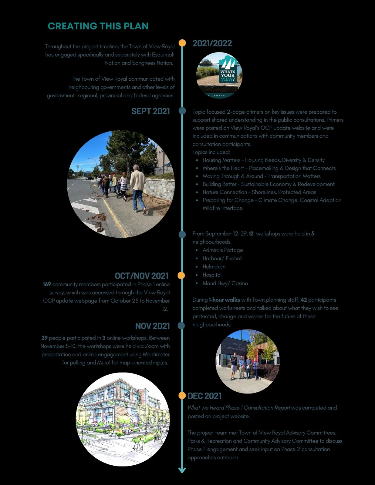
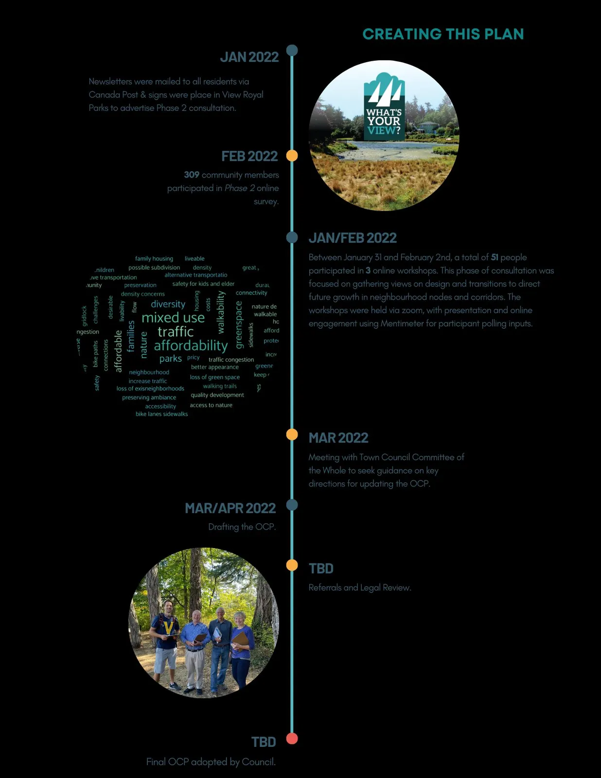
2. PLANNING PROCESS
The Town of View Royal thanks all who contributed their voices, perspectives, lived experiences and time to the OCP review process. The OCP update was featured on the Town’s website, social media, mailouts, and park signs. The review occurred over one year starting in June 2021.
CREATING THIS PLAN TIMELINE
3. ABOUT VIEW ROYAL

This is the land of the lək̓ʷəŋən People, known today as the Esquimalt Nation and Songhees Nation. The lək̓ʷəŋən People have occupied View Royal since time immemorial.
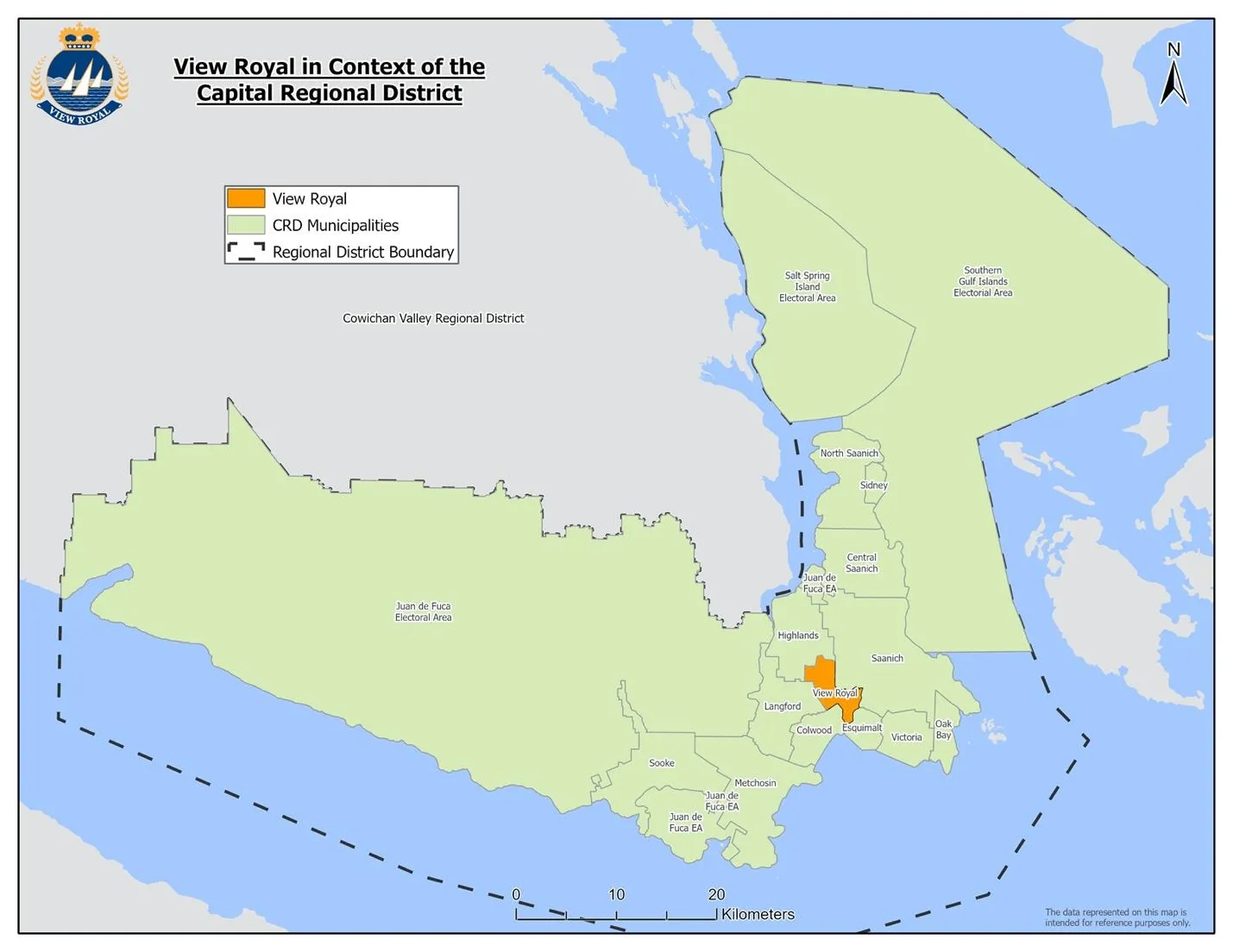
Today, View Royal is a largely residential community of ~11,000 people in the centre-west part of the Capital Region. The municipality was incorporated in December 1988. Close to 40% of the Town’s land base is parks, the largest being Thetis Lake and Mill Hill Regional Parks.
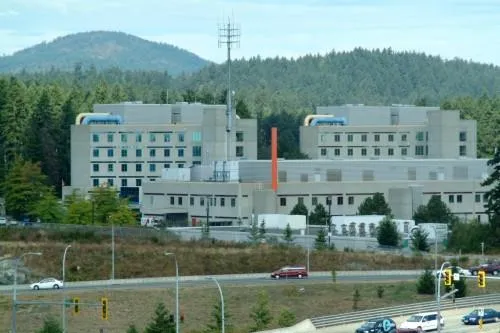
Victoria General Hospital is centrally located in View Royal and accounts for at least one third of the approximately 4,000 jobs in the Town. Relatively few people (7.5%) live and work in the Town; most commute to other municipalities. The tax base is 74% residential and 25% business.
4. VIEW ROYAL AT A GLANCE
POPULATION AND DEMOGRAPHICS
The 2021 census has the population at 11,575. It is projected to grow at 1.9% annually.
Population Age
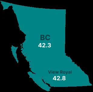
- Average age in View Royal is 42.8 years, compared to 42.3 in the province.
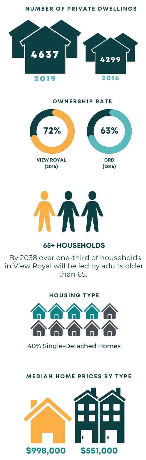
- By 2038, over one-third of households will be led by adults 65+.
Demographics
- Approximately 16% of the population are immigrants.
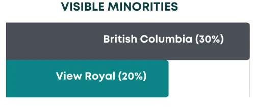
- 20% indicate they are a visible minority (significantly lower than the 30% provincial average).
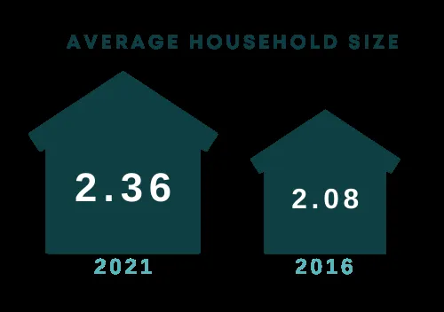
HOUSEHOLD SIZE
- Average household size was 2.36 in 2019 and is expected to decrease to 2.08 by 2036.
- 1/2 of new households by 2040 are expected to be non-family households.
EMPLOYMENT
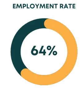
- 66% participation rate; total working population of 5,550.
- Unemployment rate of 3.8% (2016).
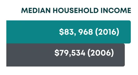
- Median household income increased from $79,534 in 2006 to $83,968 in 2016.
HOUSING
- 4,637 private dwellings in 2019.
- 72% ownership rate (2016) compared to 63% in the CRD.
- Rental vacancy rate is 0.7% (Healthy rate is 3-5%).
- 40% of housing stock is single-detached homes.
- Median single detached home cost: $998,000.
- Median condo/townhouse price: $551,000 (2021 BC Assessment).
LAND
- Land area is 14.33 sq km.
- Population density was 807.6 people per sq km in 2021.
- Future development will largely be redevelopment and infill within the Urban Containment Boundary.
5. COMMUNITY VISION STATEMENT
VIEW ROYAL IS A DYNAMIC AND INCLUSIVE COMMUNITY THAT MANAGES GROWTH, WHILE RETAINING THE CHARM OF ITS NEIGHBOURHOODS. It is home and workplace to people from all walks of life. Its neighbourhoods are attractive, affordable, walkable, and safe.
VIEW ROYAL RECOGNIZES THE IMPACTS OF CLIMATE CHANGE. The Town, developers, residents, and partners respond collectively by advancing energy-efficient buildings, improving sustainable transportation, and protecting urban forests and shorelines.
THE LOCAL ECONOMY IS DIVERSIFIED AND STRONG, PROVIDING EMPLOYMENT, SHOPPING, AND SERVICE OPTIONS TO LOCAL AND REGIONAL RESIDENTS.
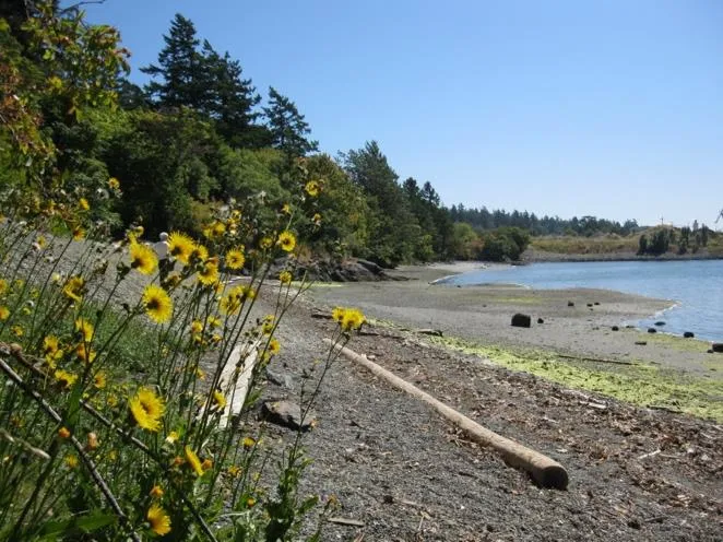
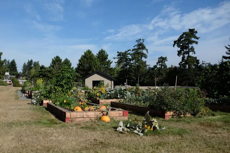
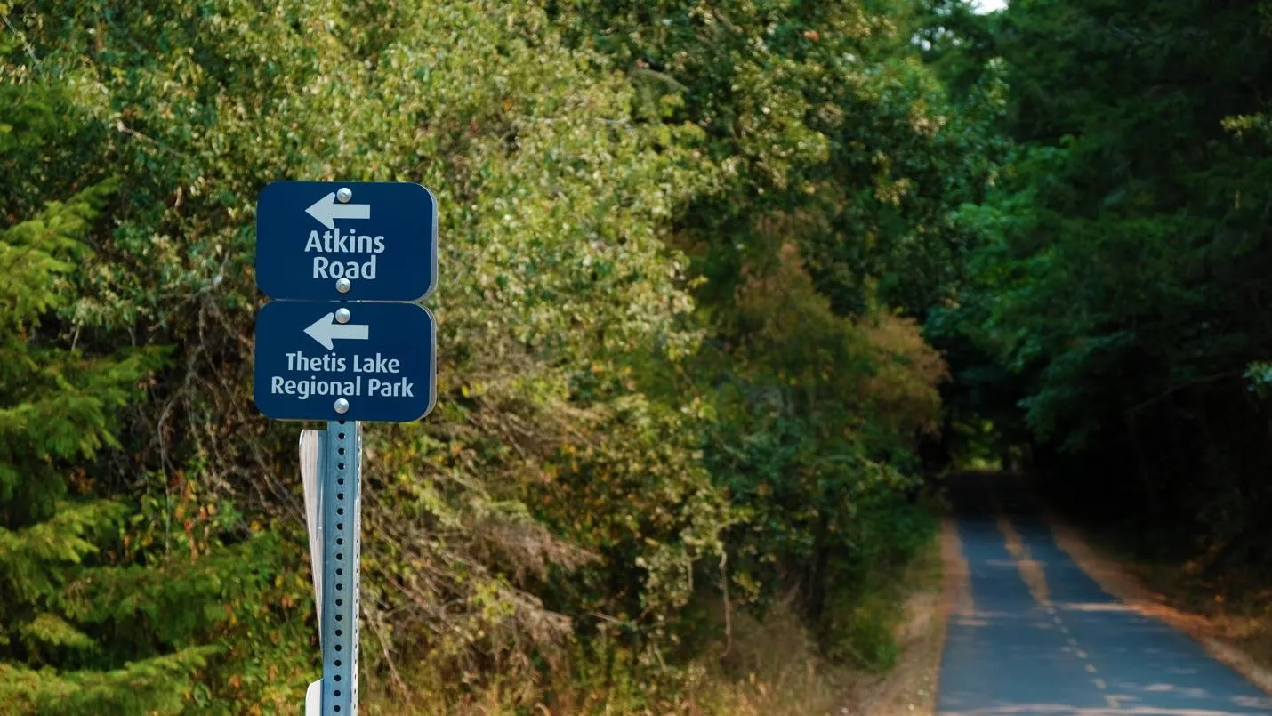
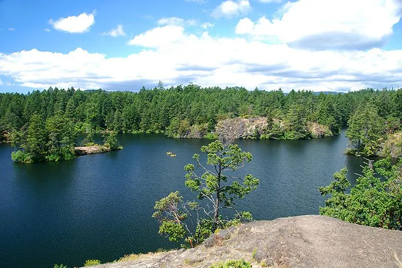
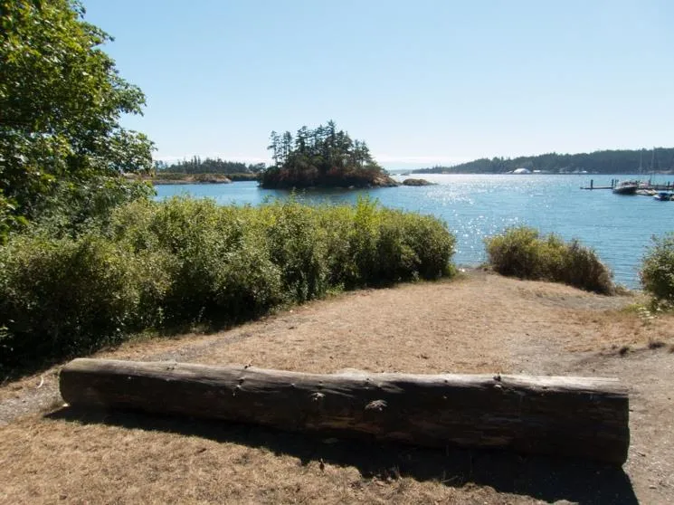
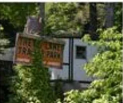
THE TOWN IS ENDOWED WITH UNIQUE NATURAL ENVIRONMENTS – Thetis Lake Park, Millstream Creek, Craigflower Creek, Esquimalt Harbour and Portage Inlet.
VIEW ROYAL, IN EMBRACING FISCAL SUSTAINABILITY AND ECONOMIC WELLNESS, “LIVES WITHIN ITS MEANS” AND ADAPTS TO CHANGE.
TEN GOALS
- Promote a strong sense of community and enhanced sense of place.
- Create an inclusive community with housing and healthy living options for all backgrounds and ages.
- Maintain the relationship between natural and residential characteristics.
- Commitment to becoming a sustainable place addressing global climate change.
- Continue building trust and reconciliation with Esquimalt and Songhees Nations.
- Preserve historic and cultural resources.
- Ensure financial sustainability of community services and regional partnerships.
- supply local employment and broaden the municipal tax base.
- Recognize the regional role in transportation and environmental systems.
- Ensure citizens are informed and involved in planning processes.
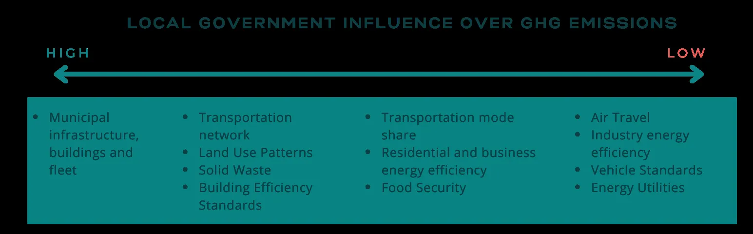
6. UNDERSTANDING VIEW ROYAL’S LOW-CARBON FUTURE
The Town has joined over 1,500 jurisdictions in declaring a climate emergency. View Royal can reduce GHG emissions by an estimated 36% below 2007 levels by 2030, with a long-term target of 100% reduction by 2050.
7. REGIONAL CONTEXT STATEMENT
The OCP must be consistent with the Capital Regional District (CRD) Regional Growth Strategy (RGS) adopted March 2018 (Bylaw 4017). View Royal is identified as a community within the Urban Containment Boundary and a node for housing and employment.
PART 2: THEMATIC POLICIES
1 | LAND USE AND URBAN DESIGN
GOALS
- Create an inclusive community with diverse housing and transportation options.
- Encourage high-quality public space design and sense of place.
- Protect the relationship between natural environments and residential characteristics.
VIEW ROYAL TODAY
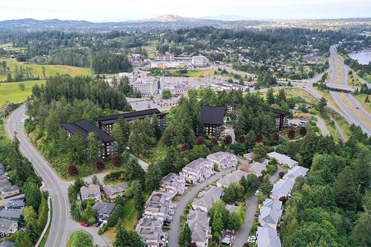
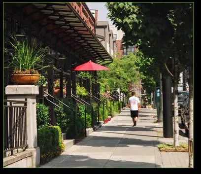
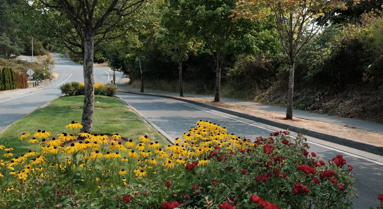
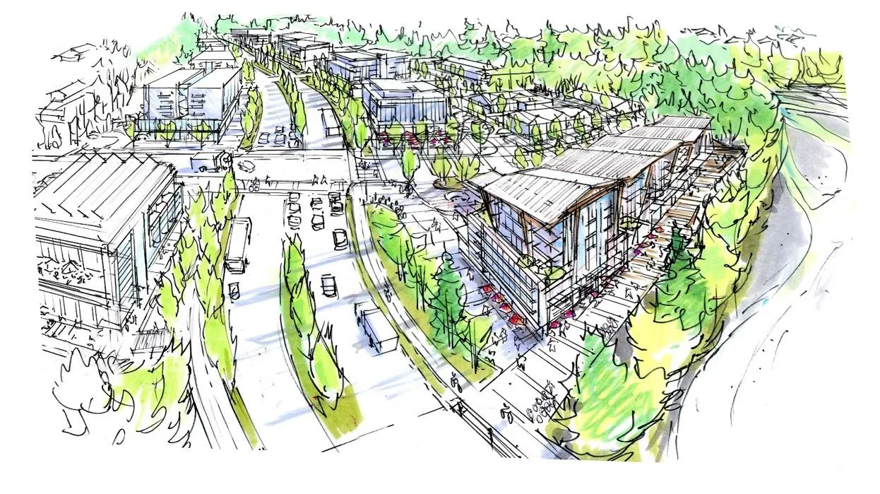
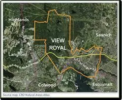
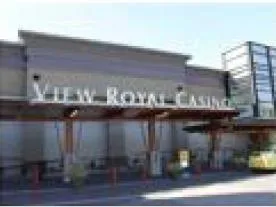
View Royal is located between the City of Victoria and the western communities. Currently, commercial uses are limited to auto-oriented locations along Island Highway and Admirals Road. The Town lacks an identifiable town core.
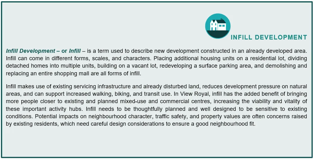
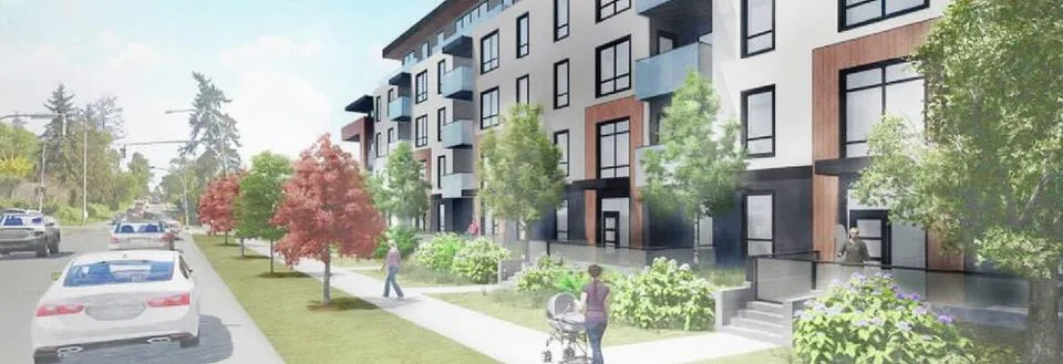
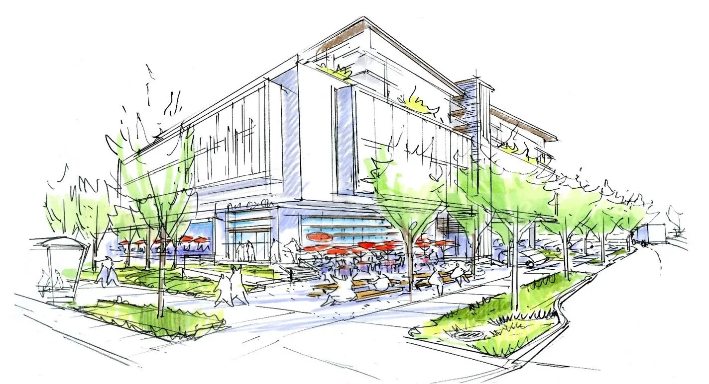
INFILL DEVELOPMENT
INTEGRATING LAND USE AND TRANSPORTATION
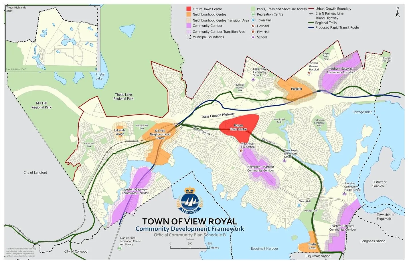
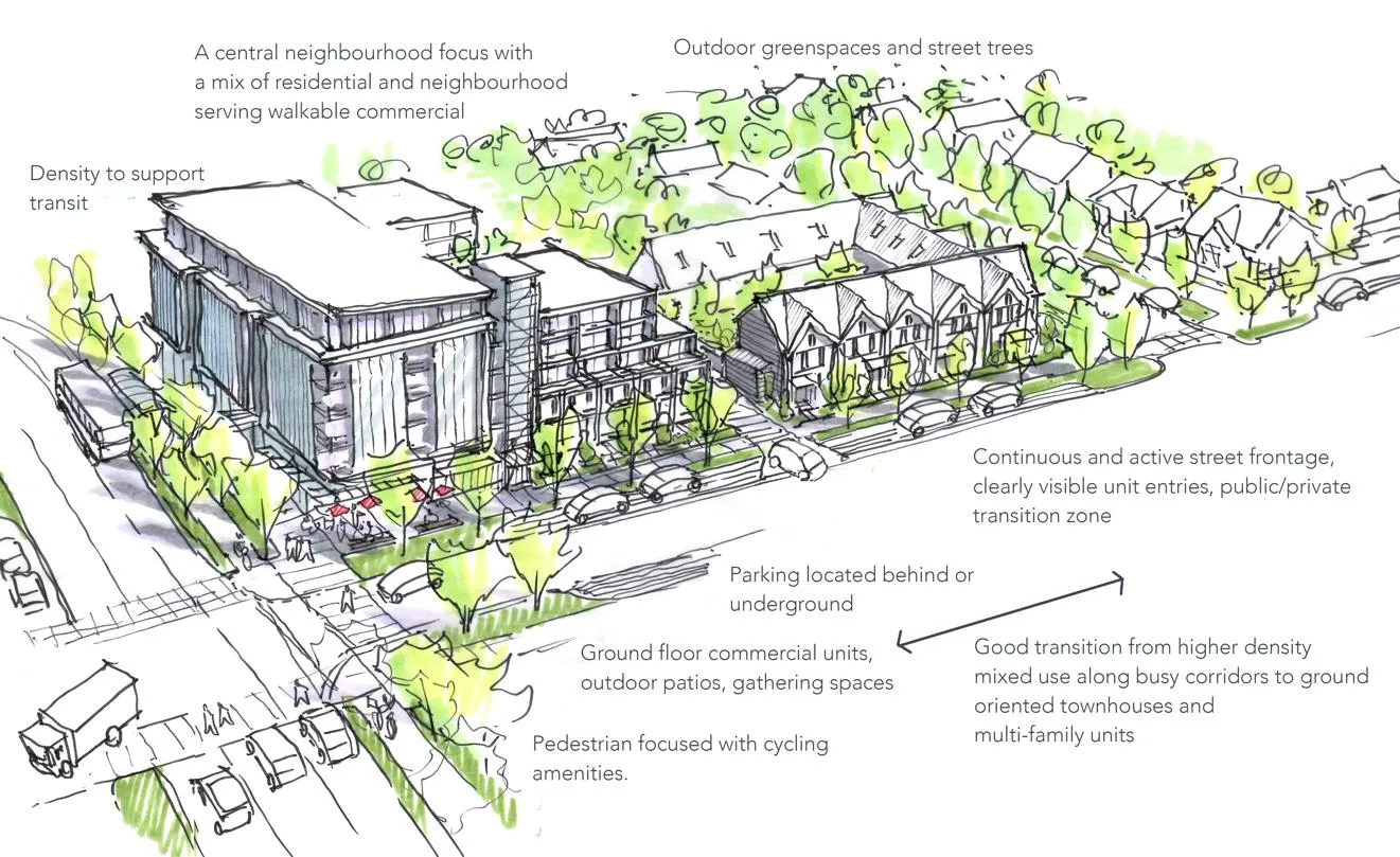
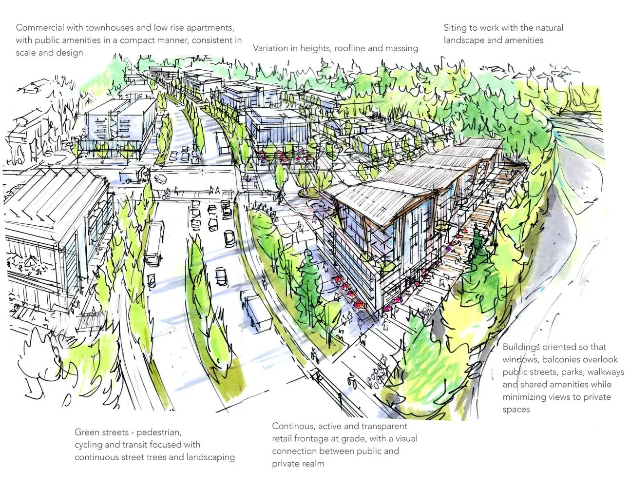
COMMUNITY DEVELOPMENT FRAMEWORK
Transition Areas:
- Lakeside Village
- Eastern Gateway Community Corridor (Admirals)
- Western Gateway Corridor
- 6 Mile Neighbourhood Centre
- Town Centre (Fort Victoria)
- Harbour-Helmcken Community Corridor
- Hospital
- Northern Gateway Corridor
- Thetis Cove
NEIGHBOURHOOD CENTRES
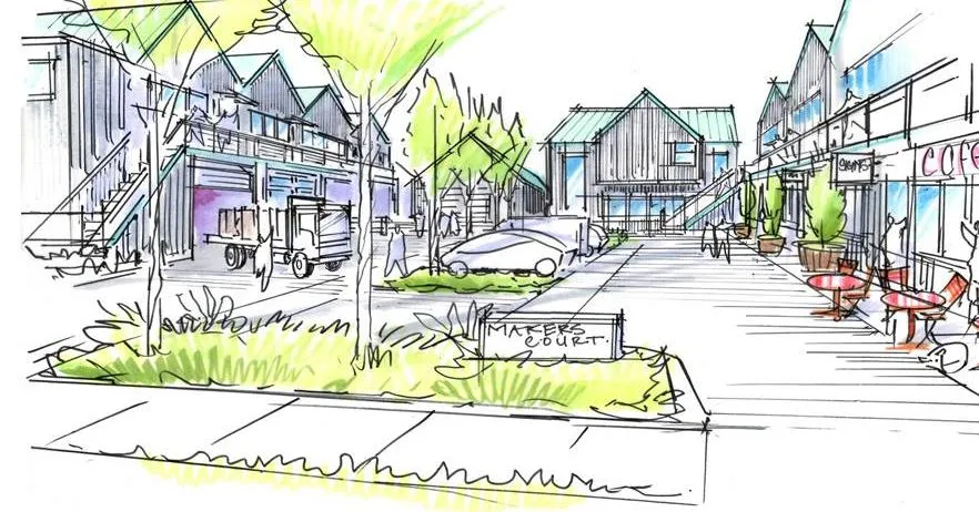
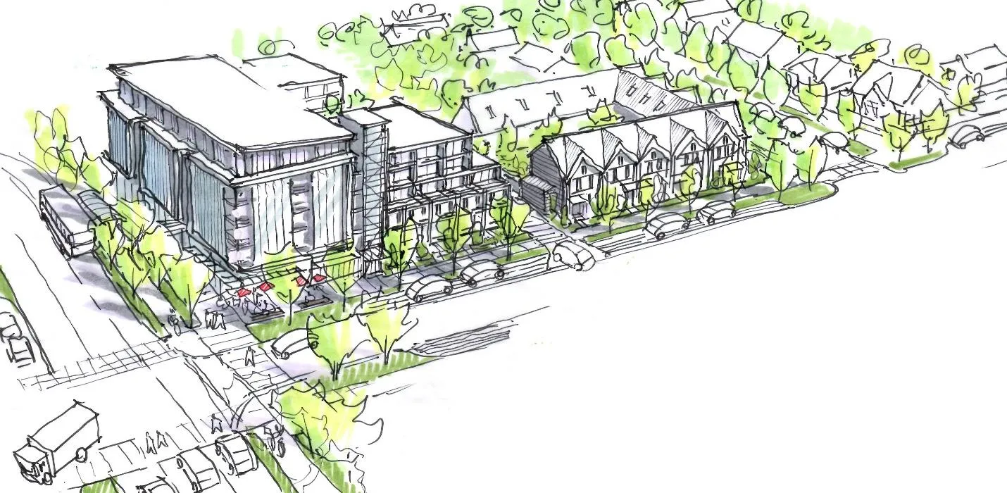
The OCP identifies four mixed-use Neighbourhood Centres:
- Lakeside Village: eastern side of Six Mile Road; apartment dwellings and ground-level commercial.
- Six Mile: planned for the area where the E&N Rail and Galloping Goose Trail cross; envisioned as a transit-oriented hub.
- Hospital: surrounding Victoria General Hospital; aims for synergies between health services, transit, and housing.
- Thetis Cove: province-acquired site intended for the Esquimalt Nation; planned for attached housing and public waterfront access.
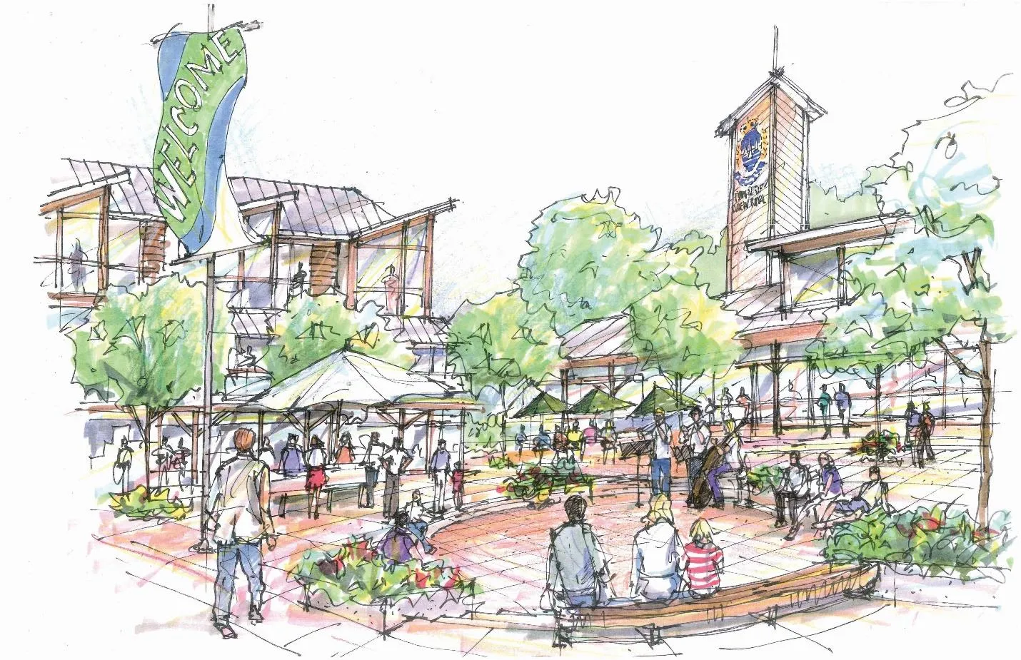
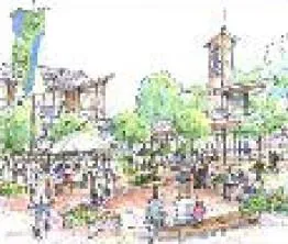
TOWN CENTRE
The Fort Victoria RV Park site is identified as the preferred location for a long-term View Royal Town Centre.
COMMUNITY CORRIDORS
LAND USE DESIGNATIONS
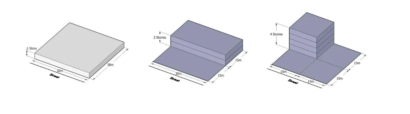
Floor Space Ratio (FSR): FSR expresses the ratio of built area to land area.
Land Use Designations Table:
| Land Use | Form & Character | Examples |
|---|---|---|
| Large-Lot Residential | Detached Homes on large lots. | [Image 41] |
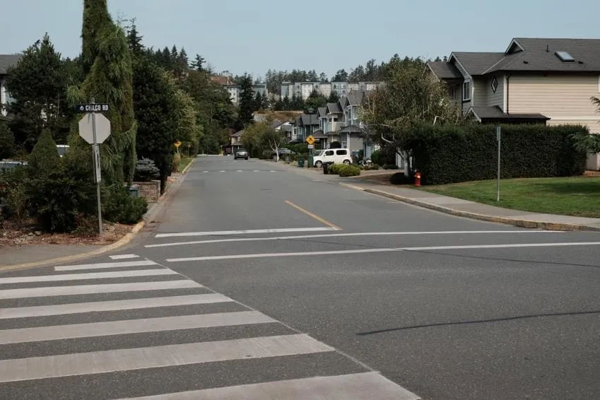
| Residential | Predominantly detached houses and townhouses; max FSR 0.6 for infill. | [Image 42] |
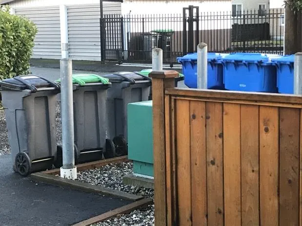
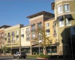
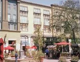
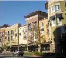
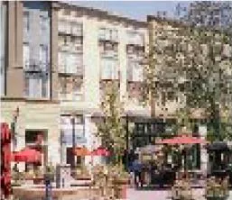
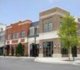
| Mixed Residential | Small lot detached, townhouses, low-rise apartments. Up to 1.6 FSR. | [Image 43] |
| Neighbourhood Mixed-Use | Commercial with townhouses and low-rise apartments. 1.5 FSR. | [Image 44] |
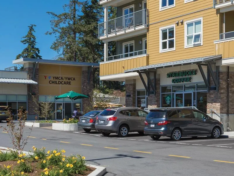
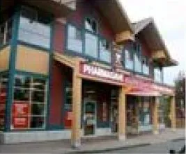
| Neighbourhood Centre | Commercial with apartments. 3.0 FSR. | [Image 45] |
| Intensive Mixed-Use | Commercial with townhouses and low-rise apartments. 2.5 FSR. | [Image 46] |
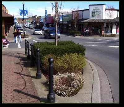
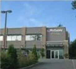
| Commercial | Retail, office, tech, and service commercial. 2.5 FSR. | [Image 47] |
| Park / Open Space | Local/Regional parks, trails, protected areas. | [Image 48] |
| Community Facility | Government buildings, schools, community centres. | [Image 49] |
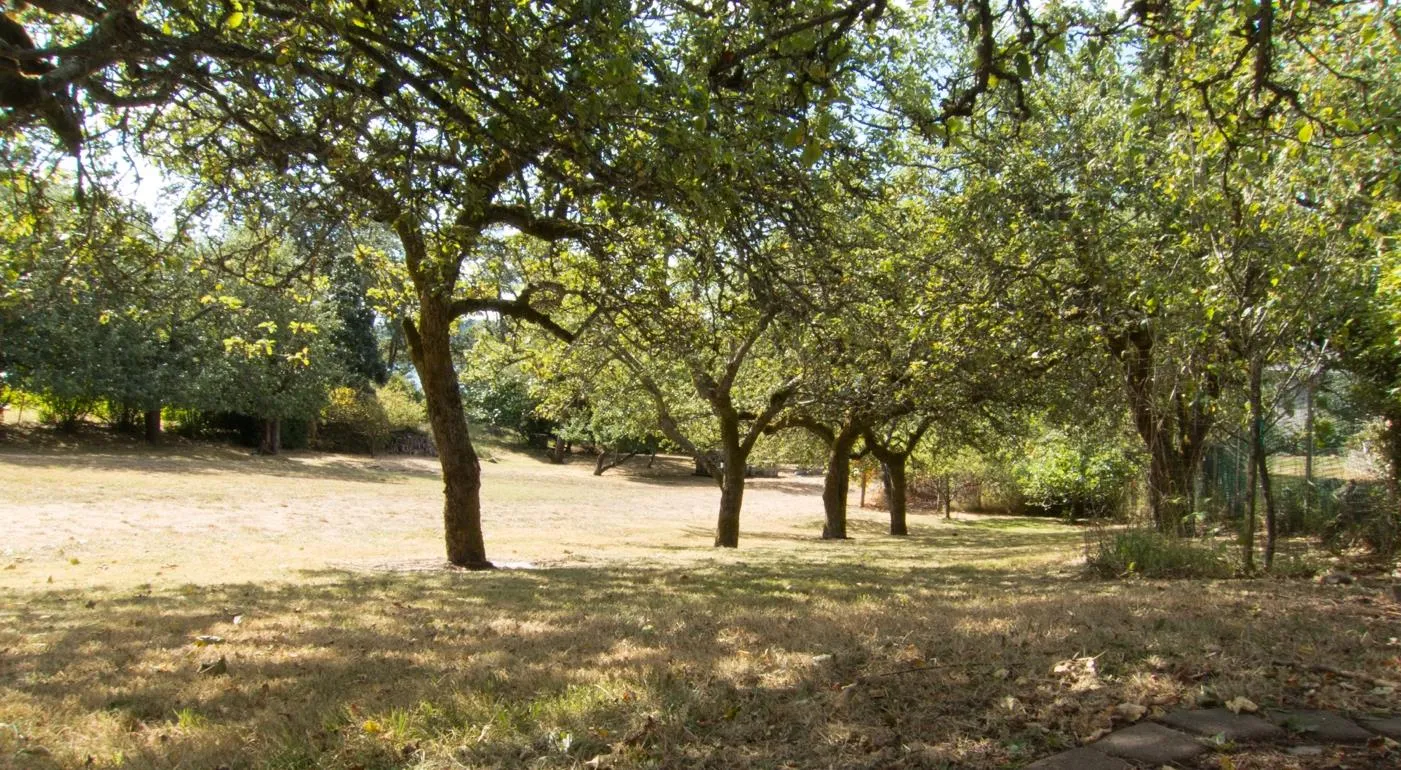
| Rural | Agricultural and large lot residential; 1 unit per 10 hectares. | [Image 50] |
| Comprehensive Dev (CDA) | Areas with unique designations. | [Image 51] |
LAND USE OBJECTIVES AND POLICIES
OBJECTIVE LU1: Direct majority of growth into compact nodes and corridors.
- LU 1.4 Diversity of Forms: Support housing variety within 400m (10-minute) walking distances.
- LU 1.8 Temporary Use Permits: Considered on a case-by-case basis.
OBJECTIVE LU2: Preserve ambiance of established residential neighbourhoods.
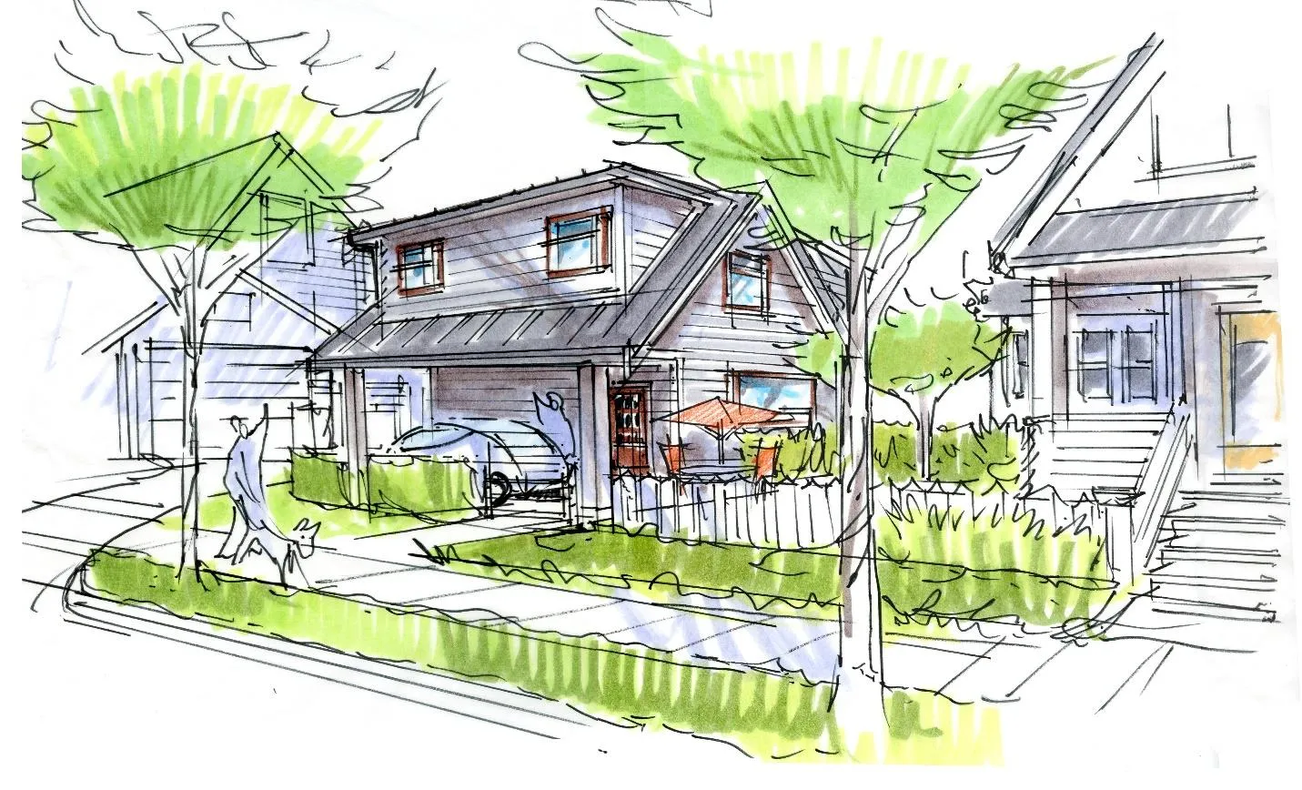
- LU 2.3 Targeted Infill: Encourage infill to provide ground-oriented family housing.
- LU 2.4 Detached Secondary Suites: Consider allowing them on properties > 350m².
OBJECTIVE LU3: Support development of a community-serving Town Centre.
- LU 3.1 Site: Recognize Fort Victoria RV Park as preferred location.
OBJECTIVE LU4: Support high-quality development and "complete streets."
- LU 4.10 Universal Design: Apply principles to all public space improvements.
- LU 4.13 CPTED: Integrate Crime Prevention Through Environmental Design.
OBJECTIVE LU5: Protect and enhance natural features and parks.
- LU 5.4 Urban Growth Boundary: Maintain the UGB to direct urban development.
NEIGHBOURHOOD POLICIES
- Harbour Neighbourhood: Support the Harbour-Helmcken Community Corridor; intensification at Helmcken intersection.
- Hospital Neighbourhood: Support Northern Gateway corridor; densities between 2.0 and 3.0 FSR.
- Thetis Neighbourhood: Preserve recreational integrity of Thetis Lake Regional Park; discourage development north of the park.
LAND USE IMPLEMENTING ACTIONS
- ACTION LU1: Update Transportation Master Plan.
- ACTION LU5: Develop an infill development guidebook.
- ACTION LU8: Coordinate with BC Transit for transit-oriented development.
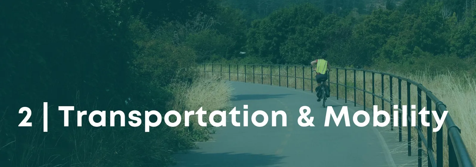
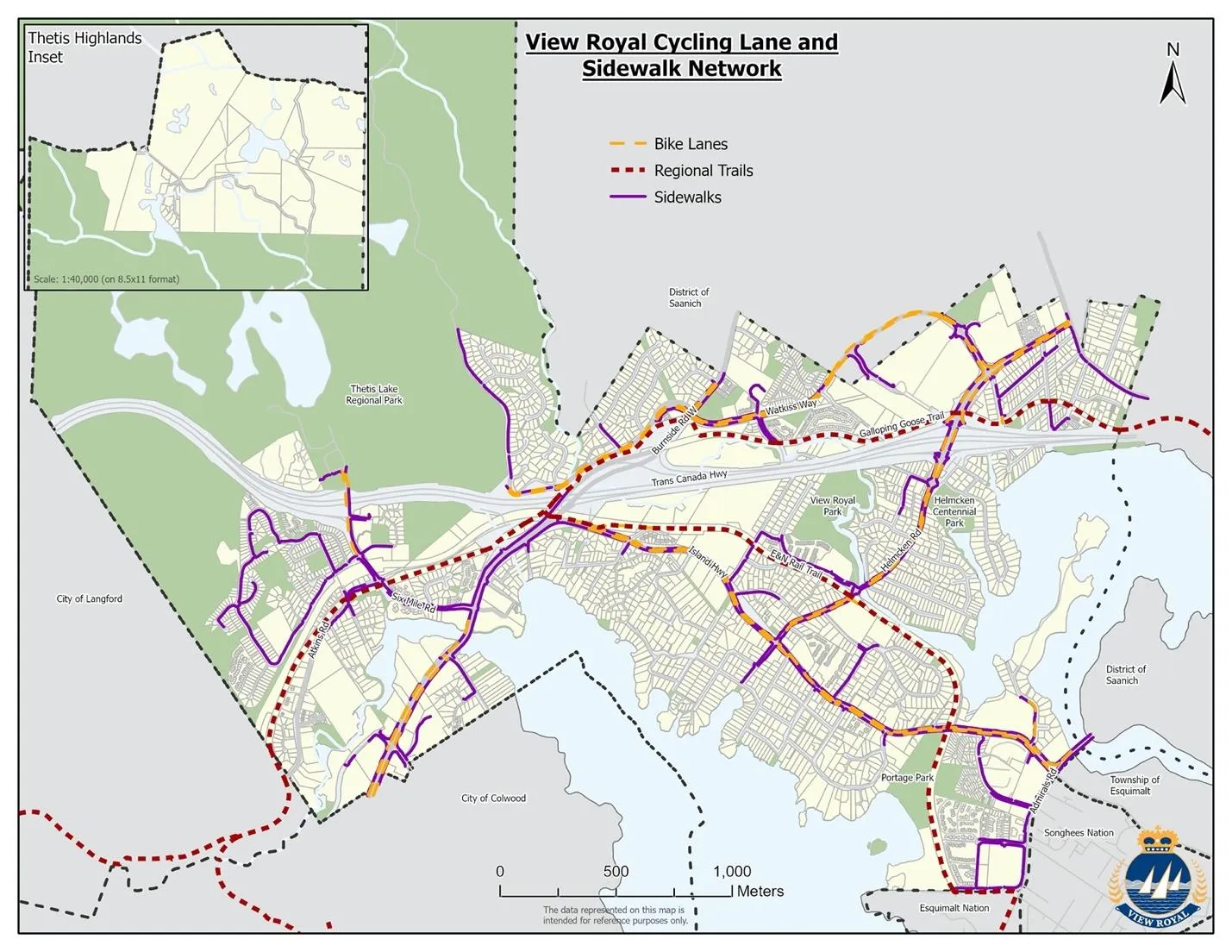
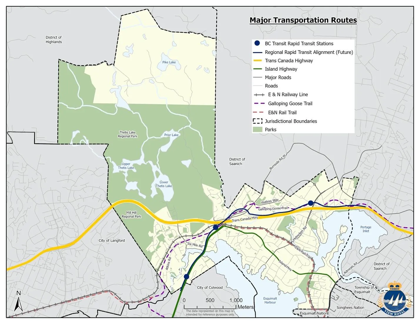
2 | TRANSPORTATION AND MOBILITY
GOALS
- reduce greenhouse gas emissions from transportation.
- Create an inclusive community with diverse transportation options.
- Cooperate with regional partners to address regional issues.
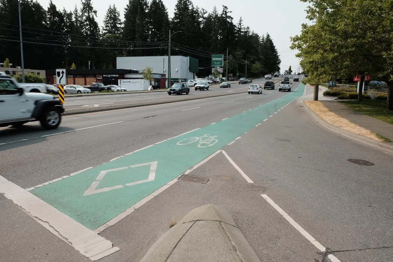
VIEW ROYAL TODAY
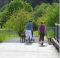
View Royal prioritized pedestrian, active transportation, and transit, with private vehicles as the lowest priority.
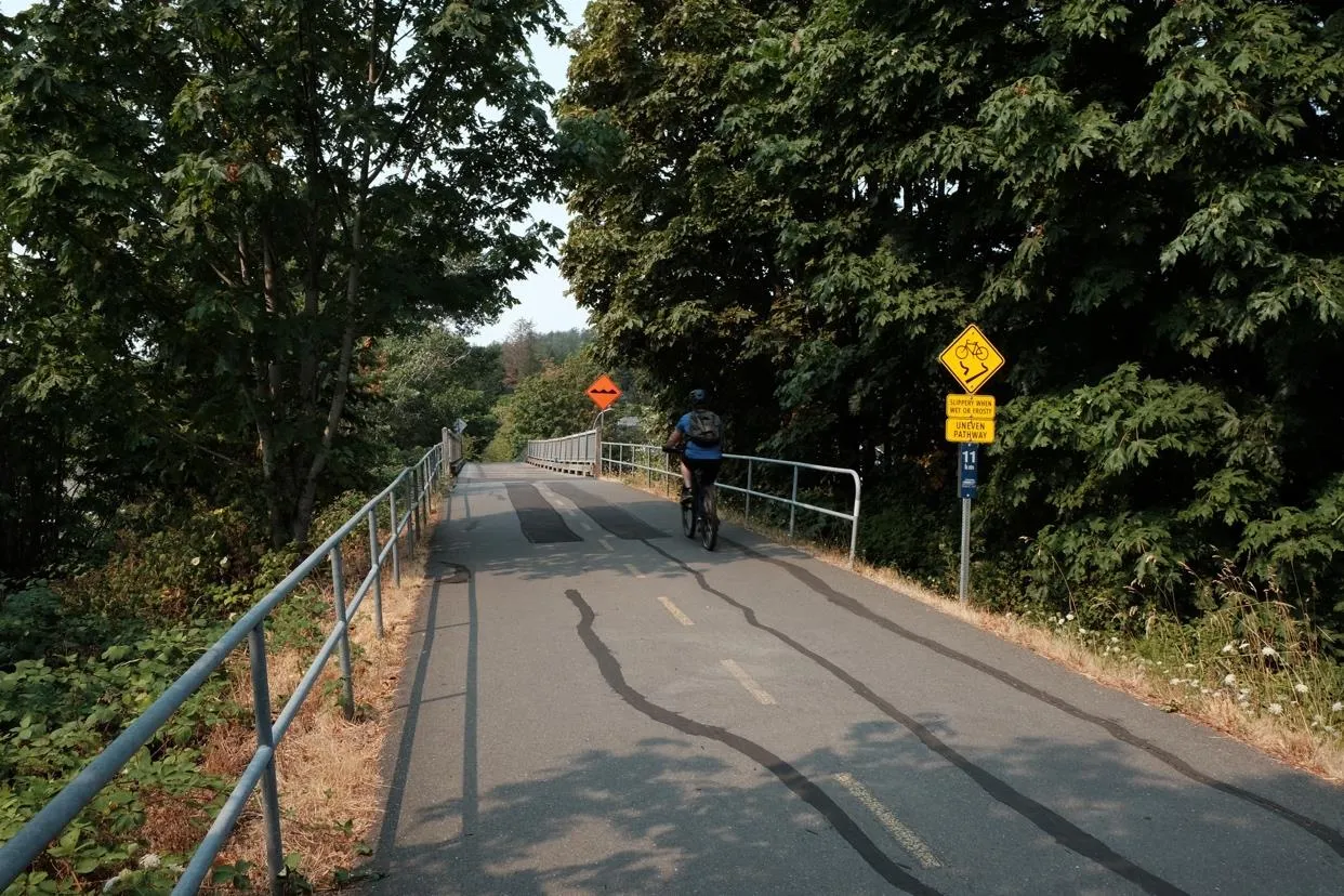
Existing Infrastructure:
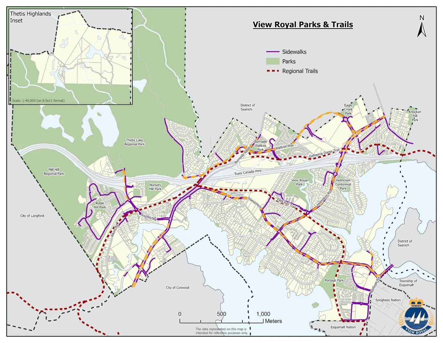
- Walking and Cycling: Recent projects closed gaps, but fragmentation remains at the Trans-Canada Highway.
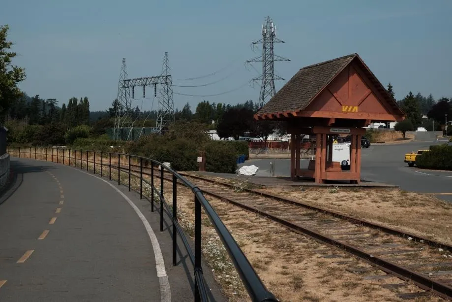
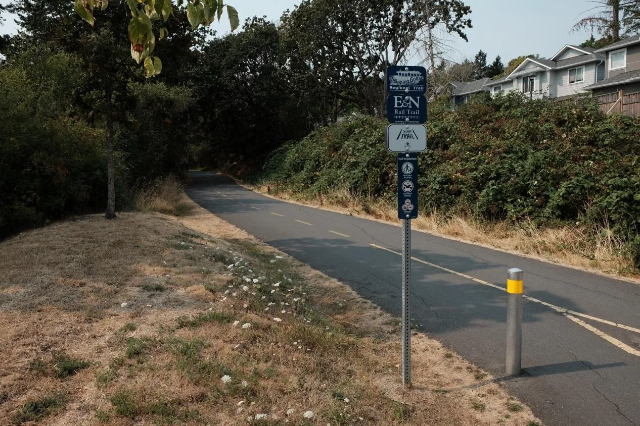
- Regional Trails: Galloping Goose Trail and E&N Rail Trail are primary commuter routes.
- Bus and Rapid Transit: Spacing goal for transit stops is 300m - 500m.
- E&N Corridor: Advocate for reinstatement of rail service.
- Major Roads: Highway 1 and Island Highway separate neighbourhoods and cause traffic gridlock.
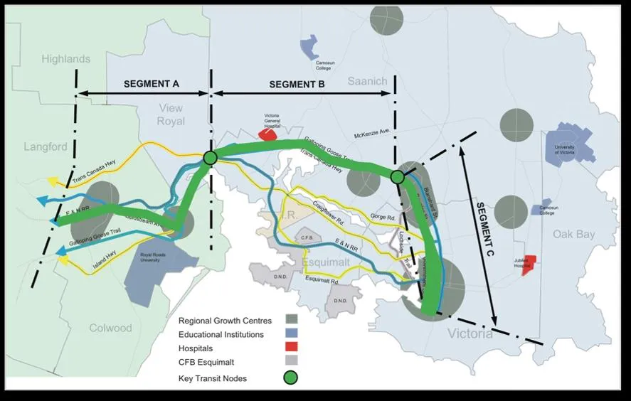
TRANSPORTATION PLANS
TRANSPORTATION OBJECTIVES AND POLICIES
OBJECTIVE TR1: Priority modes are walking, cycling, and transit.
- TR 1.5 Rapid Transit: stations should be planned as transportation hubs, not "park-and-ride" lots.
- TR 1.7 TDM: Encourage Transportation Demand Management for new developments.
OBJECTIVE TR2: Connect Neighbourhood Centres, parks, and facilities.
- TR 2.5 Density near Transit: Focus development within 400m of existing transit.
OBJECTIVE TR3: Safe, comfortable, and efficient movement.
- TR 3.11 Environmentally Friendly: Encourage carpooling, car co-ops, e-bikes, and scooters.
- TR 3.13 Electrification: Require vehicle and bike parking electrification in new developments.
TRANSPORTATION IMPLEMENTING ACTIONS
- ACTION TR1: Develop an Active Transportation Network Plan.
- ACTION TR5: Advocate for commuter rail on the E&N corridor.
3 | HOUSING
GOALS
- Provide housing options for all ages, family types, and economic means.
- Protect relationships between natural environments and residential character.
VIEW ROYAL TODAY
The 2020 Housing Needs Assessment highlighted:
- Single-family homes are the primary form of housing.
- median-earning households struggle to afford average homes.
- Low rental vacancy rate (0.7%).
- Need for more than 200 non-market rental units.
PLANNING TO MEET HOUSING NEEDS

"Missing Middle" Housing: refers to townhomes and low-rise apartments that fit between detached homes and high-rises.
HOUSING AFFORDABILITY
Affordable housing is defined as spending less than 30% of gross annual income on shelter. In View Royal, 35% of renters and 19% of homeowners exceed this limit.
HOUSING OBJECTIVES AND POLICIES
OBJECTIVE HS1A: Range of housing types and tenures.
- HS 1.3 Family Housing: Encourage 10% of units in new multi-residential projects to be 3+ bedrooms.
- HS 1.4 Aging in Place: Promote 10% of units to meet accessible/adaptable standards.
OBJECTIVE HS2: Protect tenants from rental conversion.
- Policy HS 2.1: mitigating loss of affordable units during redevelopment.
OBJECTIVE HS3: Market Rental Housing Protection.
- HS 3.6 Short-Term Rentals: Limit STRs to hosts meeting principal residency requirements.
OBJECTIVE HS4: Sustainable settlement patterns.
- HS 4.3 Carriage/Garden Suites: Consider allowing them on properties > 600m².
HOUSING IMPLEMENTING ACTIONS
- ACTION HS3: Prepare a comprehensive Housing Strategy.
- ACTION HS5: Adopt an Affordable Housing Policy.
4 | ECONOMIC DEVELOPMENT
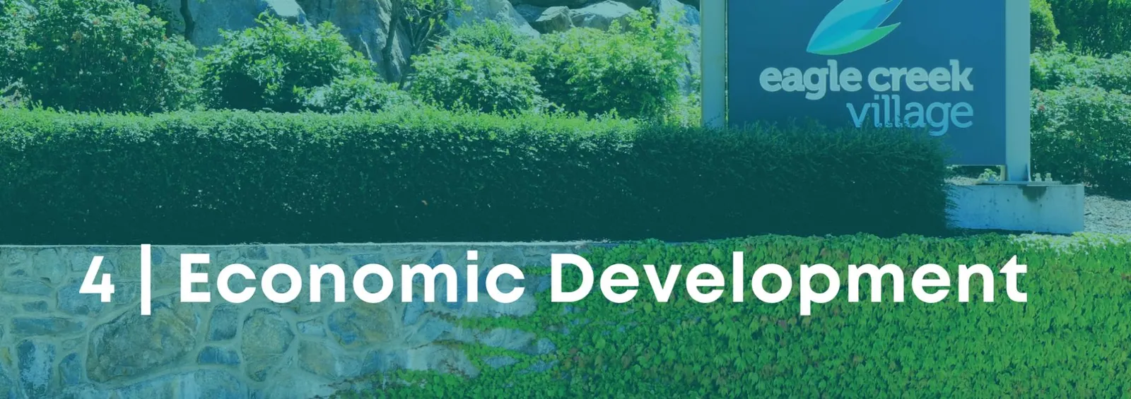
OVERVIEW
The Town envisions robust and diversified local employment opportunities, focusing on redevelopment of under-utilized lands along corridors and gateways.
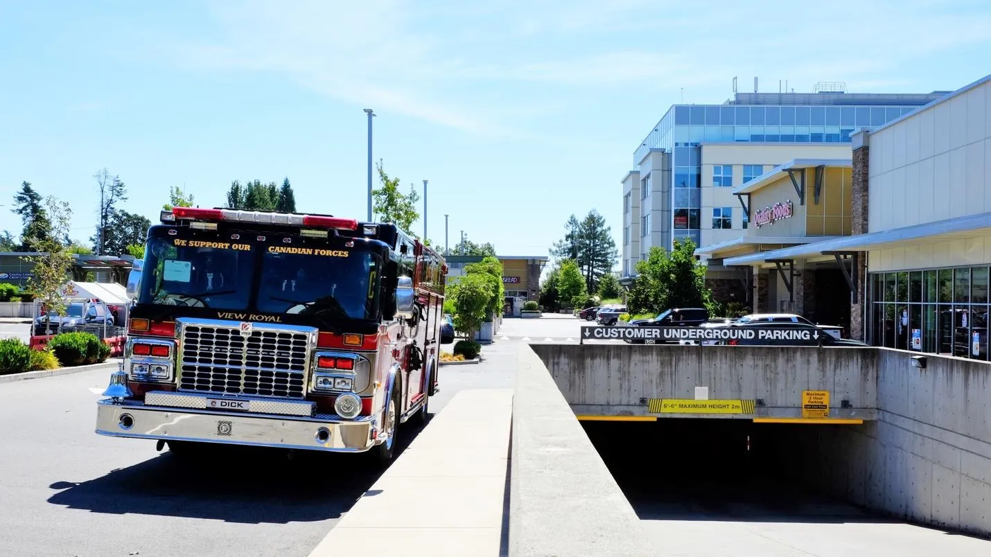
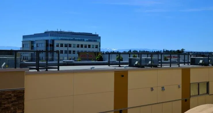
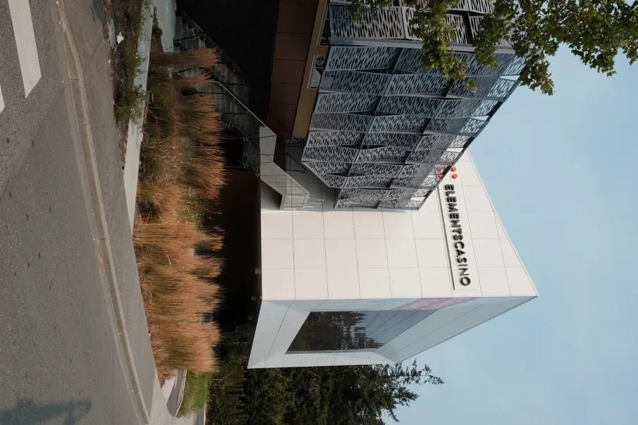
VIEW ROYAL TODAY
- Approximately 400,000 sq ft of retail and service space.
- 147,000 sq ft of office space (50% medical related).
- Retail growth projection: 229,000 - 370,000 sq ft by 2040.
- Jobs-to-population ratio is 0.45 (regional target is 0.36).
The Tax Base: Residential assessments increased 39% from 2017 to 2021. 71% of property taxes come from residential (Class 1) and 27% from business (Class 6).
ECONOMIC OBJECTIVES AND POLICIES
OBJECTIVE ED1: Support commercial and institutional development.
- ED 1.4 Home-Based Businesses: Support businesses compatible with residential uses.
OBJECTIVE ED2: Redevelopment Incentives.
- ED 2.3 Density Bonus: Provide bonus density in return for contributions to affordable housing.
- ED 2.4 Western Gateway: Pursue employment uses like hotel, light industrial, and high-tech.
ECONOMIC IMPLEMENTING ACTIONS
- ACTION ED1: Update the Economic Development Strategy.
- ACTION ED4: Examine bonus density policy for affordable housing.
5 | NATURAL ENVIRONMENT, ENERGY AND CLIMATE CHANGE

VIEW ROYAL TODAY
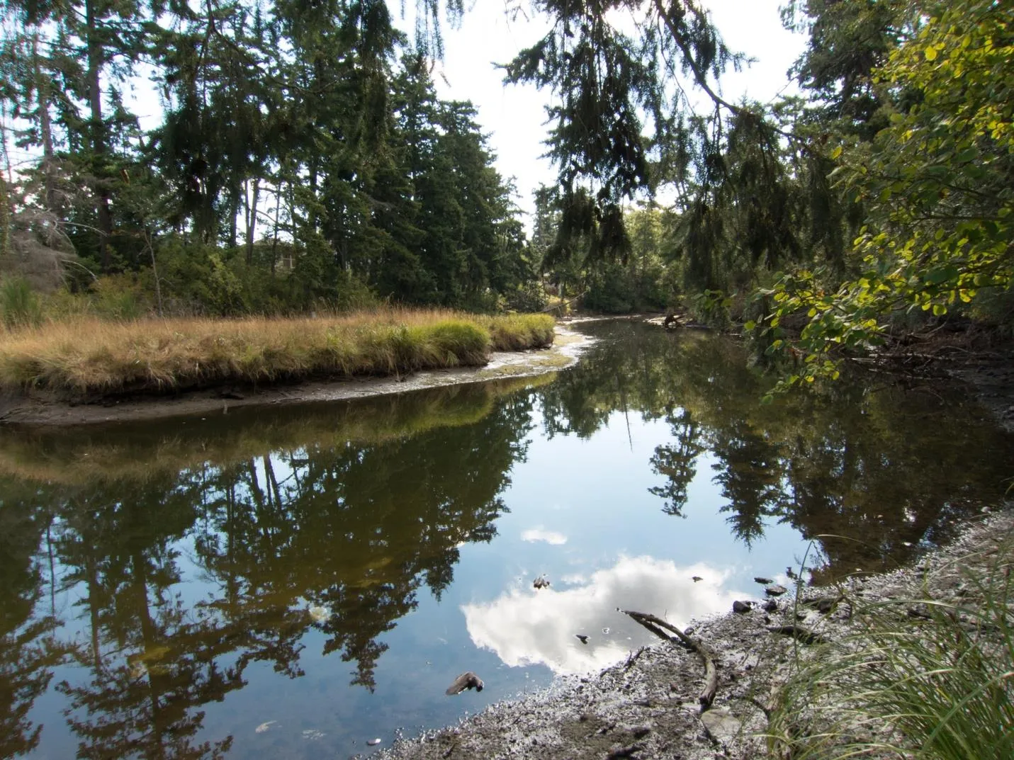
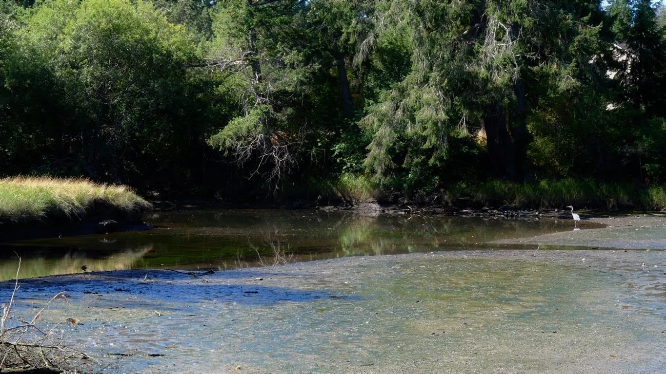
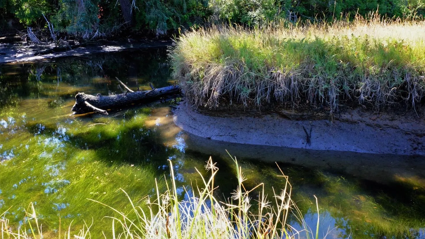
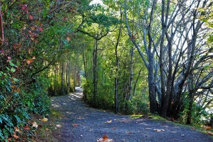
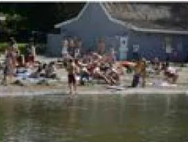
View Royal has an abundance of natural assets including Thetis Lake, Millstream Creek, and Esquimalt Harbour. Close to 40% of the Town is parks.

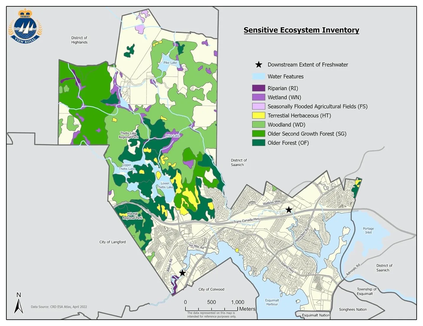
SENSITIVE ECOSYSTEMS
CLIMATE CHANGE RISKS
- Sea Level Rise: coastal portions of Harbour and Helmcken neighbourhoods are at risk.
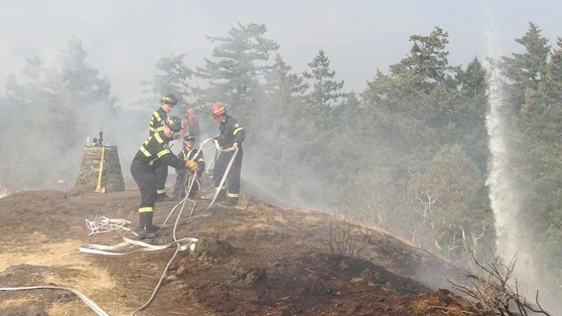
- Wildfire: Risk is increasing at "wildland/urban interfaces" (e.g., near Thetis Lake Park).
- Changing Climate: Drier summers and extreme winter precipitation.
NATURAL ENVIRONMENT OBJECTIVES AND POLICIES
OBJECTIVE NE1: Environmental Conservation.
- NE 1.5 Native Vegetation: Encourage native trees; enforce the Tree Protection Bylaw.
- NE 1.8 Watersheds: Cooperate on Millstream, Hospital, and Craigflower Creek plans.
OBJECTIVE NE2: Balance built form with living environment.
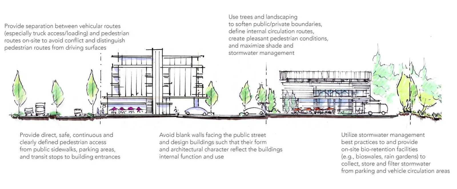
- NE 2.5 Design: "Design with the land" using bioswales, rain gardens, and permeable surfaces.
- NE 2.12 Urban Growth Boundary: maintain to preserve greenspace.
OBJECTIVE NE4: Climate change mitigation and leadership.
- NE 4.2 GHG Targets:
- 45% reduction below 2007 levels by 2030.
- 100% reduction below 2007 levels by 2050.
- NE 4.6 Energy Efficiency: Consider steps 4 and 5 of the BC Energy Step Code.
NATURAL ENVIRONMENT IMPLEMENTING ACTIONS
- ACTION NE2: Conduct a high-risk vulnerability analysis for infrastructure.
- ACTION NE5: Develop an Invasive Species and Native Habitat Restoration Strategy.
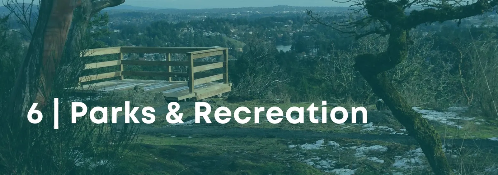
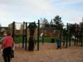
6 | PARKS AND RECREATION
VIEW ROYAL TODAY
Parks constitution approximately 40% of the land base. Indoor recreation is primarily provided through the Juan de Fuca Recreation Centre in Colwood.
CHALLENGES
- Underserved Neighbourhoods: Hospital and Harbour neighbourhoods lack sufficient park space.
- Connectivity: Fragmentation by highways makes accessing parks difficult.
- Launch Facilities: Served by facilities at Shoreline Drive and Stewart Avenue.
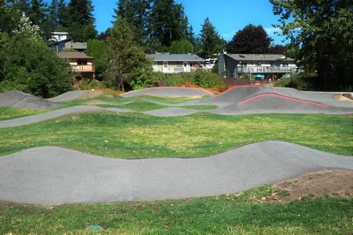
PARK CLASSIFICATIONS
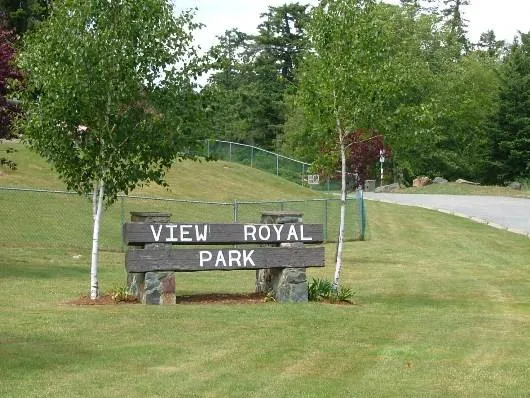
- Town Park: (e.g. View Royal Park) Large parks with active facilities.
- Community Park: Large parks for passive and active recreation.
- Neighbourhood Park: Smaller areas for local residents.
- Neighbourhood Greenspace: Small spaces within 1/2 km walking distance of homes.
- Natural Greenspace: Protects natural systems.
- Shoreline Access: Waterfront access points.
- Regional Park: Managed by CRD (Thetis Lake, Mill Hill).
- Linear Park: Connections between park spaces.
PARKS OBJECTIVES AND POLICIES
OBJECTIVE PR1: Variety of amenities.
- PR 1.4 Parkland Standard: Minimum 5.0 hectares per 1,000 people.
OBJECTIVE PR3: Increase water and shoreline access.
- PR 3.1 Policy: Prioritize access in areas where it is currently limited.
OBJECTIVE PR6: Implement Parks Master Plan recommendations.
- PR 6.1: Emphasize historical significance of Portage Park with interpretive signs.
PARKS IMPLEMENTING ACTIONS
- ACTION PR1: Prioritize investments in specific neighbourhood parks.
- ACTION PR7: Update Development Cost Charge (DCC) Bylaw for park improvements.
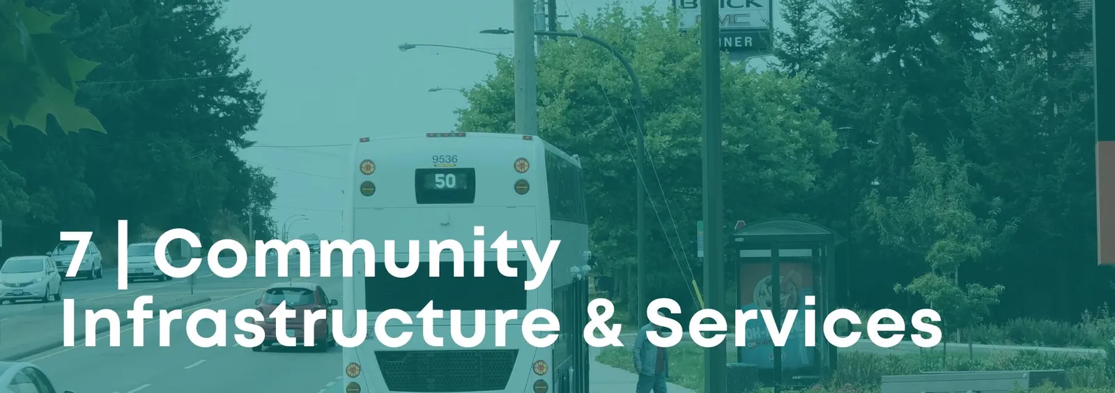
7 | COMMUNITY INFRASTRUCTURE AND SERVICES
OVERVIEW
Servicing and infrastructure investments are designed for long-term fiscal responsibility and climate adaptation.
SERVICES TODAY
- Water: Connected to the regional distribution system owned by the CRD.
- Sewer: ~50 km of pipeline and 17 pump stations.
- Drainage: Managed through open ditches and culverts; a 15-year drainage program is underway.
- Garbage/Recycling: weekly collection; recycling managed through CRD Environmental Services.
PROTECTIVE SERVICES
- Fire: View Royal Fire Department has 7 full-time and 30 part-time staff.
- Police: Serviced by West Shore RCMP detachment in Langford.
INFRASTRUCTURE OBJECTIVES AND POLICIES
OBJECTIVE IS1: Coordinate infrastructure with land use.
- IS 1.5 New Development: Encourage on-site stormwater management and pervious surfaces.
OBJECTIVE IS2: Environmental sustainability.
- IS 2.2 Green Infrastructure: Expand engineered bioswales and groundwater recharge areas.
OBJECTIVE IS5: Protective Services presence.
- IS 5.4 Sea-level Rise: Plan for 0.5m rise by 2050 and 1.0m by 2100.
INFRASTRUCTURE IMPLEMENTING ACTIONS
- ACTION IS4: review and implement a new Emergency Plan.
- ACTION IS8: Develop a coastal sea level rise adaptation strategy.
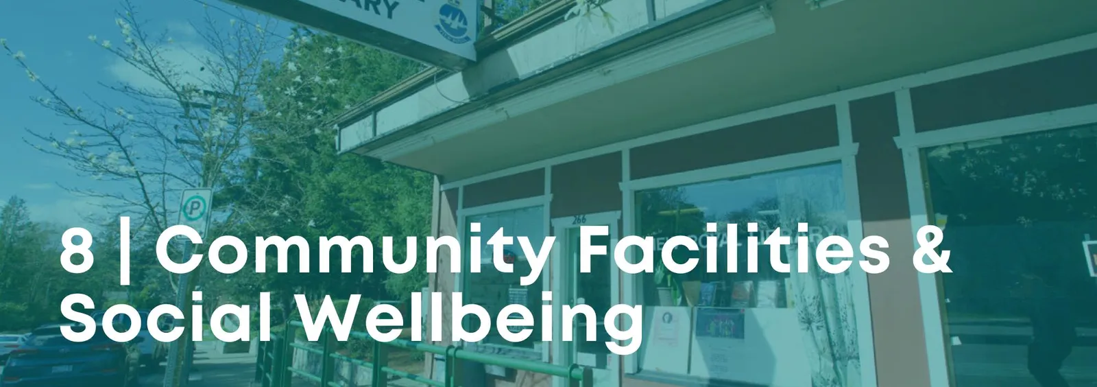
8 | COMMUNITY FACILITIES AND WELLBEING
HERITAGE
View Royal is home to the Craigflower Manor (built 1856), one of Canada’s National Historic Sites.
WELLBEING OBJECTIVES AND POLICIES
OBJECTIVE CH1: Protect heritage resources.
- CH 1.1 Heritage Register: Continue identifying properties for the municipal register.
OBJECTIVE CH4: Protect traditional lands.
- CH 4.1 Traditional Foods: Collaborate with Esquimalt and Songhees Nations to protect gathering lands.
OBJECTIVE CH7: Inclusive community.
- CH 7.1 Seniors: Ensure housing facilitates "aging in place."
OBJECTIVE CH10: Public Schools.
- CH 10.1: Recognize schools as community education and gathering centres.
WELLBEING IMPLEMENTING ACTIONS
- ACTION CH2: Host an annual Community-to-Community event with First Nations.
- ACTION CH4: Consider developing a Public Art Strategy.
PART 3: DEVELOPMENT PERMIT AREAS

1. JUSTIFICATION AND AUTHORITY
The Town designates DPAs under Section 488 of the Local Government Act for environmental protection, hazard protection, and guiding form and character.
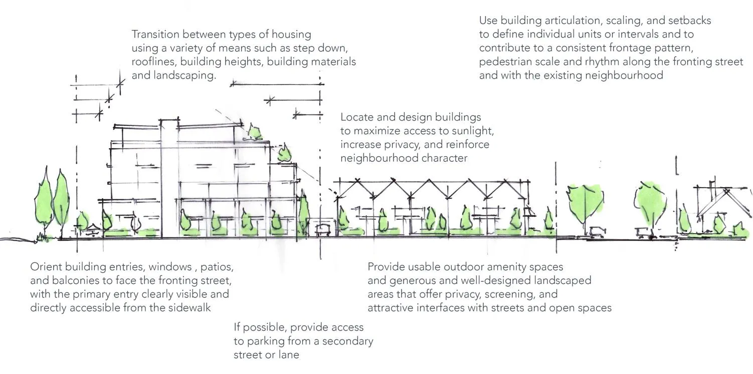
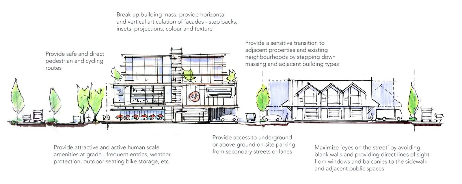
2. FORM AND CHARACTER OF DEVELOPMENT

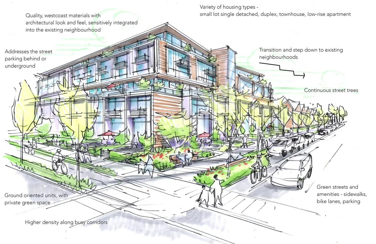
DPA: Mixed Residential
- Justification: Incremental replacement of aging housing stock with duplexes, townhouses, and low-rise apartments.
- Guidelines:
- Materials: Durable, "West Coast" design (wood, stone).
- Siting: Orientation toward the street; underground parking preferred.

DPA: Neighbourhood Mixed Use
- Guidelines: Ground floor commercial must contribute to a safe, pedestrian-friendly streetscape.

DPA: Intensive Mixed Use
- Guidelines: Clustered buildings on key roads; one primary gathering place per area.
DPA: Commercial
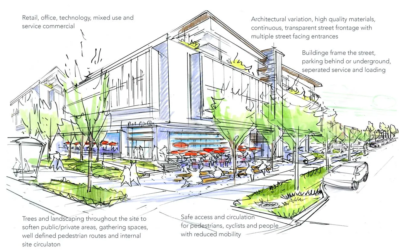
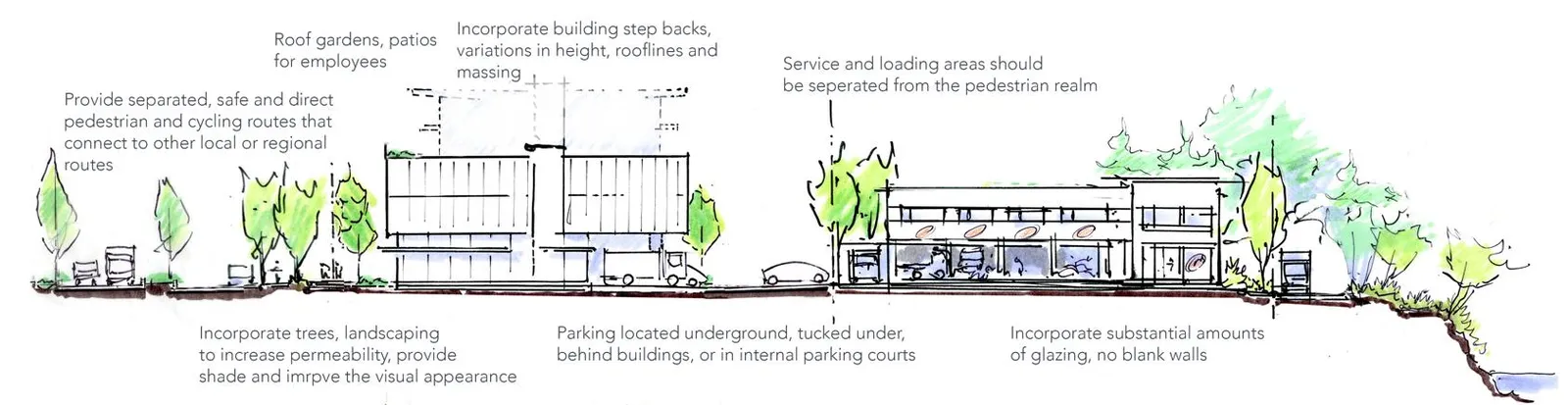
- Guidelines: Buildings should frame public streets; surface parking must be located behind buildings.
3. ENVIRONMENTAL PROTECTION & NATURAL HAZARD DPAs

Natural Watercourse and Shoreline Areas:
- Protects riparian areas of Esquimalt Harbour, Portage Inlet, Craigflower Creek, and Millstream Creek.
- Setbacks: Minimum 15-metres for new buildings.
Sensitive Terrestrial Ecosystems:
- Covers areas near Mill Hill and Thetis Lake, and all wildland/urban interface areas.
PART 4: IMPLEMENTATION

PLAN IMPLEMENTATION ACTIONS
| OCP ACTION | Timeframe | Responsibility |
|---|---|---|
| LAND USE | ||
| ACTION LU1: Update Transp. Master Plan | 1-2 years | Engineering/Planning |
| ACTION LU2: Update Zoning Bylaw (Active Transp) | 3-5 years | Planning |
| ACTION LU3: Town Centre Master Plan | 5-10 years | Planning |
| ACTION LU4: Density Bonus Zoning | 1-2 years | Planning |
| ACTION LU5: Infill Development Guidebook | 3-5 years | Planning |
| ACTION LU7: Update DPA Guidelines | 5-10 years | Planning |
| TRANSPORTATION | ||
| ACTION TR1: Active Transp. Network Plan | 5-10 years | Engineering/Planning |
| ACTION TR2: Long-range sidewalk plan | 3-5 years | Engineering |
| ACTION TR3: Bike lane/path construction plan | 3-5 years | Engineering |
| ACTION TR5: Advocate for E&N rail service | Ongoing | Council |
| HOUSING | ||
| ACTION HS1: Review dev application process | 1-2 years | Planning |
| ACTION HS3: Housing Strategy | 5-10 years | Planning |
| ACTION HS5: Affordable Housing Policy | 5-10 years | Planning |
| ACTION HS7: Prepare Infill Guidebook | 3-5 years | Planning |
| ECONOMIC DEVELOPMENT | ||
| ACTION ED1: Economic Development Strategy | 3-5 years | Planning |
| ACTION ED2: Review parking/loading bylaws | Ongoing | Planning |
| NATURAL ENVIRONMENT | ||
| ACTION NE1: Corporate Energy Strategy | 1-2 years | Planning |
| ACTION NE2: Vulnerability Analysis | 3-5 years | Engineering/Planning |
| ACTION NE4: Review flood elevation policies | 3-5 years / 5-10 years | Engineering/Planning |
| ACTION NE5: Invasive Species Strategy | 3-5 years | Parks/Planning |
| ACTION NE9: Energy Step Code implementation | 5-10 years | Council |
| PARKS AND RECREATION | ||
| ACTION PR1: Implement Parks Master Plan | 1-2 years | Eng./Parks/Planning |
| ACTION PR3: Regional Green/Blue Spaces Strategy | Ongoing | All |
| ACTION PR4: Review DCC Bylaw | 3-5 years | Engineering |
| INFRASTRUCTURE | ||
| ACTION IS1: Update sanitary/drainage plans | 1-2 years | Engineering |
| ACTION IS2: Multi-family compost pick-up | 3-5 years | Engineering |
| ACTION IS4: New Emergency Plan | 5-10 years | Fire |
| COMMUNITY WELLBEING | ||
| ACTION CH1: Reconciliation engagement | Ongoing | All |
| ACTION CH2: Community-to-Community events | 1-2 years | Council |
| ACTION CH4: Public Art Strategy | 5-10 years | Planning |
| ACTION CH7: Heritage inventory development | 5-10 years | Planning |
GLOSSARY OF TERMS (Key Excerpts)
- Affordable Housing: Housing where rent/mortgage is 30% or less of gross annual income.
- FSR (Floor Space Ratio): Ratio of buildable area to land area.
- Missing Middle Housing: House-scale buildings with multiple units (townhomes) compatible with single-family neighborhoods.
- Transit-oriented Development (TOD): Mixed-use development clustered around a transit station.
SCHEDULES
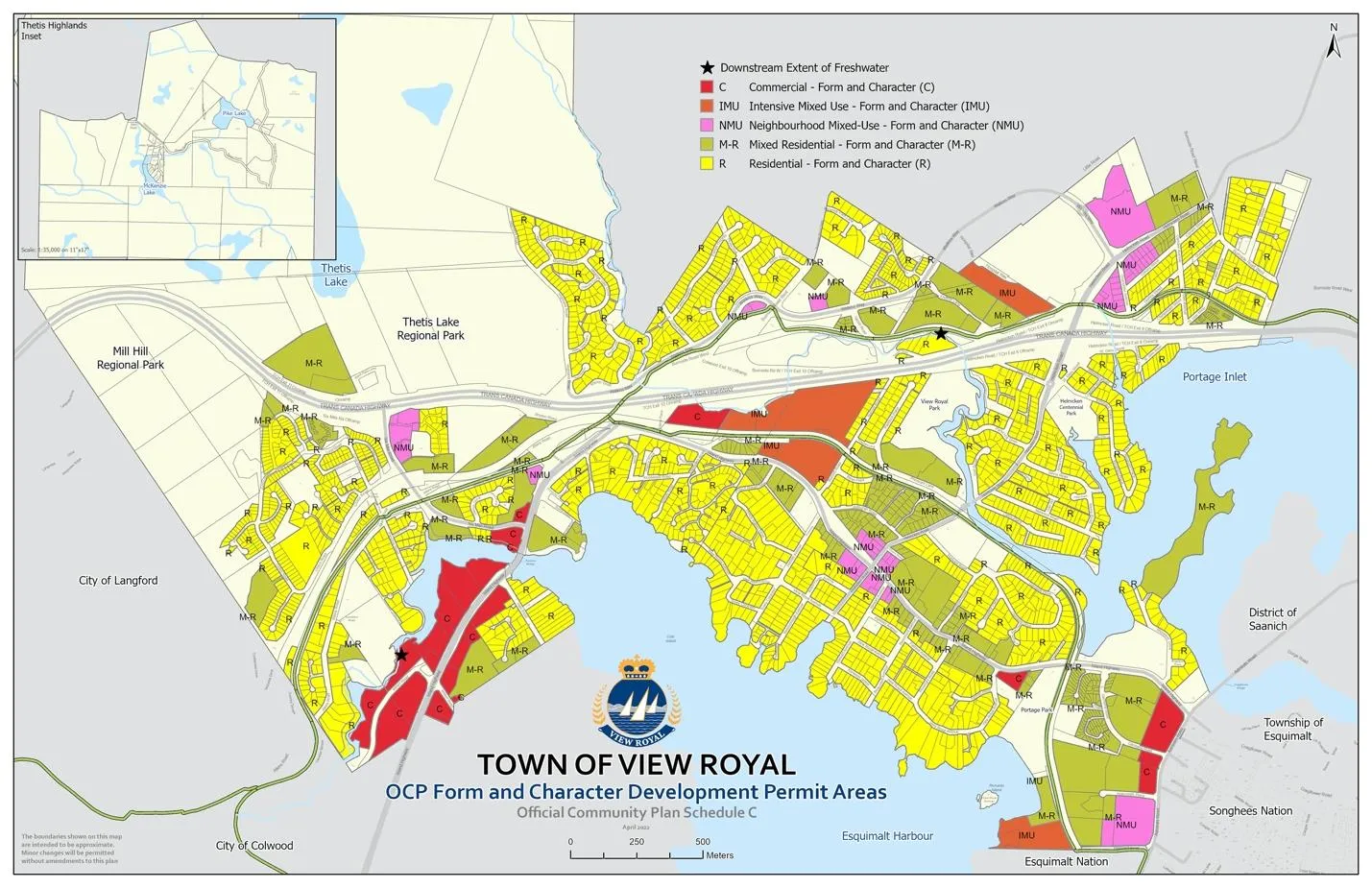
- Schedule A: OCP Land Use Designations
- Schedule B: Community Development Framework
- Schedule C: Form & Character DPAs
- Schedule D: Environmental Protection & Natural Hazard DPAs
Document Images
(63)
Infographic comparing average household size in 2021 (2.36) to 2016 (2.08)
Infographic summary of housing dwellings, ownership rates, 65+ households, and median home prices
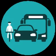
Figure 4: Rendering of a garden suite infill example
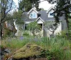
Figure 13: Diagram showing FSR of 1.0 calculated across 1, 2, and 4 storeys
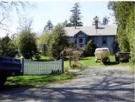
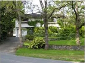
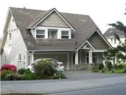
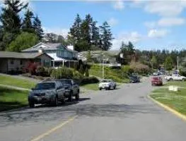
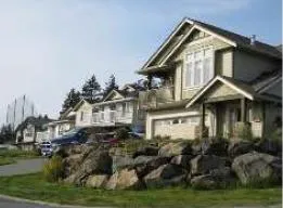
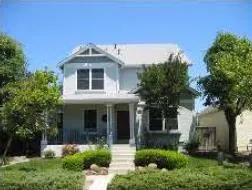
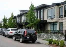
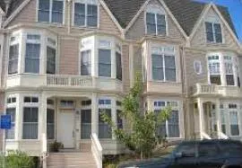
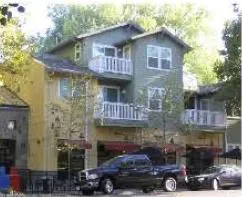
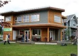
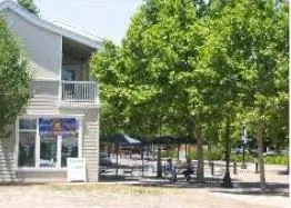
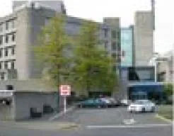
Photo of a cyclist on a trail labeled "2 | Transportation & Mobility"
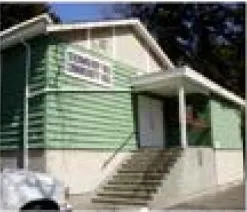
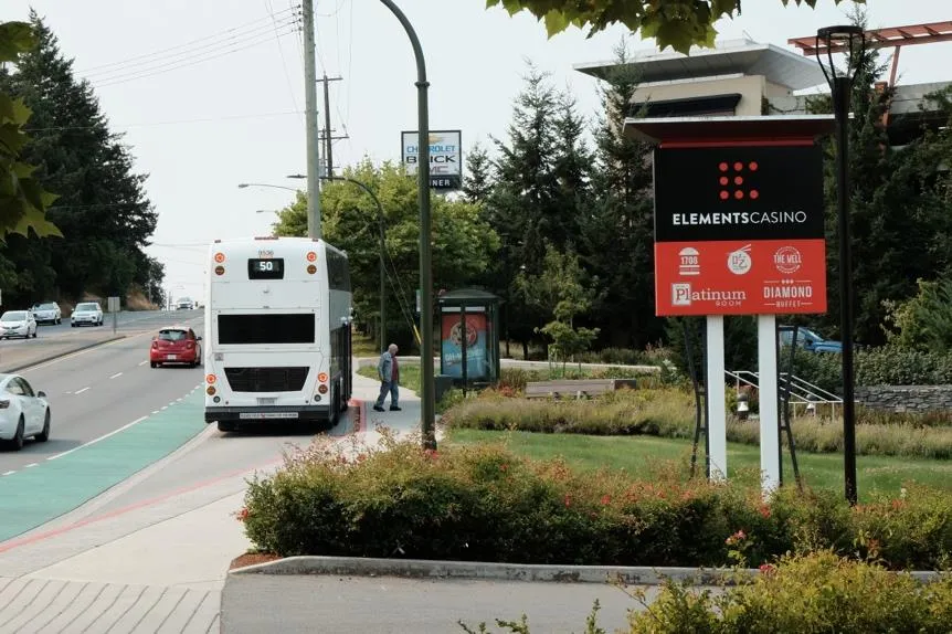
Photo of Casino Area Intersection with bike lanes
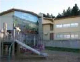
Figure 14: Map of the Transportation Network

Cover of View Royal Transportation Master Plan (2016)

Cover of CRD Regional Pedestrian & Cycling Masterplan (2011)
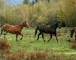
Photo of a paved bike path
Map 3: View Royal Cycling Lane and Sidewalk Network
Map 4: Major Transportation Routes
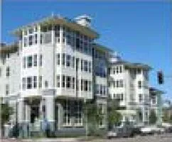
Photo of a modern apartment building labeled "3 | Housing"
Infographic icon representing affordable housing
Image 13: Aerial view of a View Royal neighbourhood