Staff Report
2018 - 2021 Reported Incidents Charts
February 8, 2022Pages 65–714 sections
A series of charts and data tables showing the number and percentage of reported RCMP incidents by area from 2018 to 2021.
View Royal 2021 reported incidents: 3,617Langford 2021 reported incidents: 13,355View Royal incidents increased by 15% in 2021 compared to 2020Colwood 2021 reported incidents: 4,590
Reported Incidents per Area (2018 - 2021)
Pages 1 & 2 is the same data shown in 3 different charts – the number of reported incidents per area from 2018 - 2021
Reported Incidents Data Table
| VIEW ROYAL | LANGFORD | COLWOOD | METCHOSIN | HIGHLANDS | MALAHAT | RESERVES |
|---|---|---|---|---|---|---|
| 2021 | 3617 | 13355 | 4590 | 929 | 340 | 221 |
| 2020 | 3146 | 12803 | 4572 | 945 | 336 | 186 |
| 2019 | 3320 | 13830 | 4423 | 919 | 342 | 163 |
| 2018 | 3071 | 11290 | 3598 | 990 | 388 | 165 |
Page 65–71
Percentage of Reported Incidents per Area (2018 – 2021)
Pages 3 & 4 is the same data shown in 3 different charts – the percentage of reported incidents per area from 2018 – 2021
There are too many variables (categories) to make a pie chart for all of the data in the table, however, pages 5 & 6 shows a break down of the percentages in each area per year
Percentage Incidents Data Table
| VIEW ROYAL | LANGFORD | COLWOOD | METCHOSIN | HIGHLANDS | MALAHAT | RESERVES |
|---|---|---|---|---|---|---|
| 2021 | 15.04% | 55.55% | 19.09% | 3.86% | 1.41% | 0.92% |
| 2020 | 13.65% | 55.55% | 19.84% | 4.10% | 1.46% | 0.81% |
| 2019 | 13.90% | 57.89% | 18.51% | 3.85% | 1.43% | 0.68% |
| 2018 | 15.18% | 55.79% | 17.78% | 4.89% | 1.92% | 0.82% |
Page 65–71
Annual Percentage Breakdown of Reported Incidents per Area
Pages 5 & 6 show the percentage of reported incidents in each area per year (2018 – 2021)
2021 % Reported Incidents per Area
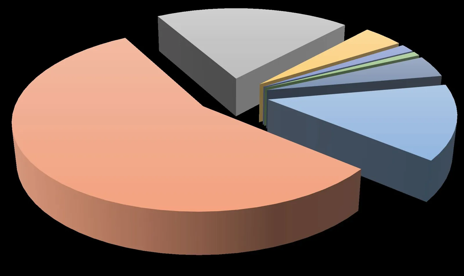
- LANGFORD: 55.55%
- COLWOOD: 19.09%
- VIEW ROYAL: 15.04%
- METCHOSIN: 3.86%
- RESERVES: 3.33%
- HIGHLANDS: 1.41%
- MALAHAT: 0.92%
2020 % Reported Incidents per Area
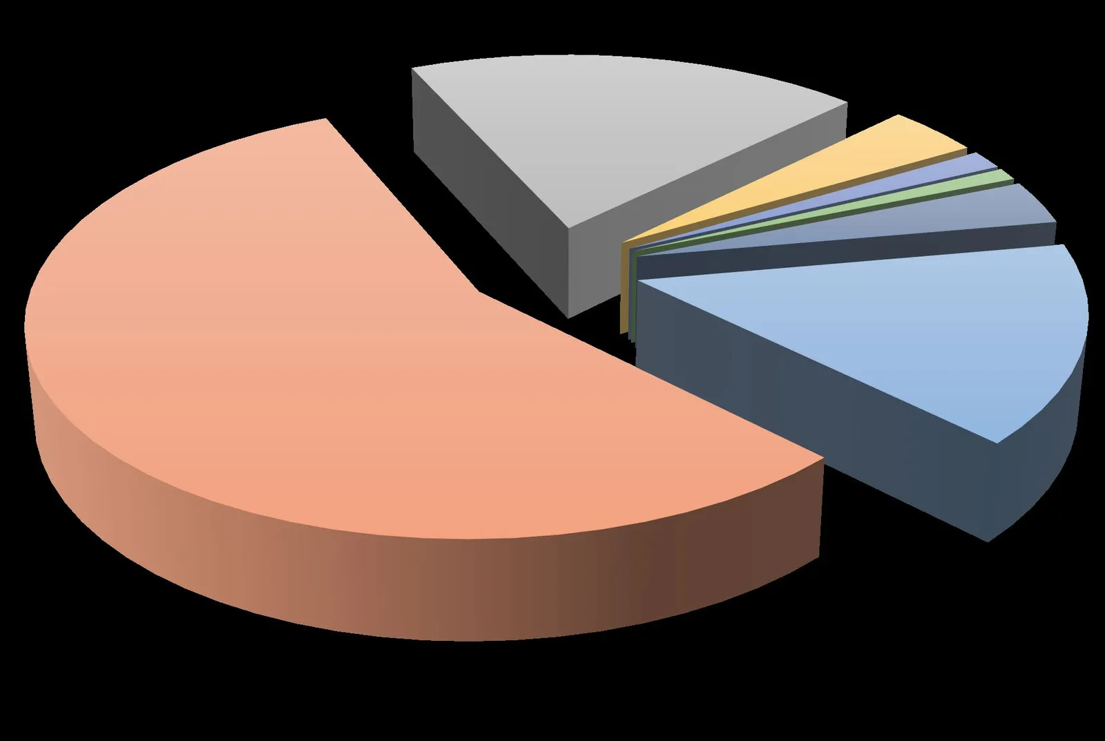
- LANGFORD: 55.55%
- COLWOOD: 19.84%
- VIEW ROYAL: 13.65%
- METCHOSIN: 4.10%
- RESERVES: 3.98%
- HIGHLANDS: 1.46%
- MALAHAT: 0.81%
2019 % Reported Incidents per Area
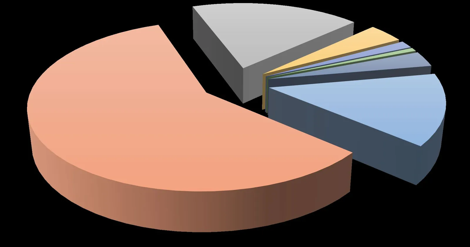
- LANGFORD: 57.89%
- COLWOOD: 18.51%
- VIEW ROYAL: 13.90%
- METCHOSIN: 3.85%
- RESERVES: 3.06%
- HIGHLANDS: 1.43%
- MALAHAT: 0.68%
2018 % Reported Incidents per Area
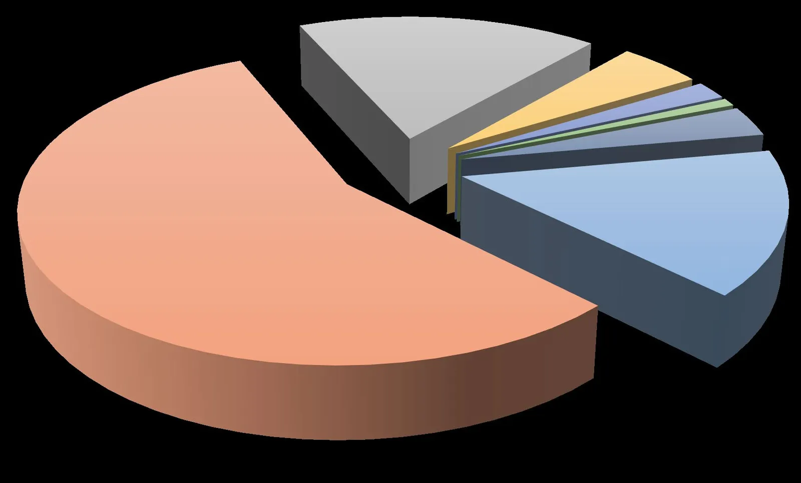
- LANGFORD: 55.79%
- COLWOOD: 17.78%
- VIEW ROYAL: 15.18%
- METCHOSIN: 4.89%
- RESERVES: 3.22%
- HIGHLANDS: 1.92%
- MALAHAT: 0.82%
Page 65–71
View Royal Reported Incidents & Percent Change (2018 - 2021)
2018 – 2021 - Year over year reported incidents & percent changes for View Royal
- 2018: 3071 reported incidents
- 2019: 3320 reported incidents (< +8% > change from 2018)
- 2020: 3146 reported incidents (< -5% > change from 2019)
- 2021: 3617 reported incidents (< +15% > change from 2020)
Page 65–71
Extracted from: 2022 02 08 Committee of the Whole Agenda - Agenda - Pdf