Presentation - REZONING 2021/03 10 Erskine Lane
A staff presentation outlining the zoning history, development concept, site data summary, and environmental considerations for the 10 Erskine Lane rezoning application.
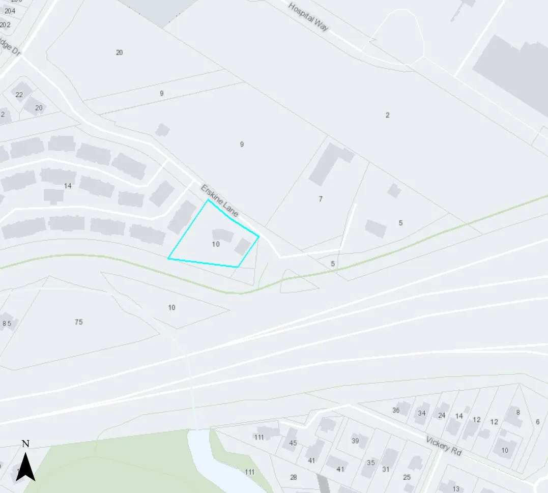
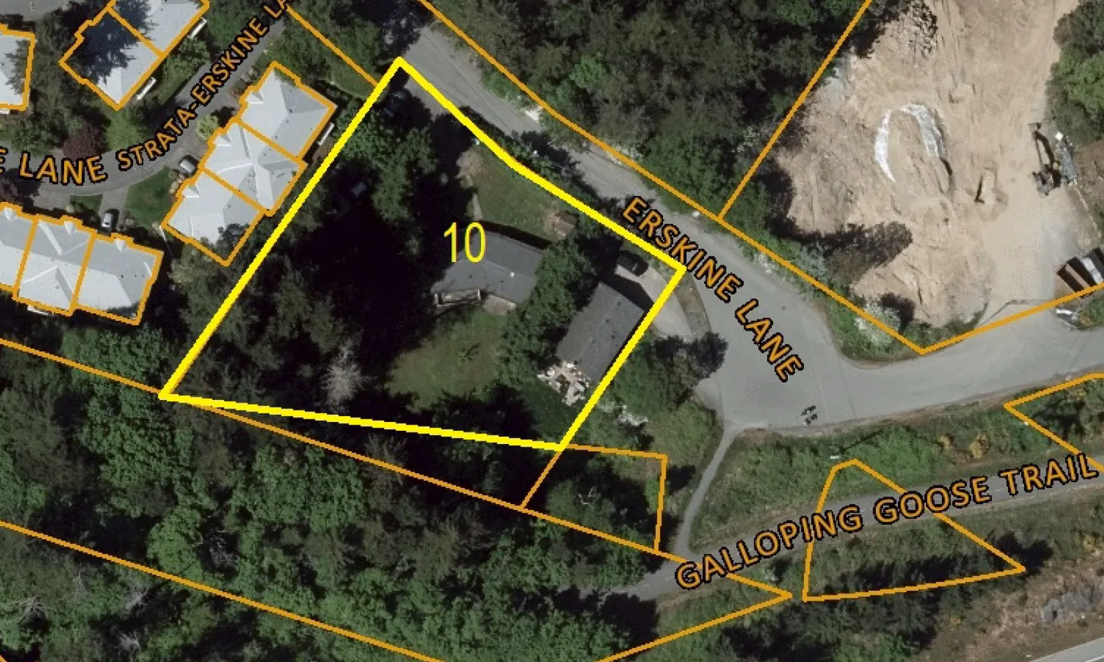
REZONING 2021/03
10 Erskine Lane
To introduce a rezoning application to amend the CD 12: Comprehensive Development (Erskine Lane) zone to increase the building height, floor space ratio and number of multifamily residential units for the property at 10 Erskine Lane.
Zoning history
Rezoned in 2008 for 30 apartment units with following identified community amenity contributions:
- Upgrade of the connection to the Galloping Goose Trail to the east of the Land, including a 1.8 metre brushed-finished sidewalk between the land and the trail connection. Trail connection is to extend from the paved road surface to the Galloping Goose trail and is to be 2.0 metres in width and constructed to a standard acceptable to the Director of Engineering.
- Construction of a 1.8 metre brushed-finish concrete sidewalk [from] the frontage of the land and continuing to Watkiss Way.
- Community amenities were to be secured in a covenant
- The covenant was not registered
- The development permit was approved but not issued and has since lapsed
- Processes at Town Hall have substantially changed since this time to avoid this situation occurring again and covenants are now required in registerable format before adoption of bylaws.
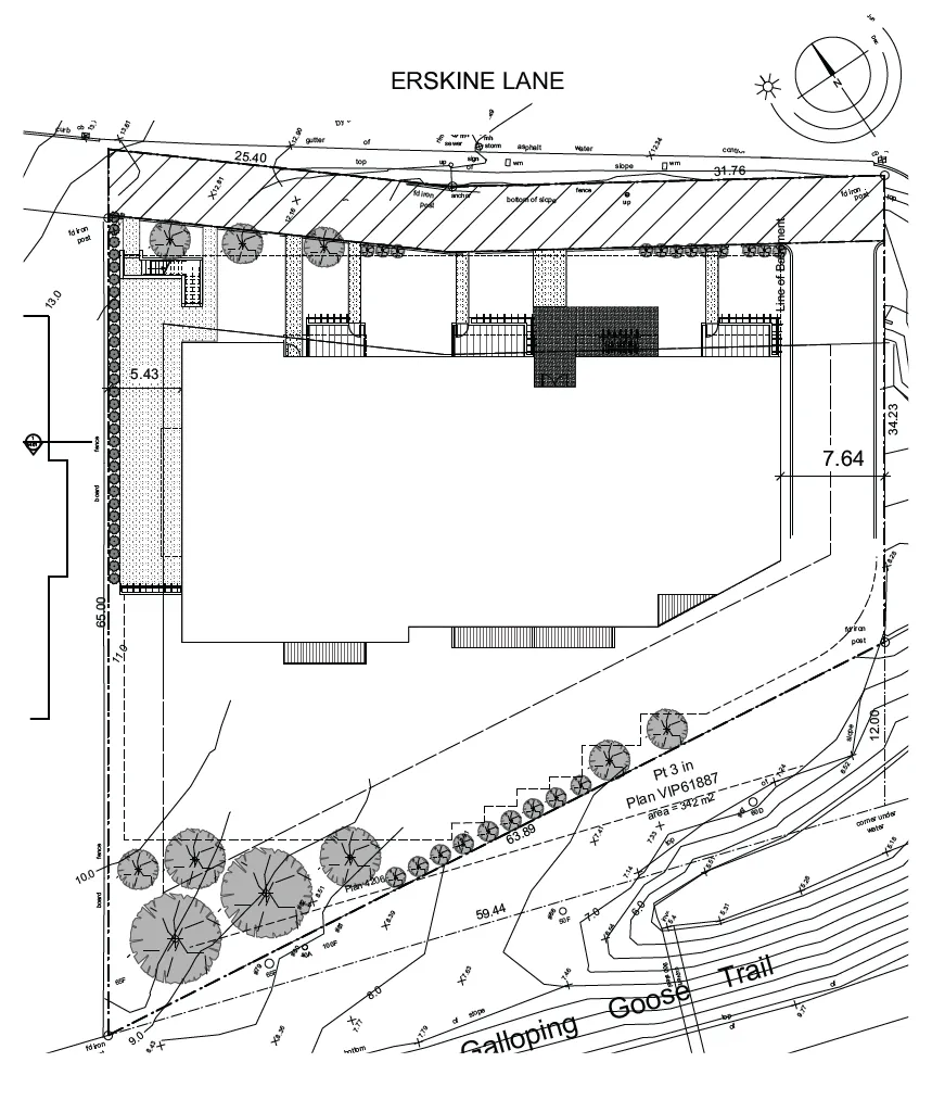
Development Concept

Site Data Summary
| Item | Details |
|---|---|
| Site Area | 2774 m2 |
| Floor Area | 3851.7 m2 |
| Floor Space Ratio | tbc |
| Units/Hectare | tbc |
| Building Height | 17.5 m |
| Storeys | 5 |
| Site Coverage | tbc |
| Units | 43 |
| Vehicle Parking | 53* (53 required) |
| Accessible Parking | 1 (1 required) |
| Secure Bicycle Parking | 43 (43 required) |
Unit Mix
| Units by number of bedrooms | Proposed |
|---|---|
| 0-bedroom units | 5 |
| 1-bedroom units | 18 |
| 2-bedrooms units | 20 |
Design Comment
Development concept helps illustrate the applicant’s intent. Form and character to be formally addressed through a development permit application after rezoning.
Staff notes the following:
- A context illustration with the townhouses next door should be provided. While the applicant proposes that a hedge be planted, this may not be adequate to address privacy and overlook issues for the Townhouse units.
- Stepping back the upper floor of the building reduces the massing and would add visual interest to the roofline
- The building and parking are sited to preserve a stand of trees at the south end of the property
Official Community Plan Context
The site is designated Mixed Residential in the Official Community Plan, which supports multifamily use. It is on the periphery of the Hospital Neighbourhood Centre and would provide additional residential density to support the commercial and employment components of the centre. The proposal is generally in keeping with other OCP policies, including the following:
- The development promotes complete streets through the provision of additional pedestrian and cycling amenities
- The development concept is street oriented with ground level units having a direct connection to the street
- The building form makes efficient use of limited land
- This site is in a location with multimodal transportation opportunities
Proposed Zone
| Category | Existing | Proposed |
|---|---|---|
| Principal uses | Residential Apartment | No change |
| Maximum number of residential units | 30 | 43 |
| Floor Space Ratio | 0.85:1 | 1.38* |
| Building Height | 12m | 17.5m |
| Storeys | Three | Five |
| Lot Coverage | 35% | tbc |
| Siting of Buildings and Structures from a lot line | ||
| - Front | 7.5m | No change |
| - Rear | 10m | 5.4m |
| - Side | 7.5m | No change |
| - Side, Flanking | 6m | No change |
*Site area after road dedication will need to be confirmed.
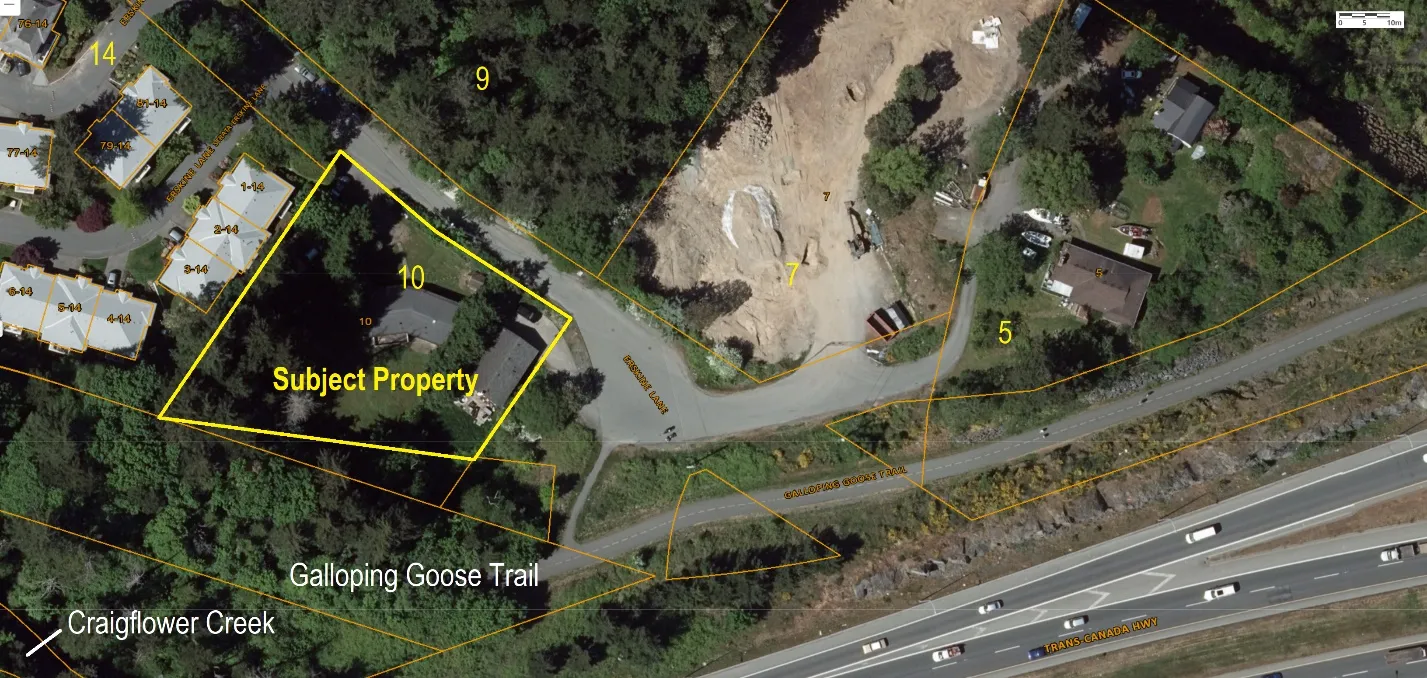
Environment
- Not within any environmental Development Permit Areas
- Mature fir trees in the southwest corner and along the west property line.
- Site has been designed to retain the trees in the southwest corner as a buffer to the Galloping Goose Regional Trail.
- Trees along the west property line be removed and replaced with hedge
Document Images
(1)