Appendix
Schedule 1 – Fence/Retaining Wall Location
March 18, 2014Page 311 section
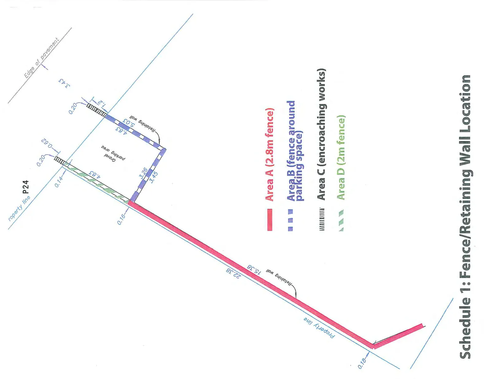
A color-coded map defining 'Area A' through 'Area D' for the purpose of variance recommendations.
Area A: 2.8m fenceArea B: fence around parking spaceArea C: encroaching worksArea D: 2m fence
Schedule 1: Fence/Retaining Wall Location
Legend
- Area A (2.8m fence)
- Area B (fence around parking space)
- Area C (encroaching works)
- Area D (2m fence)
Map Details
- Property line
- Retaining wall
- Gravel parking area
- Edge of pavement
- P24
Dimensions and Notations:
- Area A: Total length of 22.38; portion along retaining wall is 15.38. Offset of 0.18 at the bottom left and 0.16 at the top junction.
- Area B: Dimensions of 3.45 and 3.26 on the bottom edge; 5.03 and 4.83 along the right edge (retaining wall side).
- Area C: Small hatched sections labeled with dimensions 0.20, 0.62 near the top left and 0.20, 1.2 near the top right.
- Area D: Length of 4.83 with an offset of 0.14.
- Other: Distance of 3.43 from the top of the works to the edge of pavement.
Page 31
Extracted from: 2014 03 18 Council Agenda