Correspondence from Victoria Regional Transit Commission re: Transit Priority Update
An update from the VRTC regarding transit priority measures on Douglas Street and Highway 1, including proposed transit hubs.
March 3, 2014
Town of View Royal Attention: Mayor and Council 45 View Royal Avenue Victoria, BC V9B 1A6
Re: Transit Priority Update
Dear Mayor & Council:
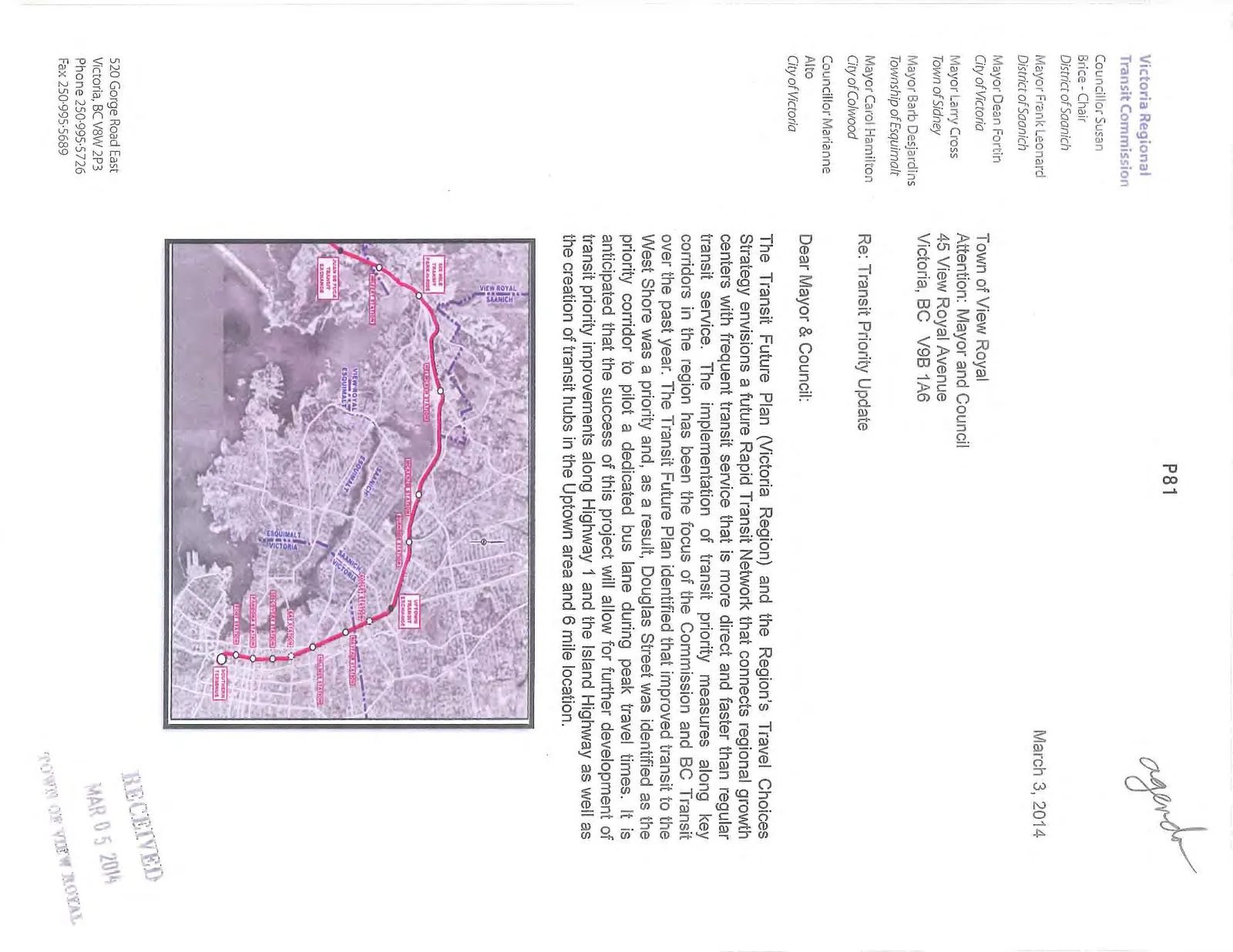
The Transit Future Plan (Victoria Region) and the Region's Travel Choices Strategy envisions a future Rapid Transit Network that connects regional growth centers with frequent transit service that is more direct and faster than regular transit service. The implementation of transit priority measures along key corridors in the region has been the focus of the Commission and BC Transit over the past year. The Transit Future Plan identified that improved transit to the West Shore was a priority and, as a result, Douglas Street was identified as the priority corridor to pilot a dedicated bus lane during peak travel times. It is anticipated that the success of this project will allow for further development of transit priority improvements along Highway 1 and the Island Highway as well as the creation of transit hubs in the Uptown area and 6 mile location.
An update of the progress of this transit priority work is provided below. Please contact BC Transit staff if you wish to discuss in further detail.
Douglas Street
Following additional refinement of the design options on the segments between Fisgard and Hillside, the City of Victoria and BC Transit have engaged a consulting firm to commence detail design. Led by the City of Victoria, it is anticipated that City crews will commence work in mid-February and be completed this spring. The work will primarily include the removal of curb bulbs at Herold and Pembroke Streets, re-laning, and minor curb modifications to accommodate bus only operations in both directions during peak periods of 0600-0900 and 1500-1800. At all other times, the lanes will continue to serve as parking.
Design work for Phase 2, from Hillside to Tolmie, will follow the Phase 1 work. Construction is tentatively scheduled to commence later this year, with completion in 2015, and will tie into planning works from Tolmie to Uptown currently being undertaken by the Ministry of Transportation and Infrastructure (MoTI).
Highway 1
The improvements along this segment of the corridor are being led by MoTI and are expected to include initiatives that further improve traffic flow for all modes of traffic. BC Transit is working with MoTI staff to identify viable opportunities that would specifically improve transit service, such as dedicated bus lanes and bus on shoulder options.
Transit Hubs
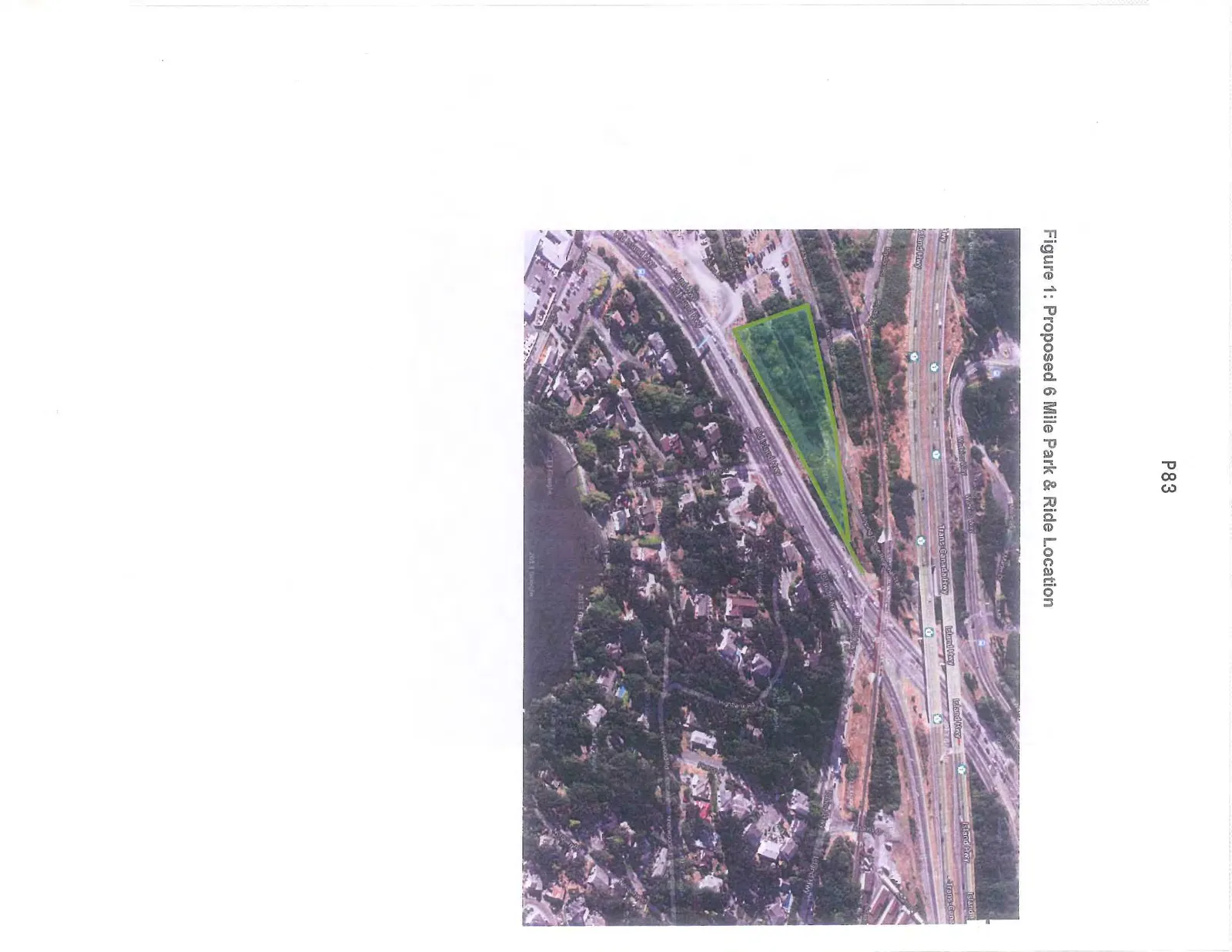
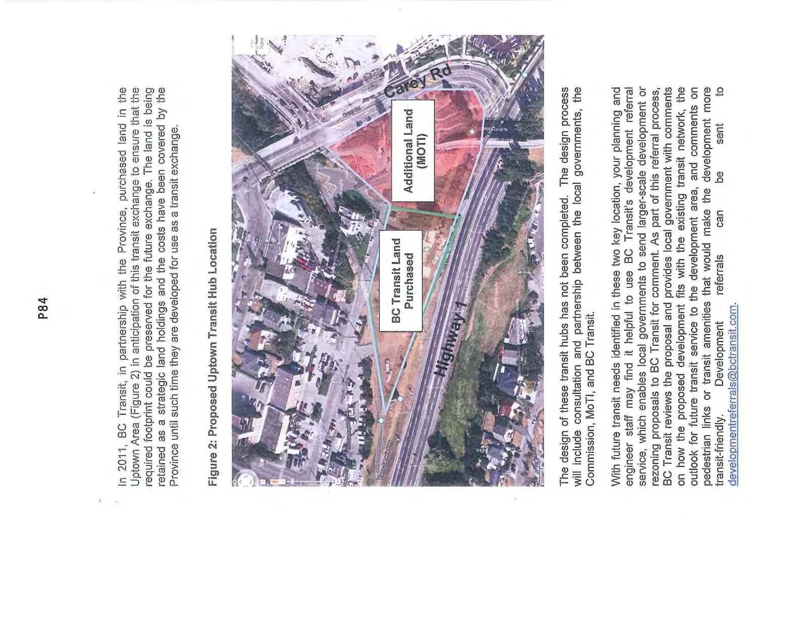
The Transit Future Plan for Victoria identified the Uptown area and the 6 Mile area as the two key locations that would benefit from the creation of transit hubs (an exchange at Uptown and a park and ride at 6 Mile), to best serve the current and future network of transit.
The location at 6 Mile has been identified (Figure 1), and BC Transit has worked with the Province to secure the land for future development.
Figure 1: Proposed 6 Mile Park & Ride Location
In 2011, BC Transit, in partnership with the Province, purchased land in the Uptown Area (Figure 2) in anticipation of this transit exchange to ensure that the required footprint could be preserved for the future exchange. The land is being retained as a strategic land holdings and the costs have been covered by the Province until such time they are developed for use as a transit exchange.
Figure 2: Proposed Uptown Transit Hub Location
The design of these transit hubs has not been completed. The design process will include consultation and partnership between the local governments, the Commission, MoTI, and BC Transit.
With future transit needs identified in these two key location, your planning and engineer staff may find it helpful to use BC Transit's development referral service, which enables local governments to send larger-scale development or rezoning proposals to BC Transit for comment. As part of this referral process, BC Transit reviews the proposal and provides local government with comments on how the proposed development fits with the existing transit network, the outlook for future transit service to the development area, and comments on pedestrian links or transit amenities that would make the development more transit-friendly. Development referrals can be sent to developmentreferrals@bctransit.com.
Thank you for your continued support to move transit forward in the region.
Yours sincerely,
Susan Brice, Chair Victoria Regional Transit Commission
cc: Commission Members
Attachments: Link to Transit Priority Identification Report: http://bctransit.com/regions/vic/news/commission/pdf/cmtg-ra-729.pdf
Final report http://www.bctransit.com/transitfuture/pdf/vrptc_2013-06-20_Draft_Final_Document.pdf
Document Images
(2)