This site is in beta — data may be incomplete and features are still being added.
Council Meeting/Documents/Evidence for Hazard Falling Rock Concerns
Appendix

Evidence for Hazard Falling Rock Concerns

November 19, 2024Pages 121–1231 section

Map and photos identifying the location of falling rock hazards.

13.b) Hazard Falling Rock Safety Concerns - Councillor Rogers
Location: Island Highway near MoTH right of way

LOCATION of falling Rock hazard
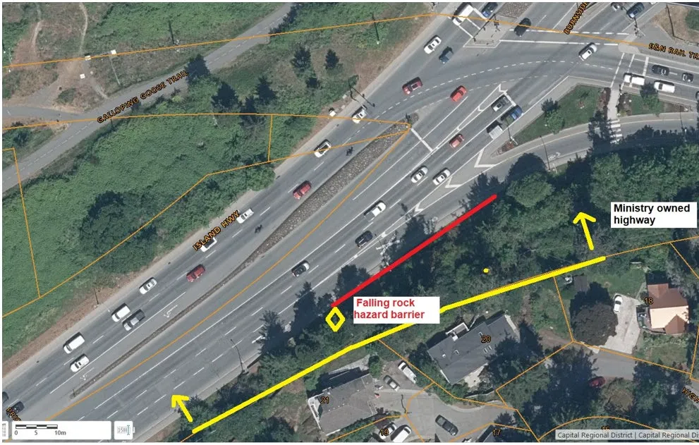
Aerial map identifying the "Falling rock hazard barrier" location near Island Hwy, the Galloping Goose Trail, and Ministry owned highway.

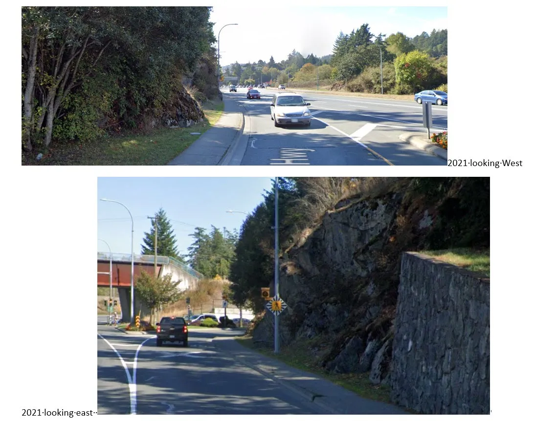
2021 looking West 2021 looking east

Street-level view from 2021 looking West along the highway beside the rock face.
Street-level view from 2021 looking East along the highway showing the rock face and an overpass.

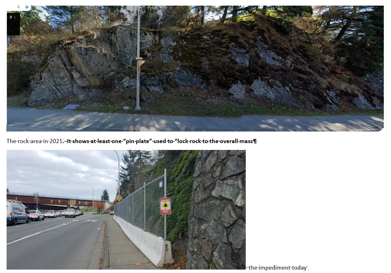
The rock area in 2021. It shows at least one “pin plate” used to “lock rock to the overall mass”

the impediment today

Page 121–123
Extracted from: 2024 11 19 Council Agenda - Agenda - Pdf