Council Meeting/Documents/Presentation: DEVELOPMENT VARIANCE PERMIT 2024-01 – 339, 341, 345 Island Highway
Presentation
Presentation: DEVELOPMENT VARIANCE PERMIT 2024-01 – 339, 341, 345 Island Highway
June 18, 2024Pages 69–754 sections
Visual presentation summarizing the purpose, context, and staff recommendation for the development variance permit at Island Highway.
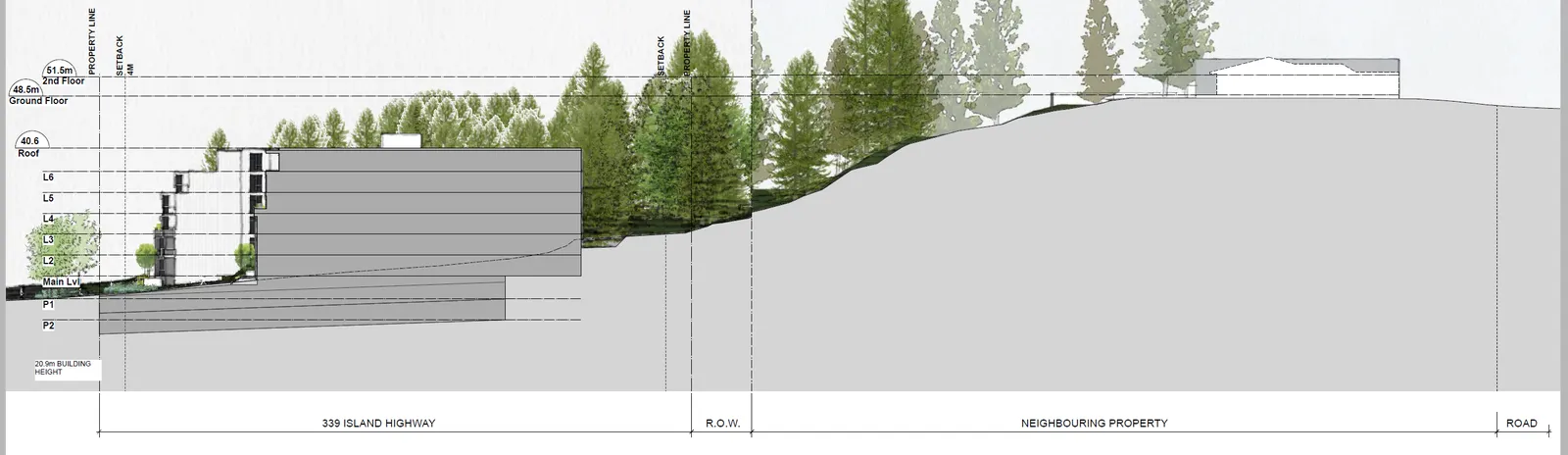
June 18, 2024Visualizes the building's interaction with the natural slope
DEVELOPMENT VARIANCE PERMIT 2024-01 – 339, 341, 345 Island Highway
Council Meeting – June 18, 2024
Page 69–75
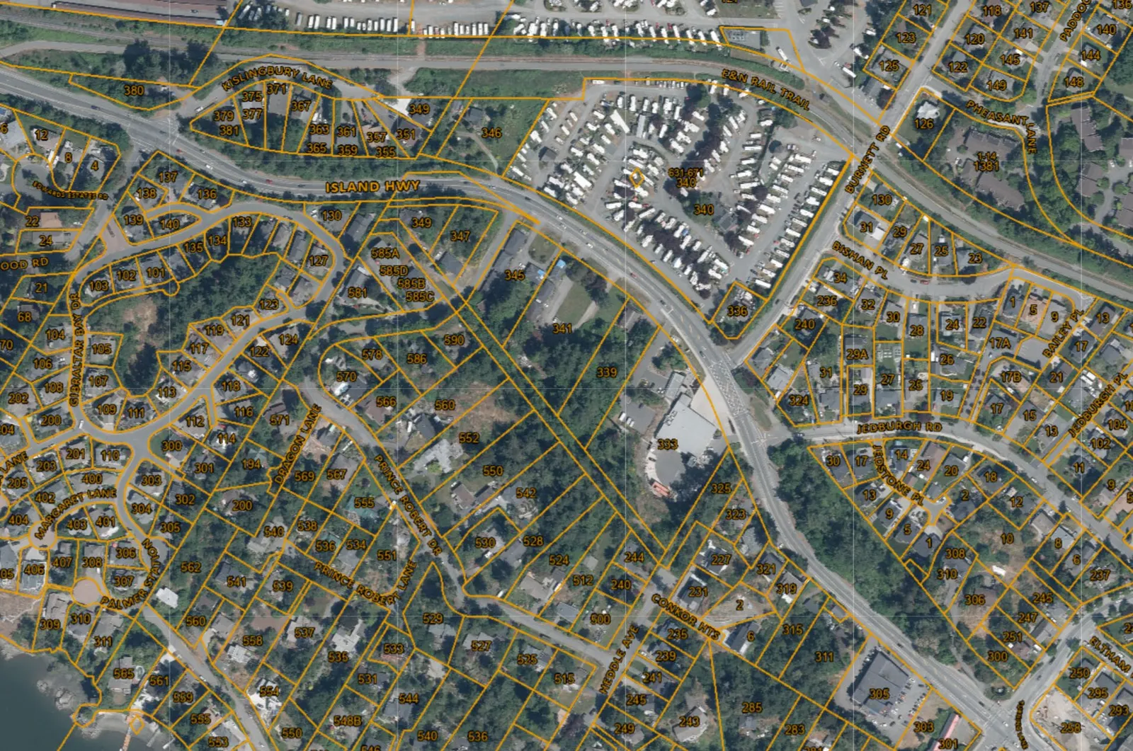
Purpose
- Increase the total number of storeys permitted in the Mixed-Residential Land Use Designation from four to six storeys; and
- Increase the maximum permitted building height in the RM-3 Zone: Mixed Residential from 13.5 m to 20.7 m.
Page 69–75
Discussion
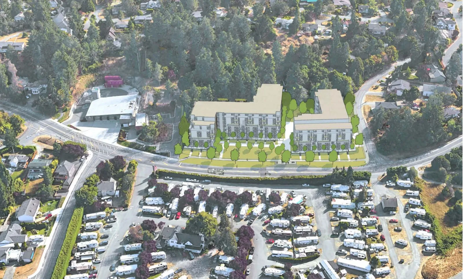
South Elevation – Heddle Park
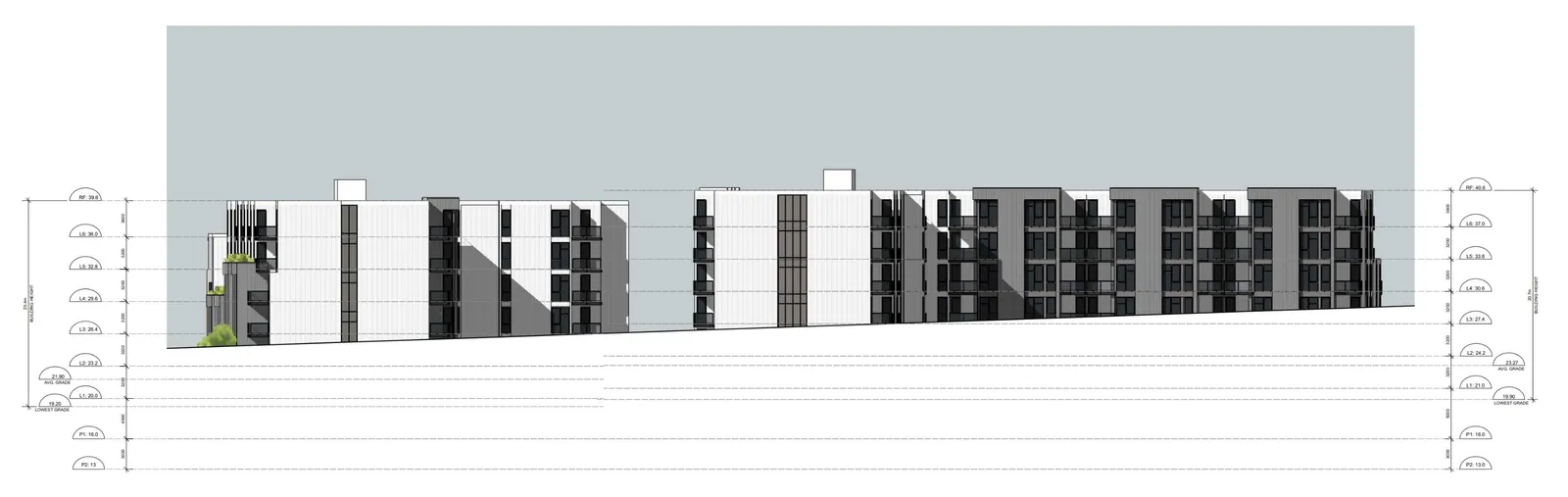
North Elevation – Island Highway
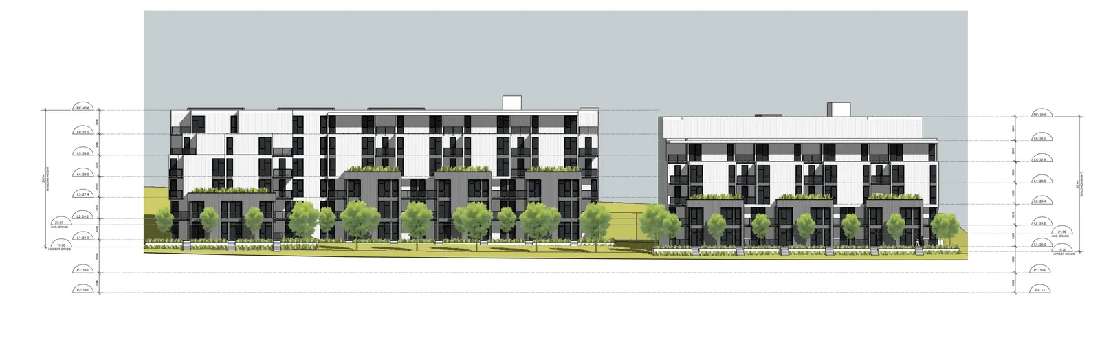
West Elevation – Prince Robert Drive
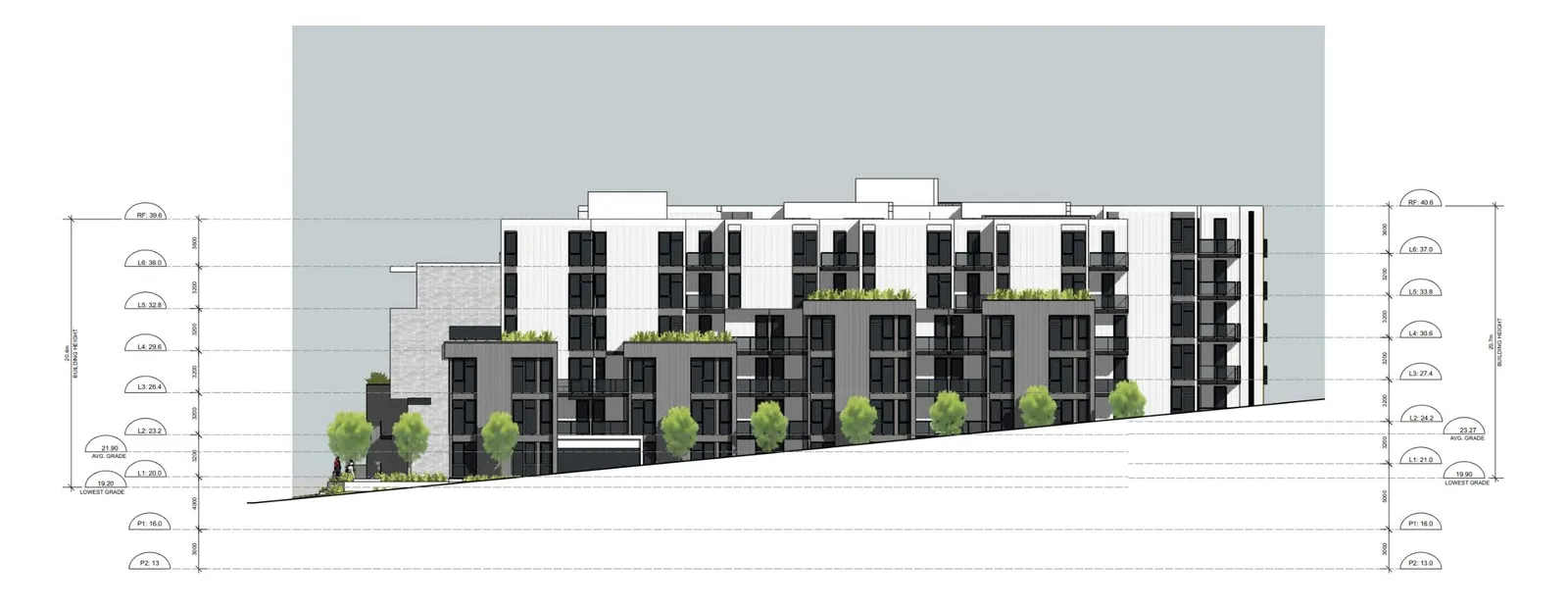
East Elevation – Public Safety Building/Fire Hall
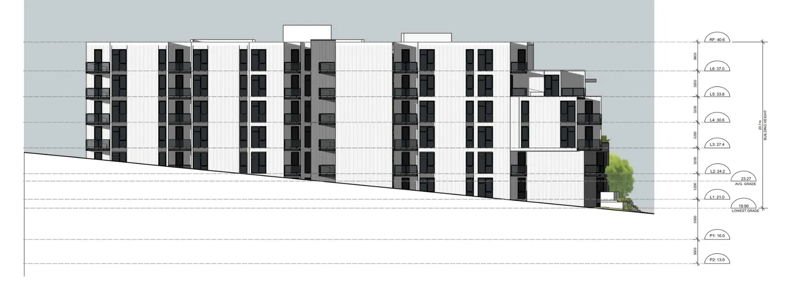
- Proposed building is designed to be built with the natural slope of the site
- Design elements such as building articulations reduce the perceived massing of building
- Total height of the building would be less than the existing single-family dwelling on Prince Robert Drive
- Given the topography of site, minimal expected visual impact to residential properties along Prince Robert Drive
Page 69–75
Recommendations
THAT Development Variance Permit Application 2024-01 be approved as per the report dated June 6, 2024, from the Senior Planner titled “Development Variance Permit 2024 -01 – 339, 341, 345 Island Highway”;
AND THAT Development Variance Permit Application 2024-01 include the following variances:
- Increase the total number of storeys permitted in the Mixed-Residential Land Use Designation Area in the Official Community Plan from four to six storeys; and
- Increase the maximum building height permitted in the RM-3 Zone: Mixed Residential from 13.5 m to 20.7 m.
Page 69–75
Document Images
(1)
Extracted from: 2024 06 18 Council Agenda - Agenda - Pdf