Environmental Impact Assessment for 315 Stewart Avenue
A comprehensive environmental assessment for the dock replacement project, evaluating impacts on the Natural Watercourse and Shoreline Areas Development Permit Area.
Shih Long (Abel) Cheng 315 Stewart Avenue Victoria, BC V9B 1R6
19 January 2015
RE: Environmental Impact Assessment for 315 Stewart Avenue, Victoria, BC for Natural Watercourse and Shoreline Areas Development Permit Area (Town of View Royal)
On 5 January 2015, Sara Stallard, BSc, ASCT, Dipl.Env.Tech. of Swell Environmental Consulting Ltd. (Swell) visited the site at 315 Stewart Avenue, Victoria, BC to evaluate the existing condition of the property in reference to a proposed dock replacement within the Town of View Royal's Natural Watercourse and Shoreline Areas Development Permit Area (Figures 1-3). As per View Royal's Schedule Q of the Official Community Plan (2011) Bylaw No. 811, the site was assessed for sensitive ecosystems, red and blue listed species, wildlife trees, and all environmentally sensitive areas within the site. This Environmental Impact Assessment summarizes our assessment of the environmental conditions at the property and potential impacts from the proposed dock construction work zone.
Site Conditions
The 760-m² waterfront site is a mostly vacant lot consisting of an old garage and historic evidence of patios, terraces, gardening and landscaping activities (Photos 1-4). The residential lot and the lot to the north were subdivided with the house portion remaining on the northern lot. The area of the 15-m DPA setback for the two lots has the appearance of being one yard; however, the subject site consists only of the southerly 16-m (approx.) portion of the shoreline.
The easterly 2/3 of the lot is flat and partially vegetated with ornamental plants. The shoreline 1/3 of the property slopes steeply to the northwest at an approximate 40% slope. The 15-m DPA setback is entirely contained within this steep section and consists of mature native trees with little to no understory or herbaceous layer over heavily terraced landscaping. The shoreline consists of a combination of cement and wood beam seawalls and a cement staircase leading below the high water mark to a mixed sand/pebble/cobble and bedrock beach. A wooden dock and pier in disrepair has been fenced off from access. The dock appears to rest on the marine bottom at low tide, as do the neighbouring docks. A supply trolley on a motorized cable runs from the top of slope to a large Douglas-fir adjacent to the dock (Photos 5-9).
The mature trees within the DPA range in size from 29 – 75 cm dbh (diameter at breast height) and consist of Douglas-fir (Pseudostuga menziesii) and grand fir (Abies grandis), with one unidentified Prunus sp. at the edge of the 15-m DPA on the south property line. The largest tree is a Douglas-fir of approximately 75 cm dbh on the shoreline, adjacent to the dock, but leaning away from it. The sparse understory, where present, consists of a few specimens of native shrubs including snowberry (Symphoricarpos alba), dull Oregon-grape (Mahonia nervosa) and possibly ocean spray (Holodiscus discolor), with the remainder consisting of ornamentals such as laurels and invasive species. English ivy (Hedera helix) is dominant, accompanied by lamium, periwinkle (Vinca major), bamboo, Scotch broom (Cytisus scoparius), Himalayan blackberry (Rubus discolor), and cotoneaster. Evidence of previous efforts at English ivy removal on a number of trees on site was noted. The neighbouring properties north and south have well-established ivy coverage on mature trees.
A review of the Conservation Data Centre (CDC) and Sensitive Ecosystem Inventory (SEI) mapping resulted in no known datasets for this site. No rare or uncommon wildlife or plant species were observed on the site and the historically heavily impacted nature of the site makes the presence of rare and uncommon species unlikely. No current nesting or obvious wildlife activity was noted in the large shoreline Douglas-fir, however, this tree has high habitat and environmental value because of its size and location.
A detailed marine assessment was not conducted as part of this report. However, the Capital Regional District (CRD) Harbours Atlas was reviewed and showed the following habitat bands for Limekiln Cove. The primary bioband for the upper intertidal consists of black lichen within an intertidal flat composed of mud, fines, sand, silt, pebble, cobble and scattered bedrock. The eelgrass distribution in the cove is located sub-tidally at the mouth of the cove (Figure 3). The evidence of significant stormwater flows at the head of the cove is indicated by runoff channels in the mud flats. This runoff is fed by four municipal stormdrains at the base of Helmcken Road.
Proposed Project
The owners are proposing to replace the deteriorating dock, pier and ramp, along with the associated pilings and concrete pad on the shoreline (Figures 4-7). The proposed replacement structures will be in the current locations and will have a smaller footprint than the existing structures, with the water-contacting portion of the dock reduced by approximately 33%.
- Old dock (33.3 m²) + old ramp & pier (10.4 m²) = Total current footprint (43.7 m²)
- New dock (22.3 m²) + new ramp & pier (12.5 m²) = Total proposed footprint (34.8 m²)
The two steel pilings will be replaced by new pilings in a concrete poured pad. A concrete landing pad of 1.5 m² will be poured for the pier on the shoreline adjacent to the base of the large Douglas-fir.
The owner has stated that all known federal and provincial permits and permissions have been obtained for the installation of the proposed dock refurbishment.
Natural Watercourse and Shoreline Areas Development Permit Area, Bylaw No. 811
According to the View Royal Official Community Plan (OCP 2011) Bylaw No. 811, the following Guidelines would apply to the Natural Watercourse and Shoreline Areas DPA in this location:
General Guidelines
- Development of riparian and shoreline areas should be limited and not negatively impact the ecological health of the immediate area or impede public access.
- Retention of existing healthy riparian and shoreline vegetation should be maximized with any paths, structures or other constructed areas sited to minimize impact on trees and sensitive areas.
- Restoration of riparian and shoreline vegetation and habitat, including removal of invasive species, is encouraged for all properties within this Development Permit Area.
- Development should result in a net increase in native vegetation in almost all circumstances including trees, shrubs and grasses.
- For shoreline areas heavily impacted by previous development, target the restoration of ecologically appropriate vegetation for an average 15m wide (minimum 5 m) shoreline zone over 50% of the shore length.
- Riparian and shoreline area development should sensitively manage storm water, focusing on infiltration and release of storm water in ways and quantities that mimics natural patterns, avoids scouring and erosion and results in storm water free from pollutants.
- Shoreline protection measures should be limited to those necessary to prevent damage to existing structures or established uses on adjacent upland. [Additional guidelines applicable to shoreline stabilization are not included here, as this shoreline has been previously hardened and no additional works have been proposed – Swell.]
- The preservation and enhancement of native trees and shrub clusters that overhang the waters edge is strongly encouraged as these provide shade, protection and feeding habitat for fish and wildlife.
Guidelines for new and replacement of existing docks and boat launch facilities
- Docks and wharves should ensure that public access along the shore is maintained, and should serve multiple users as much as possible rather than one dock per property.
- Design, size and location of docks and wharves should not limit opportunities for water access for neighbouring private properties.
- Private docks and wharves should be designed to provide access to the water and seasonal boating opportunities, rather than sized to facilitate year round moorage of boats.
- Docks and wharves should be sited to avoid impacts on sensitive ecosystems such as eelgrass beds, fish habitat, and natural processes such as currents and littoral drift.
- Docks should be constructed in a manner that permits the free flow of water beneath. Supports should be located on hard substrate.
- Floating docks should not rest on the bottom at any time and a minimal, moveable ramp should be utilized to connect the dock with the shore rather than a fixed wharf or pier.
- Piers and pilings and floating docks are preferred over solid core piers.
- Docks should be constructed of stable materials that will not degrade over time. The use of unenclosed plastic foam or the use of creosote treated pilings is strongly discouraged.
Impact of Proposed Development on Natural Conditions
Because of the historically highly disturbed nature of the subject site, both in the backshore and the foreshore, and the efforts made to keep the proposed structures within the current footprint, there is no long-term impact expected from the proposed development on the current natural condition of the site.
The root base of the large shoreline Douglas-fir extends under the proposed location of the 1.5 m² concrete landing pad; however, it is a shallow pad within a highly disturbed footpath of fill adjacent to the seawall and would replace, in part, a current concrete slab.
Minimal shading of marine benthos occurs, as the current dock alignment lies within the deep shadows from the steeply-sloped and treed, northwest-facing shoreline of 40% slope (see Figures 2 & 3). While the underside of the proposed dock will continue to contact the beach at low tide, the new footprint of the water-contacting portion of the dock would be reduced by approximately 33% from current conditions. The cove has existing bottom-sitting docks at neighbouring properties and the cove itself is subject to concentrated stormwater inputs from municipal runoff. The dock is not within the eelgrass beds noted by the CRD Harbours Atlas. The concrete base for the pilings (less than 1 m²), to be poured in the intertidal area, constitutes the only increase in affected surface area. Provided that all Best Management Practices for concrete works in the intertidal area are followed, no long-term negative effects would be expected.
Recommendations and Best Management Practices (BMPs)
The site at 315 Stewart Avenue is a heavily impacted residential lot that due to historic and present residential uses has no intact natural riparian or upland ecosystems, observed rare or uncommon species (plant or wildlife), or sensitive upland habitats. The proposed dock replacement would have a minimal effect on the ecological conditions of the 15-m setback and associated foreshore. However, despite the impacted nature of the site, the 15-m backshore and foreshore still have ecological value which can be increased, and features with integral habitat value such as the shoreline Douglas-fir.
In addition to any requirements within the issued federal and provincial permits, the following Best Management Practices are recommended to ensure minimal risk to the DPA:
- Erosion & Sediment Control and Spill Prevention & Response measures must be implemented to protect the marine ecosystem from construction activities:
- Schedule excavation and construction activities during dry weather;
- Ensure concrete wastes are contained: wet concrete is not deposited into surrounding water, remove excess concrete, and do not allow water from equipment and tool cleaning to enter the environment;
- Remove all wastes associated with dock and piling installation;
- Construct dock and floats off-site or in the upland area;
- Cover exposed soils and excavations (e.g. tarps, grass seed);
- Install sediment barriers (e.g. sediment fences, compost-filled barriers such as Filtrexx Soxx), if needed;
- Spill response kits will be on site when heavy machinery is working, and operators trained in their use;
- Equipment refuelling at a designated location isolated from aquatic ecosystems and stormdrain catchbasins; and
- Equipment will be inspected for leaks prior to beginning work.
- Marine construction activities are restricted to the following Reduced Risk Timing Windows in order to ensure that significant harm does not occur to fish or fish habitat, as per Fisheries and Oceans Canada under the federal Fisheries Act:
- Summer Window: July 1 – August 1
- Winter Window: December 1 – February 15
- Dock and pier construction in the marine environment have additional specific BMPs and should be reviewed by the marine contractor in the following documents: Pile Driving and Related Operations – BC Marine and Pile Driving Contractors Association, Fisheries and Oceans Canada (DFO) Operational Statement for Dock and Boathouse Construction, and Standards and Best Practices for Instream Works – Wharf, Pier, Dock, Boathouse & Mooring (Appendix 1). (See also http://www.dfo-mpo.gc.ca/pnw-ppe/pathways-sequences/index-eng.html.)
- The shoreline Douglas-fir should be protected from adverse effects of construction:
- Excavate minimal material for concrete landing pad over roots BY HAND;
- Ensure concrete does not directly contact roots;
- Do not prune roots;
- Ensure that heavy equipment and materials stockpiles do not encroach upon the Critical Root Zone;
- Consult an ISA-certified arborist if the health of the tree is in question.
- A Qualified Environmental Professional (QEP) should be on site for critical stages of the project, including a pre-construction meeting with the contractor, pouring of the marine concrete footings, and periodically throughout the construction period to ensure BMPs are followed and no pollution (e.g. sediment laden water, concrete, spills) enters the marine environment.
In addition to the above BMPs, View Royal Bylaw No. 811 recommends restoration of shoreline ecosystems where possible. The 15-m DPA would benefit from the removal of invasive species and replanting of native species. The owners have indicated an enthusiasm for this on an ongoing basis.
Native species should be planted with the target guidelines from the OCP in mind. Table 1 contains a partial list of appropriate native species for this 15-m setback. The replanting activities with the highest positive impact will be those bordering the high water mark, including trees and shrubs that will eventually result in overhanging vegetation on the foreshore. Removal of English ivy on tree trunks is especially critical. Berry-producing native species have been included for the interest of the owner and include: coastal and woodland strawberry, salmonberry, thimbleberry, Saskatoon berry, black huckleberry, evergreen huckleberry and red huckleberry. Some of these plants have specialised requirements and habits. Additional information can be provided upon request.
A free local source of native plants is periodically available through the District of Saanich Native Plant Salvage Program. The program requires registration and an orientation session, but is open to all members of the public. More information can be obtained through Darren Copley at the District of Saanich, or through the website at http://www.saanich.ca/living/natural/stewardship/npsp.html?ref=shortURL. Alternatively, native species can be purchased from local nurseries.
Provided the Best Management Practices above are followed, we do not expect the proposed construction activities to have any negative impacts to the current ecosystems of the 15-m DPA setback. If implemented, the suggested restoration activities would provide significant improvement over the current conditions for wildlife, aquatic life, and both the backshore and foreshore ecosystems.
In summary, the proposed work will not disturb any rare or endangered species or ecosystems and provided the measures described in this review are followed, the effects of the project on the marine environment and shoreline conditions are minimal.
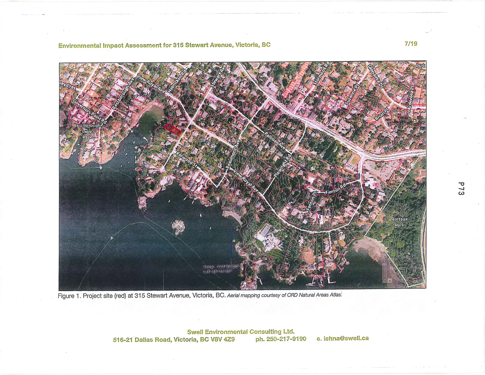
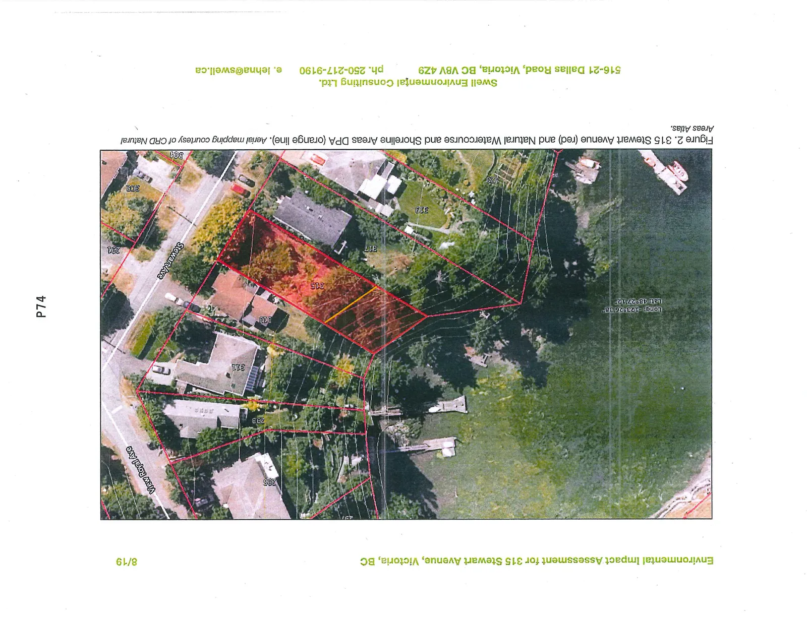
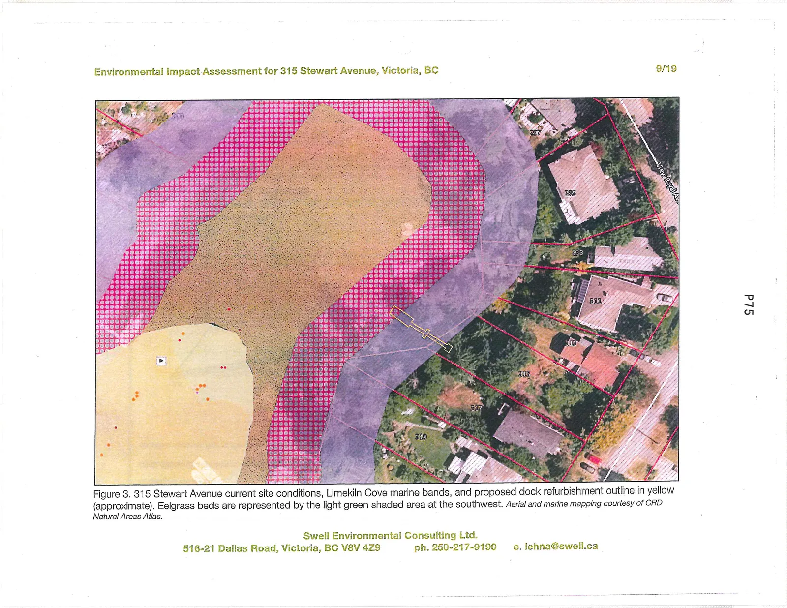
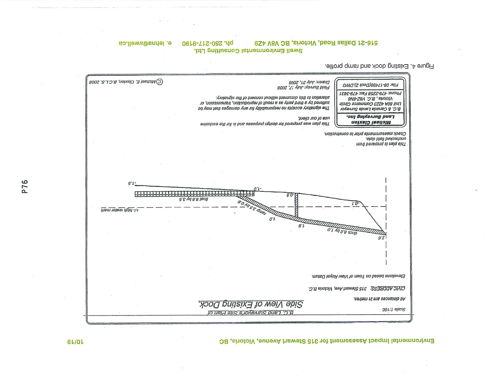
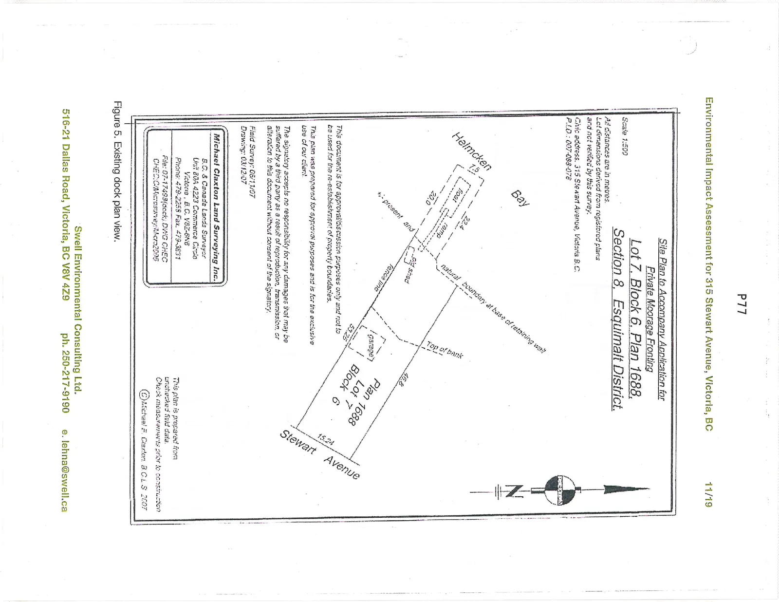
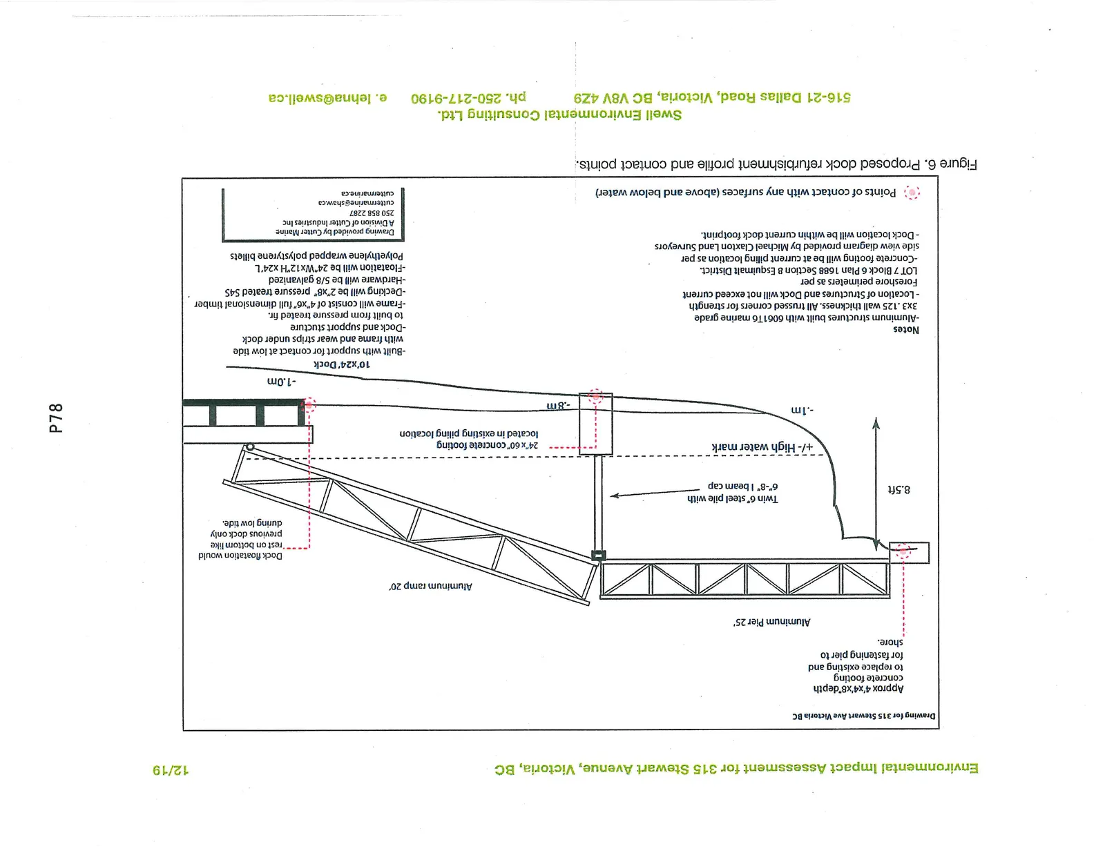
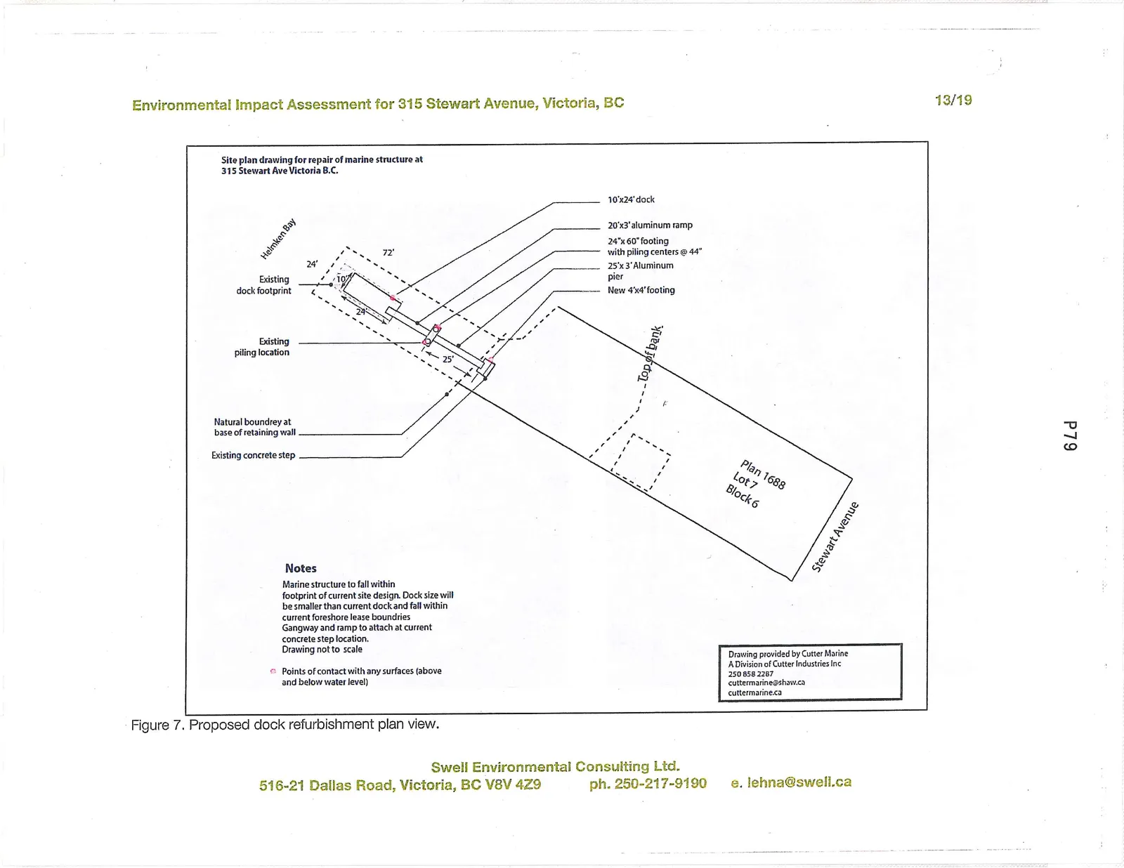
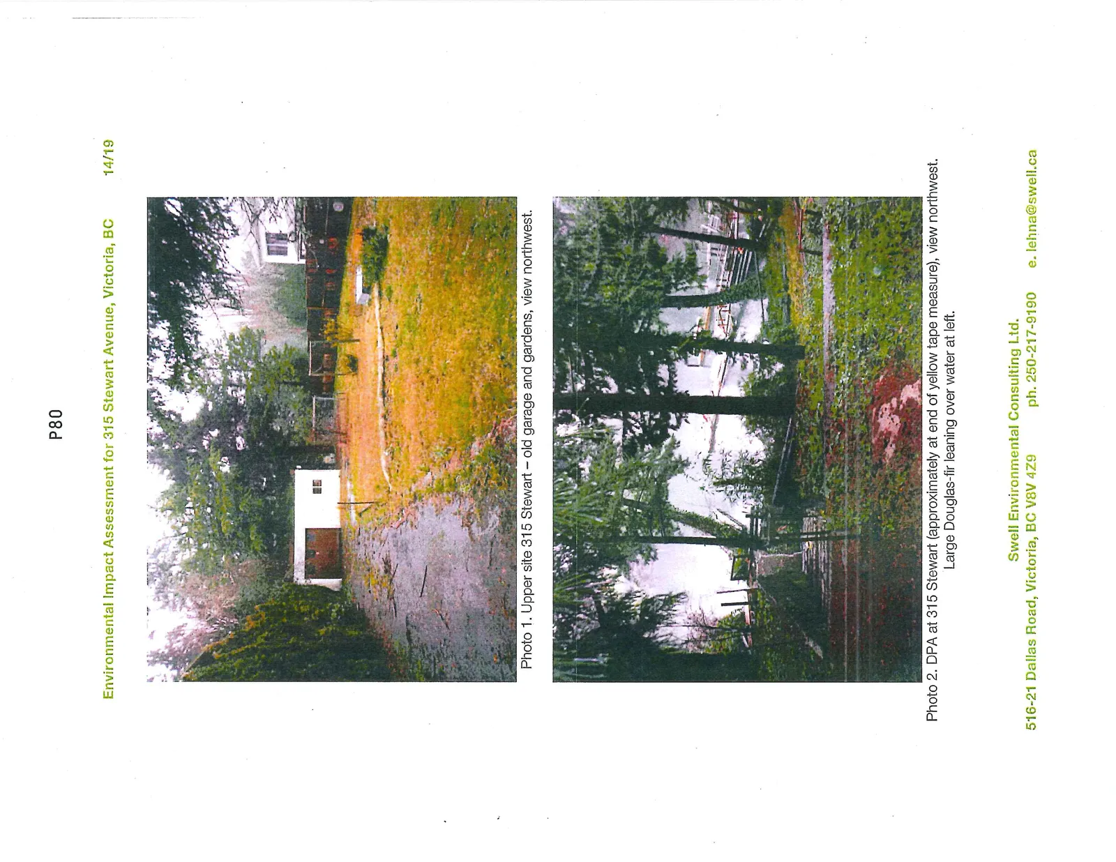
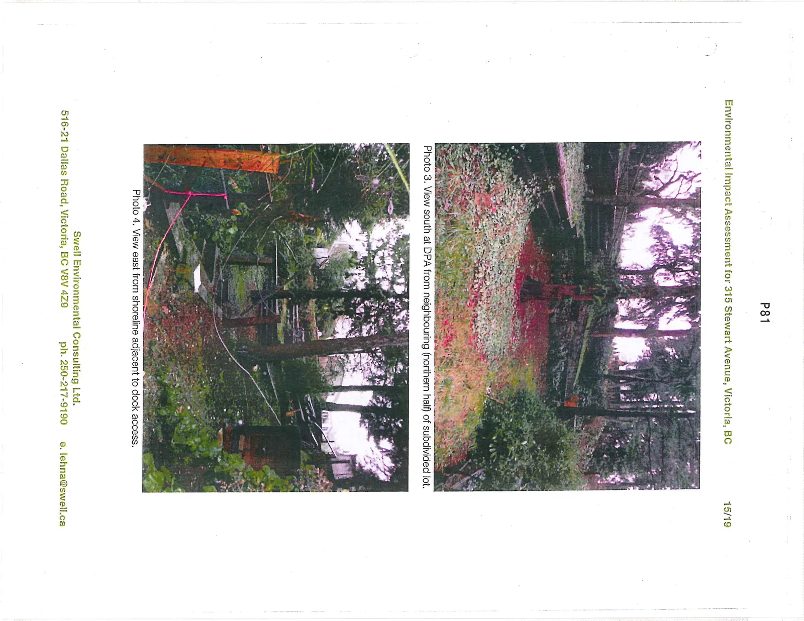
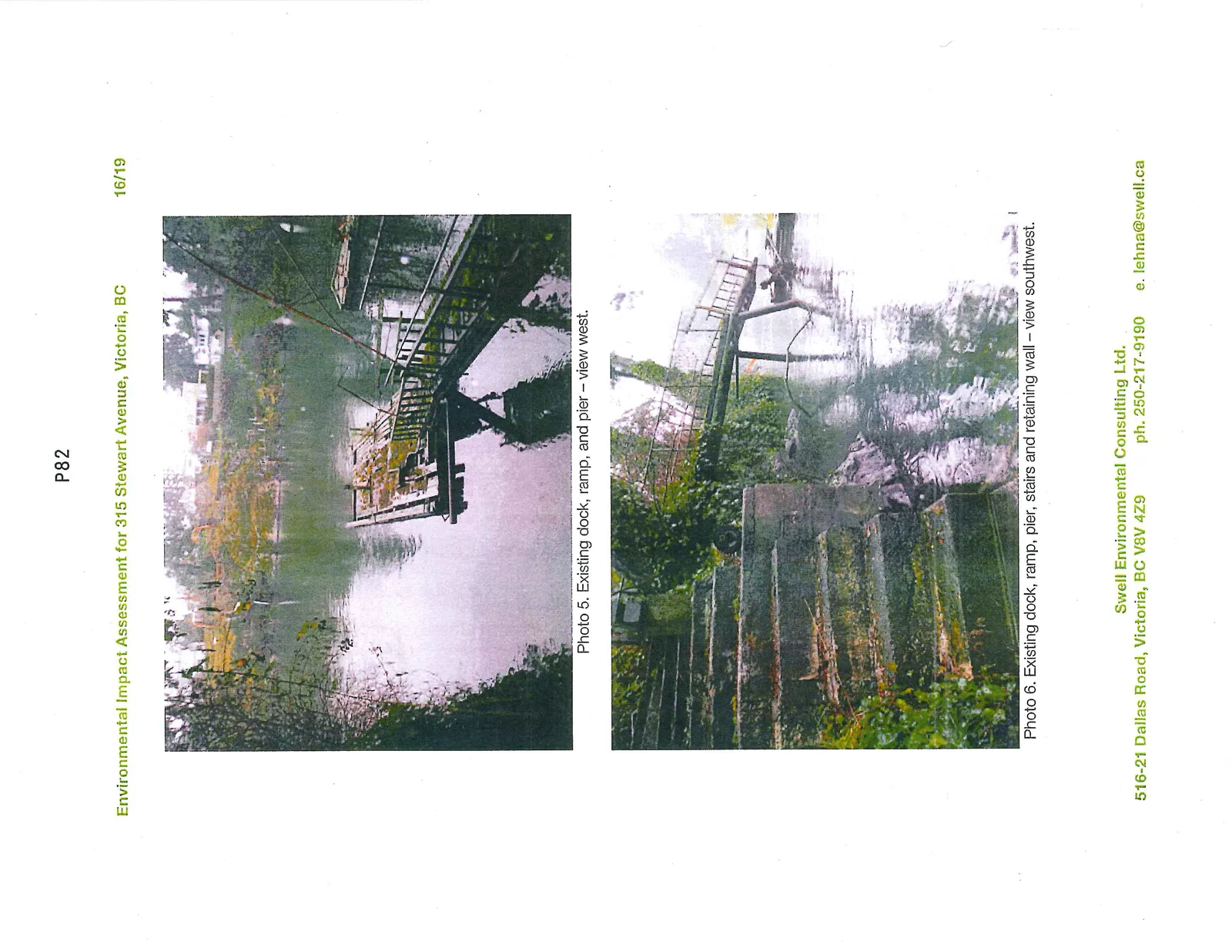
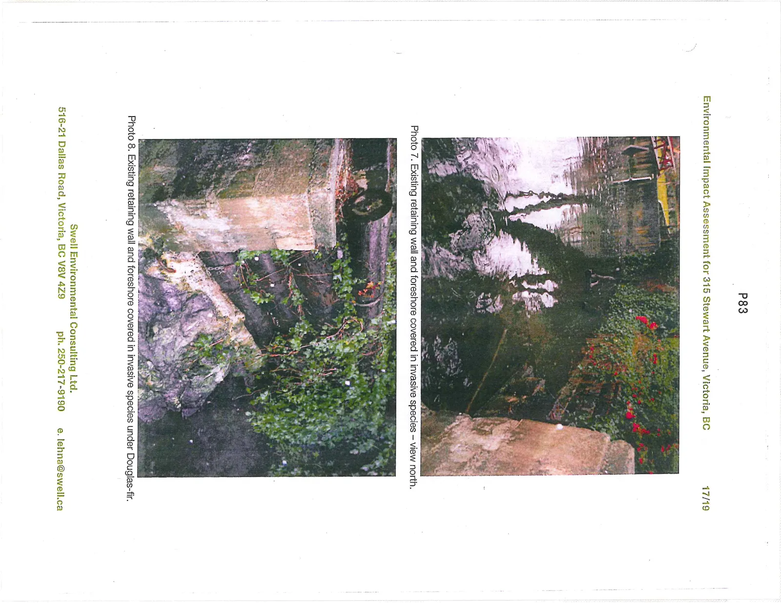
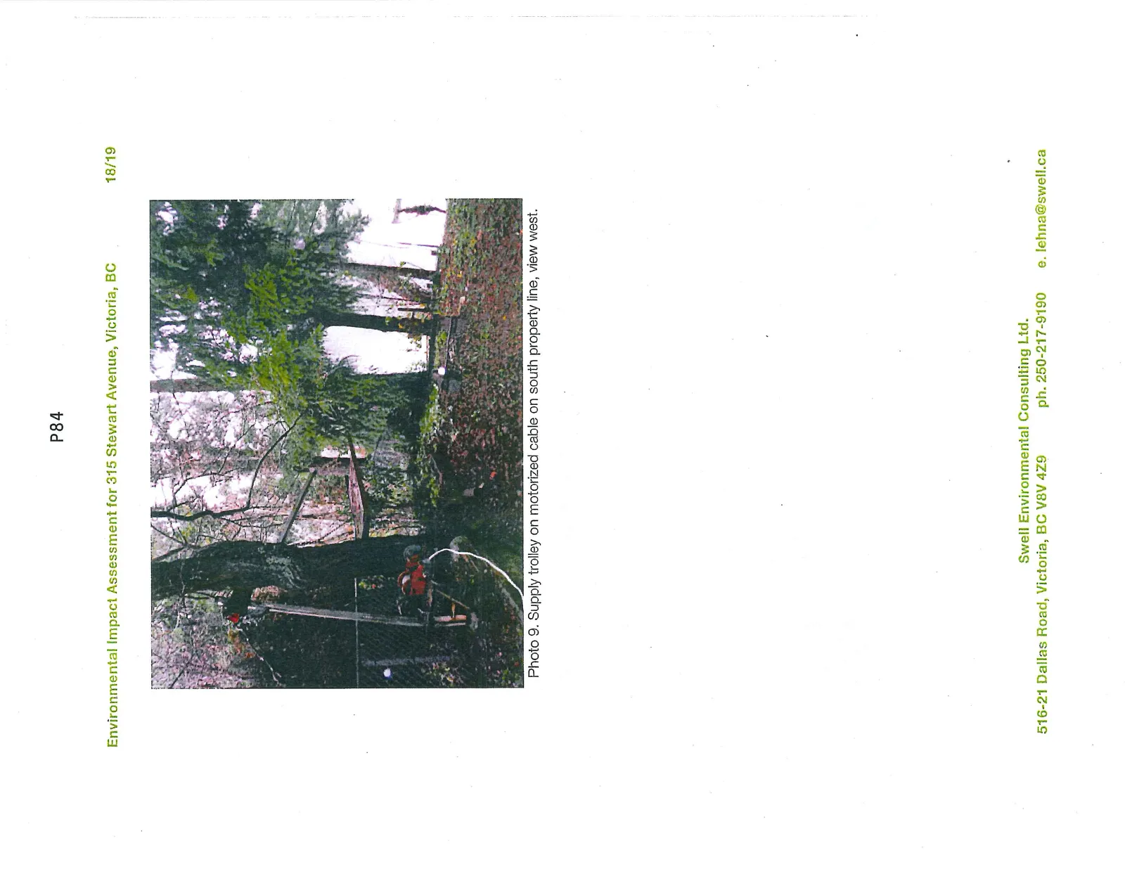
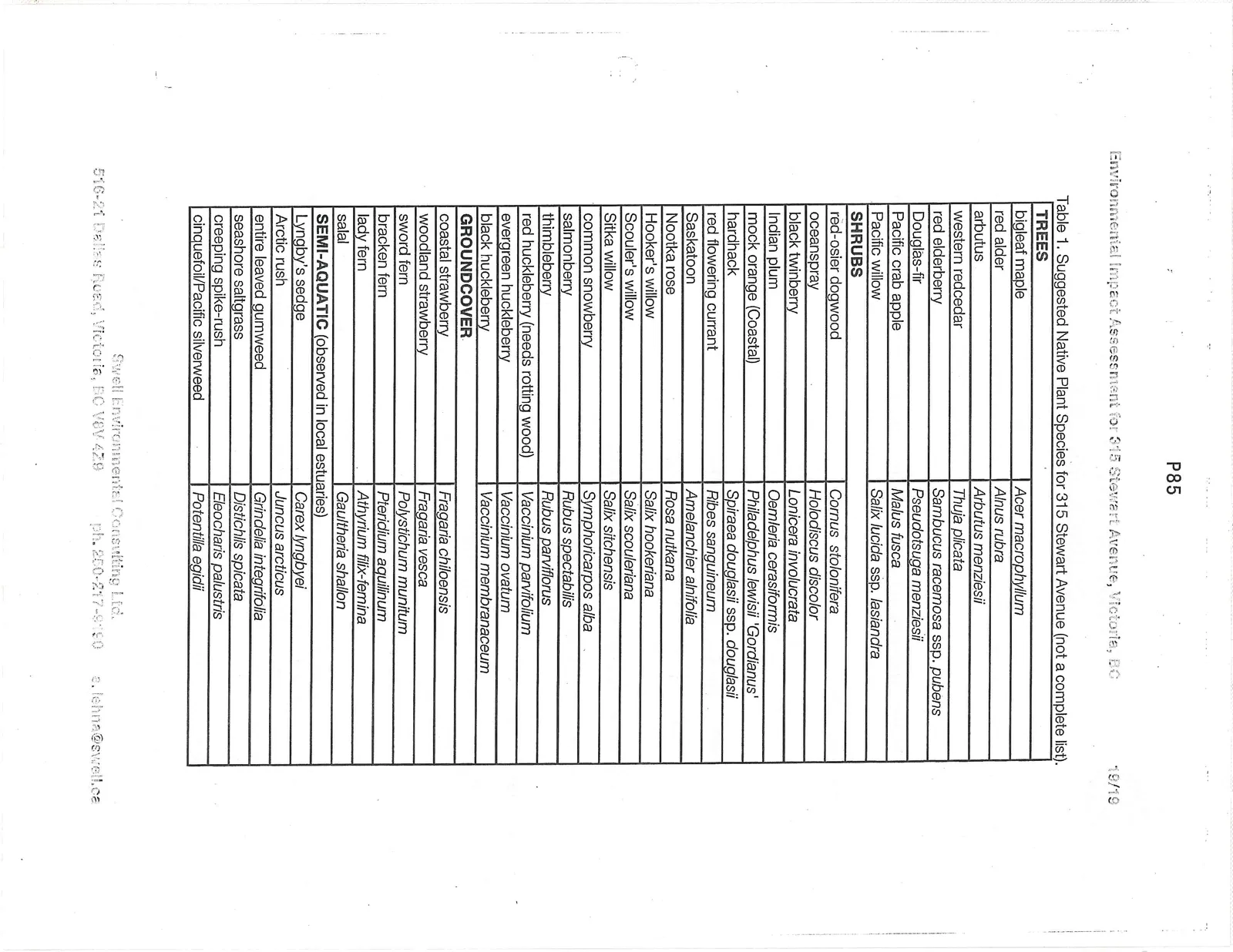
Table 1. Suggested Native Plant Species for 315 Stewart Avenue (not a complete list).
| Category | Common Name | Scientific Name |
|---|---|---|
| TREES | bigleaf maple | Acer macrophyllum |
| red alder | Alnus rubra | |
| arbutus | Arbutus menziesii | |
| western redcedar | Thuja plicata | |
| red elderberry | Sambucus racemosa ssp. pubens | |
| Douglas-fir | Pseudotsuga menziesii | |
| Pacific crab apple | Malus fusca | |
| Pacific willow | Salix lucida ssp. lasiandra | |
| SHRUBS | red-osier dogwood | Cornus stolonifera |
| oceanspray | Holodiscus discolor | |
| black twinberry | Lonicera involucrata | |
| Indian plum | Oemleria cerasiformis | |
| mock orange (Coastal) | Philadelphus lewisii 'Gordianus' | |
| hardhack | Spiraea douglasii ssp. douglasii | |
| red flowering currant | Ribes sanguineum | |
| Saskatoon | Amelanchier alnifolia | |
| Nootka rose | Rosa nutkana | |
| Hooker’s willow | Salix hookeriana | |
| Scouler’s willow | Salix scouleriana | |
| Sitka willow | Salix sitchensis | |
| common snowberry | Symphoricarpos alba | |
| salmonberry | Rubus spectabilis | |
| thimbleberry | Rubus parviflorus | |
| red huckleberry (needs rotting wood) | Vaccinium parvifolium | |
| evergreen huckleberry | Vaccinium ovatum | |
| black huckleberry | Vaccinium membranaceum | |
| GROUNDCOVER | coastal strawberry | Fragaria chiloensis |
| woodland strawberry | Fragaria vesca | |
| sword fern | Polystichum munitum | |
| bracken fern | Pteridium aquilinum | |
| lady fern | Athyrium filix-femina | |
| salal | Gaultheria shallon | |
| SEMI-AQUATIC | (observed in local estuaries) | |
| Lyngby’s sedge | Carex lyngbyei | |
| Arctic rush | Juncus arcticus | |
| entire leaved gumweed | Grindelia integrifolia | |
| seashore saltgrass | Distichlis spicata | |
| creeping spike-rush | Eleocharis palustris | |
| cinquefoil/Pacific silverweed | Potentilla egidii |
Document Images
(6)