SCHEDULE 'A' - Reference Plan for Chilco Road Closure
Legal survey plan showing the 'Subject Area' for the road closure designated in Bylaw 939.
Road Closure and Removal of Highway Dedication - Part of Chilco Road Bylaw No. 939, 2015
SCHEDULE "A"
REFERENCE PLAN TO ACCOMPANY THE TOWN OF VIEW ROYAL ROAD CLOSURE BYLAW No. OF PART OF CHILCO ROAD DEDICATED BY PLAN EPP55110, SECTION 98, ESQUIMALT DISTRICT, PURSUANT TO SECTION 120 OF THE LAND TITLE ACT AND SECTION 40 OF THE COMMUNITY CHARTER.
PLAN EPP55111. BCGS 92B.043
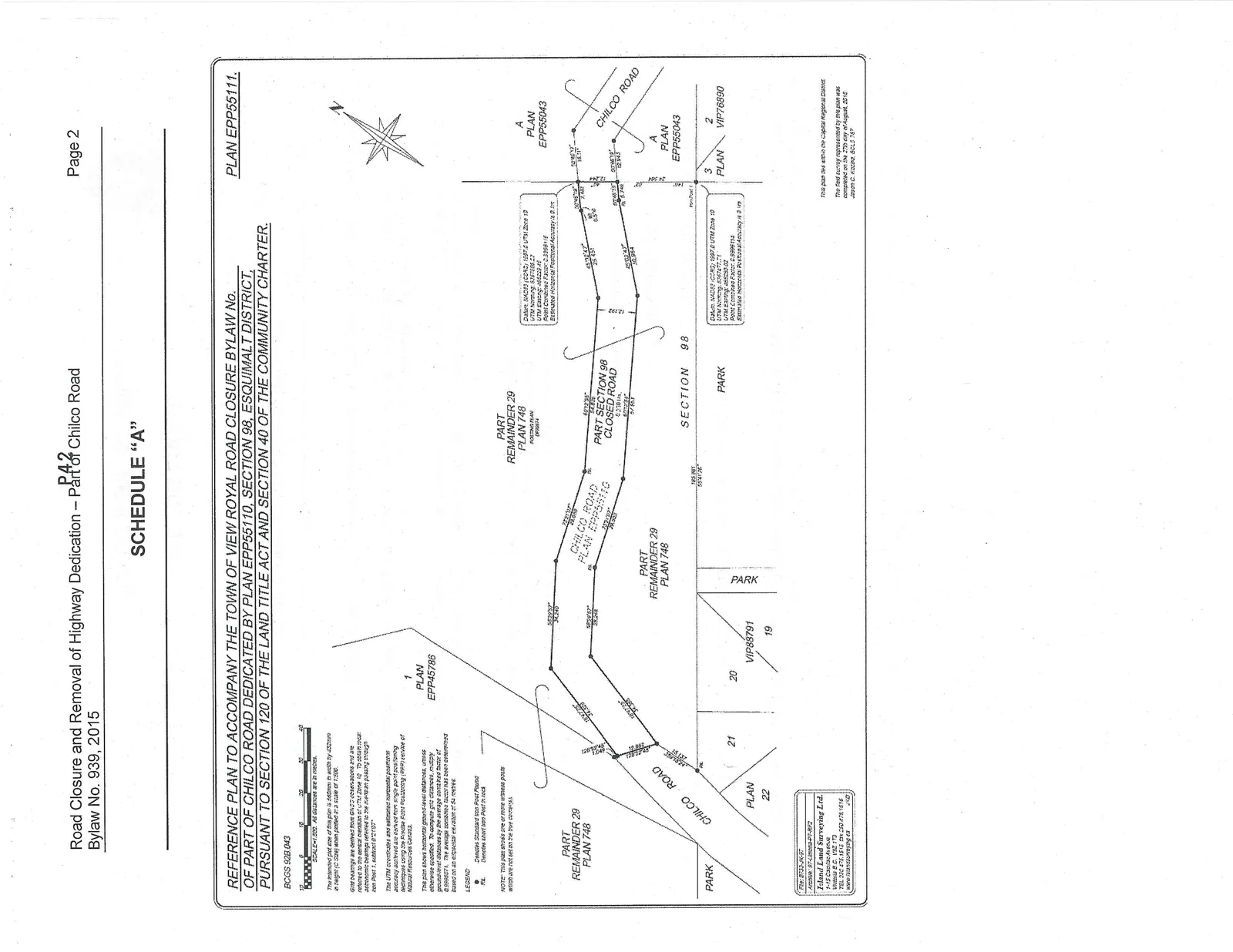
- SCALE=1:500. All distances are in metres.
- The intended plot size of this plan is 560mm in width by 432mm in height (C Size) when plotted at a scale of 1:500.
- Grid bearings are derived from GNSS observations and are referred to the central meridian of UTM Zone 10. To obtain local astronomic bearings referred to the meridian passing through Iron Post 1, subtract 0°21'07".
- The UTM coordinates and estimated horizontal positional accuracy achieved are derived from single point positioning techniques using the Precise Point Positioning (PPP) service of Natural Resources Canada.
- This plan shows horizontal ground-level distances, unless otherwise specified. To compute grid distances, multiply ground-level distances by the average combined factor of 0.9996071. The average combined factor has been determined based on an ellipsoid elevation of 64 metres.
LEGEND
- ● Denotes Standard Iron Post Found
- IP Denotes short Iron Post in rock
NOTE: This plan shows one or more witness posts which are not set on the true corner(s).
Surveyor Information: Island Land Surveying Ltd. 1-15 Craiglea Avenue Victoria B.C. V8Z 1T3 TEL 250 475 1515 fax 250 475 1516 www.islandsurveying.ca
File: 8133-R-P2 Archive: S7-Lenora-R1-RP2
The field survey represented by this plan was completed on the 27th day of August, 2015. Jason C. Kozina, BCLS 787
This plan lies within the Capital Regional District.