This site is in beta — data may be incomplete and features are still being added.
Council Meeting/Documents/Attachment 2. Site Concept Plan and Renderings - 1342/1352 Trans Canada Highway
Appendix

Attachment 2. Site Concept Plan and Renderings - 1342/1352 Trans Canada Highway

May 2, 2017Pages 77–826 sections

Visual site concept plan and 3D renderings for the proposed development at 1342/1352 Trans Canada Highway.

8.1.d) Official Community Plan Amendment Application No. 2017/02 and Rezoning Application No. 2016/02 - 1342/1352 Trans-Canada Highway
Eric Barker ArchitectOctober 6, 2016

Attachment 2.

Site Concept Plan
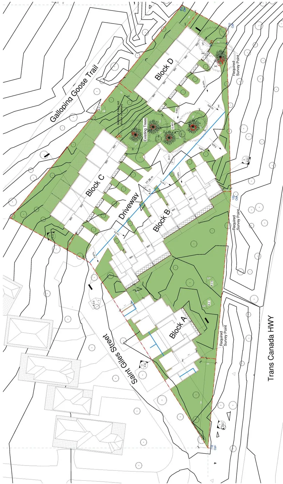
Site concept plan showing building Blocks A, B, C, and D, driveway access from St. Giles Street, and proximity to Galloping Goose Trail and Trans Canada Highway.
Page 77–82

Attachment 2. (continued)

Bird’s Eye View from South
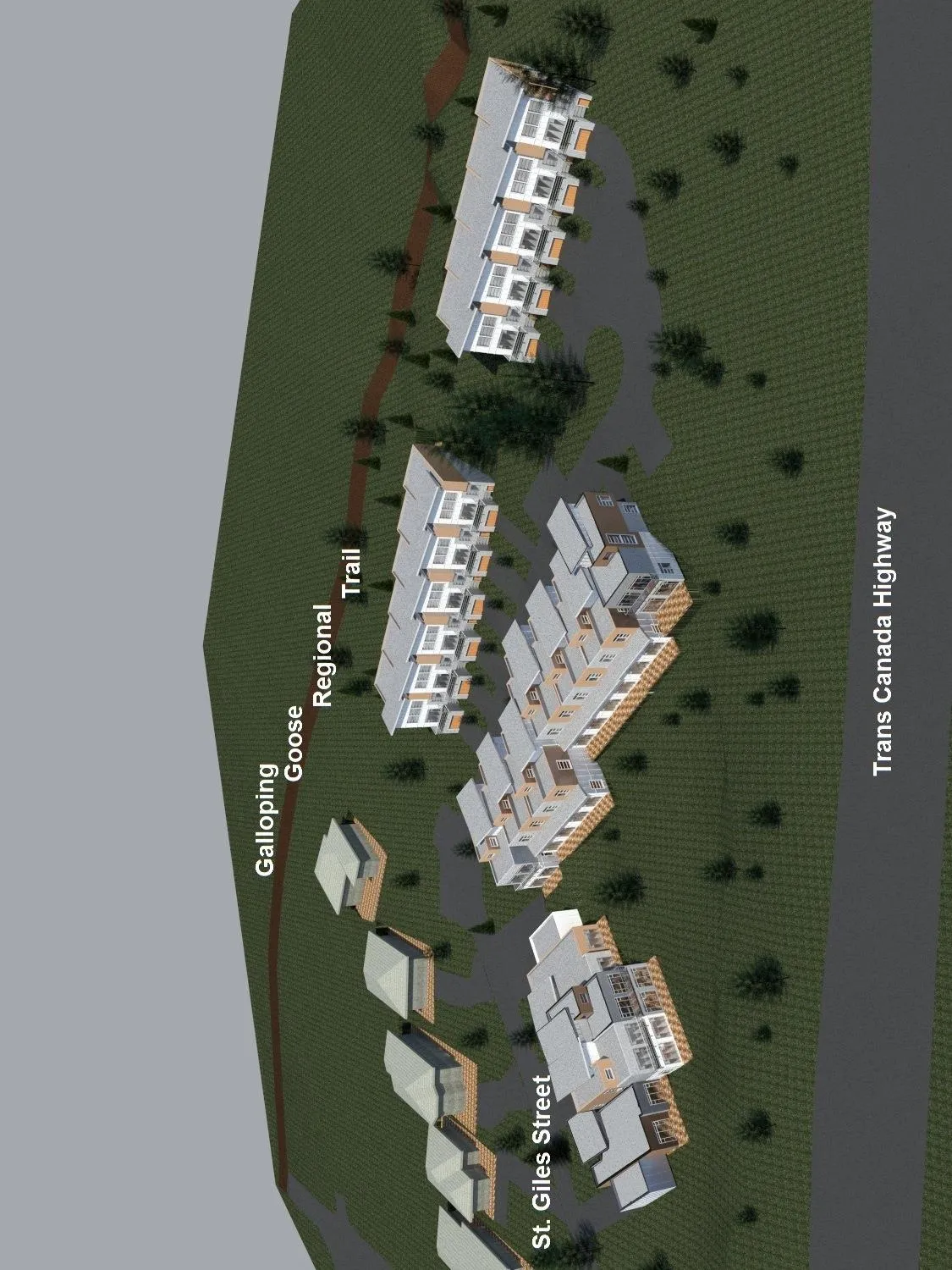
Architectural 3D rendering of the site development viewed from the south, illustrating building orientation relative to St. Giles Street, the Trans Canada Highway, and the Galloping Goose Regional Trail.
Page 77–82

Attachment 2. (continued)

Bird’s Eye View from Southwest
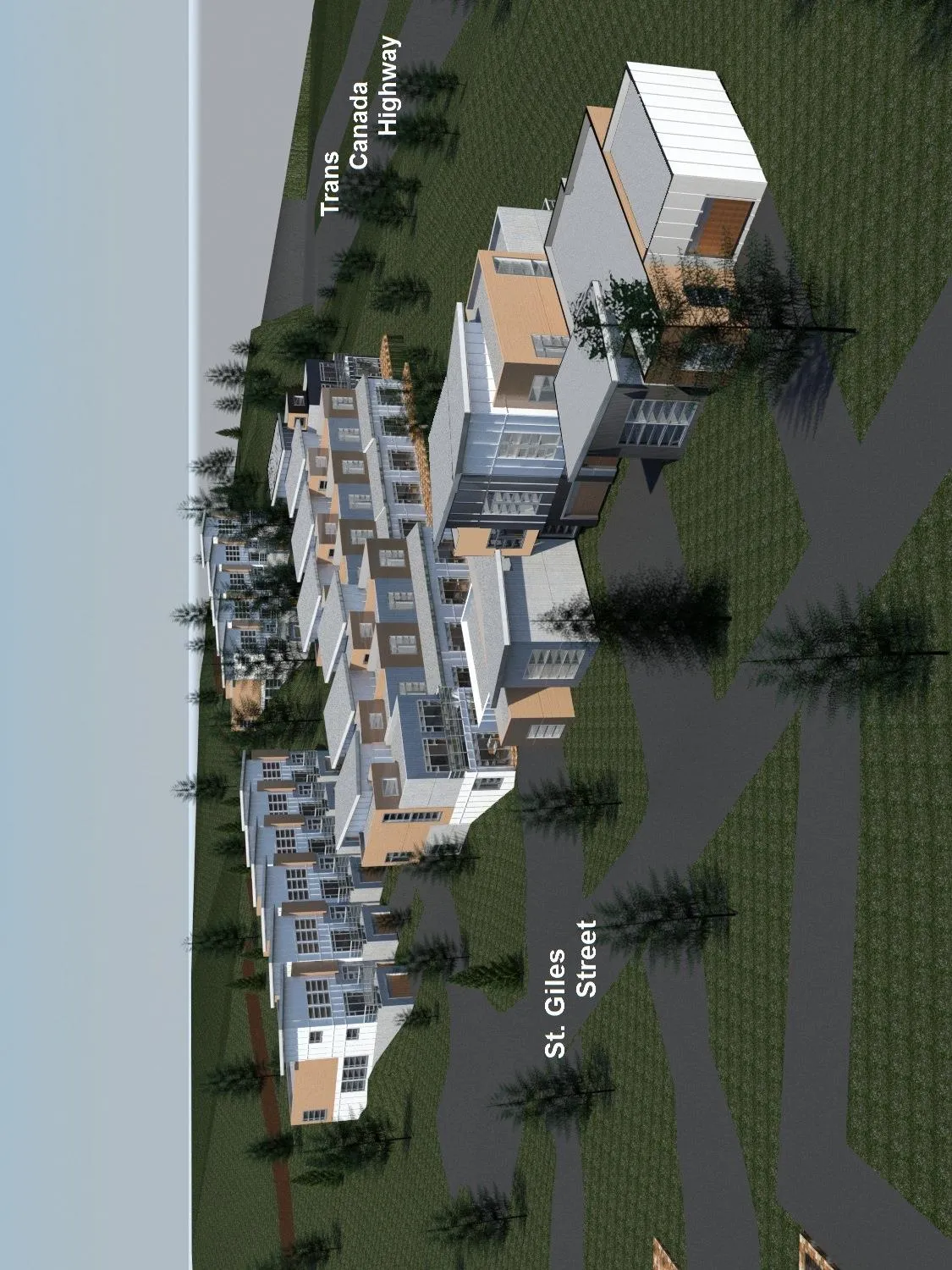
Architectural 3D rendering of the site development viewed from the southwest, showing building facades and their placement along St. Giles Street near the Trans Canada Highway.
Page 77–82

Attachment 2. (continued)

View from Camden Street
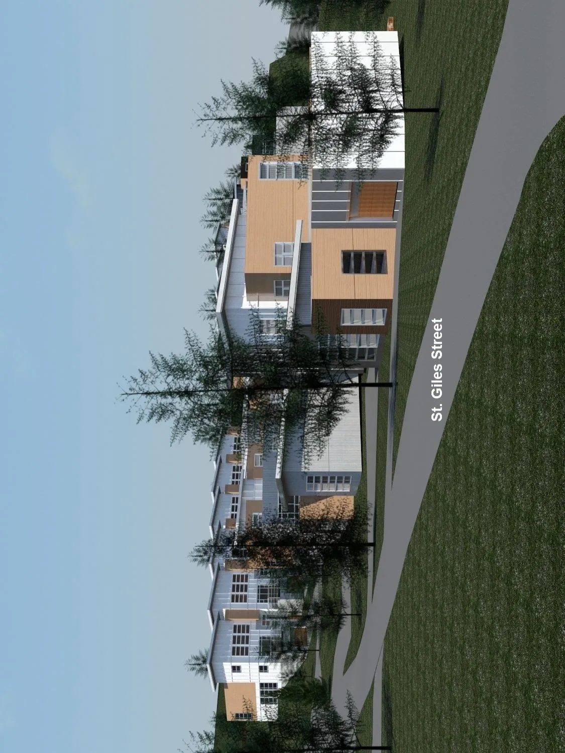
Architectural 3D rendering showing the view of the development from Camden Street, highlighting building elevation and the streetscape along St. Giles Street.
Page 77–82

Attachment 2. (continued)

Bird’s Eye View from Northwest
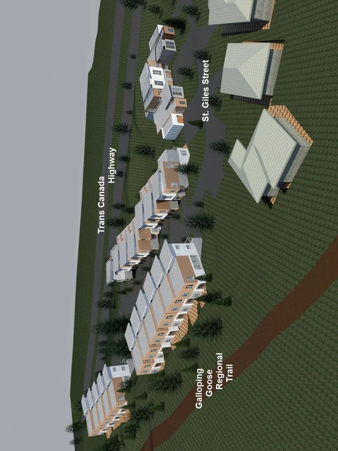
Architectural 3D rendering of the site development viewed from the northwest, showing the layout of the buildings between the Trans Canada Highway and the Galloping Goose Regional Trail.
Page 77–82

Attachment 2. (continued)

View from Trans Canada Highway Eastbound towards Victoria
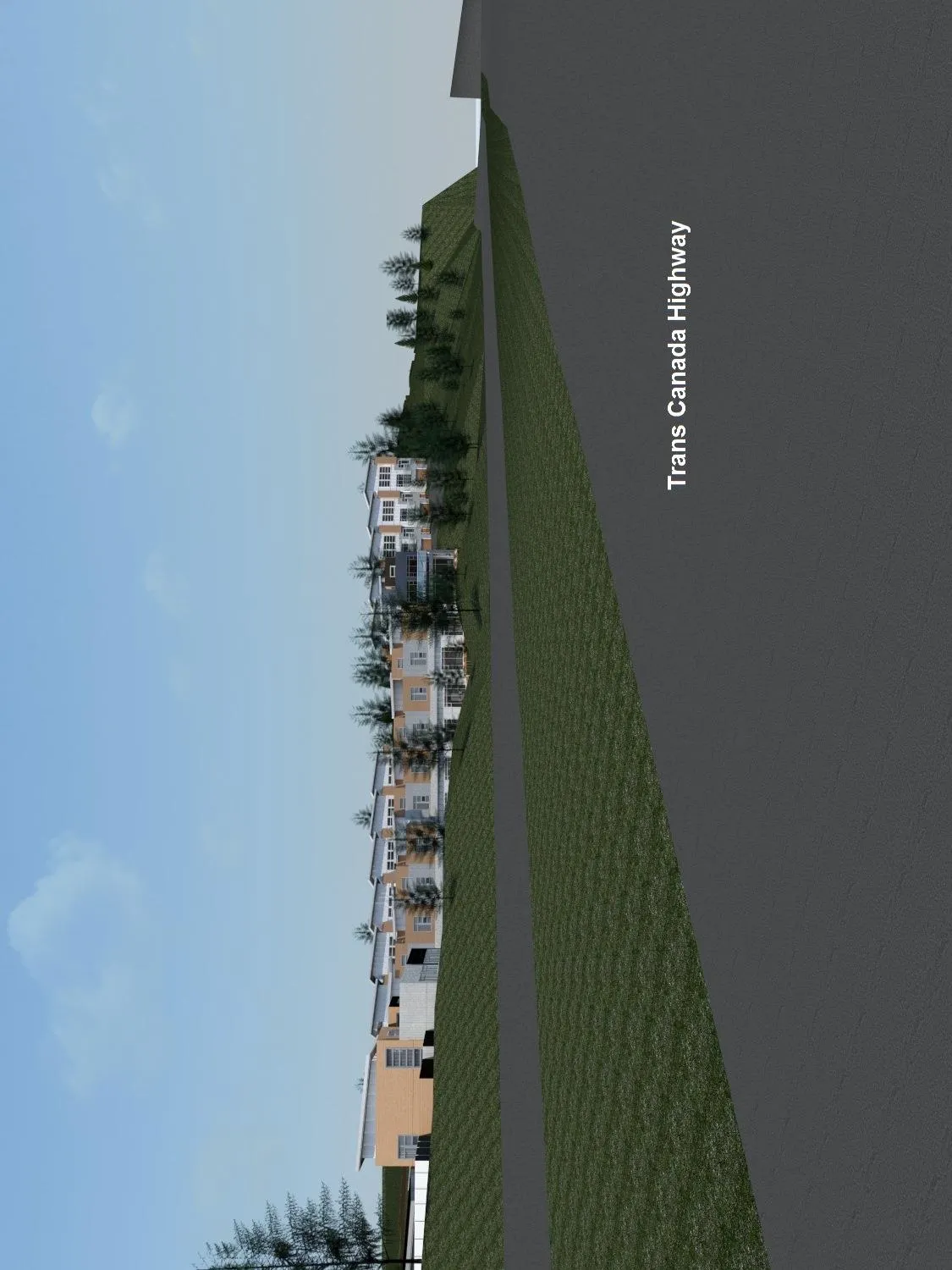
Architectural 3D rendering depicting the perspective of the development as seen from the Trans Canada Highway while traveling eastbound towards Victoria.
Page 77–82
Extracted from: 2017 05 02 Council Agenda - Agenda - Pdf