Bylaw No. 963 - Official Community Plan Amendment (1266 Burnside)
Bylaw text and map amending the land use designation for 1266 Burnside Road West from Community Facility to Residential.
TOWN OF VIEW ROYAL BYLAW NO. 963
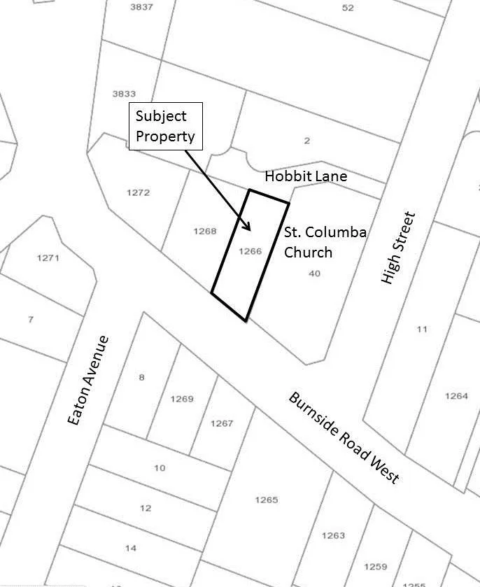
A BYLAW TO AMEND THE TOWN OF VIEW ROYAL OFFICIAL COMMUNITY PLAN WITH RESPECT TO THE LAND USE DESIGNATION OF BLOCK 27, SECTION 9, ESQUIMALT DISTRICT, PLAN 1407 (1266 BURNSIDE ROAD WEST)
The Council of the Town of View Royal, in open meeting assembled, enacts as follows:
This Bylaw may be cited as "Official Community Plan No. 811, 2011, Amendment Bylaw No. 963, 2017”.
Schedule ‘L’ (Land Use Designations) of Official Community Plan Bylaw No. 811, 2011 is amended by amending the land use designation and land use designation boundary for the lands shown as “CF” within lands legally described as BLOCK 27, SECTION 9, ESQUIMALT DISTRICT, PLAN 1407, which is currently designated Community Facility (CF), such that the land use designation for the aforementioned property is established as follows: a) The land as shown outlined and labelled “Subject Property” on the sketch plan attached hereto and forming part of this Bylaw as Schedule ‘1 ’ is designated Residential (R).
READ A FIRST TIME THIS ___ th DAY OF _________, 2017.
READ A SECOND TIME THIS ___ th DAY OF _________, 2017.
PUBLIC HEARING HELD THIS ___ th DAY OF _________, 2017.
READ A THIRD TIME THIS ___ th DAY OF _________, 2017.
ADOPTED BY COUNCIL, SIGNED BY THE MAYOR AND THE CLERK AND SEALED WITH THE SEAL OF THE TOWN OF VIEW ROYAL THIS ___ th DAY OF _________, 2017.
MAYOR CLERK
SCHEDULE 1.
Document Images
(1)