Appendix
Attachment 2: Map Title (CRD Map)
September 17, 2019Page 191 section
An aerial map from the Capital Regional District showing the property boundaries of 29 Brigadoon Place and surrounding lots.
Map Scale 1:500
Map Title
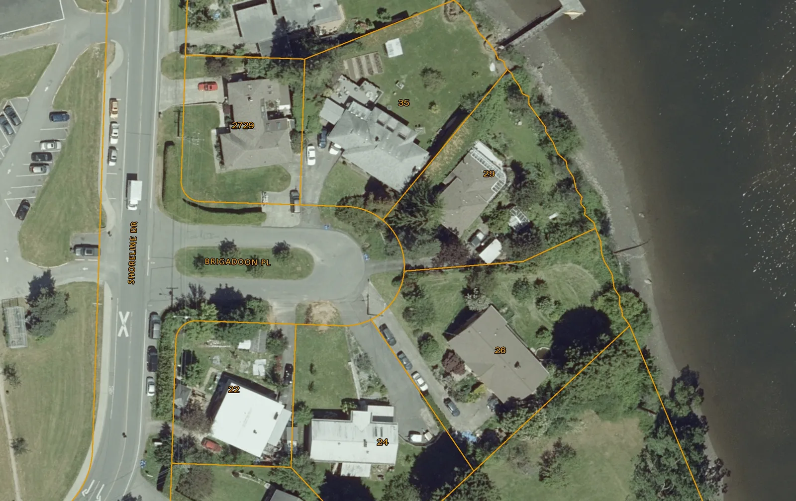
Notes
Important: This map is for general information purposes only. The Capital Regional District (CRD) makes no representations or warranties regarding the accuracy or completeness of this map or the suitability of the map for any purpose. This map is not for navigation. The CRD will not be liable for any damage, loss or injury resulting from the use of the map or information on the map and the map may be changed by the CRD at any time.
Page 19
Document Images
(1)
Extracted from: 2019 09 17 Council Agenda - Agenda - Pdf