This site is in beta — data may be incomplete and features are still being added.
Council Meeting/Documents/Attachment 2 - Subject Property Orthophoto
Appendix

Attachment 2 - Subject Property Orthophoto

November 2, 2021Page 1231 section

An aerial orthophoto highlighting the project site at 298 Island Highway.

1 CALL TO ORDER
298 Island HighwayAerial view of existing Namaste restaurant site
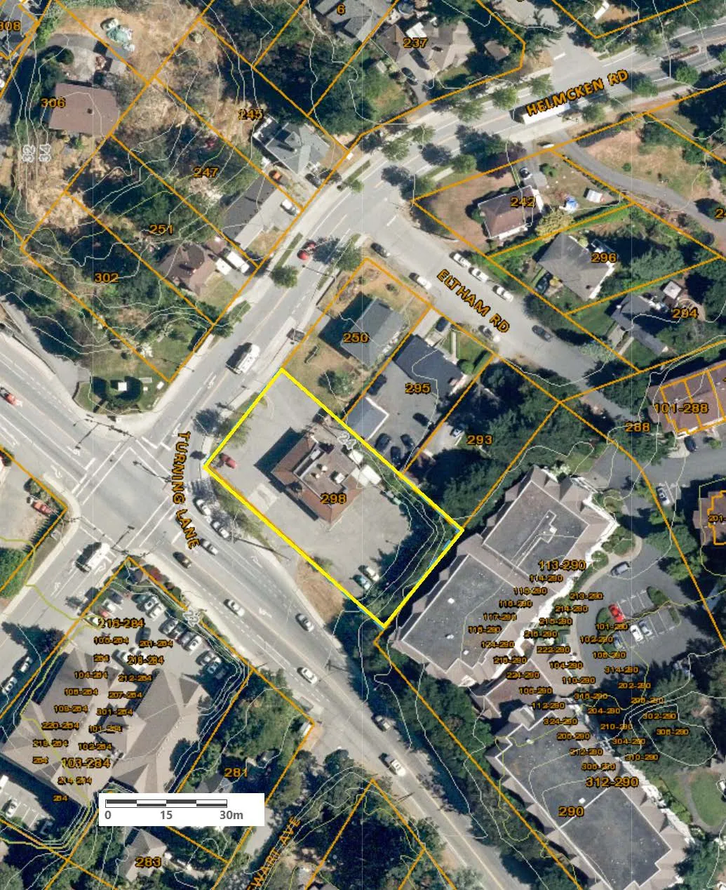
Aerial map showing property boundaries and lot numbers. A property labeled 298 is highlighted with a yellow border. Adjacent streets include Helmcken Rd, Eltham Rd, Turning Lane, and Watti Ave. A scale bar at the bottom indicates a distance of 0 to 30 meters.
Page 123
Extracted from: 2021 11 02 Council Agenda - Agenda - Pdf