Appendix
SITE PLAN - 280 Island Highway (AS APPROVED)
April 14, 2020Page 2021 section
The approved technical site plan for the residential development at 280 Island Highway.
September 2016 original approvalAlan Lowe Architect Inc.
PROJECT INFORMATION
LEGAL ADDRESS: LOT A, SECTION 27, ESQUIMALT DISTRICT PLAN 26190
CIVIC ADDRESS: 250 ISLAND HIGHWAY, VIEW ROYAL, B.C.
ZONING DATA
- ZONING: RM-3 MIXED RESIDENTIAL
- SITE AREA: 1,676.99 m² (18,051 sq.ft.)
- GROUND FLOOR AREA: 568.20 m² (6,116 s.f.)
- SECOND FLOOR AREA: 712.93 m² (7,674 s.f.)
- THIRD FLOOR AREA: 712.93 m² (7,674 s.f.)
- FOURTH FLOOR AREA: 681.72 m² (7,338 s.f.)
- GROSS FLOOR AREA: 2,675.78 m² (28,802 s.f.)
- F.S.R.: 1.595:1 (1.6:1 Allowed)
- BLDG. AREA: 744.62 m² (8,014 s.f.)
- BUILDING HEIGHT: 14.40 m (47'-3") (13.5 m [44'-3 1/2"] max. allowed)
- STOREYS: 4
- LOT COVERAGE: 44.39% (60% allowed)
- SETBACKS (REQUIRED):
- FRONT YARD: 4.25 m (13'-11 1/2") (7.5m)
- REAR YARD: 3.58 m (11'-8 3/4") (7.0m)
- SIDE YARD (WEST): 4.20 m (13'-11 1/2") (4.0m)
- SIDE YARD (EAST): 4.84 m (15'-10 3/4") (4.0m)
- OCCUPANT LOAD: 82
- OFF STREET PARKING STALLS: 40
- UNDERGROUND PARKING STALLS (80%): 32
- SURFACE STALLS (20%): 8
- BICYCLE PARKING: 37 x CLASS 1 (6 x BIKE RACK AT BLDG. ENTRANCE)
- RESIDENTIAL UNITS:
- GROUND FLOOR: 6 x 1BD, 1 x 2BD
- 2ND FLOOR: 7 x 1BD, 3 x 2BD
- 3RD FLOOR: 7 x 1BD, 3 x 2BD
- 4TH FLOOR: 8 x 1BD, 2 x 2BD
- TOTAL UNITS: 37
BUILDING CODE ANALYSIS:
- OCCUPANCY: GROUP C - RESIDENTIAL
- BUILDING CLASSIFICATION: 3.2.2.50 Group C up to 4 storeys, Sprinklered (3.2.2.50 (2) a) Floor assemblies shall be fire separations with a fire resistance rating of not less than 1 HR.
AVERAGE GRADE CALCULATION
| POINT | CALCULATION | RESULT |
|---|---|---|
| POINTS A&B | (32.45+32.45)/2=32.45 x 21.08 m = | 684.04 |
| POINTS B&C | (32.45+32.45)/2=32.45 x 1.19 m = | 38.62 |
| POINTS C&D | (32.45+32.45)/2=32.45 x 6.43 m = | 209.07 |
| POINTS D&E | (32.45+32.40)/2=32.43 x 3.31 m = | 107.08 |
| POINTS E&F | (32.40+32.45)/2=32.43 x 1.53 m = | 49.67 |
| POINTS F&G | (32.45+32.45)/2=32.45 x 21.99 m = | 713.57 |
| POINTS G&H | (32.45+32.50)/2=32.47 x 2.42 m = | 78.57 |
| POINTS H&I | (32.50+32.28)/2=32.39 x 5.65 m = | 183 |
| POINTS I&J | (32.28+31.83)/2=32.05 x 1.32 m = | 42.31 |
| POINTS J&K | (31.83+31.83)/2=31.83 x 7.89 m = | 251.14 |
| POINTS K&L | (31.83+31.40)/2=31.62 x 14.47 m = | 457.47 |
| POINTS L&M | (31.40+31.40)/2=31.40 x 8.20 m = | 257.48 |
| POINTS M&N | (31.40+31.00)/2=31.20 x 2.62 m = | 81.74 |
| POINTS N&O | (31.00+28.68)/2=29.84 x 14.59 m = | 435.36 |
| POINTS O&P | (28.68+28.68)/2=28.68 x 6.46 m = | 185.27 |
| POINTS Q&R | (32.45+32.45)/2=32.45 x 3.73 m = | 121.03 |
| POINTS R&A | (32.45+32.45)/2=32.45 x 15.49 m = | 502.65 |
| TOTAL | 4397.07 | |
| AVERAGE GRADE | 4397.07 / 139.29m (PERIMETER) = | 31.56m GEODETIC |
Revision History
| No. | Issued / Revisions | Date |
|---|---|---|
| 4 | DEVELOPMENT PERMIT | 9 SEPT 16 |
| 3 | DEVELOPMENT PERMIT | 9 JUNE 16 |
| 2 | DEVELOPMENT PERMIT | 31 MAY 16 |
| 1 | DEVELOPMENT PERMIT | 11 MAY 16 |
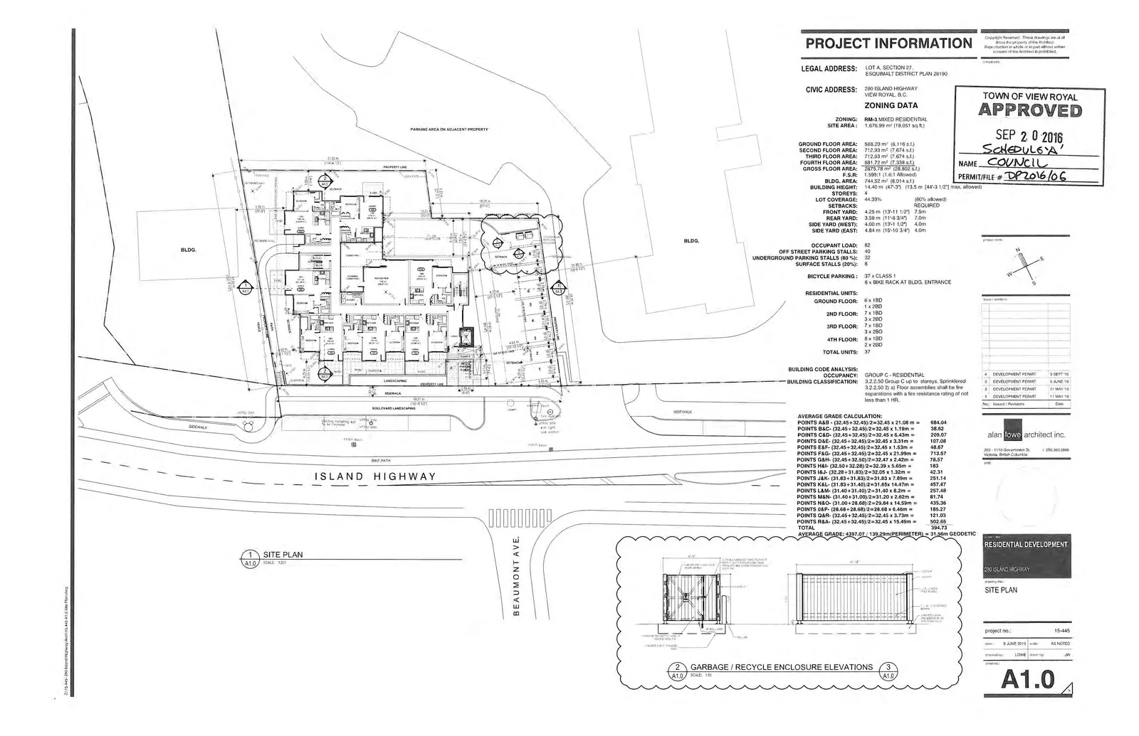
RESIDENTIAL DEVELOPMENT 250 ISLAND HIGHWAY
SITE PLAN
- project no.: 15-445
- date: 9 JUNE 2016
- scale: AS NOTED
- checked by: LOWE
- drawn by: JW
- Sheet No.: A1.0
Page 202
Extracted from: 2020 04 14 Special Council Agenda - Agenda - Pdf