This site is in beta — data may be incomplete and features are still being added.
Council Meeting/Documents/Peninsula Streams Presentation to Mayor & Council – November 17, 2020
Presentation

Peninsula Streams Presentation to Mayor & Council – November 17, 2020

November 17, 2020Pages 48–767 sections

Presentation slides covering the history and projects of the Peninsula Streams Society and details of the BEACH Initiative.

5.b Beach Nourishment
Organization incorporated May 15, 2002Highlights projects like Millstream Fishway and BEACH InitiativeShowcases 'Green Shores' restoration model

Presentation to Mayor & Council – November 17, 2020
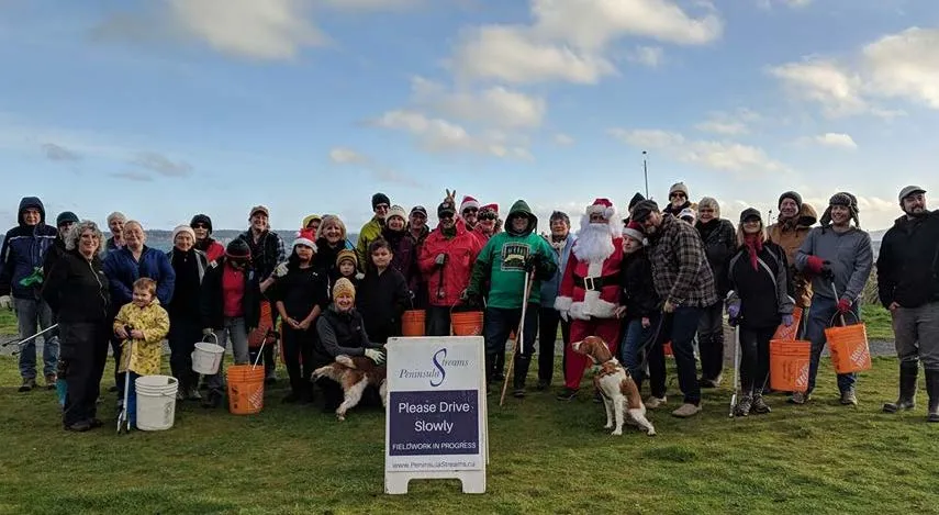
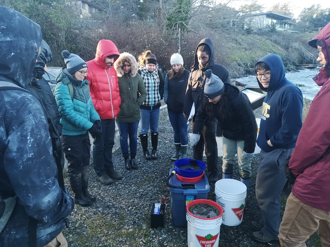
Group of volunteers for the Island View Beach Clean-up and Forage Fish Egg Beach Survey on Dec 15
Page 48–76

The Peninsula Streams Society

Incorporated May 15, 2002 by 5 groups:

  1. WSIKEM-TenTen Stewardship Partnership
  2. ḰENNES (Hagan/Graham Creek) Watershed Project
  3. Tatlow Streamkeepers (now Friends of Chalet Creek)
  4. Saanich Inlet Protection Society
  5. Sidney Anglers Association
  • Gained Registered Charity Status in 2006

Stewardship Groups (or groups with stewardship goals) we work with and support:

  1. Friends of Chalet Creek
  2. Friends of Shoal Harbour Sanctuary
  3. Sidney Anglers Association (Reay Creek)
  4. Residents of Reay Creek Pond
  5. ḰENNES (Hagan/Graham Creek) Watershed Project
  6. Friends of Tod Creek Watershed
  7. Friends of Swan Creek Watershed
  8. Friends of Colquitz River Mainstem
  9. Goward Springs Watershed Stewards
  10. Gabo Creek stewards
  11. Friends of Maltby Lake Watershed
  12. Colquitz Coalition (umbrella group)
  13. Golden Rods and Reels (Elk/Beaver Lake, O’Donnell Creek)
  14. Friends of Robert’s Bay

2020 Projects

  • Millstream Fishway Project
  • Colquitz Mainstem Riffle Construction and Riparian Restoration and Protection-Phase 2
  • Swan Creek Enhancement
  • Tod Creek Fish Camera, Tod Passive Integrated Transponder (PIT) Program
  • Lochside Meadow Monitoring (Blenkinsop Creek)
  • Beach Education and Conservation of Habitat (BEACH) Initiative

2020 Programs

  • Water Quality in Hagan/Graham, Tetayut, Goward Springs, Tod Creek, Maltby Lake and Swan Creek
  • Environmental Education Programs – reduced this year due to COVID-19
  • B.E.A.C.H. programs ongoing and expanded

Some Stats

  • Adult volunteer participation 2500+ hrs/year
  • We host workshops on stewardship, Streamkeeping and fish counting/identification.
  • Every year we offer ~35 volunteer events, incl. invasive species removal, creek enhancement, environmental education, plantings, fish releases, beach clean-ups, monitoring + community meetings (among other activities)
Page 48–76

Beach Education And Conservation of Habitat (BEACH) Initiative

Beaches provide:

  • Places for families, friends and for solitude
  • Places for recreation and rest
  • Habitat for a great variety of terrestrial and marine life, including otters, raccoons, birds, fish, invertebrates, algae and plants

Beaches are under threat from:

  • Pollution
  • Overland flow erosion
  • Outfalls and storm drain outlets
  • Garbage and derelict boats
  • Dog feces and trampling/compaction/disturbance
  • Sea-level rise and climate-related storm activity
  • Backshore development

Goals:

  • Empower local citizens through the support that stewardship leadership can provide: education, training and organization related to beach conservation and protection
  • Restore, conserve and protect local beaches
  • Clean-up and monitor local beaches and waterways

Activities:

  • Beach nourishment
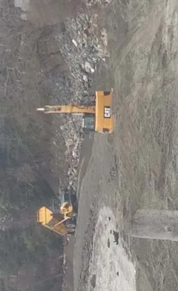
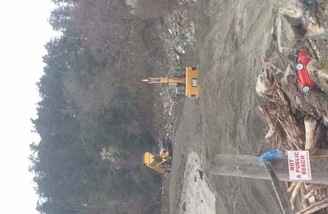
    Heavy machinery performing beach nourishment work
    Heavy machinery performing beach nourishment work
  • Clean-ups
  • Forage fish egg surveys
  • Beach biophysical and biological surveys
  • Beach seining
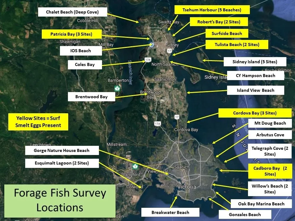
Map of Forage Fish Survey Locations around the Saanich Peninsula and Victoria area, highlighting yellow sites where Surf Smelt eggs were present
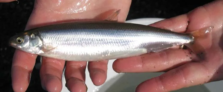
Close-up of a Surf Smelt held in a hand
Close-up of a Sand lance, also known as a “needlefish”

Forage Fish Egg Beach Survey

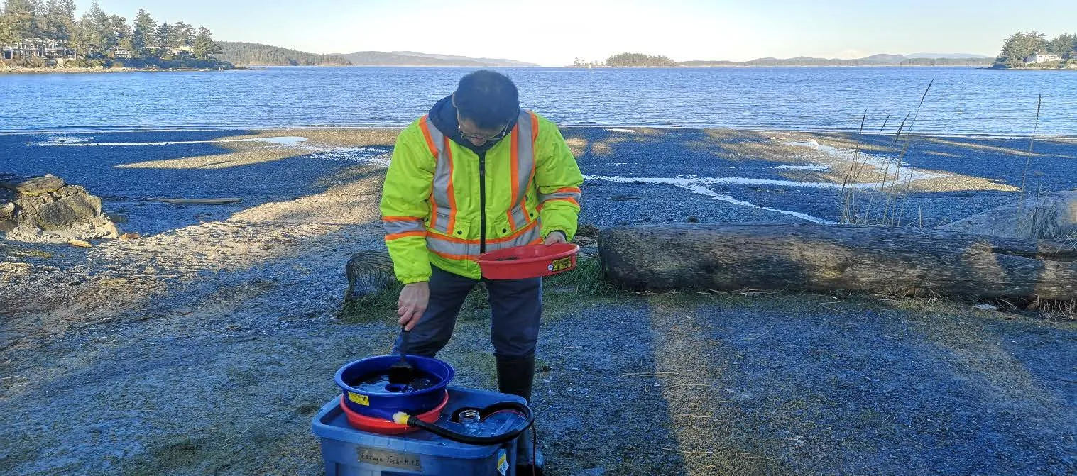
Volunteers conducting a Forage Fish Egg Beach Survey at Island View on Jan 9
Volunteers conducting a Forage Fish Egg Beach Survey at Telegraph Cove on Feb 4
Volunteers conducting a Forage Fish Egg Beach Survey at Robert’s Bay on Mar 4
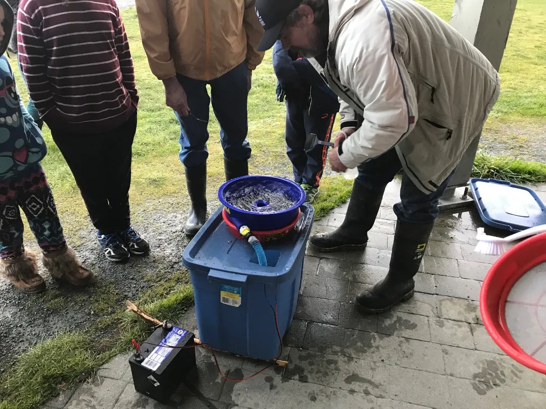
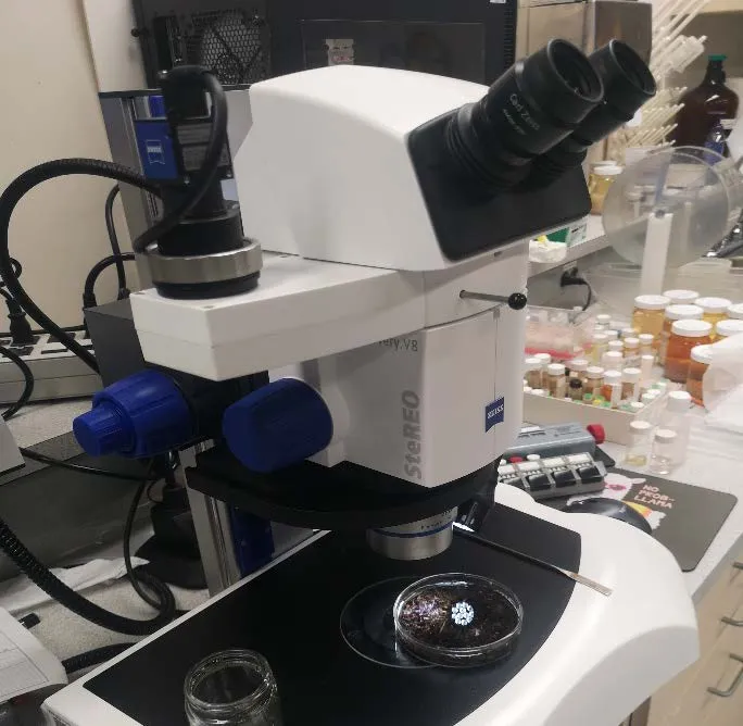
Microscope setup used by the Institute of Ocean Sciences (IOS) for survey analysis

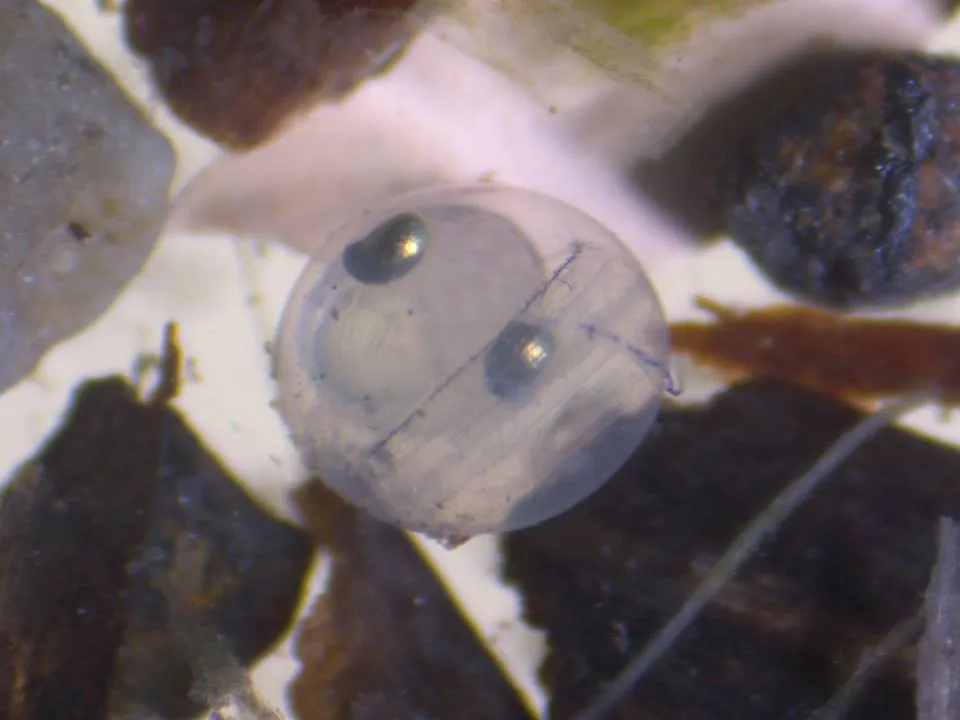
Forage Fish Egg Beach Survey: Results
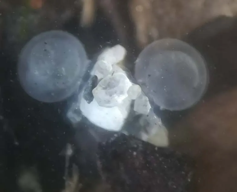
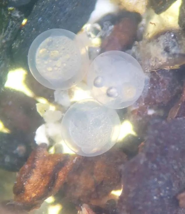
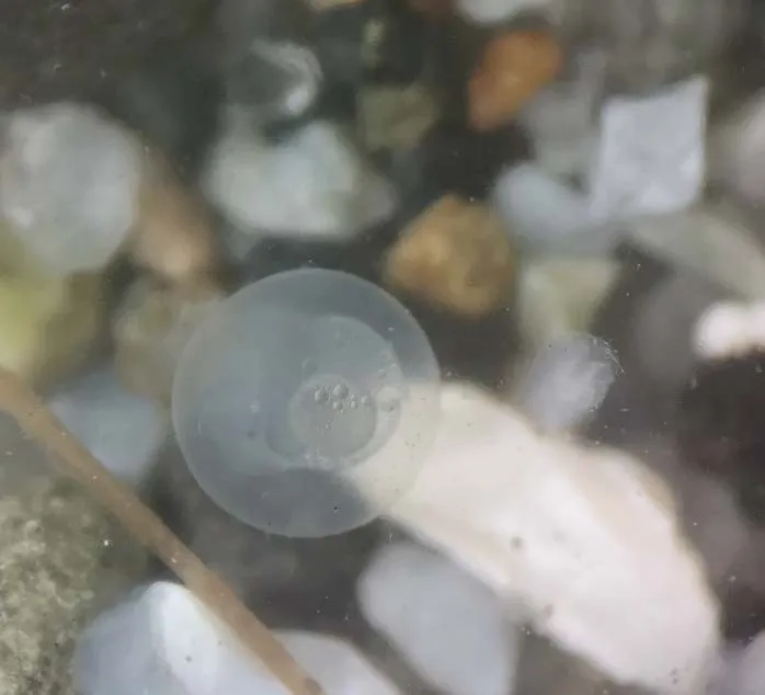
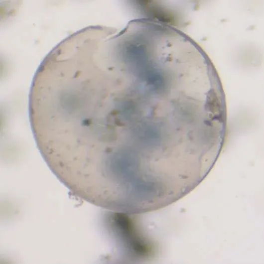
Microscopic view of a Sand Lance Egg from Tryon Beach
Microscopic view of a Hatched Egg from Tryon Beach
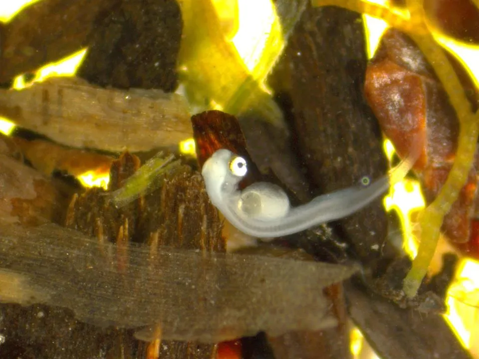
Microscopic view of a Sand Lance larva from Tryon Beach
Microscopic view of Sand Lance Eggs from McMicken Beach
Microscopic view of a Sand Lance Egg from Lillian Hoffar Beach
Microscopic view of Sand Lance Eggs from NS Yacht Club Beach
Page 48–76

Pat Bay Beach Nourishment

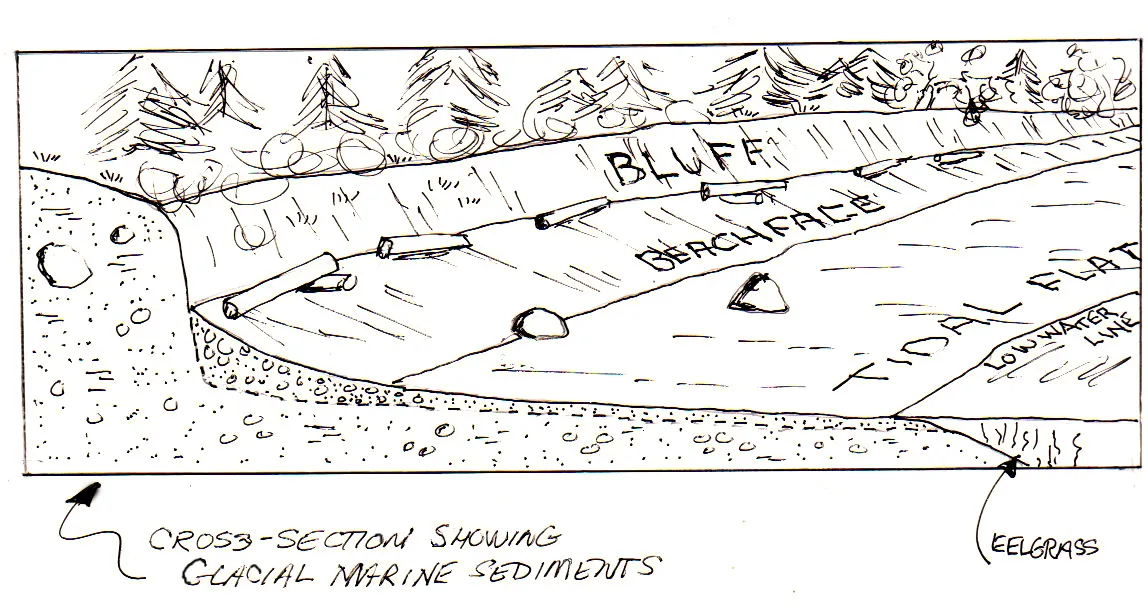
Erosion of bluff provides sediment to beach – finer material (silt & clay) is lost offshore but pebble and sand remains to create beach.
Cross-section diagram showing glacial marine sediments, a bluff, beachface, tidal flat, low water line, and eelgrass habitat
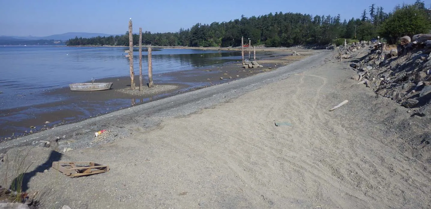
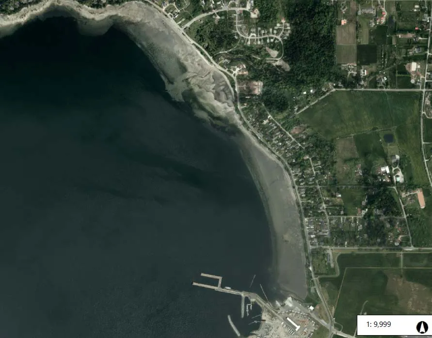
Aerial map of Pat Bay Beach Nourishment project phases: Phase 1 (2012), Phase 2 (2015), and Phase 3 (March 2018)

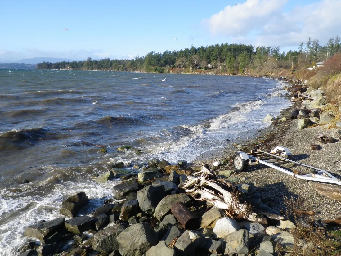
Photo comparison A – South end of Reach 2, looking north
Pat Bay Beach on September 16, 2011
Pat Bay Beach on June 25, 2014, showing construction activity
Pat Bay Beach on May 28, 2015, following nourishment

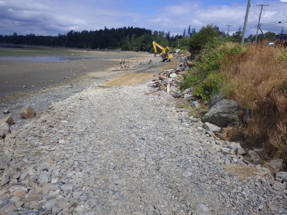
Pat Bay Beach Nourishment March 2018
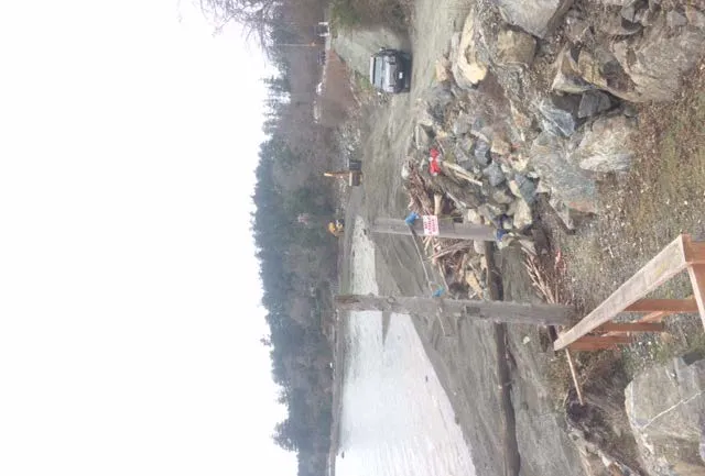
Pat Bay Beach nourishment construction site view 1
Pat Bay Beach nourishment construction site view 2
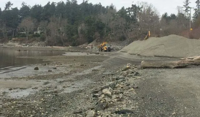
Pat Bay Beach nourishment construction site view 3 with heavy machinery
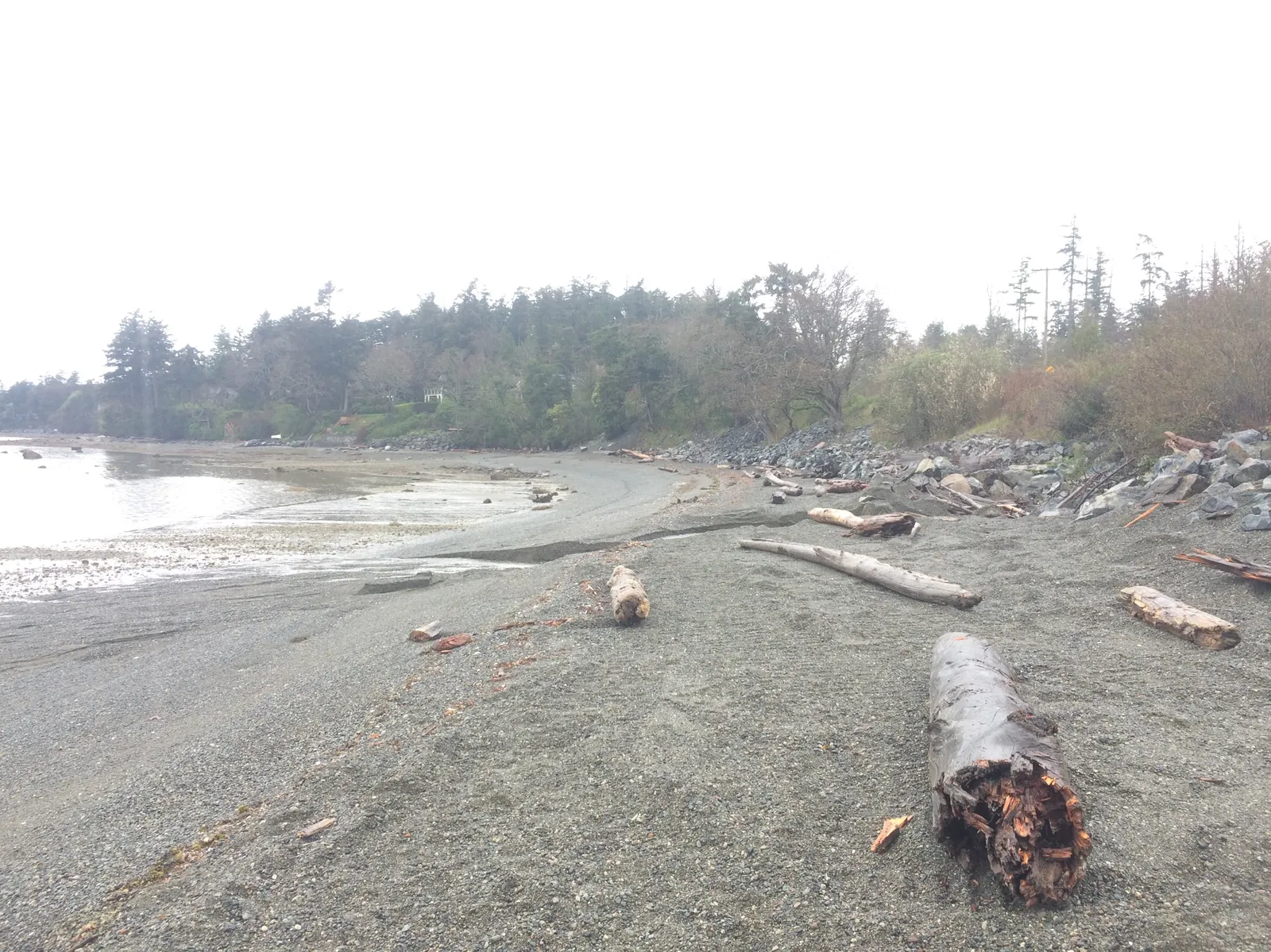
Pat Bay Beach as it appeared in April 2018

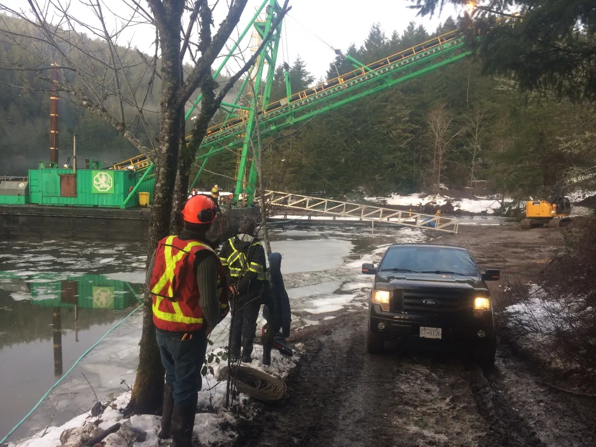
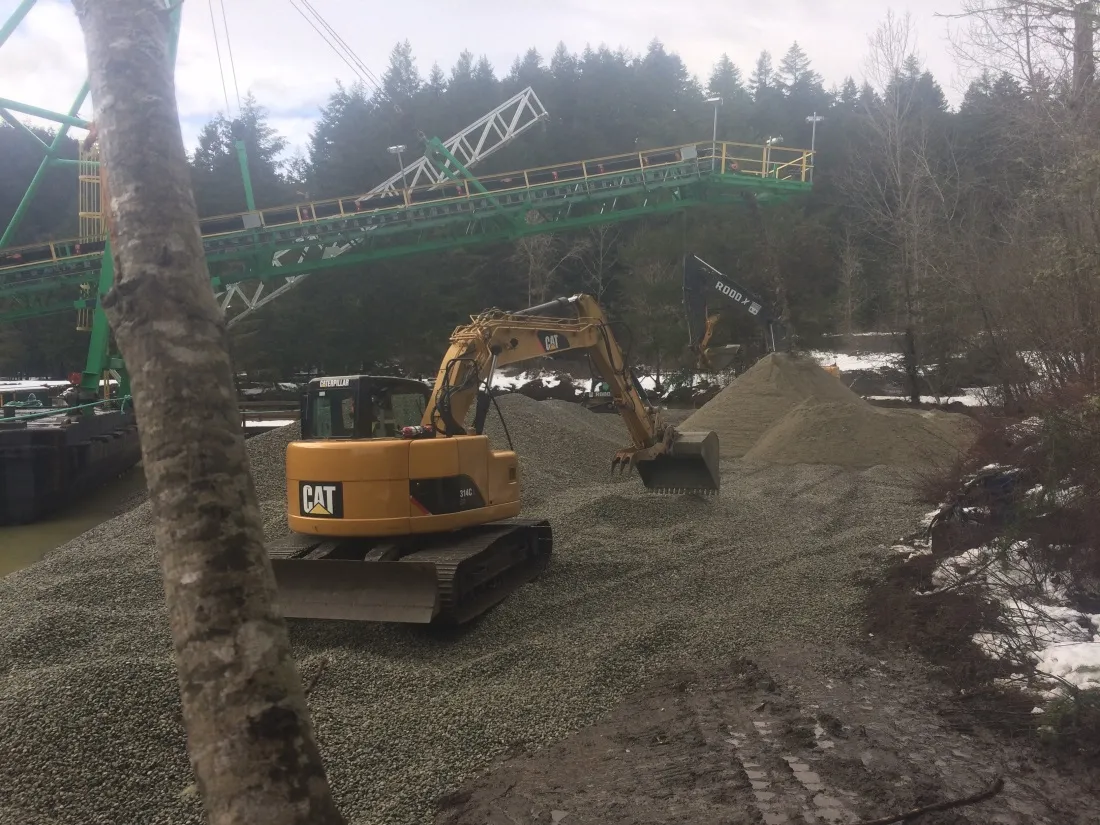
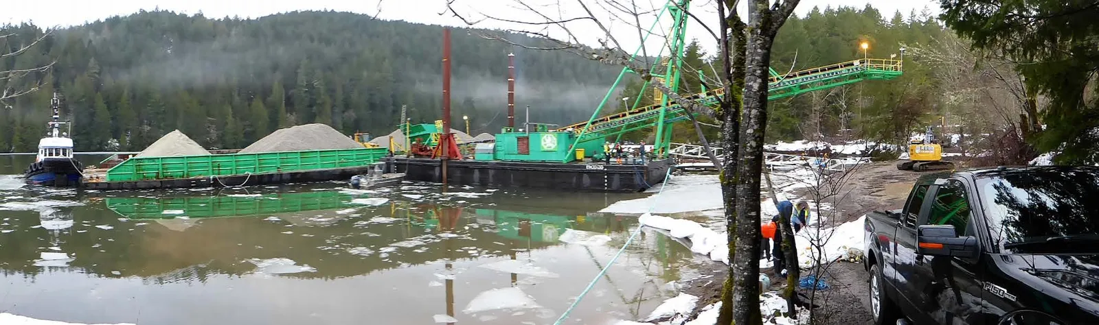
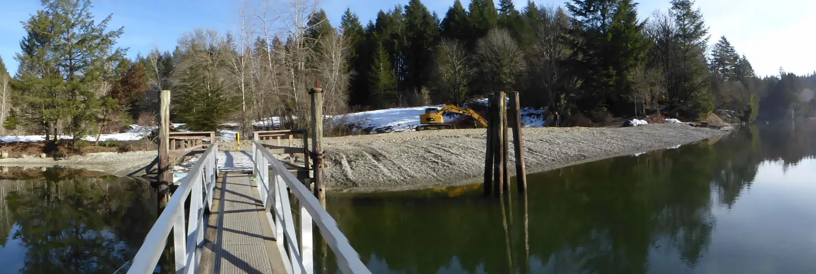
Tod Inlet Beach Project– February 10, 2017
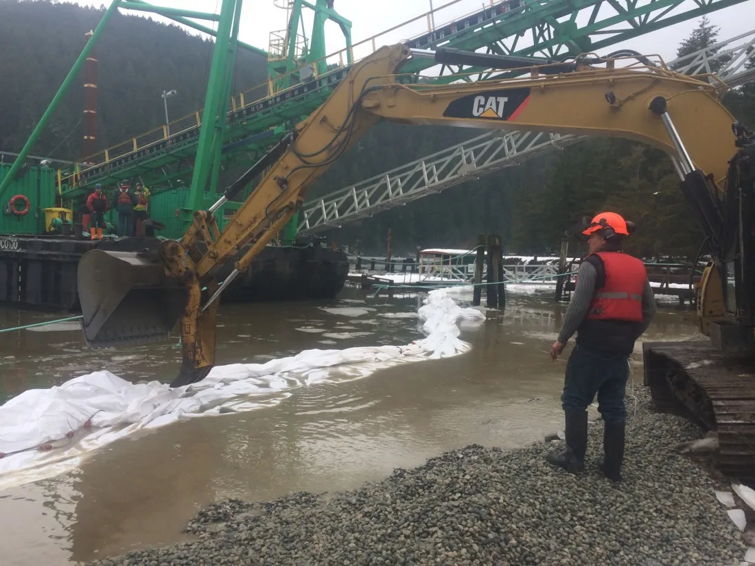
Tod Inlet Beach project site showing a CAT excavator on gravel
Tod Inlet Beach project site showing a truck and conveyor system over the water
Tod Inlet Beach project site showing an excavator working at the water's edge
Wide view of the Tod Inlet Beach project showing barges with sediment and large conveyor machinery
Wide view of the completed Tod Inlet Beach nourishment area and dock
Page 48–76

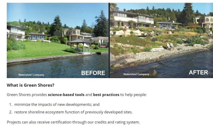
What is Green Shores?

Green Shores provides science-based tools and best practices to help people:

  1. minimize the impacts of new developments; and
  2. restore shoreline ecosystem function of previously developed sites.

Projects can also receive certification through our credits and rating system.
Before and After comparison of a shoreline property utilizing Green Shores principles, moving from a concrete sea wall to a naturalized gravel beach with native plantings
Page 48–76

Town of View Royal

Beach Nourishment Proposal 2020-21
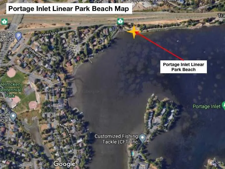
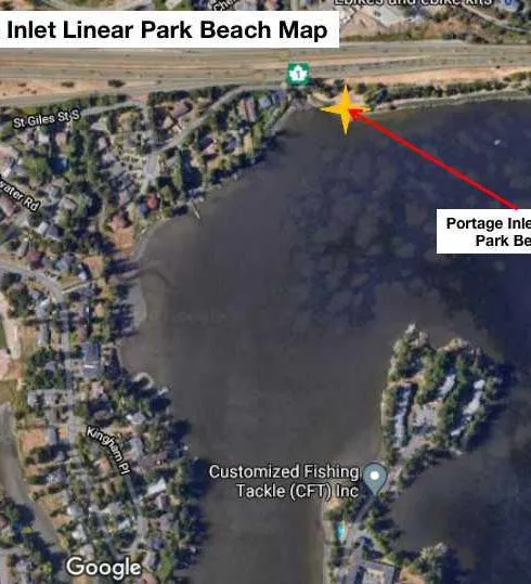
Inlet Linear Park Beach Map overview
Detailed map showing the location of Portage Inlet Linear Park Beach
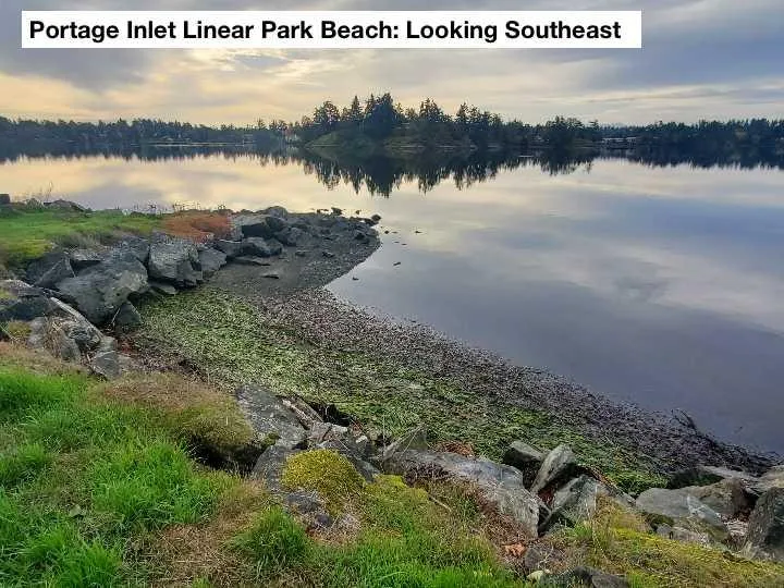
Photo of Portage Inlet Linear Park Beach looking Southeast
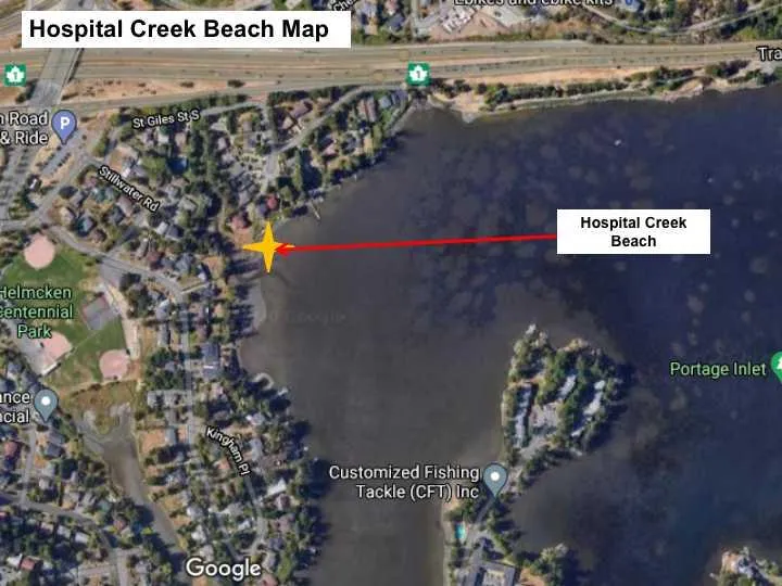
Hospital Creek Beach Map overview
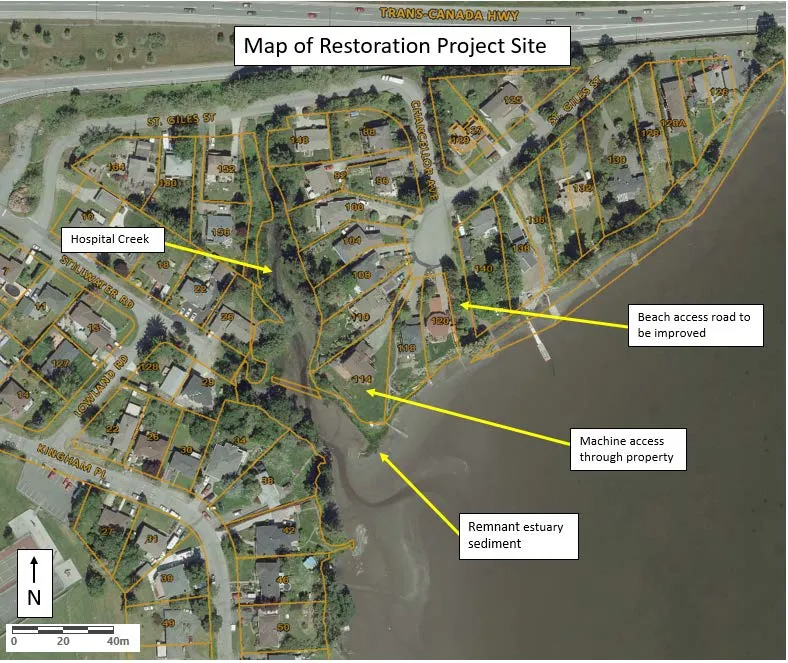
Map of Restoration Project Site at Hospital Creek, showing Beach access road improvements, machine access points, and remnant estuary sediment
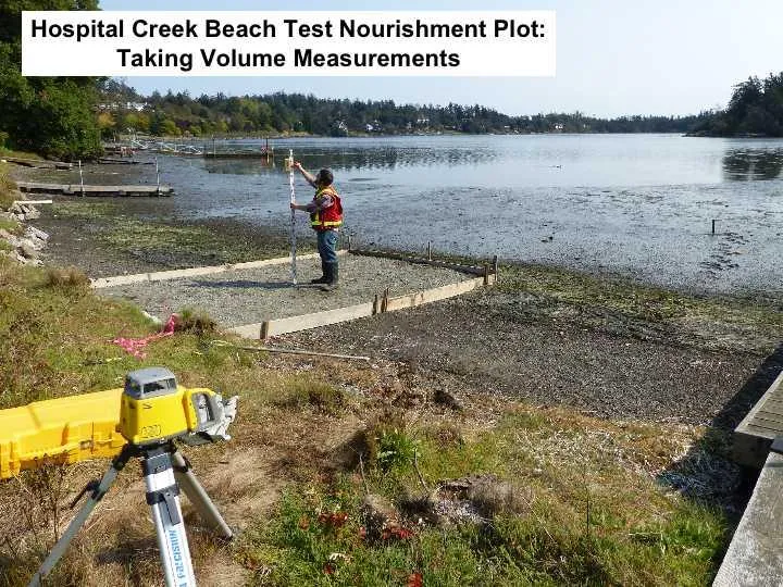
Hospital Creek Beach Test Nourishment Plot showing a staff member taking volume measurements with survey equipment
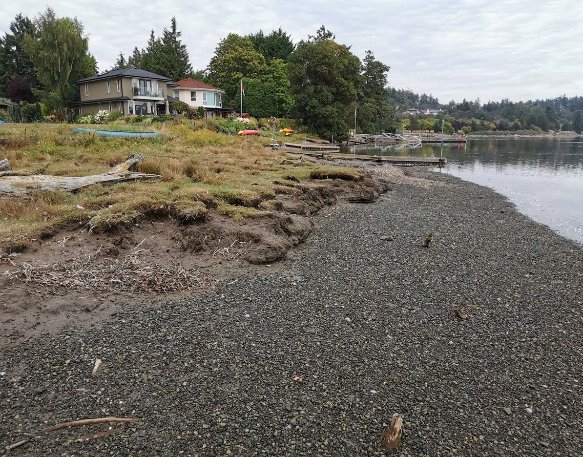
Erosion of Hospital Creek estuary sediment adjacent to waterfront homes on Chancellor Ave
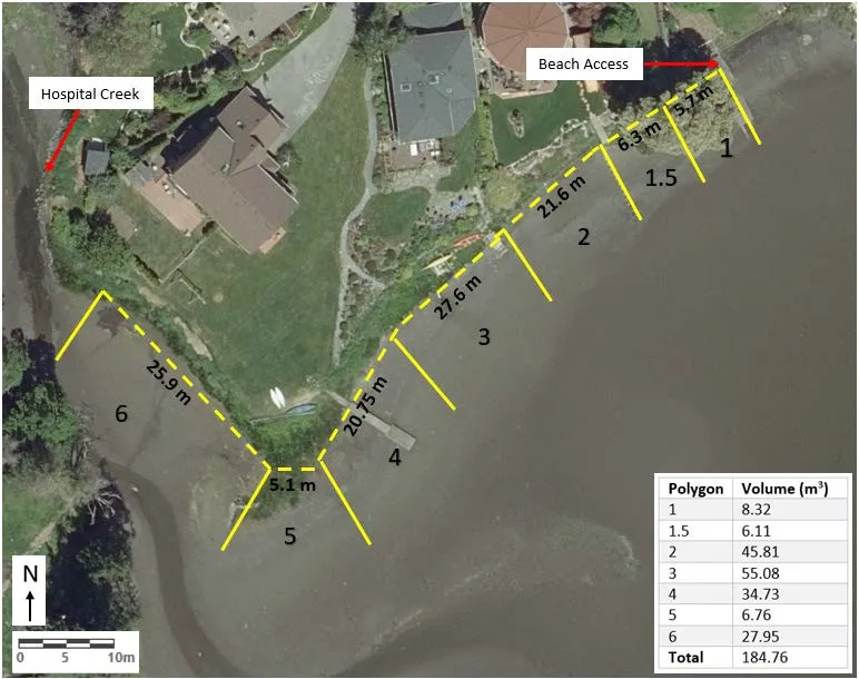
Map showing measurement polygons for the Hospital Creek restoration project
Polygon Volume (m³)
1 8.32
1.5 6.11
2 45.81
3 55.08
4 34.73
5 6.76
6 27.95
Total 184.76
Page 48–76

For more information:

www.PeninsulaStreams.ca PeninsulaStreams@gmail.com
Ian Bruce, R.P.Bio – Executive Coordinator
**Ian Bruce, R.P.Bio – Executive Coordinator** 250-363-6596
Francesca Loro, BSc. – Stewardship Coordinator
**Francesca Loro, BSc. – Stewardship Coordinator** 250-363-6480

Brian Koval, R.P.Bio – Assistant Coordinator 250-363-6596

Thank you~! Connect with us on Facebook, Twitter, Flickr and YouTube

Page 48–76
Extracted from: 2020 11 17 Council Agenda - Agenda - Pdf