This site is in beta — data may be incomplete and features are still being added.
Council Meeting/Documents/Attachment 1. Location Map and Attachment 2. Orthophoto
Appendix

Attachment 1. Location Map and Attachment 2. Orthophoto

November 17, 2020Pages 179–1802 sections

Maps showing the site location and surroundings for the 298 Island Highway proposal.

1 CALL TO ORDER
Address: 298 Island HighwayNortheastern quadrant of Island Highway and Helmcken Road

Attachment 1. Location Map
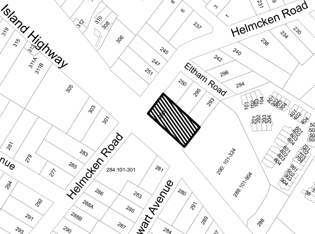
Location map showing property boundaries and street names, including Island Highway, Helmcken Road, Eltham Road, and Stewart Avenue. A specific property lot, numbered 298, is highlighted with diagonal black lines.
Page 179–180

Attachment 2. Orthophoto
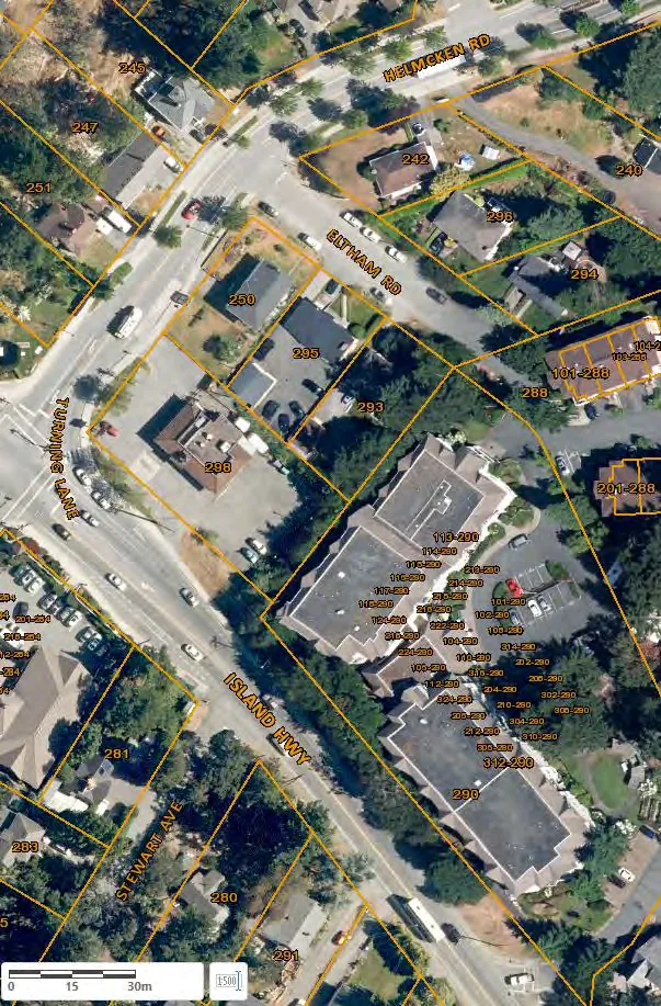
Aerial orthophoto of the neighborhood shown in the location map, with property boundaries and lot numbers overlaid. The image includes a scale bar indicating 0 to 30 meters.
Page 179–180
Extracted from: 2020 11 17 Council Agenda - Agenda - Pdf