OCP2020/01 and REZONING 2020/04 Presentation - 298 Island Highway
Staff presentation regarding the Official Community Plan amendment and rezoning application for 298 Island Highway.
OCP2020/01 and REZONING 2020/04
298 Island Highway

OUTLINE
- Traffic circulation
- Revision to Zoning Bylaw 1061
- Covenant
1. Traffic circulation
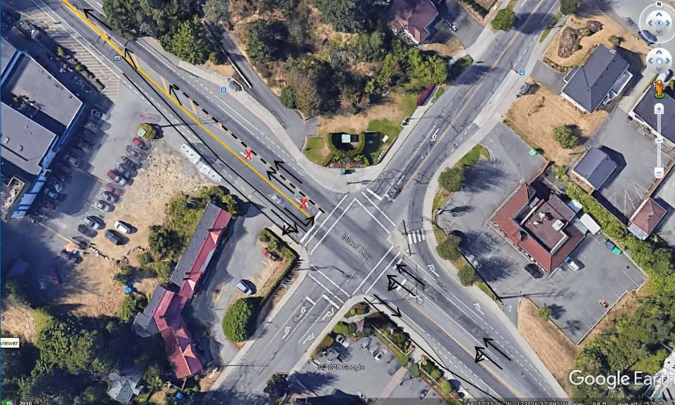
A. Roundabout concept at Island Highway/Helmcken intersection to prevent Rudyard/Stormont cut-through traffic
Horizontal and vertical alignment
Sight lines
Insufficient right of way to fit a roundabout
Concerns regarding disparity in leg volumes
Roundabouts best when approach legs have similar volumes
Island Highway’s two approaches very much outweigh the Helmcken approach - a huge volume of traffic would be hindered to assist a very small percentage of vehicles
Exiting vehicles more likely to use the Pheasant roundabout as they should rather than travel through the Rudyard/ Stormont route.
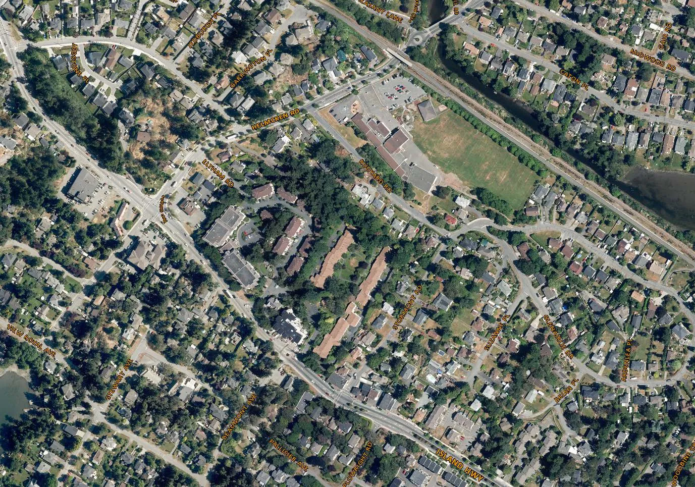
B. Removing the right turn lane on Island Highway west bound
- Significant right turn demand at Island Highway on to Helmcken Road heading toward Trans-Canada Highway.
- Would create longer queues on Island Highway west bound during peak times, especially pm peak
- Would likely create more undesirable results than positive ones
2. Zoning Bylaw 1061 Changes
1. New definition
“Neighbourhood Grocery” means a grocery with a leasable floor area of less than 700m2. Neighbourhood Grocery may include, as an accessory uses only: bakery, café, and delicatessen.
2. Uses
Principal Uses
- Neighbourhood Grocery
- Residential, Apartment
3. Uses
Conditions of Use a. Neighbourhood Grocery use, with the exception of parking, may only be located on the first storey. b. The daily hours of operation for a Neighbourhood Grocery are limited to between 6.00am and 11.00pm.
3. Covenant
a. Provision of a community amenity contribution of $3,500 per residential unit prior to issuance of a building permit b. No chain or franchise
RECOMMENDATION
THAT, coincident with final reading of Zoning Bylaw No. 900, 2014, Amendment Bylaw No. Bylaw No. 1061, 2020, a covenant be registered on the lands at 298 Island Highway for:
a. Provision of a community amenity contribution of $3,500 per residential unit prior to issuance of a building permit b. No chain or franchise
Development Concept
Previously presented material
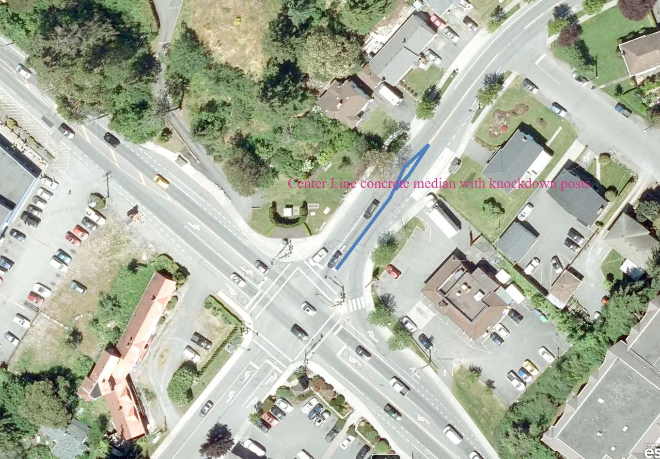
Subject Property
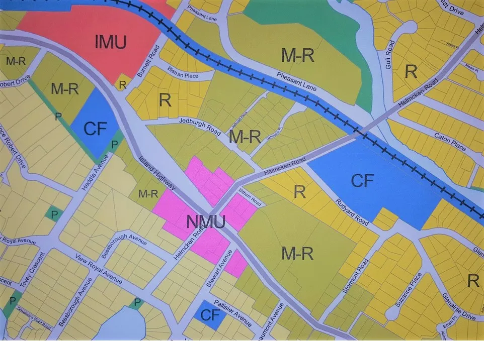
Official Community Plan land use designations
CD-26: Island Highway / Helmcken Comprehensive Development
Principal Uses
- Mixed Commercial and Residential Use
Accessory Uses
- Home Occupation
| CD-26: Island Highway / Helmcken Comprehensive Development | |
|---|---|
| Lot Size | |
| Lot Size, minimum | 1500 m² |
| Lot Density | |
| Floor Space Ratio | 3.0:1 |
| Lot Coverage, maximum | 75% |
| Impermeable Surface Coverage, maximum | 80% |
| Size of Principal Buildings and Other Structures | |
| Building Height, maximum | 21m and 6 storeys |
| Building Width, minimum | 6m |
| Siting of Buildings and Other Structures (Principal and Accessory) | |
| Front Lot Line Setback, minimum except for 5th and 6th storeys | 0m |
| Front Lot Line Setback, minimum for 5th and 6th storeys | 2.0m |
| Rear Lot Line Setback, minimum | 3.0m |
| Side Lot Line Setback | 3.0m |
| Flanking Lot Line Setback, minimum except for 5th and 6th storeys | 0m |
| Flanking Lot Line Setback, minimum for 5th and 6th storeys | 2.0m |
4. DEVELOPMENT CONCEPT
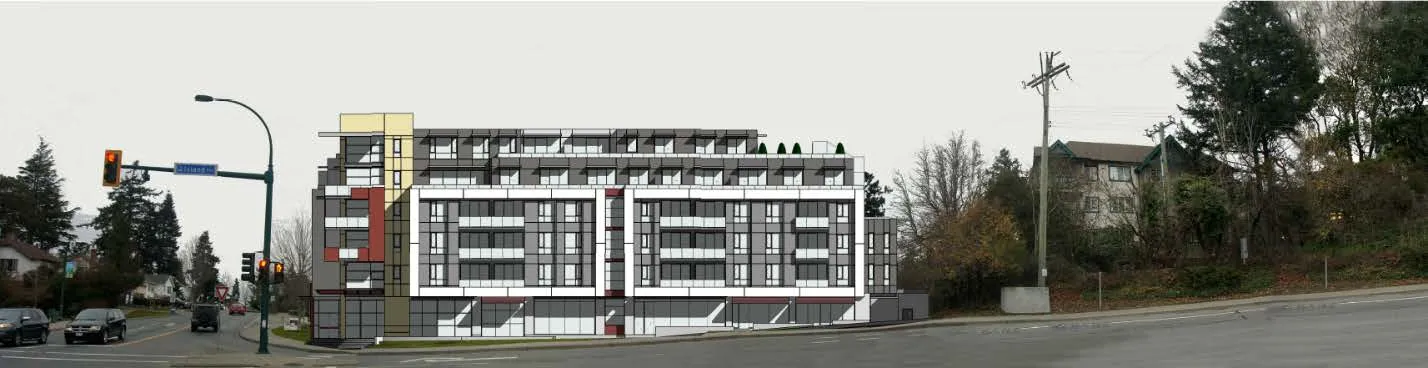
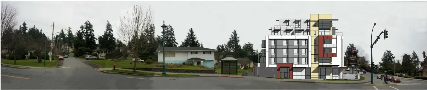
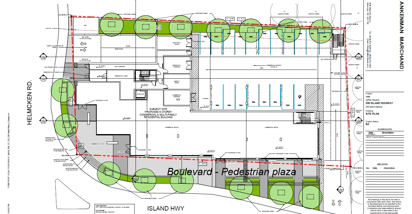
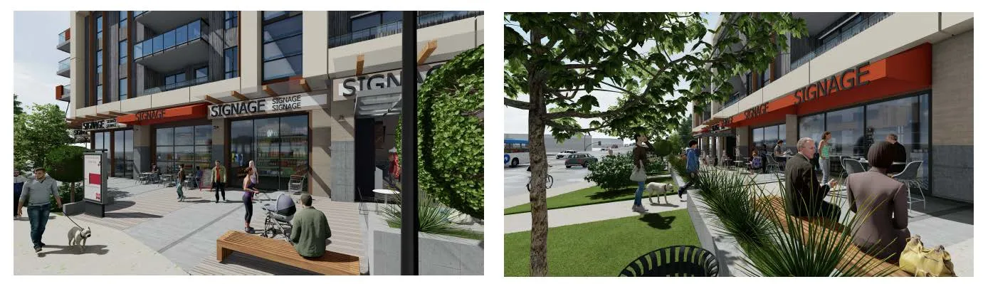
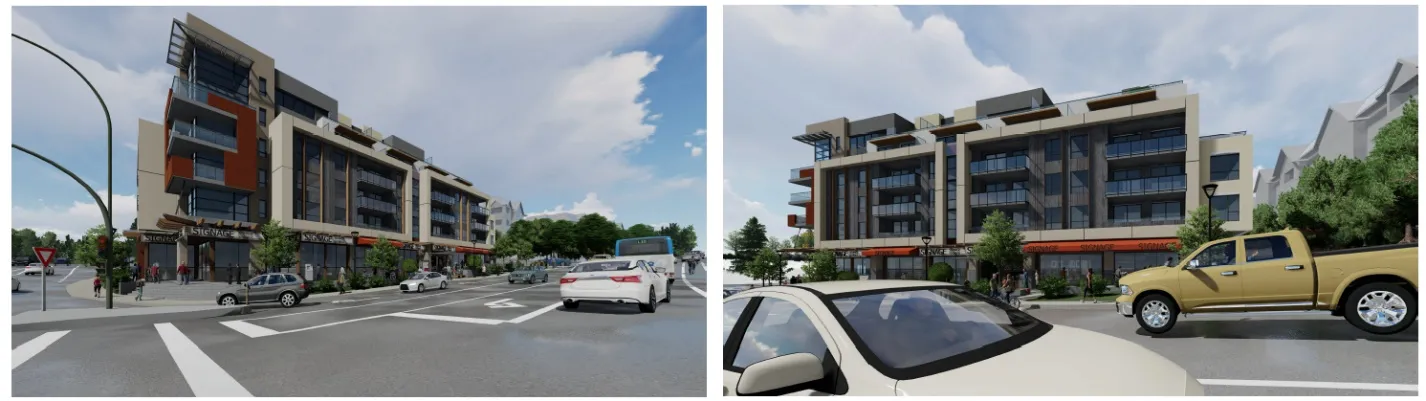
Development Concept (development permit stage)
- Six-storey building with the upper two storeys set back
- Ground floor: 560m² commercial use
- Upper floors: 54 apartment units
- Two levels of underground parking
- 16 one-bedroom units
- 37 two-bedroom units
- 1 three-bedroom unit
| Development Metric | Value |
|---|---|
| Lot Size | 1853m² |
| Floor Area | 5559 m² |
| Floor Space Ratio | 3.0:1 |
| Units/Hectare | 292 |
| Building Height | 20.3m |
| Storeys | 6 |
| Site Coverage | 75% |
| Units Proposed | 54 |
| Vehicle Parking | 103 (103 required) |
| Secure Bike Parking | 62 (56 required) |
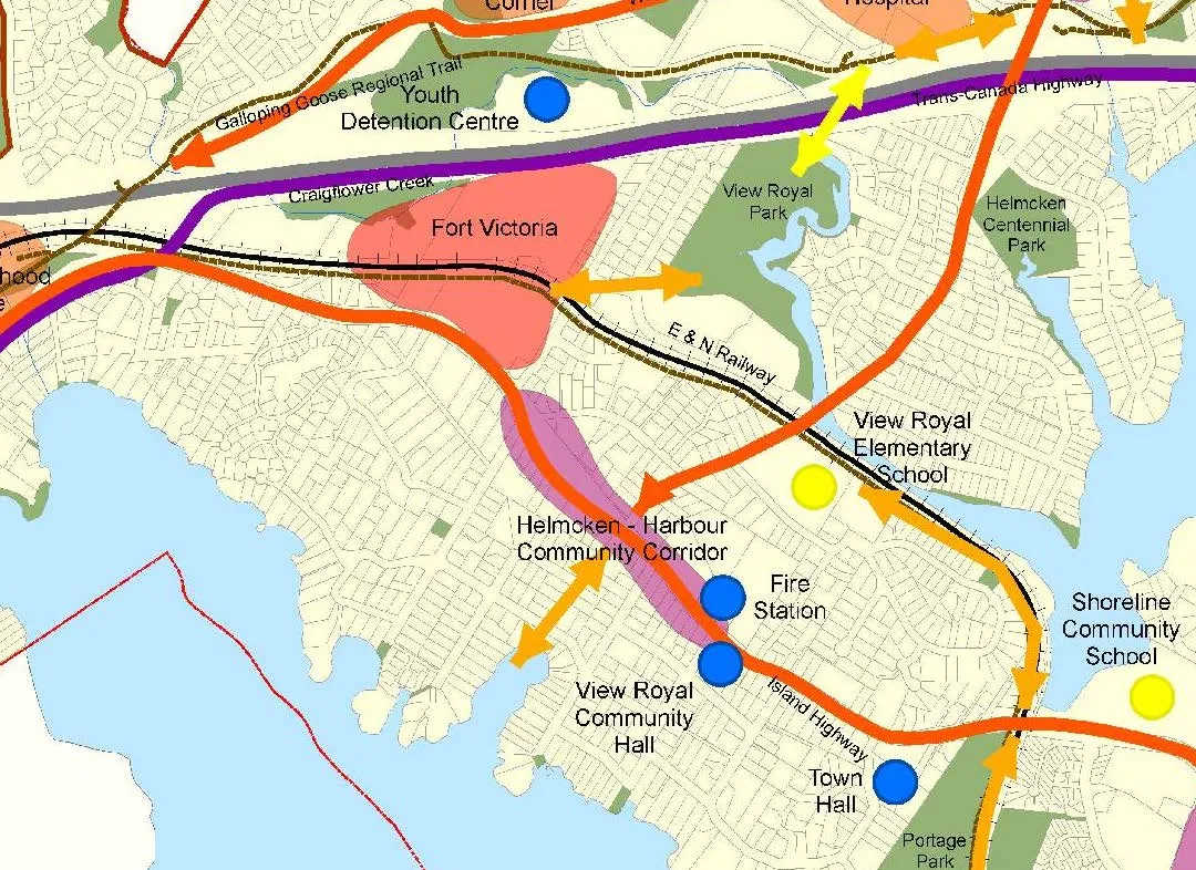
Official Community Plan Context
- Consideration should be made on whether the mixed-use intensity would be appropriate for the corridor’s lots sizes and adjacent residential areas
| Development | Address | Units | Lot Area | Units per hectare |
|---|---|---|---|---|
| Current proposal | 298 Island Highway | 54 | 0.1853 ha | 291.4 |
| Lions Cove | 288/290 Island Highway | 66 | 0.8275 ha | 80.0 |
| Maia London | 280 Island Highway | 37 | 0.1677 ha | 220.6 |
| <DP approved, not built> | 242-244 Island Highway | 37 | 0.1860 Ha | 198.9 |
Official Community Plan Consultation
- The application was referred to the relevant agencies as part of the application review process with no major concerns noted.
- If the application moves forward to a public hearing, the agencies be formally notified of the amendment bylaw in conjunction with the public hearing process.
Consultation and Notification by applicant
- April 2020 – door knocking campaign for residences within three blocks
- May 2020 - open house for 288/290 Island Highway (Lions Cove).
- October 2020 – over 500 flyers distributed to properties within the 400m public hearing notification radius, with website/email address setup to receive comments
New Zone
- Mixed Use Commercial Residential
| Metric | Value |
|---|---|
| Lot Size | 1853m² |
| Floor Area | 5559 m² |
| Floor Space Ratio | 3.0:1 |
| Building Height | 20.3m |
| Site Coverage | 75% |
Community Amenity Contribution
- The Community Amenity Contribution Policy target is $3,500 per unit.
- $189,000 based on 54 units
- Community amenity contribution provision to be secured in a covenant.
Possible community amenities
- Housing amenity contribution (CRD Regional Housing Trust Fund)
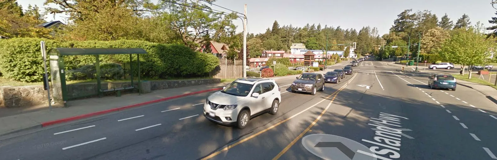
- Improve eastbound transit stop across the street on the high volume 14 UVic and 46 Dockyard routes.
- Current ridership weekday average of 116 boardings and 28 alightings
- A T-4 shelter (i.e. high volume) is required when boarding exceeds 400.
Document Images
(1)