Appendix
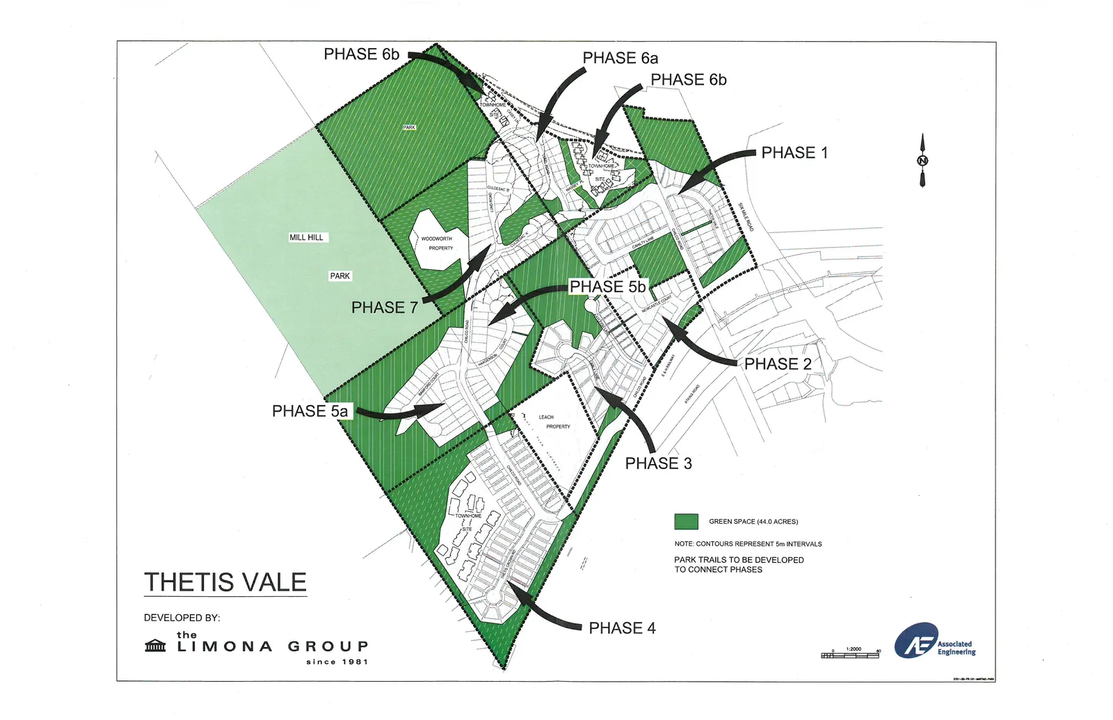
THETIS VALE PHASING MAP - Attachment 3
May 1, 2018Page 711 section
Comprehensive map of the Thetis Vale development showing phases and green space distribution.
44.0 acres green space total
THETIS VALE
DEVELOPED BY:
the LIMONA GROUP since 1981
Legend and Notes:
- GREEN SPACE (44.0 ACRES)
- NOTE: CONTOURS REPRESENT 5m INTERVALS
- PARK TRAILS TO BE DEVELOPED TO CONNECT PHASES
Map Details:
- Phases: Phase 1, Phase 2, Phase 3, Phase 4, Phase 5a, Phase 5b, Phase 6a, Phase 6b, Phase 7.
- Properties and Parks: Mill Hill Park, Woodworth Property, Leach Property.
- Roads and Infrastructure: Six Mile Road, Atkins Road, Chilco Road, E & N Railway, Newcastle Court, Canetti Lane.
- Additional Features: Designated Townhome Sites and Cul-de-sac.
Scale: 1:2000
Page 71
Extracted from: 2018 05 01 Council Agenda - Agenda - Pdf