Appendix
Tree Removal Detail - Plan (Associated Engineering)
July 5, 2016Page 251 section
Engineering drawing showing proposed tree removal and green space for Thetis Vale Phase 7.
Project No. 20142701Shows green space of 1.60 ha
LIMONA CONSTRUCTION THETIS VALE PHASE 7 TREE REMOVAL DETAIL-PLAN
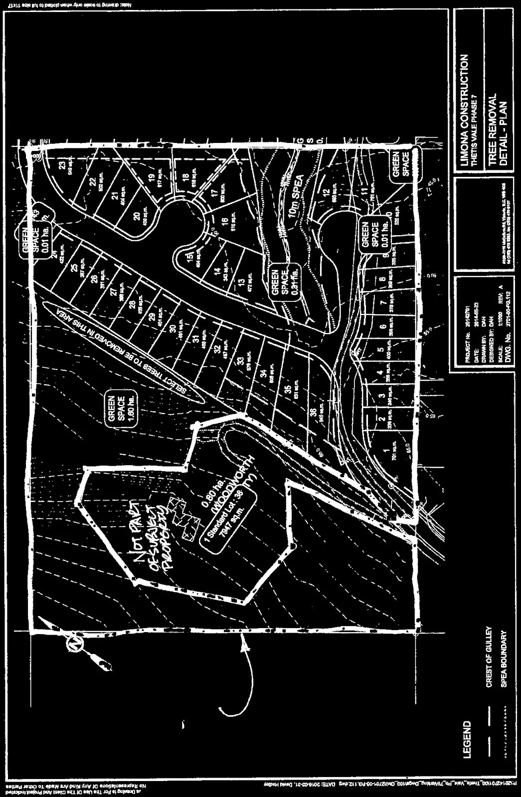
Site Plan Annotations
- SUBJECT PROPERTY (Handwritten label with arrow)
- SELECT TREES TO BE REMOVED IN THIS AREA (Designated central corridor covering multiple lots)
- NOT PART OF SUBJECT PROPERTY (Cross-hatched area labeled "0.80 ha. (WOODWORTH PROPERTY) 1 Standard Lot : 38 7947 sq.m.")
Green Space Designations
- GREEN SPACE: 1.60 ha.
- GREEN SPACE: 0.31 ha.
- GREEN SPACE: 0.01 ha. (Two distinct locations)
Project Information
| Field | Detail |
|---|---|
| PROJECT No. | 20142701 |
| DATE: | 2014-05-23 |
| DRAWN BY: | DAH |
| DESIGNED BY: | DAH |
| SCALE: | 1:1250 REV. A |
| DWG. No. | 2701-00-P3.112 |
Legend
- CREST OF GULLEY: Represented by a dashed line with single dots.
- SPEA BOUNDARY: Represented by a solid line with perpendicular tick marks.
Note: drawing to scale only when plotted to full size 11x17
Page 25
Document Images
(1)
Extracted from: 2016 07 05 Council Agenda - Pdf