Attachment 4 Environmental Overview Assessment for the Natural Watercourse and Shoreline Areas Development Permit Area at the Lot 1 Midwood Road
A comprehensive environmental report assessing the shoreline conditions and outlining protection measures for the proposed development.
Swell Environmental Consulting Ltd. 480 Beach Drive, Victoria, BC V8S 2M5 ph. 250-217-9190 e. lehna@swell.ca
Steve Briggs White Wolf Homes 7893 Wallace Dr Saanichton, BC V8M 1L5
September 24, 2021
RE: Environmental Overview Assessment for the Natural Watercourse and Shoreline Areas Development Permit Area at the Lot 1 Midwood Road, Town of View Royal
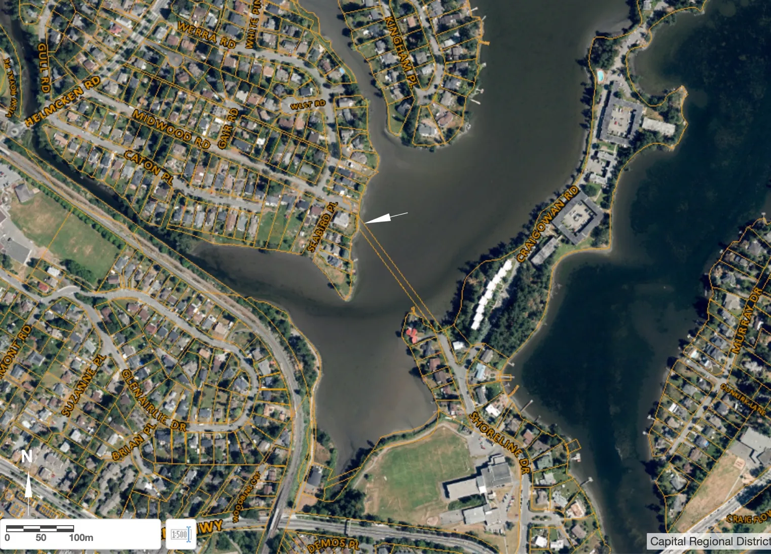
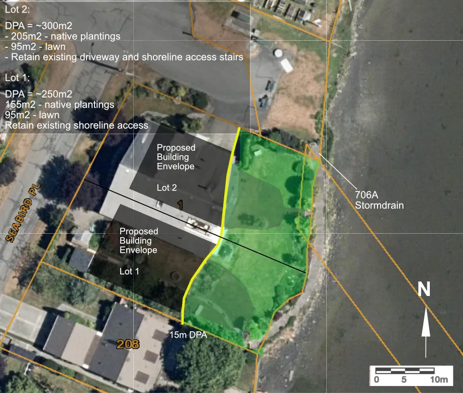
On April 13, 2021 Lehna Malmkvist, MSc, RPBio of Swell Environmental Consulting Ltd. (Swell) visited the site at Lot 1 Midwood Road, in the Town of View Royal to evaluate the existing condition of the property in reference to proposed subdivision within the Town of View Royal’s Natural Watercourse and Shoreline Areas Development Permit Area (DPA) (Figures 1-3). As per View Royal’s Schedule Q of the Official Community Plan (2011) Bylaw No. 811, the site was assessed for sensitive ecosystems, red and blue listed species, wildlife trees, and all environmentally sensitive areas within the site. This Environmental Review summarizes our assessment of the environmental conditions at the property and potential impacts from the proposed work.
Site Conditions
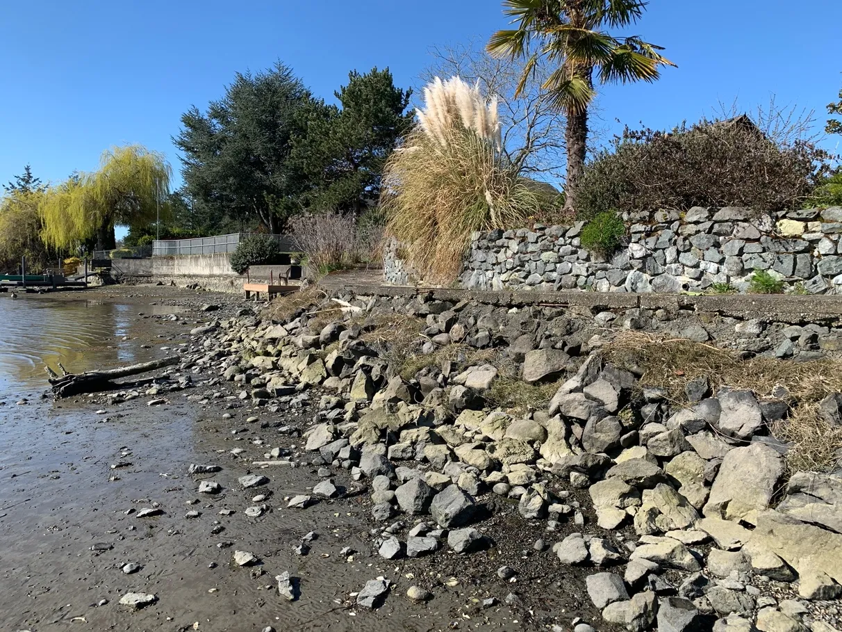
The approximately 1396m² waterfront property on Portage Inlet shoreline is a historically developed lot, with a single-family home, driveway, lawn, ornamental landscaping, mortared rock retaining wall, shoreline access path and stairs (Photos 1-22). The is flat to the eastern edge, where there is a retaining wall along the property boundary, and then a concrete walkway, and riprap to the shoreline, which are both off the property.
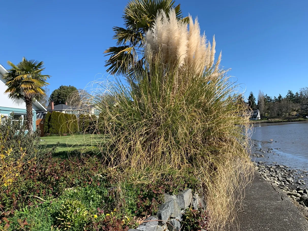
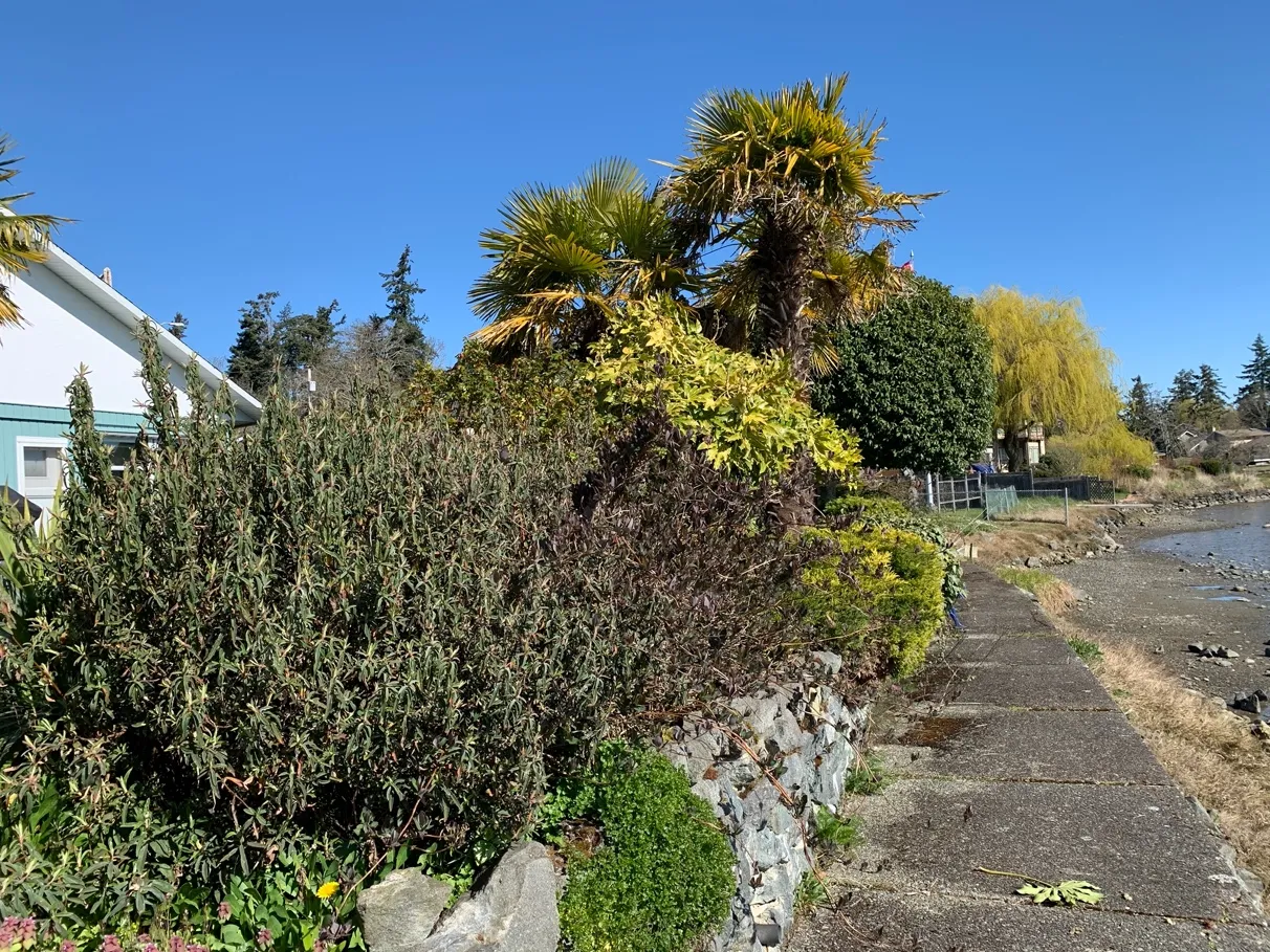
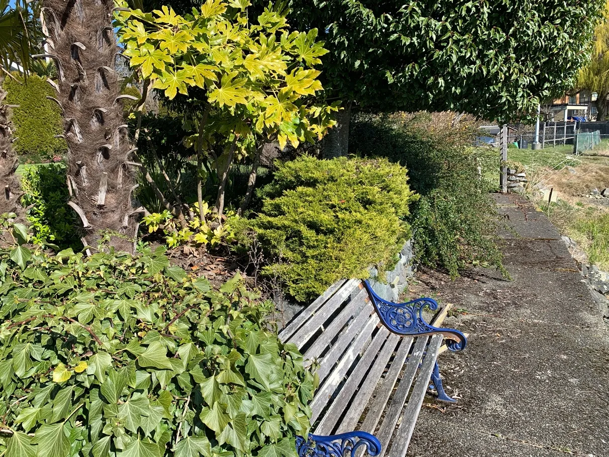
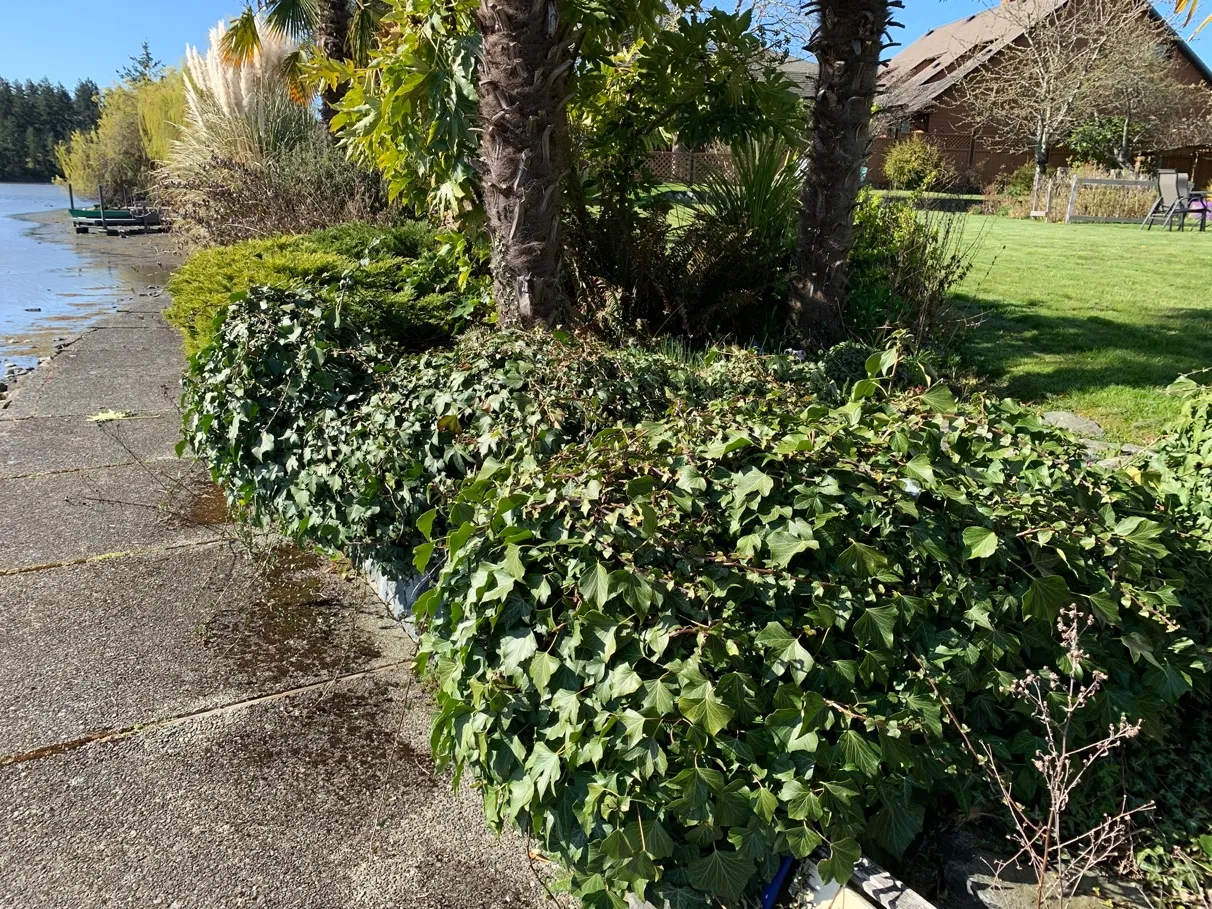
The 15m DPA on the property is a historically cleared/disturbed area consisting of lawn with ornamental landscaping around the perimeter (Photos 1-8). Vegetation includes ornamental palm trees, laurel, pampas grass, yucca, rhododendrons, escalonia, juniper, forsythia, and heather, with other ornamental shrubs and perennials, including non-native invasive plants such as: English ivy (Hedra helix), bluebells (Campanula rotundifolia), grape hyacinth (Muscari botryoides), oxeye daisy (Leucanthemum vulgare), trailing buttercup (Ranunuculs repens), purple deadnettle (Lamium purpureum), periwinkle (Vinca minor), thistle (Cirsium sp.).
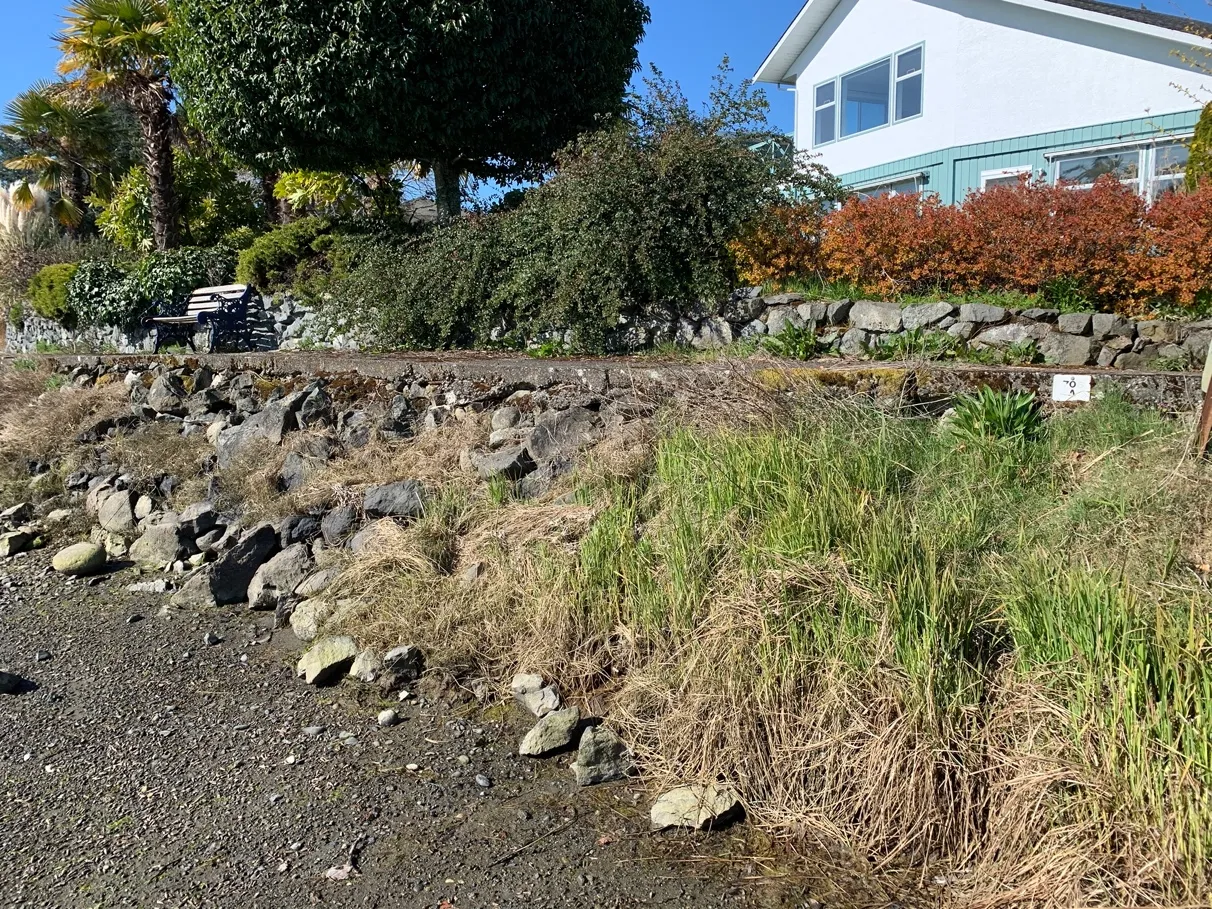
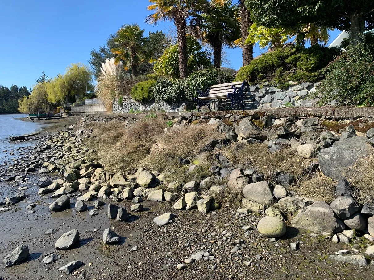
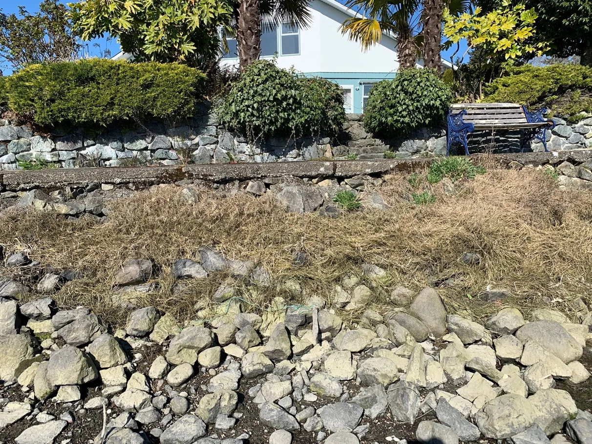
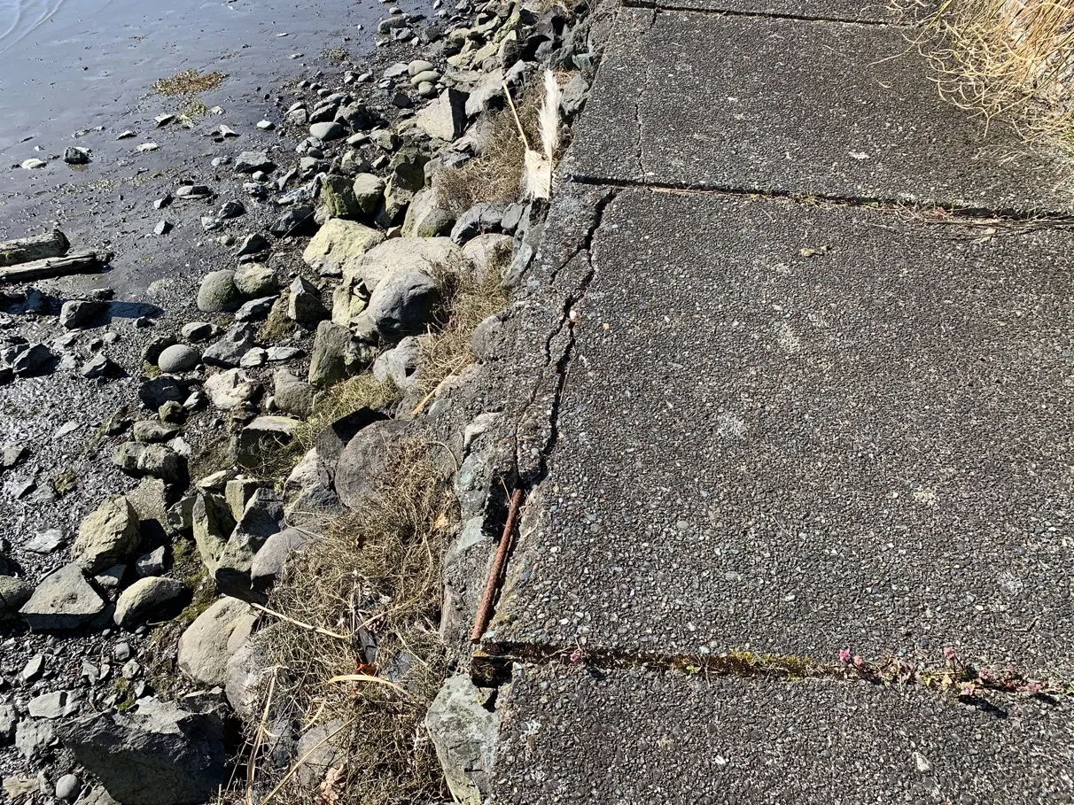
The walkway on the shoreline is only along this one property, and does not provide public access along the shoreline or connect to other access points. It is a thin concrete slab which is showing evidence of cracking, which is on top of riprap along the shoreline (Photos 9-13 and 16-20).
The shoreline edge consists of rip rap and a soft muddy shore. There is salt marsh vegetation, growing in the spaces between the riprap, and at the top of the riprap there are some native species seashore saltgrass (Distichlis spicata), sea plantain (Plantago maritima), perennial saltwort (Salicornnia virginica), and a sedge, likely, Lyngbei's sedge (Carex lyngbei), gumweed (Grindelia sp.) as well as non-native, invasive species, grasses, and ornamental vegetation (Photos 16-20).
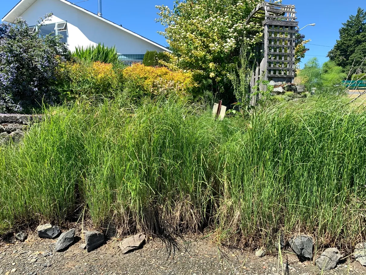
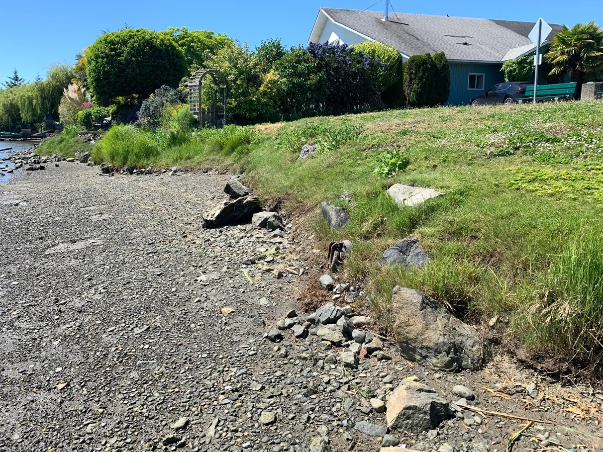
The site is adjacent to the Midwood Road end point, which has a lawn area along the shoreline, with some salt marsh vegetation at the shoreline (Photos 21 and 22).
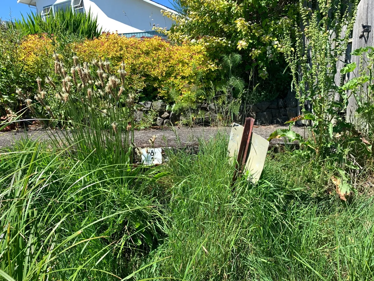
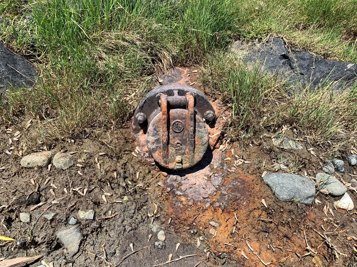
There are two stormdrains adjacent to the site. #706, a metal pipe with a flap covering, which is in the Seabird Place Road right-of-way, north of the property (Photo 22). And, 706A, which apparently discharges near the north property boundary. Signage is visible for the outlet, however, no outlet for the pipe or headwall is visible. Sara Stallard, AScT. (pers. comm. June 1, 2021), who conducts stormwater sampling for the Capital Regional District, provided the following information about 706A: no pipe has been observed, flows come out to the left and right of the 706A sign, at the base of the concrete walkway and mortared rock wall. No outlet channel was observed and there is no evidence of erosion from stormwater flows (Photos 14 and 15).
A review of the Conservation Data Centre (CDC) and Sensitive Ecosystem Inventory (SEI) mapping resulted in one listing, for Geyer’s Onion (Allium geyeri var. tenerum), that may occur around Portage Inlet, however, due to the historically disturbed nature of the site, there is no undisturbed suitable habitat, such as Garry Oak Vernal Pool, Vernal Pools, Seasonal Seeps, Riparian, Riparian Herbaceous, Rock/Sparsely Vegetated Rock, at the property. It was not observed at the site and is unlikely to occur there.
No rare or uncommon wildlife or plant species were observed on the site and the historically heavily impacted nature of the site makes the presence of rare and uncommon species unlikely.
No current bird nesting was noted. No detailed wildlife surveys were conducted.
Proposed Project
The owner is proposing to remove the existing single family home, and subdivide the property into two lots, each with a building envelope for a single family home (Figures 2 and 3):
- Building envelopes are outside the 15m DPA area
- In the DPA, the following development is proposed:
- New stormdrain connection for Lots 1 and 2 into the existing outlet north of Lot 2.
- Removal of existing ornamental landscaping
- Landscaping in the DPA to retain shoreline access and some lawn area
- Plant the DPA area with native plants to meet the DP Guideline
- DP Guideline: For shoreline areas heavily impacted by previous development, target the restoration of ecologically appropriate vegetation for an average 15m wide (minimum 5 m) shoreline zone over 50% of the shore length.
- Lot 1 – 155m² of native planting, 95m² of lawn, retain existing shoreline access
- Lot 2 – 205m² of native planting, 95m² of lawn, retain existing driveway area in the DPA, and existing shoreline access stairs
The project has been designed to meet the View Royal Development Permit Guidelines.
All landscaping works are proposed above the Present Natural Boundary of the sea, the existing storm drain outlet will be utilized, and the Measures to Protect Fish and Fish Habitat identified by DFO at https://www.dfo-mpo.gc.ca/pnw-ppe/measures-mesures-eng.html will be implemented during the project, a Fisheries and Oceans Project Review is not required for this work.
Natural Watercourse and Shoreline Areas Development Permit Area, Bylaw No. 811
According to the View Royal Official Community Plan (OCP 2011) Bylaw No. 811, the following Guidelines would apply to the Natural Watercourse and Shoreline Areas DPA in this location:
General Guidelines
- Development of riparian and shoreline areas should be limited and not negatively impact the ecological health of the immediate area or impede public access.
- Retention of existing healthy riparian and shoreline vegetation should be maximized with any paths, structures or other constructed areas sited to minimize impact on trees and sensitive areas.
- Restoration of riparian and shoreline vegetation and habitat, including removal of invasive species, is encouraged for all properties within this Development Permit Area.
- Development should result in a net increase in native vegetation in almost all circumstances including trees, shrubs and grasses.
- For shoreline areas heavily impacted by previous development, target the restoration of ecologically appropriate vegetation for an average 15 m wide (minimum 5 m) shoreline zone over 50% of the shore length.
- Riparian and shoreline area development should sensitively manage storm water, focusing on infiltration and release of storm water in ways and quantities that mimics natural patterns, avoids scouring and erosion and results in storm water free from pollutants.
- Shoreline protection measures should be limited to those necessary to prevent damage to existing structures or established uses on adjacent upland.
- In the design of new developments or re-development, the use of soft engineered and innovative alternatives to stabilizing shorelines and preventing erosion, such as bioengineering rather than traditional hard engineered measures should be used. In general, the harder the construction measure, the greater the impact on shoreline process, including sediment transport, geomorphology and biological functions. Hard" measures refer to those with solid, hard surfaces, such as concrete bulkheads, while "soft" structural measures rely on less rigid materials, such as biotechnical vegetation measures or beach enhancement. There is a range of measures varying from soft to hard that include:
- Vegetation enhancement.
- Upland drainage control.
- Biotechnical measures.
- Beach enhancement.
- Anchor trees.
- Gravel placement.
- Rock (rip rap) revetments.
- Gabions.
- Concrete groins.
- Retaining walls or bulkheads.
- Where hard measures can conclusively be shown to be the only means of effectively preventing erosion, they should be designed in consultation with a registered professional biologist, qualified environmental professionals and professional engineers, as appropriate.
- The preservation and enhancement of native trees and shrub clusters that overhang the waters edge is strongly encouraged as these provide shade, protection and feeding habitat for fish and wildlife.
Guidelines for Specific Shore Types
Marsh Shores include both mudflat and delta areas, and are generally highly sensitive and productive natural areas. The intertidal (foreshore) zone in this area is typically dynamic, changing in response to large stream flows and storm events. Though dynamic, the shore zone in these areas is generally accreting rather than eroding. It is important to allow sufficient space to allow these natural sediment processes to occur. With this type of shoreline, the following guidelines apply:
i. Provide a property-specific assessment with respect to building setbacks and shore protection designs, as stream sediment processes are important and will vary from site to site. ii. Dredging or filling of marsh shore should not be permitted. iii. Use of marsh shore areas should be limited to park or conservation uses that do not require structural intrusions. iv. Where shore protection measures are necessary, make use of “beach nourishment” designs, which add appropriately sized material to the upper beach, creating a natural beach slope and beach armour. v. Sea walls and rip rap embankments should not be used to protect these shoreline areas.
Potential Risks and Environmental Protection Measures
The site at Lot 1 Midwood Ave is a previously developed residential lot with a historically developed DPA along the shoreline. There were no observed rare or uncommon species (plant or wildlife), or sensitive upland habitats. The proposed subdivision is expected to have a minimal effect on the ecological conditions of the 15m DPA and associated foreshore, and removal of non-native, invasive and ornamental vegetation and replacement with native plantings in the DPA are will improve the overall ecological health of the marine shoreline ecosystem in the DPA.
The potential ecological risks of the removal of the existing ornamental vegetation, removal of the existing house and future construction on the site, in the DPA, adjacent to the marine environment are: erosion of bare soil, sedimentation of the marine environment, petroleum spills and damage to existing indigenous plant species onsite.
These potential impacts will be minimized by implementing the following Environmental Protection Measures:
Protecting ecological features
- Locate no-go zones, retained trees and vegetation, and sensitive areas are fenced/marked and communicated to all personnel, including sub-contractors and trades.
- Avoid placing soil/gravel piles and heavy construction materials around roots of trees to be retained, or otherwise cutting into root zones or compacting soils by driving and parking vehicles on root zones.
- Arborist to be consulted to protect trees to be retained (two street trees on Seabird Place).
Pre-Clearing Nesting Bird Survey
For all vegetation required to be removed, a pre-clearing nesting bird survey will be conducted to meet the following requirements:
- Section 34 of the BC Wildlife Act protects birds and their eggs from possession, molestation or destruction. The nests of eagles, peregrine falcons, gyrfalcons, ospreys, herons, and burrowing owls are protected at all times of the year. The nests of all other species are protected when the birds or their eggs are in the nest.
- Pre-clearing nesting bird surveys should be conducted if tree or vegetation removal will occur during breeding season. While the period between March 15 and August 15 has been identified by Environment Canada and the BC Ministry of Environment as the general period most likely to involve active bird nesting, this time period does not coincide with the breeding and nesting habits of eagles, many owls species, or herons (Grant Bracher, FLNRO and Ann Nightingale, Rocky Point Bird Observatory pers. comm. 2018).
- To minimize the risk of nest destruction, we recommend that tree and vegetation clearing occur between August 15 and January 30.
- If clearing must occur between February 1 and August 15, then a nesting bird survey should be conducted 1-3 days prior to construction (depending on recommendations from a nesting bird expert and time in the nesting season). A pre-clearing nest survey reduces the potential risk of nest destruction but does not guarantee no nests are present. Destruction of nests is illegal and subject to penalties, regardless of having conducted surveys or doing the work outside of the breeding season. When vegetation and trees are removed, the contractor should look for nests and if any nests with eggs or young are found in felled vegetation they should be taken to Wild ARC in Metchosin - 1-855-622-7722
Ornamental and Invasive Vegetation Removal
- Ornamental and invasive species should be removed prior to planting the native species, invasive species on the site include: English ivy (Hedra helix), bluebells (Campanula rotundifolia), grape hyacinth (Muscari botryoides), oxeye daisy (Leucanthemum vulgare), trailing buttercup (Ranunuculs repens), purple deadnettle (Lamium purpureum), periwinkle (Vinca minor), thistle (Cirsium sp.).
House Removal
- No debris from the house removal will be left in the Development Permit Area
- Properly dispose of all materials removed from the house
- No sediment or spills may enter the marine environment (see protection measures described below)
Erosion & Sediment Control
- Minimize vegetation removal and remove during dry weather, if possible
- Install sediment barriers (e.g. sediment fence) along the shoreline edge of the proposed work
- Excavations conducted during forecasted dry weather, where possible
- Do not direct water runoff from the site or dewatering from excavations directly into the marine environment. If dewatering of excavations is required, the Environmental Monitor must be consulted to determine where runoff can be directed or if sediment settling facilities (tanks, berms) are required.
- Cover exposed soils, if needed (e.g. poly, tarps, mulch, seeding, ‘rough and loose’ treatment)
- Ensure soil and debris stockpiles are placed away from the shoreline and sediment-laden water cannot flow into the waterbodies.
- Ensure no tracking of sediments on to roadways from truck traffic (road sweeping and installing rock/hog fuel at entrance to minimize tracking)
- Contact Environmental Monitor immediately with any concerns.
Spill Prevention and Response
- Equipment is inspected for leaks prior to beginning work.
- Spill response kits (capable of addressing the volume of fuel/oils/chemicals on site) are on site when any heavy machinery is working, and operators are trained in their use.
- Equipment refueling is at a designated location and >30 m from marine ecosystems and stormdrain
- Fuel generators must be placed in a spill-proof container capable of addressing the maximum volume of fuel involved (e.g. plastic bin, or impermeable containment area (eg. poly-lined bermed depression).
- Store all fuel cans in spill-proof containers (e.g. as above).
- Concrete wash-water and wet concrete is highly alkaline and toxic to fish and other aquatic organisms. All concrete wash-water from equipment, trucks and/or hand tools needs to be directed to a settling area away from runoff paths to the waterbodies. Freshly poured concrete needs to be covered when rain is forecasted or runoff needs to be isolated from waterbodies during the curing process.
- In case of spills, the following general steps are recommended:
- Stop source of spill/prevent further spillage (turn off valves, right overturned containers)
- Block spill from reaching aquatic environment or pathways to waterbodies
- Block spill from spreading
- Call Environmental Monitors
- Clean up spilled materials
Stormdrain Installation
- The drainage for both Lots 1 and 2 will be connected into the existing stormdrain and outlet north of Lot 2.
- Using the existing outlet is preferred to avoid disturbance of existing native shoreline vegetation.
- Provided the existing storm drain outlet will be utilized, and the Measures to Protect Fish and Fish Habitat identified by DFO at https://www.dfo-mpo.gc.ca/pnw-ppe/measures-mesures-eng.html will be implemented during the project, a Fisheries and Oceans Project Review is not required for this work.
- Detailed design for any stormdrain outlets should incorporate a Green Shores approach to minimize the impact to the marine habitat.
Site Restoration
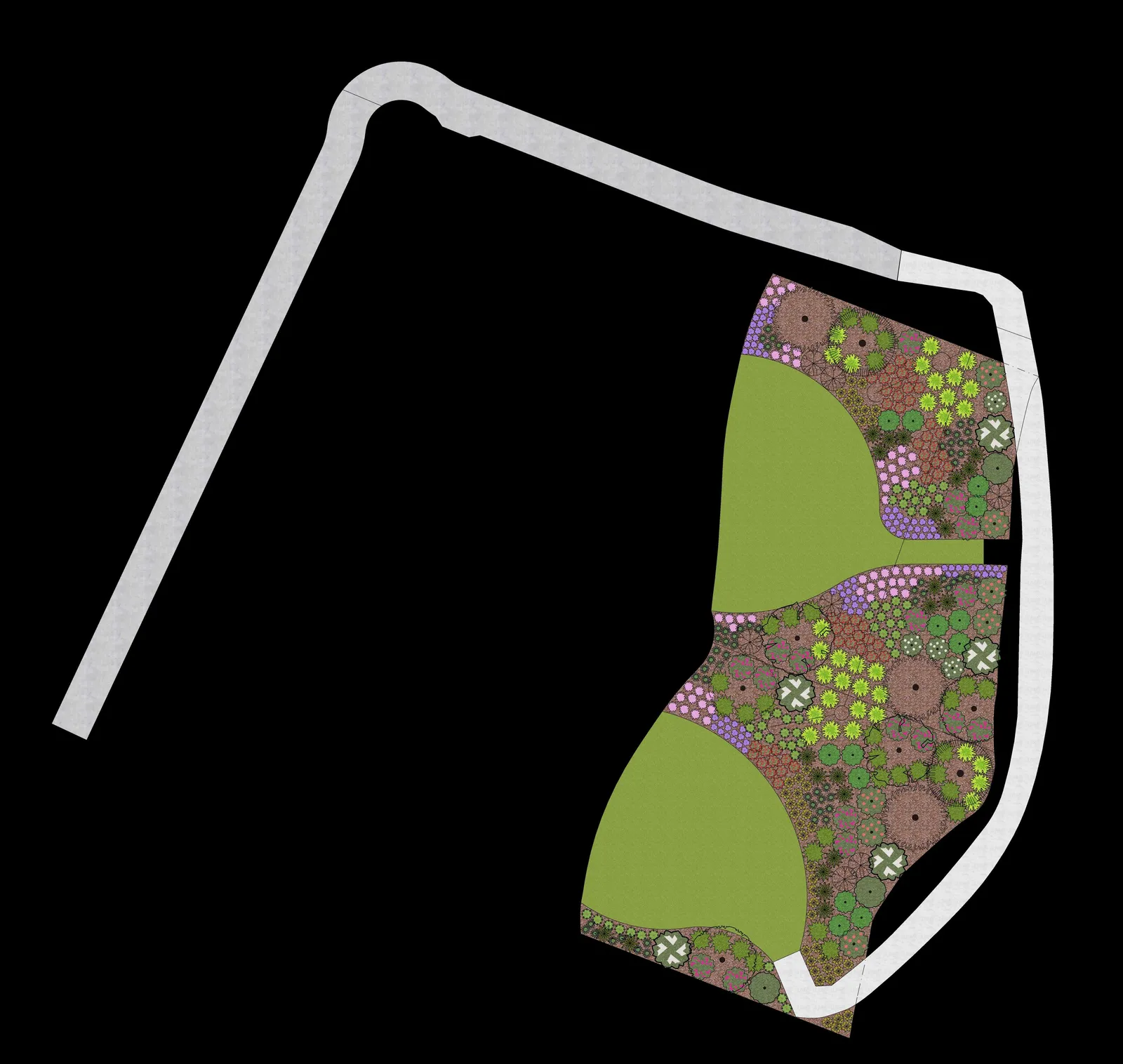
Following completion of house construction, implement the native shoreline plantings, as shown in the landscape plan in Figure 3 within 1 year.
- Remove and control invasive species prior to planting.
- Vegetation to be planted as per Figure 3 substitutions must be approved by the biologist
- Landscaping must be planted to BC Landscape Standards (soil, mulch, irrigation, and staking, if needed), and should be irrigated and monitored for a period of 3 growing seasons to ensure they are well established, and they should be replaced if they do not survive.
- Irrigation
- Years 1 and 2 - watering 1/week deeply during the growing season (e.g. May 1-Sep 30, weather dependent), 2/week when temperatures are over 28 °C or plants are wilting.
- Years 3 onwards - Water as needed to establish and wean plants off irrigation.
- Maintenance
- Invasive species removal a minimum of 4 times/growing season for a minimum of 3 growing seasons
Green Shores for Salmon Shoreline Restoration
- Stewardship Council of British Columbia and the Pacific Salmon Foundation are working with the Capital Regional District and local municipalities on the feasibility of creating Green Shores for Salmon demonstration projects utilizing road-end areas, and, if possible, potentially adjacent private property.
- The Midwood Road shoreline and the deteriorating walkway, off the property on the east side of Lot 1 Midwood are a potential site for this project.
- If the site is suitable for the program, the owner is supportive of the Town of View Royal working with the Green Shores for Salmon to remove the walkway, and develop a planting plan to soften the shoreline in front of their property, if the site meets project requirements.
Environmental Monitoring
The following environmental monitoring protocol is recommended to ensure that environmental protection measures are properly implemented and maintained, and to meet regulatory reporting requirements:
- Owner must notify the QEP, Lehna Malmkvist, a minimum of 2 weeks prior to the initiation of the works.
- Preconstruction meeting with contractor to review Environmental Protection Measures and Permit Requirements
- Pre-clearing nesting bird survey, if needed (depending on time of year), as described previously.
- Site visits during key phases
- Inspect Erosion & Sediment Control measures once they are installed
- During removal of the house
- During removal of the ornamental and invasive vegetation in the DPA
- During native species planting in the DPA
- Heavy rainfall (>10mm/24 hours) until the QEP is satisfied that erosion and sediment control measures are preventing sediment laden water from entering the marine environment
- Emergencies, such as spills
- To assess completion of the project
- Preparation of a completion report to be provided to the municipality to ensure all DP requirements are completed by within 1 year of completion of the house construction.
Summary
The works within the DPA have been designed to meet the Natural Watercourse and Shoreline Areas Development Permit Guidelines. Provided the Environmental Protection Measures described are followed, I expect the proposed construction activities to have minimal negative impacts to the current ecological condition of the ecosystems of the 15m DPA setback or the marine environment. The restoration activities (ornamental and invasive species removal and native plantings) will provide an improvement over the current ecological conditions for the shoreline ecosystem and will benefit the shoreline and marine ecosystem.
Please do not hesitate to contact us with any questions you may have.
Sincerely,
Lehna Malmkvist, MSc, RPBio (#1613)
LANDSCAPE PLAN
Native Plant Species Identified in Landscape Plan:
Salix scouleriana - Scouler's Willow 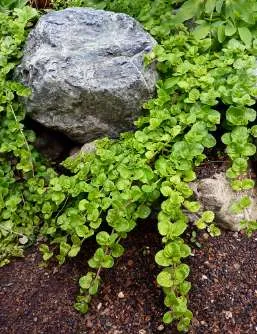
Pinus contorta var. contorta - Shore Pine 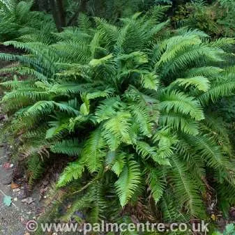
Malus fusca - Pacific Crabapple 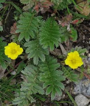
Arbutus menziesii - Arbutus 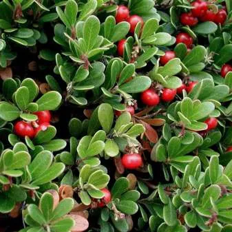
Amelanchier alnifolia - Saskatoon 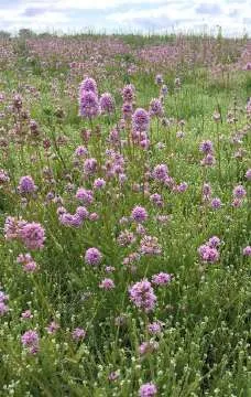
Holodiscus discolor - Ocean Spray 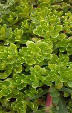
Rubus parviflorus - Thimbleberry 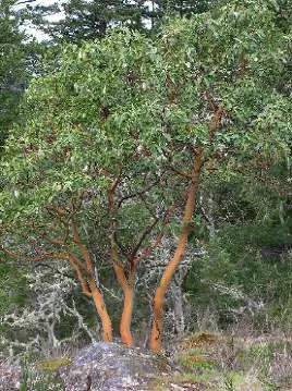
Rosa nutkana - Nootka Rose 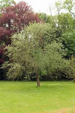
Sambucus racemosa - Red Elderberry 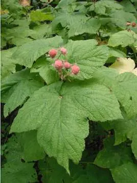
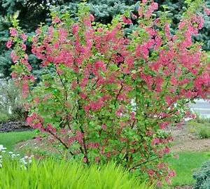
Ribes sanguineum - Red Flowering Currant 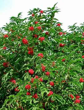
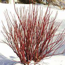
Cornus stolonifera - Red-osier Dogwood 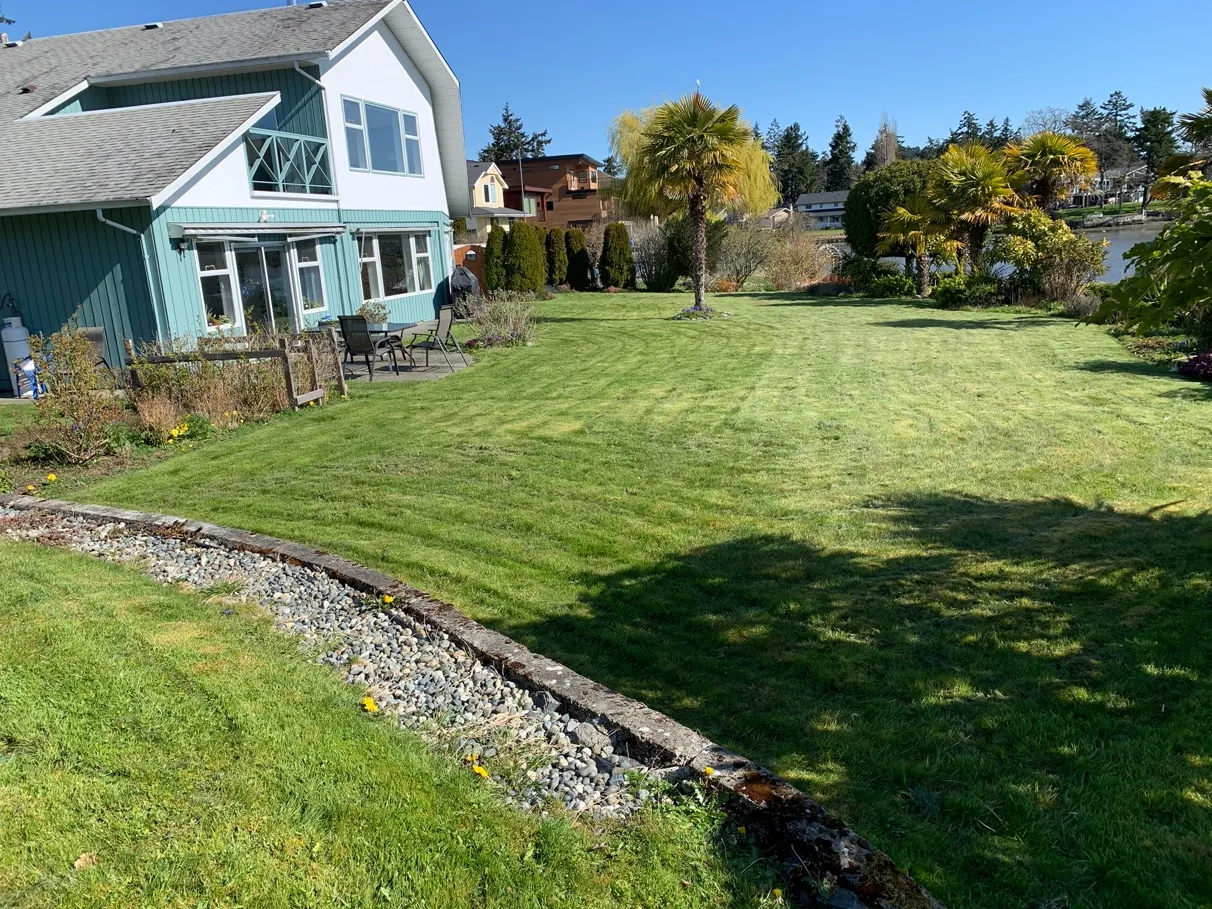
Arctostaphylos uva-ursi - Kinnickinnick 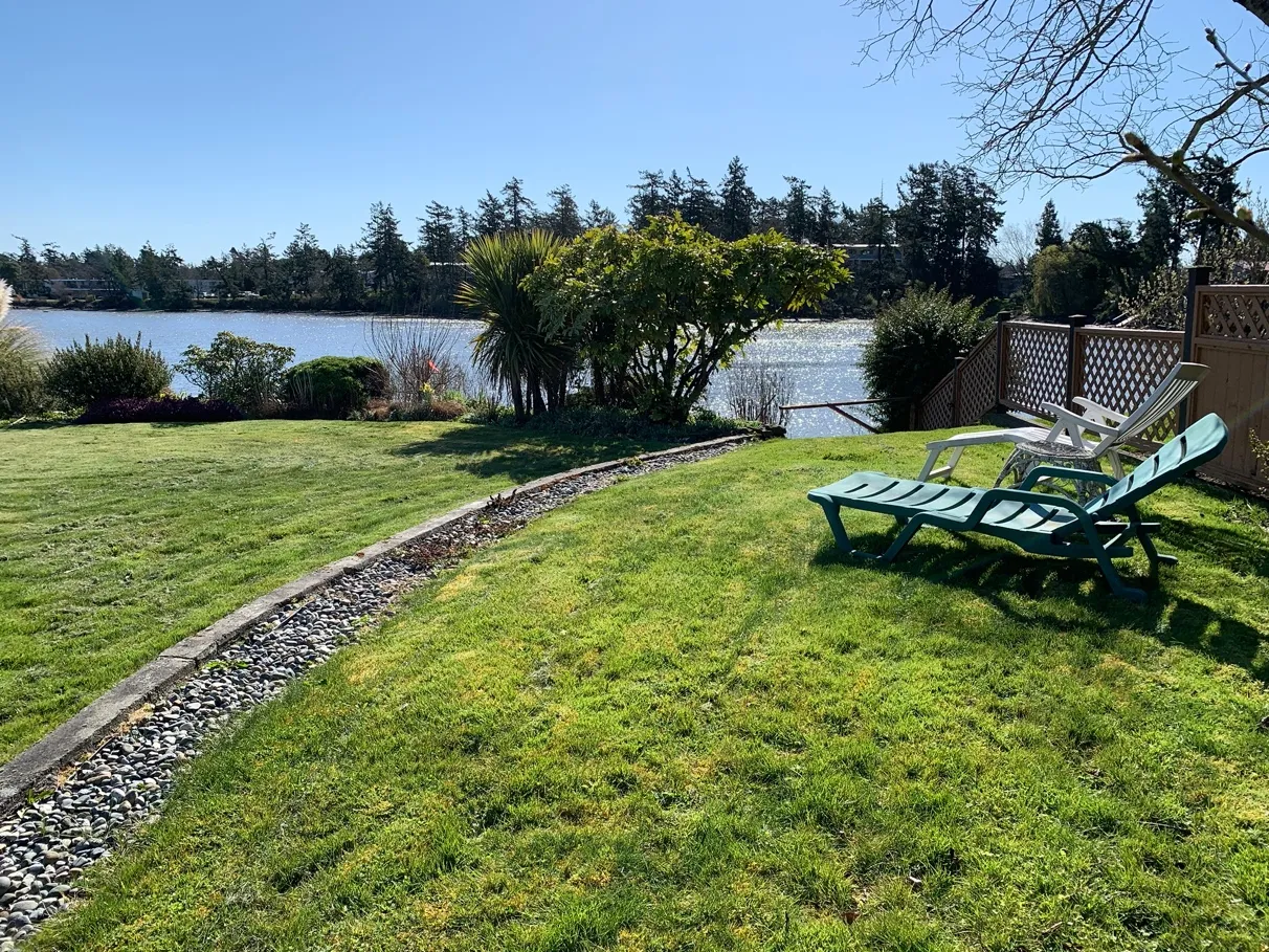
Polystichum munitum - Sword Fern 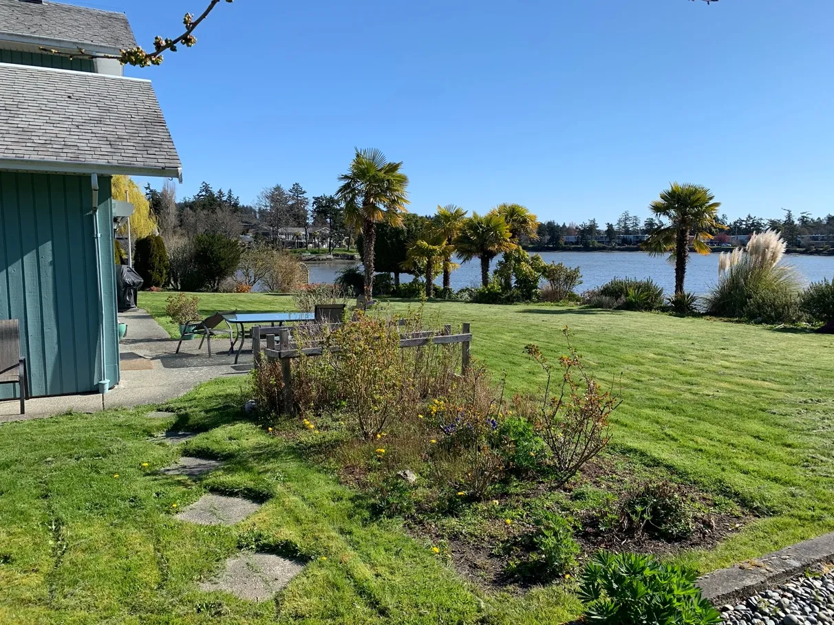
Clinopodium douglasii - Yerba Buena 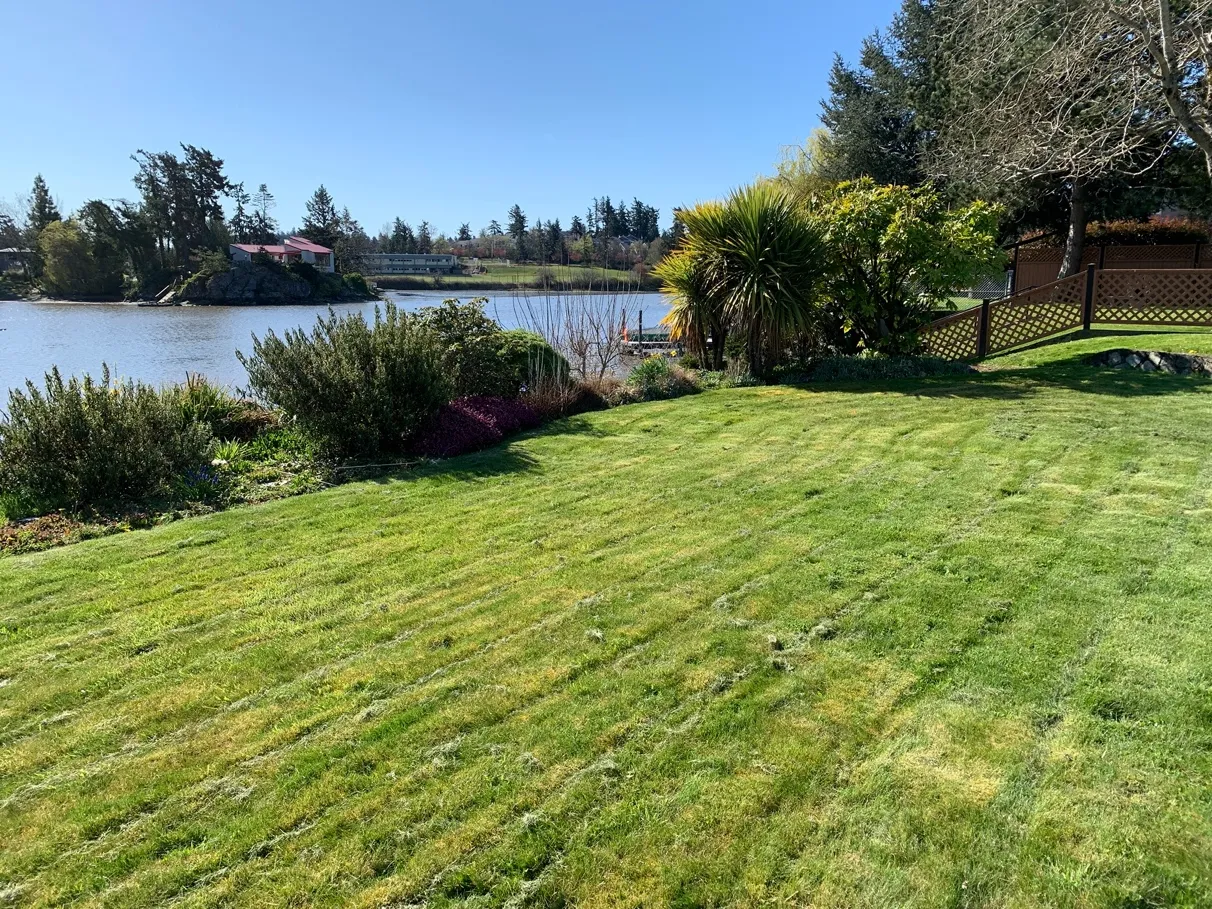
Fragaria chiloensis - Coastal Strawberry 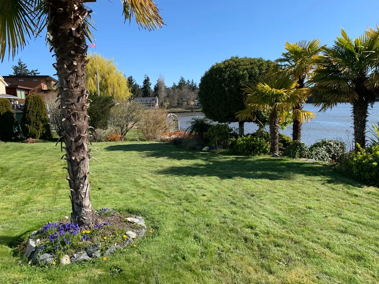
Potentilla anserina - Silverweed 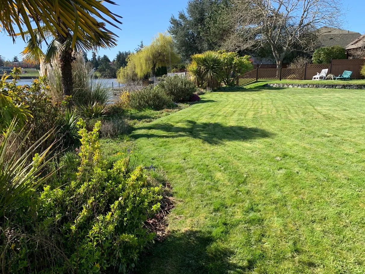
Plectritis congesta - Sea Blush 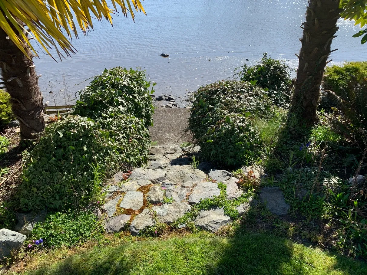
Achillea millefolium - Yarrow 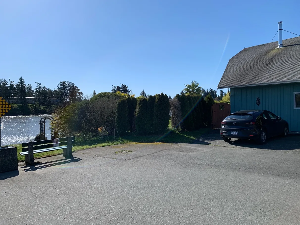
Lupinus littoralis - Seashore Lupine 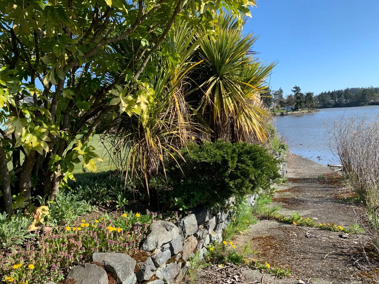
Sedum spathulifolium - Broad-leaved Stonecrop
Site Photos
Document Images
(11)
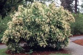
Salix scouleriana - Scouler's Willow
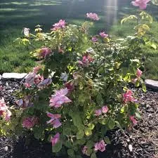
Malus fusca - Pacific Crabapple
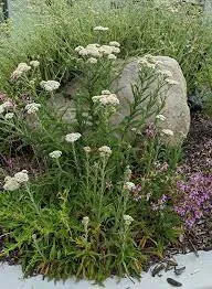
Arbutus menziesii - Arbutus
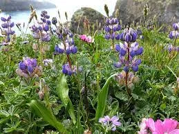
Holodiscus discolor - Ocean Spray
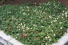
Rubus parviflorus - Thimbleberry
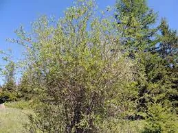
Cornus stolonifera - Red-osier Dogwood
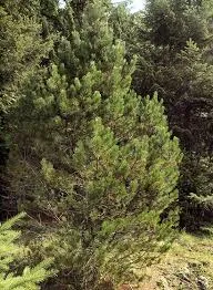
Potentilla anserina - Silverweed
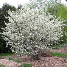
Lupinus littoralis - Seashore Lupine
Sedum spathulifolium - Broad-leaved Stonecrop