Attachment 3. Biologist’s report – Fish-KW Environmental - April 12, 2022
Comprehensive environmental review of the shoreline area and restoration plan.
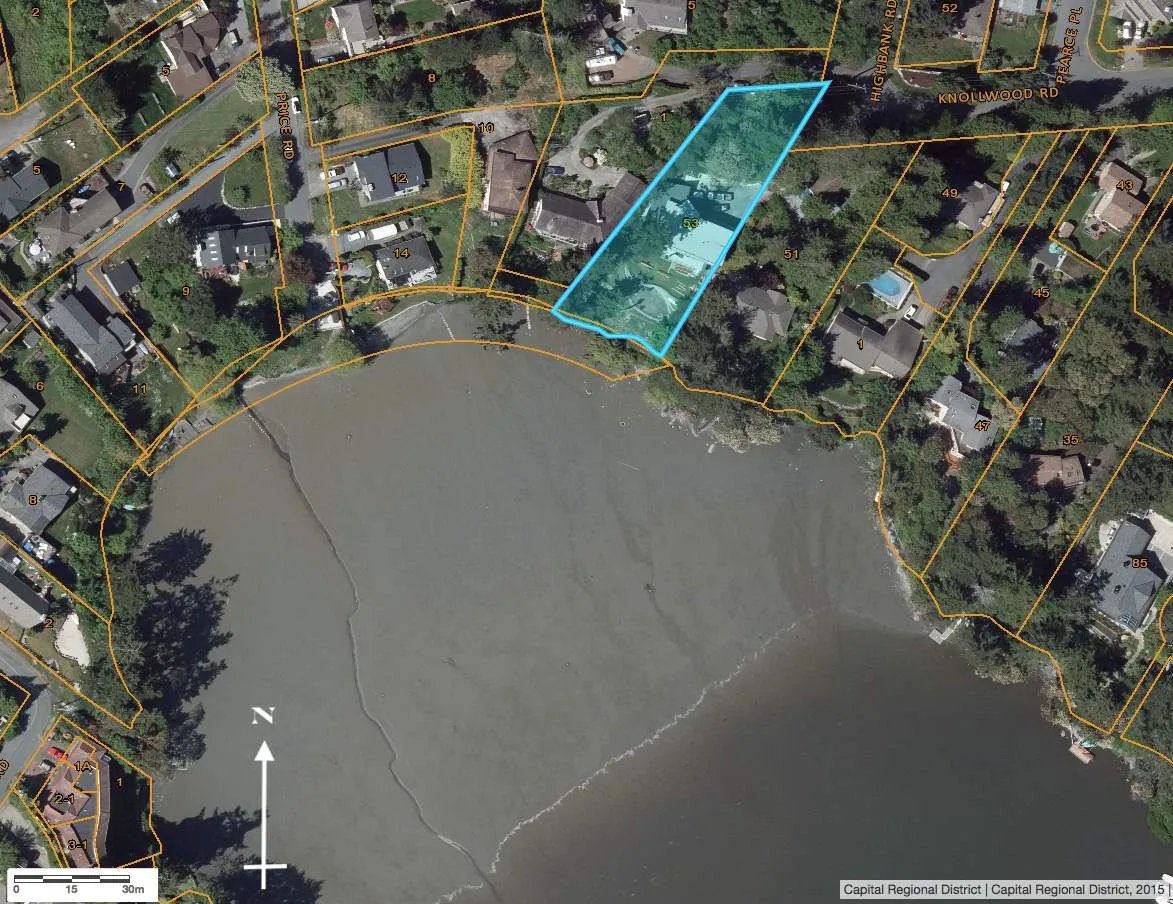
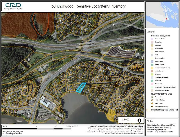
Environmental Review for 53 Knollwood Road, Victoria, BC
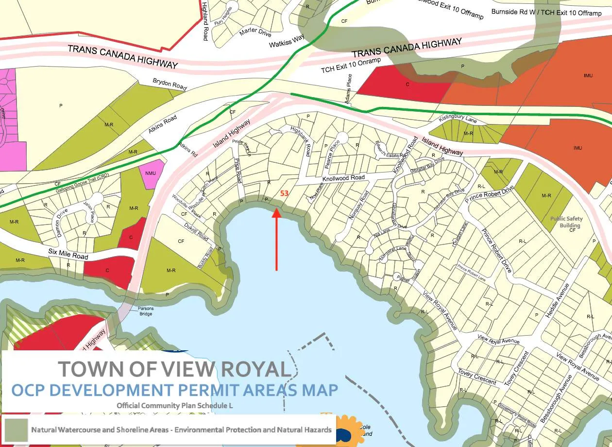
Town of View Royal’s Natural Watercourse and Shoreline Areas Development Permit Area

12 April 2022
Prepared for: Jon & Echo Michiel 53 Knollwood Road, Victoria, BC V9B 1E4
Prepared by: Sara Stallard, BSc, AscT (#22338), Envr.Tech. Fish-KW Environmental 1149 Mason St, Victoria BC V8T 1A5 (250) 480-7272 sstallard@shaw.ca
Reviewed by: Lehna Malmkvist, MSc, RPBio (#1613) Swell Environmental Consulting Ltd. 480 Beach Drive, Victoria, BC V8S 2M6 (250) 217-9190
14 April 2022
Jon & Echo Michiel 53 Knollwood Road Victoria, BC V9B 1E4
RE: Environmental Review for 53 Knollwood Road, Victoria, BC – Shoreline DPA
Fish-KW Environmental (Fish-KW) was engaged by Jon & Echo Michiel, owners of the property at 53 Knollwood Road, in Victoria, BC to evaluate the existing condition of the shoreline within the Town of View Royal’s Natural Watercourse and Shoreline Areas Development Permit Area (DPA) (Figures 1-4) in reference to proposed shoreline stabilisation and ecological restoration on the property¹. Multiple site visits were made between October 2021 to January 2022 to observe the current state of the site in reference to the DPA. As per View Royal’s Schedule Q of the Official Community Plan (2011) Bylaw No. 811, the site was assessed for sensitive ecosystems, red and blue listed species, wildlife trees, and all environmentally sensitive areas within the site and on the foreshore. This Environmental Review summarizes our assessment of the environmental conditions within the 15-m Natural Watercourse and Shoreline Areas DPA and potential impacts from the proposed construction and restoration work zone.
The role of Fish-KW Environmental is to assist the owner in identifying the boundaries of the DPA; evaluate the health of the ecosystems, their conservation and potential restoration requirements; communicate the benefits and importance of the ecosystems to the owner; and develop a workable balance of homeowner needs with conservation and management recommendations.
TOWN OF VIEW ROYAL GUIDELINES for NATURAL WATERCOURSE AND SHORELINE AREAS DPA
Natural Watercourse and Shoreline Areas Development Permit Area, Bylaw No. 811
According to the View Royal Official Community Plan (OCP 2011) Bylaw No. 811, the Natural Watercourse and Shoreline Areas DPA was developed for the purpose of protecting the natural environment, its ecosystems and biological diversity from development and includes all those upland and foreshore areas above and below and within 15 metres of the natural boundary of the sea.
Riparian areas and shorelines are important for their ecological value and contribution to the physical and cultural identity of View Royal. These areas support a rich diversity of flora and fauna and are integral elements of greater local and regional environmental systems. Unnecessarily disturbing these sensitive environments may harm their vitality and the ecological services they provide. This Development Permit Area has been established to ensure that the ecological values of sensitive watercourse and shoreline areas have been considered prior to development, and that measures will be taken to limit or avoid damage to these ecosystems. To the fullest extent possible all shorelines and riparian zones should be kept in a natural state and restored if they have been disturbed by development intrusions or public activity (View Royal OCP 2011).
The following Guidelines for the Natural Watercourse and Shoreline Areas DPA are applicable to the site:
General Guidelines
- Development of riparian and shoreline areas should be limited and not negatively impact the ecological health of the immediate area or impede public access.
¹ This Environmental Review relies, in part, on information provided by Ryzuk Geotechnical Engineering addressing site visits since 1996 (letter dated 16 November 2021), see Appendix 2.
- Retention of existing healthy riparian and shoreline vegetation should be maximized with any paths, structures or other constructed areas sited to minimize impact on trees and sensitive areas.
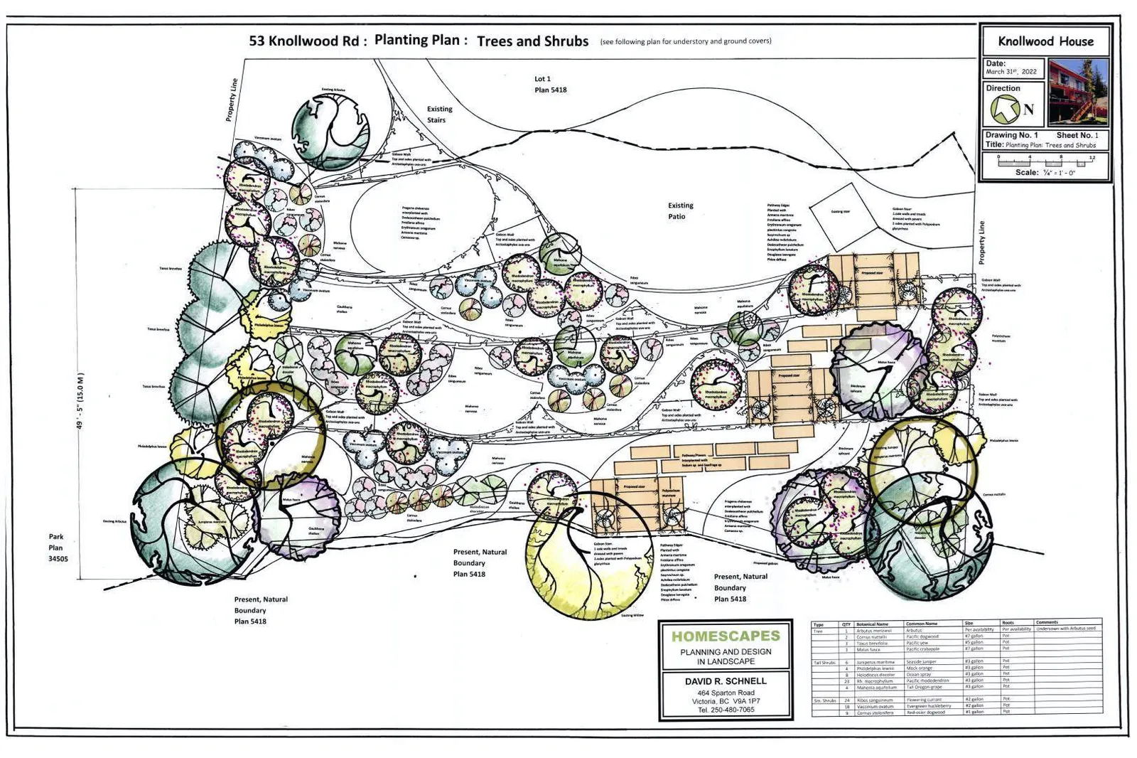
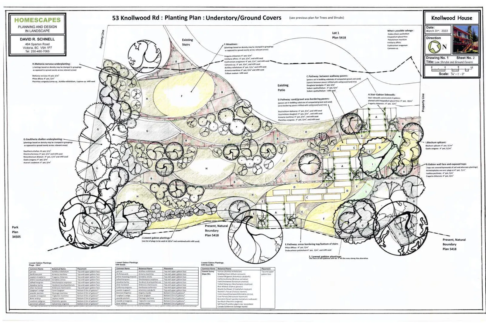
- Restoration of riparian and shoreline vegetation and habitat, including removal of invasive species, is encouraged for all properties within this Development Permit Area.
- Development should result in a net increase in native vegetation in almost all circumstances including trees, shrubs and grasses.
- For shoreline areas heavily impacted by previous development, target the restoration of ecologically appropriate vegetation for an average 15m wide (minimum 5 m) shoreline zone over 50% of the shore length.
- Riparian and shoreline area development should sensitively manage storm water, focusing on infiltration and release of storm water in ways and quantities that mimics natural patterns, avoids scouring and erosion and results in storm water free from pollutants.
- Shoreline protection measures should be limited to those necessary to prevent damage to existing structures or established uses on adjacent upland.
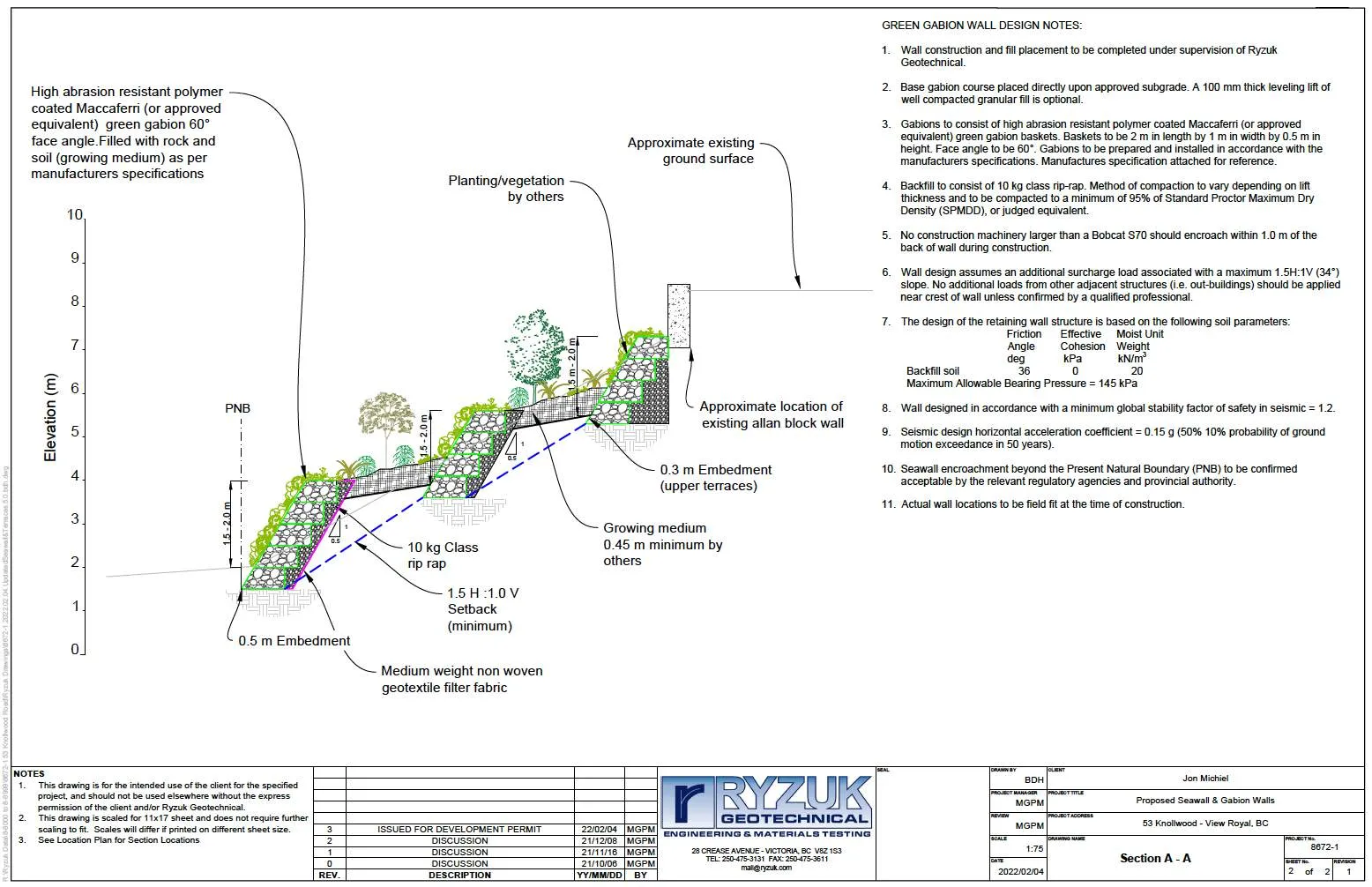
- In the design of new developments or re-development, the use of soft engineered and innovative alternatives to stabilizing shorelines and preventing erosion, such as bioengineering rather than traditional hard engineered measures should be used. In general, the harder the construction measure, the greater the impact on shoreline process, including sediment transport, geomorphology and biological functions. Hard" measures refer to those with solid, hard surfaces, such as concrete bulkheads, while "soft" structural measures rely on less rigid materials, such as biotechnical vegetation measures or beach enhancement. There is a range of measures varying from soft to hard that include:
- Vegetation enhancement.
- Upland drainage control.
- Biotechnical measures.
- Beach enhancement.
- Anchor trees.
- Gravel placement.
- Rock (rip rap) revetments.
- Gabions.
- Concrete groins.
- Retaining walls or bulkheads.
- Where hard measures can conclusively be shown to be the only means of effectively preventing erosion, they should be designed in consultation with a registered professional biologist, qualified environmental professionals and professional engineers, as appropriate.
- The preservation and enhancement of native trees and shrub clusters that overhang the water’s edge is strongly encouraged as these provide shade, protection and feeding habitat for fish and wildlife.
Guidelines - Specific Ocean Shoreline Types
Beach Shores may consist of broad silty/sandy beaches or gravely/blocky rubble beaches or mixed rock with beach sediment, and may be classified as either a drift-sector or pocket beach. With this type of shoreline, the following guidelines apply: i. Ensure that a minimum 15-metre setback for new buildings and structures, additions to existing buildings and structures, or the placement and removal of fill is maintained. ii. Where shore protection measures are necessary, make use of “beach nourishment” designs, which add appropriately sized material to the upper beach, creating a natural beach slope and beach armour. iii. Use of seawalls and rip rap embankments are generally not acceptable except when no alterative shore protection design is possible.
BACKGROUND INFORMATION
Prior to conducting the field assessment for the site, the current environmental data and information available for the area was reviewed. The CRD Natural Areas Atlas and Harbours Atlas, BC Conservation Data Centre (CDC) database, Sensitive Ecosystem Inventory (SEI) of East Vancouver Island and Gulf Islands (map sheet 92B-043), BC Fisheries Inventory Data Queries (FIDQ) and the Wildlife Tree Stewardship Program (WiTS) were reviewed for listings of environmentally sensitive ecosystems, sensitive habitat inventory mapping, rare species, red or blue listed flora and fauna, wildlife trees, or any other pertinent environmental features.
There were no environmental data points listed as occurring on this property. Five current land-based environmental data points (sensitive ecosystems and rare species) were listed within 500 m the property, all greater than 250 m distant and overlapping in some cases (Figures 5a&b). These occurrences are summarized in Appendix 1. None of these occurrences were observed on the subject site or had suitable site conditions on this existing heavily modified residential site.
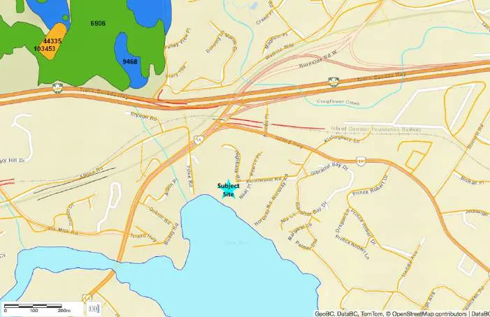
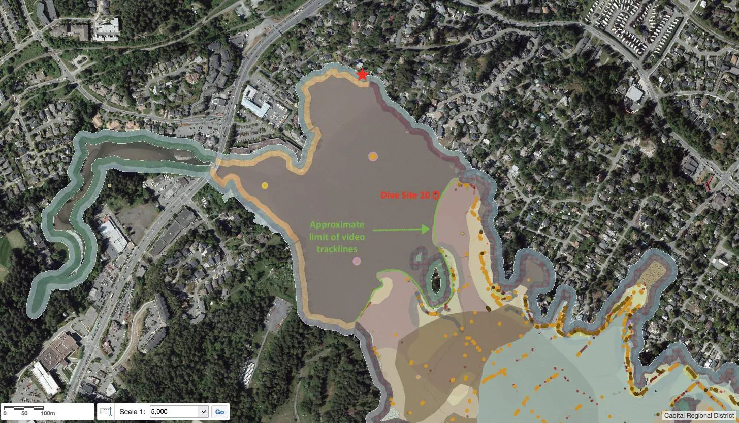
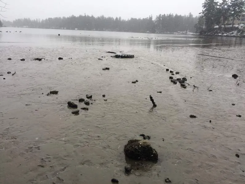
The Capital Regional District (CRD) Harbours Atlas, with data from 2000, was reviewed for intertidal and subtidal background information, supplemented with data from the original report (Archipelago Marine Resources 2004). The subject site lies in Price Bay at the very northern limit of the survey, within the extensive intertidal mudflats of the Millstream Creek Delta north of Cole Island on the northeast shoreline of Esquimalt Harbour (Figure 6). The mudflats are composed of mud and sand, and the entire bay is exposed at low tide. Marine sub- and intertidal flora and fauna (eelgrass, observed fish, other algae or invertebrates) are absent from the survey as the video tracklines do not extend into this very shallow bay. The closest dive site (~450 m southeast) observed only sand/mud with some whole shell and Graceful crab (Cancer gracilis) noted as present (ie not common or abundant). Overall Ecological Rating for the intertidal zone is Very High.
SITE ASSESSMENT
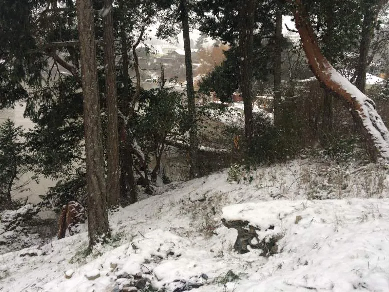
The site was visited on 7 and 26 October, 31 December 2021 and 25 January 2022 by Sara Stallard, BSc, AScT, Dipl.Env.Tech., often meeting with the current owner and contractors (Engineering and Landscaping) for the proposed project. Lehna Malmkvist, MSc, RPBio, of Swell Environmental Consulting Ltd also attended the 26 October 2021 site visit.
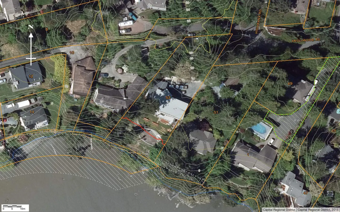
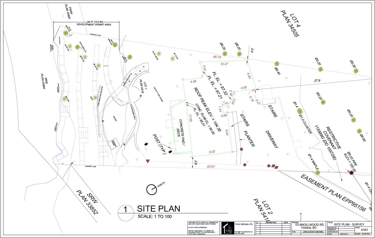
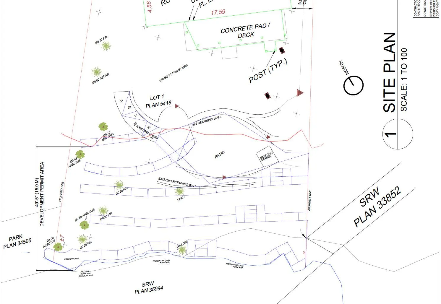
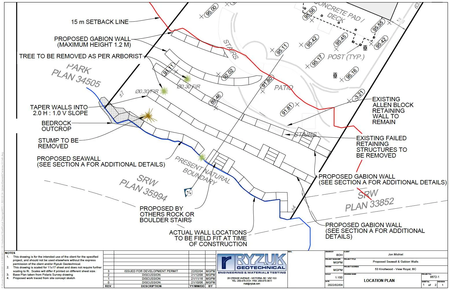
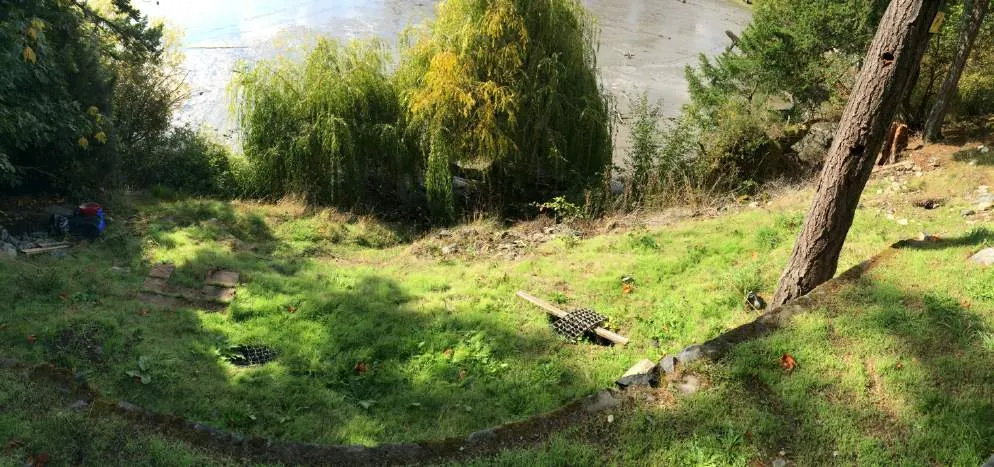
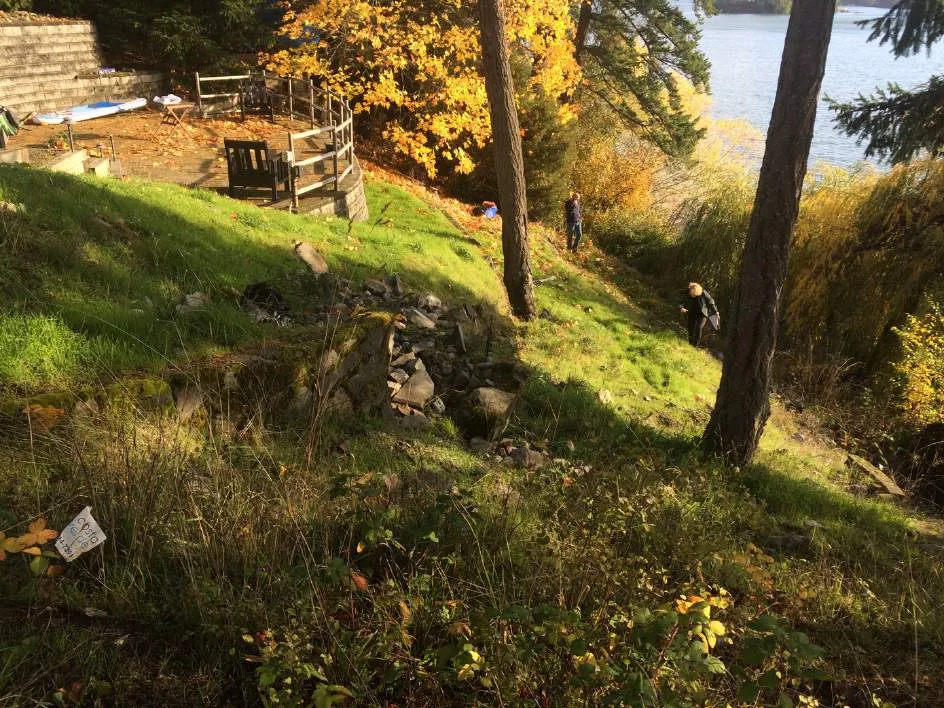
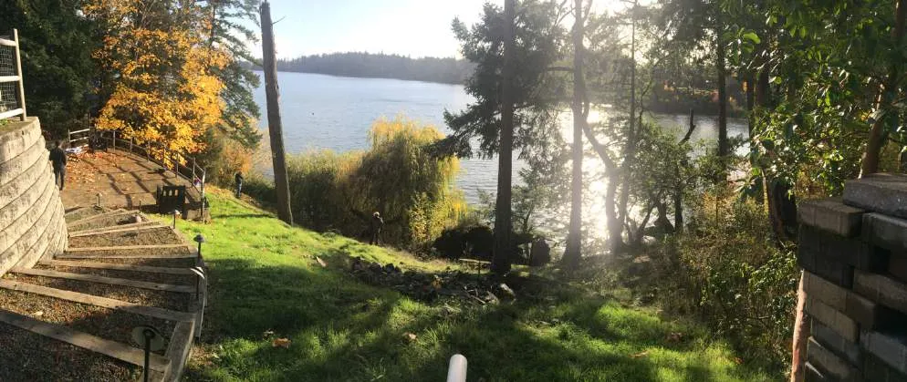
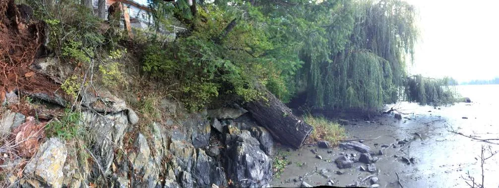
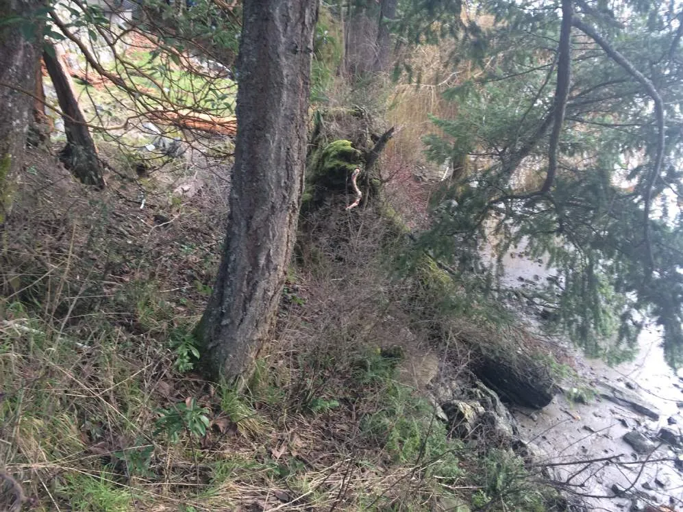
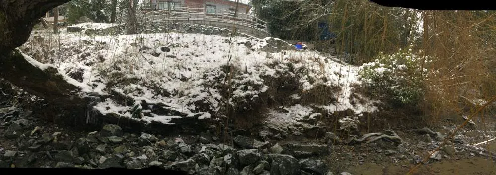
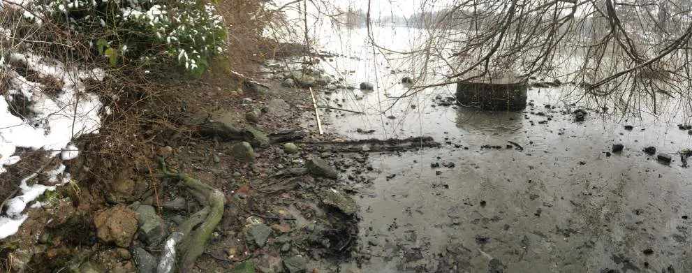
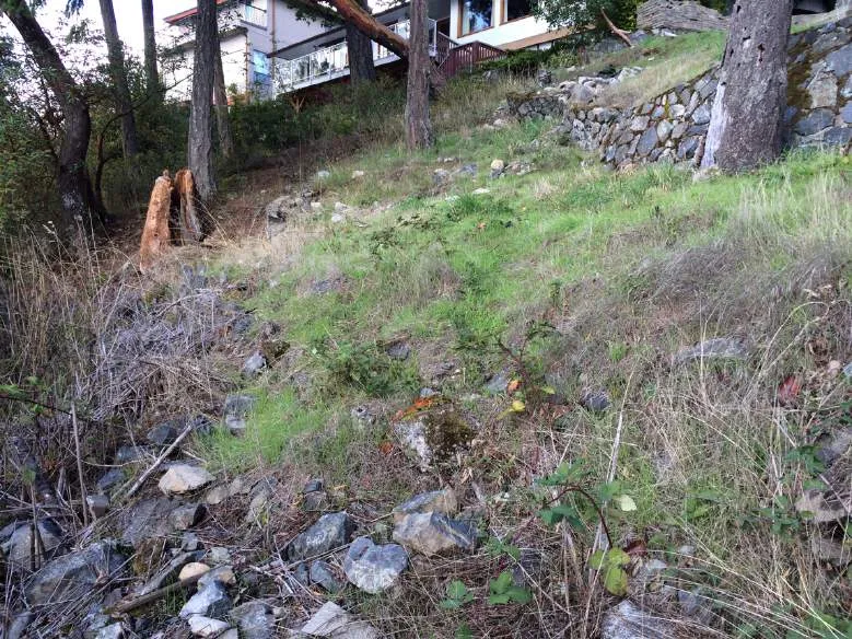
The southwestern 2/3 of this approximately 2060 m² shoreline lot has been modified by residential buildings (house and garage), driveways, patios, landscaping, and retaining walls (Photos 1-16). The steep southwest facing site slopes in a series of newer and older crumbling retaining walls to the shoreline.
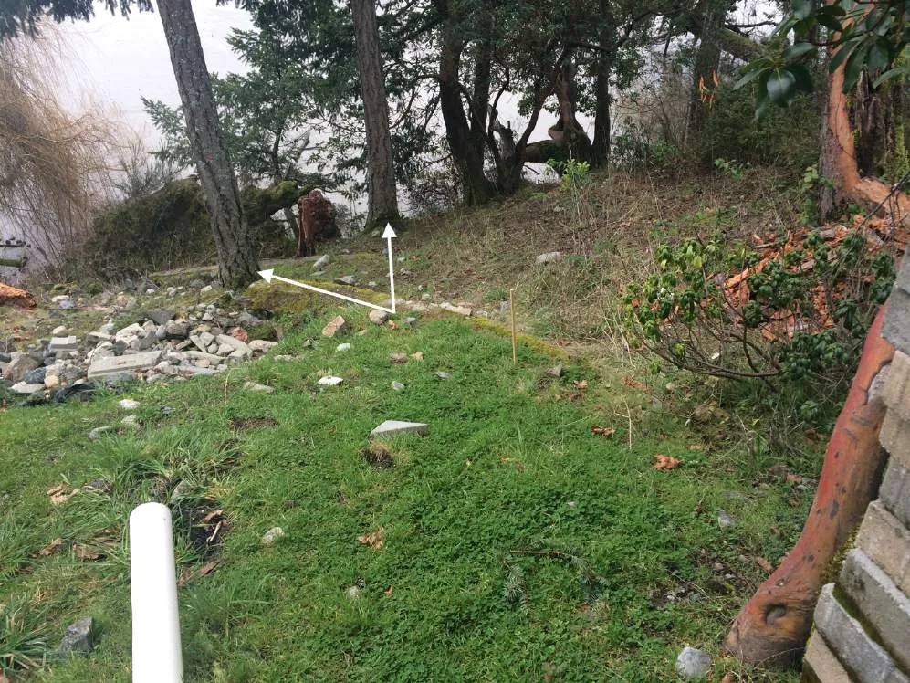
Three mortared rock retaining walls were installed by previous owners prior to a significant slope failure in 1995. The history of this slope failure is summarized in a letter report by Ryzuk in Appendix 2 (dated 16 November 2021). According to Ryzuk, the retaining walls remained mostly vertical during the slope failure, although they were transported downslope approximately 2 m, along with some mature Douglas-fir trees². This full slope failure has never been fully addressed.
In 2014, the upper slope failure was partially ameliorated when a brick patio and newer Allan-block retaining wall was installed by the previous owners in consultation with Ryzuk. This is confirmed by aerial photos between 2013 and 2015 (CRD online Regional Map). Excavations in 2014 found areas of imported fill between the existing patio and Allan block wall (to remain) and the house that may have contributed to the previous (1995) slope instability of the DPA (Ryzuk).
² These mature Douglas-fir trees are the subject of an arborist report from Scotty Tree & Arborist Service dated 7 Jan 2022 in Appendix 3 and are discussed in more detail in the following sections.
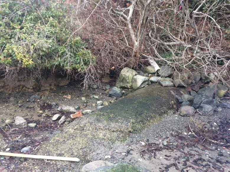
In addition to the imported fill, slope failure may have been exacerbated with leakage from a sewer lateral that extends down the slope near the eastern property line, connecting to a sewer main located on the beach at the toe of the slope (Ryzuk, Photos 9, 13). This sewer main is protected with a legal encumbrance on the shoreline below the Present Natural Boundary (PNB) (Figures 4 & 7a&b).
Perimeter drains are located on both the eastern and western property lines. The eastern pipe discharges at the top of the slope approximately at the DPA boundary, while the western drain is piped all the way to the foreshore and discharges onto a rock pile (Photos 3, 4, 13).
The 15-m Natural Watercourse and Shoreline Areas DPA setback includes approximately 2/3 of the backyard slope,
Document Images
(30)