View Royal Park Master Plan 2020
The full final draft of the View Royal Park Master Plan, detailing context, ecology, site features, and phased implementation.
View Royal Park Master Plan 2020
Liveable, green, sustainable
View Royal Park Master Plan
November 17, 2020
Prepared by: LADR Landscape Architects Inc. Project Managers
In association with: Westbrook Consulting Civil Engineers
SWELL Environmental Consulting Vegetation and Aquatic Ecologists
Prepared for: Town of View Royal Client Representative Lindsay Chase, Dir. Development Services
In association with: John Rosenberg, Dir. Engineering
Table of Contents
1.0 Introduction........................................................................................................................................... 3 1.1 Context................................................................................................................................................ 3 1.2 Objective............................................................................................................................................. 4 1.3 Methodology........................................................................................................................................ 5 1.3.1 Research and Field Reviews...................................................................................................... 5 1.3.2 Client Consultation...................................................................................................................... 5 1.3.3 Public Consultation..................................................................................................................... 6 1.4 Reference Documents........................................................................................................................ 6 2.0 Site History............................................................................................................................................ 6 3.0 Site Analysis.......................................................................................................................................... 8 3.1 Site Ecology........................................................................................................................................ 8 3.2 Soils and Hydrology.......................................................................................................................... 12 4.0 Existing Site Features......................................................................................................................... 13 4.1 Community Gardens, Playground & Structures................................................................................ 13 4.2 Trails, Parking and Signage.............................................................................................................. 13 5.0 Zoning, Bylaws and Development Restrictions............................................................................... 14 5.1 Zoning............................................................................................................................................... 14 5.2 Bylaws............................................................................................................................................... 15 5.3 Development Restrictions................................................................................................................. 15 6.0 Health and Safety................................................................................................................................ 15 7.0 The 2020 Plan...................................................................................................................................... 16 7.1 Design Foundation............................................................................................................................. 16 7.2 Primary Design Concepts................................................................................................................. 18 7.2.1 Parking....................................................................................................................................... 18 7.2.2 Picnic Areas, Off-leash Areas, Seating, & Creek Views.............................................................. 20 7.2.3 Environmental Stewardship....................................................................................................... 23 7.3 Relevant Excerpts from the 2010 Plan............................................................................................. 27 7.3.1 General...................................................................................................................................... 27 7.3.2 On-Site Stormwater Management Play Environment................................................................ 27 7.3.3 Site Lighting............................................................................................................................... 29 7.3.4 Signage...................................................................................................................................... 29 7.3.5 Field Management..................................................................................................................... 29 7.3.6 Services..................................................................................................................................... 29 8.0 Recommended Wetland & Riparian Species................................................................................... 31 9.0 Implementation.................................................................................................................................... 32 9.1 Phasing............................................................................................................................................ 32 9.2 Rough Order of Magnitude............................................................................................................... 39 Key Words.................................................................................................................................................. 40
List of Appendices
Appendix 1: Web-Based Public Survey (as posted)............................................................................. 41 Appendix 2: Web-Based Public Survey Results.................................................................................... 46 Appendix 3: In-person Questionnaire Results...................................................................................... 53 Appendix 4: Notice for Web-Based Public Survey................................................................................ 55 Appendix 5: Schedule Q: Environmental Protection & Natural Hazard Development Permit Areas...... 56
List of Maps
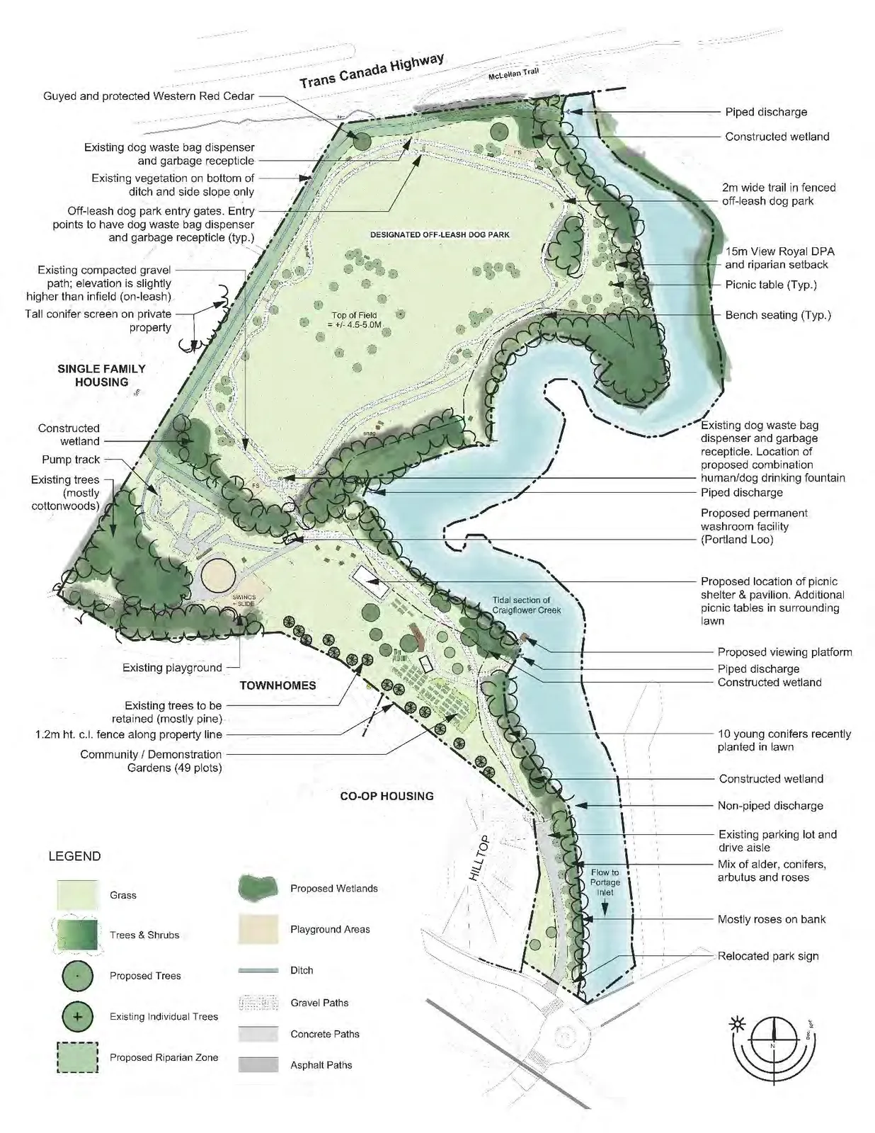
Map 1: Context Plan.................................................................................................................................... 5 Map 2: Existing Conditions...................................................................................................................... 11 Map 3: Aerial Photo 2019.......................................................................................................................... 16 Map 4: The 15 Year Vision Plan................................................................................................................ 19 Map 5: Riparian Vegetation Expansion & Wetlands The 15 Year Vision.............................................. 25
1.0 Introduction
1.1 Context
It has been a decade since the 2010 View Royal Park Master Plan, a 15-year vision plan for View Royal Park, was prepared and unanimously endorsed by Council. The Plan served the Town well and many community prioritized initiatives identified in the Plan have been realized. The 2020 Plan reviews past initiatives and park changes over the last decade, obtains and responds to current priorities and concerns discerned through community engagement, and provides recommendations to holistically enhance the park over the next ten years.
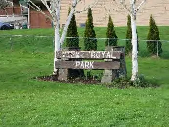
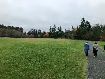
View Royal Park (VRP) is a hybrid Community/Town Park intended to serve residents throughout the municipality. With the introduction of the pump track in August 2019, VRP became a destination park and now serves families across the Capital Regional District. Its signature large open fields, all-weather walking trail and off-leash dog area remain well loved and, even more so than in 2010, many residents feel that no changes are needed.
Located adjacent the estuary at the mouth of Craigflower Creek, the entirety of VRP is a floodplain and designated Agricultural Land Reserve; it is zoned P3, Parks and Recreation. The stretch of creek beside the park is impacted by tides, heavy rain and drought. After a month of record rain during January 2020, the creek flooded and the walking trail’s value as a dike was readily apparent.
The park continues to be most popular with walkers, with or without dogs, who regularly use the loop trail at the north end of the park; this is followed closely by those who use the open field/grass areas, off leash dog area and pump track. The temporary washroom is also very well used, and many believe it to be a permanent fixture. As in 2010, park users continue to appreciate the park’s balanced approach to programmed and non-programmed open space.
The 2017 Town of View Royal Parks Master Plan defines VRP as a Community Park and recommends continuing to implement the View Royal Park Master Plan and to maintain View Royal Park as the primary focal point of the parks system. It is understood that implementation will be based on the current VRP Master Plan.
The 2011 Official Community Plan (OCP) Policy LU 10.2 recognizes View Royal Park as an important community-gathering place and recommends supporting significant improvements and connections to it.
OCP Policy PR4.1 supports the redevelopment of View Royal Park as the primary Town Park and indicates that in addition to providing for a range of recreational activities that will attract a broad section of the community, the park should provide sufficient space and amenities to facilitate large community gatherings such as festivals and group picnics.
The OCP defines a Community Park as being approximately 4 to 6 hectares in size and offering active and passive open space to several neighbourhoods, along with some recreational facilities.
The OCP defines a Town Park as a large park with a variety of recreational facilities that serve the entire municipal population. They also provide passive recreation areas, often with special natural features. View Royal Park is cited as an example of a Town Park.
Demographic
Park user survey results for the 2020 Master Plan, filtered for TOVR, suggest 67% of park users are aged 31-65 with the next largest group being children aged 0-5 at 42%. Survey results indicate seniors aged 65+, represent 32% of park users, essentially the same as children aged 6-10.
Location and General Description of View Royal Park
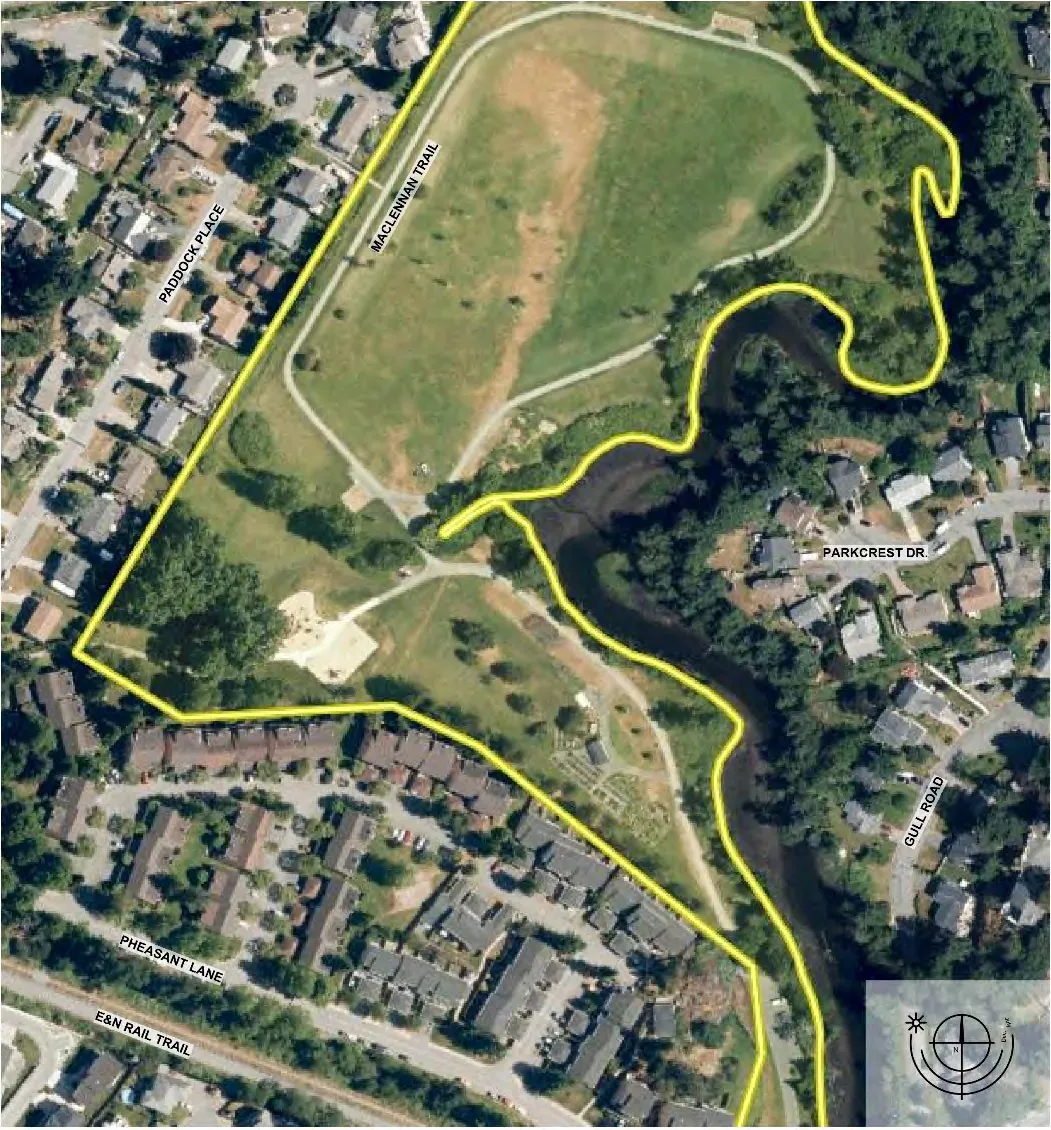
View Royal Park is located between Craigflower Creek, the Trans Canada Highway, and the back gardens of townhomes and a co-op on Pheasant Lane and single-family homes on Paddock Place. The park has four public access points plus two designated access points, one each, from the townhomes and co-op. There are also three informal gated accesses from homes on Paddock Place. The primary access point and the only one with associated parking is off Pheasant Lane near Helmcken Road. The north-west corner of the parking area currently trespasses onto neighbouring co-op land, and the co-op chain link fence currently trespasses onto park land near Pheasant Lane.
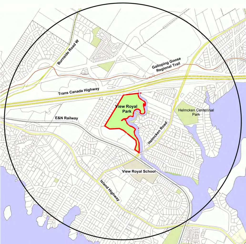
In addition to parking lot access, public access points are located at the western most point of the park off Pheasant Lane, mid-field on the western side of the park off Paddock Place, and at the north end of the park off the MacLellan Trail.
At this time there are approximately 1032 linear metres (0.6 miles) of walking trails and 2.23 hectares (5.5 acres) of off-leash field enclosed by the north trail loop. Total park area is +/-6.2 hectares (+/-15.3 acres), or the equivalent to +/- 59% of the Helmcken neighbourhood in which it is located.
1.2 Objective
The objective of the Plan is to update the 2010 Master Plan to align with evolving community needs and desires for the park space, and to respond to anticipated effects of climate change.
The 2020 Master Plan will provide a comprehensive update for holistic and responsible development in View Royal Park over the next decade.
The updated Plan will be a document which the Town can reference when making future decisions about long range capital projects related to parks within the Town and VRP specifically, as well as when making design and management decisions related to day to day and short term activities within, or impacting on, View Royal Park.
1.3 Methodology
1.3.1 Research and Field Reviews
From November 2, 2019 to mid-January 2020 the project Consultants reviewed and consolidated background information related to View Royal Park and made no less than five site visits to gain information about site conditions and park use, and to ascertain opportunities and constraints. This information was used in conjunction with survey data to update the 2010 Master Plan which was to be presented to the public on March 19, 2020, as part of the public consultation process. Unfortunately, the open house was cancelled on March 16, 2020, due to the Covid-19 pandemic.
1.3.2 Client Consultation
The Consultants worked with the Client representatives (hereafter referred to as the Client) throughout the Park Plan process. The Client provided relevant background documents prepared by or for the Town and assisted in preparing a web-based park user survey. A preliminary draft Master Plan was reviewed with the Client in mid-February. The draft Masterplan including updated (draft) plans and report was presented to View Royal Council by the Director of Development Services on March 3, 2020.
The draft masterplan that was presented at the public open house, and feedback from the open house, was presented to View Royal Council by the Director of Development Services on July 21, 2020. At that time three specific questions were asked of Council:
- Does Council want to commit to making the north field a dog priority park? View Royal currently has no dog parks identified in their Park system.
- Does Council want to make ecological protection of the foreshore a priority in View Royal Park? It is currently accessible to dogs and full of rogue trails.
- How does Council want to address parking concerns?
Client Representatives (the Client)
- Ms. Lindsay Chase, Director of Development Services
In association with
- Mr. John Rosenberg, Director of Engineering
1.3.3 Public Consultation
The public was able to provide input on the new Park Plan through a well advertised online survey, through a questionnaire used by consultants when canvassing families and individuals within the park on three separate occasions, and at a public open house. As well, the Director of Development Services was available by phone and email throughout the entire planning process.
A public open house scheduled for March 19, 2020, in the Council Chambers was cancelled on March 16th due to COVID-19 pandemic concerns. The open house was eventually held from 3-7pm on July 9, 2020, in View Royal Park. It was well attended with a total of 97 people signing in, and Mayor Screech, Councillor Rogers and Councillor Lemon participating on a part time basis.
A sample survey can be found in Appendix 1, a summary of survey results and how they compare with 2010 survey results can be found in Appendix 2, and face-to face questionnaire results can be found in Appendix 3.
1.4 Reference Documents
The following View Royal documents were reviewed in preparation of the View Royal Park Master Plan:
Town of View Royal. 2017 Parks Master Plan Town of View Royal. Official Community Plan, Bylaw No. 811 Town of View Royal. 2010 View Royal Park Master Plan
Additional References Capital Regional District (CRD). Natural Areas Atlas, Harbours Atlas, and 2019 aerial photo CRD. Website: www.crd.bc.ca/education/our-environment/watersheds
2.0 Site History
The park lands were originally inhabited by the Saanich, Songhees and Esquimalt nations, collectively known as the Lәk̓ʷәŋәn (Lekwungen). The Lekwungen called Craigflower Creek Pulkwutsang, “the place of Ghost” or “haunted by Ghosts”. It was later referred to as ‘Deadman’s Creek’ or Deadman’s River (as noted on Pemberton’s 1855 map). The VRP land, all of which is in a floodplain, was settled by Dr. John Helmcken in the 1850’s and leased as two dairy farms. Although no longer farmed, the land remains within the Agricultural Land Reserve (ALR) and represents just under half of the Town’s total ALR inventory.
Significant changes to the site and the adjacent riparian area and creek bed began in the 1960’s when the Electoral Area Director (View Royal was not yet incorporated) arranged for removal of topsoil from the site, the filling of swampy areas, and the creation of a drainage ditch (channel). This continued into the 1970’s when road building and the start of suburban development in the area created additional environmental degradation, ultimately wiping out the salmon run in the creek.
In the 1980’s environmental improvements and restoration began to be addressed. Creek obstructions were removed and the Esquimalt Anglers Association and the Department of Ocean and Fisheries began restocking the creek upstream with coho and chum salmon transplanted from Goldstream Creek. At the same time, successive Electoral Area Directors arranged for bringing in topsoil, seeding, constructing a trail and installing benches on VRP land. Suburban development began in the neighbourhood and by 2011 all lots adjacent VRP had been built on. A mix of multi-unit and single-family housing frames the south and west side of the park, and the Trans Canada Highway, at least 10m above the creek, frames the north.
Park improvements including trail extensions and upgrading, planting throughout the park and along the creek edge, field-regrading and installation of play equipment continued after the Town of View Royal was incorporated as a municipality in December 1988. Most of the riparian vegetation that we see today was planted in the early 1990’s and is not part of a naturally occurring eco-system.
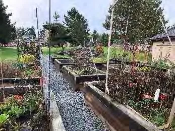
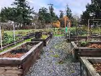
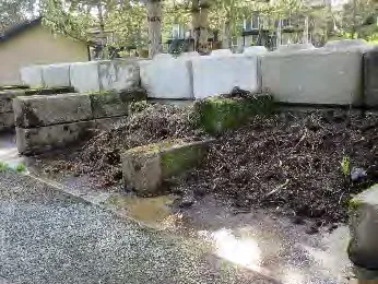
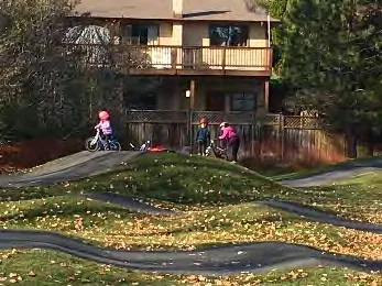
The current 49 plot community garden began with 30 plots and a shed installed by the Town in 2013. The VRP Community Garden Society added 6 plots in 2015, 8 plots and an herb and pollinator garden in 2015, and 5 plots and another pollinator garden in 2018. In 2019 the Town expanded the compost and soil storage area near the shed. Other recent improvements and additions include 2 fitness stations on the loop trail (2015), playground upgrade/expansion and loop trail upgrade (2018), and temporary washroom and pump track installation (2019). The pump track has created the greatest change to park use over the past decade, drawing people from across the CRD and significantly increasing demand for parking.
Little to nothing has been done in recent years to improve or protect the tidal riparian area along the creek adjacent the park. Fortunately, however, the community, environmental groups and various levels of government have worked to restore northern reaches of the creek and the Portage Inlet ecosystem. Today the coho salmon run is self-sustaining and thrives alongside healthy populations of cutthroat and rainbow trout, sculpin, steelhead, brown catfish (formerly called brown bullhead), smallmouth bass and pumpkinseed. The estuary habitat is being restored and its environmental, economic and cultural importance to the broader ecosystem is receiving increased recognition and support.
3.0 Site Analysis
The digital cadastral drawing received from View Royal in November 2009 was used as the base drawing for the 2010 Master Plan. For the 2020 Master Plan, a digital Land Titles drawing supplemented by survey data from Westbrook Consulting forms the base plan; the plans are not an exact match and the 2020 base plan is the more accurate of the two. Note that existing parking lot encroachments onto private land appear on the 2020 plan.
The 2020 existing conditions plan includes all park amenities included in the 2010 Plan, as well as new features: community gardens and shed, temporary washroom, expanded play area, and fitness stations. It also includes an accurate survey of existing trails and parking area, culverts, ditches and some specific trees along with the June 2019 pump track layout, prepared for View Royal by Transitions Bike Parks Inc. Updated environmental information is provided by Swell Environmental Consulting.
Detailed information on the soils, hydrology, condition of underground services, and accurate topography (grades/contours/ watercourses) is limited. Geotechnical, topographical and underground service information must be verified prior to doing any work on site. A comprehensive vegetation survey is also recommended and should be completed during spring or early summer (or both) to allow for documentation of any rare or endangered species and native bulbs and wildflowers that might be present.
3.1 Site Ecology
The site remains much the same as described in 2010. The major changes that have impacted the site ecology are: 1) construction of the pump track (2019) and 2) loop trail upgrades in 2018. These are discussed in Section 3.2 Soils and Hydrology.
The riparian areas for this project are defined as:
- 5m on either side of the man-made drainage channel/ditch that runs along the north, west and south side of the open field area (approximately 2/3+ of the park), discharging into the creek from the culvert that currently separates the on and off-leash areas. This channel receives water from higher lands surrounding it, including half of the park field (the centre of the field is approximately 1m-1.5m higher than the loop trail which, in turn, is higher than the channel). The 5m setback complies with the provincial Riparian Areas Protection Regulation (RAPR).
- 15m from the natural boundary of Craigflower Creek. The 15m setback complies with View Royal’s Environmental Regulations, Land Use Bylaw and Council policy. Note this is a tidal riparian setback; any work proposed for below the high-water mark requires DFO approval.
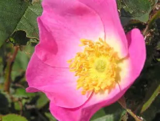
Current vegetation in the tidal riparian zone is a mix of native trees and shrubs - roses are noticeably dense just above the creek’s natural boundary – and ornamental and invasive species, all traversed by numerous rogue trails leading to the creek. Tidal marshes, tidal meadows, shoreline shrubs, and one very small shoreline meadow are located along the water’s edge. Prevalent invasive species in this area include reed canary grass, Himalayan blackberry, English ivy, and Scotch broom; daphne and other less prevalent invasives are also apparent.
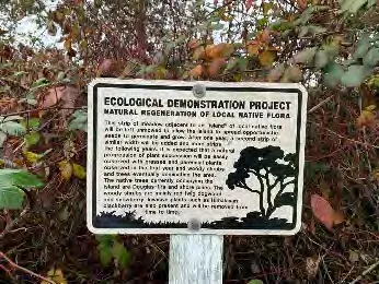
Vegetation elsewhere in the park includes a (new since 2010) square configuration of 12 shade trees in the centre of the open field on the north end of the park, a mature buffer of mixed trees and shrubs (primarily native) in the portion of channel riparian zone immediately east of the pump track, a native cottonwood grove immediately west and south of the pump track, a designated ecological demonstration area in the north-east corner of the park (municipal initiative now over grown with invasive species), and a mix of single firs, and non-native pines and cedars, scattered along the full length of the west edge of the park.
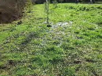
Ten small conifers recently planted between the trail and creek in the tidal riparian zone north of the parking lot appear to be failing and a row of what was 6 ornamental shade trees in irrigated lawn on the east side of the entry drive from Pheasant Lane has been reduced to 4; the two missing trees should be replaced. This groomed space creates a transition between the highly groomed Helmcken Road landscaping and the more naturalized and non-serviced park and presents a groomed presence on Pheasant Lane.
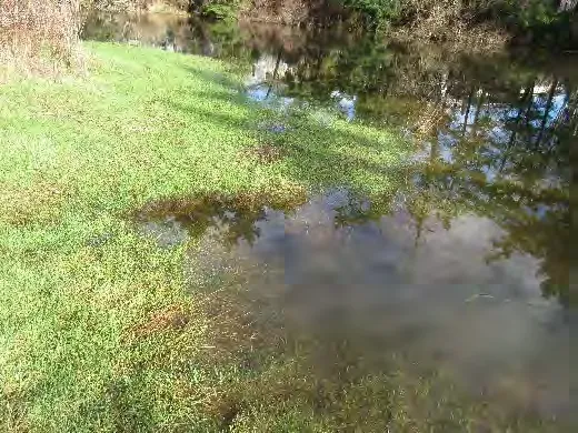
Currently, 11.8 acres or approximately ¾ of the park consists of large areas of mown grass, much of which is wet to very wet from late fall to mid spring. Approximately 5.5 acres of this (nearly half) is a designated off-leash dog area. Trail and field improvements in 2015 created the equivalent of a pedestrian dike path around the dog field, providing pedestrians with a dry trail year round. It is unknown if drainage in the fields and park has improved overall; January 2020 park reviews found numerous areas of wet to very wet and even ponding throughout the park. Most of these saturated areas are recommended for future wetlands.
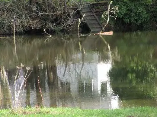
The tidal riparian vegetation and stands of shrubs and trees along the drainage channel at the west end of the park provide habitat and food for birds, small mammals and beneficial insects, however, the unlimited dog access to many of these areas is problematic and negatively impacts riparian and ultimately creek and estuary health.
A comprehensive vegetation survey has not been completed.
Results from the on-line survey and questionnaire indicate park users have an increased interest in protecting/restoring the riparian buffer and expanding naturalized areas throughout the park. A minimum of 75% of View Royal survey respondents cited bird, wildlife and fish habitat as a very important natural feature, and more than 50% cited expanding the urban forest, building resilience to climate change, managing on-site stormwater and removing invasive species as very important components of a sustainability strategy. There was also specific interest in planting large trees for shade and fruit trees for food security.
Park user suggestions for improvement include: removing invasive species (possibly using volunteers), controlling pedestrian and dog access to the water’s edge (fencing and signage), creating a viewing platform, planting large shade trees at various locations within the park, rejuvenating the ditch at the north end of the park (it’s not draining), and planting a vegetative buffer on the slope at the north end of the park near the Trans Canada Highway (this for noise reduction more than anything else).
Given that VRP is in a floodplain with a history of flooding, and anticipated climate change impacts include increasingly intense periods of rain, high tides and sea level rise, Sea Level Rise (SLR) Planning for the park is encouraged.
Status of Environmental Recommendations from 2010 Master Plan:
A comparison between ecological recommendations in the 2010 Master Plan and status indicates no progress towards ecological improvement or stability has been made in View Royal Park over the past decade.
| Recommendation | Status |
|---|---|
| Viewing platforms | No viewing platforms installed |
| Educational signage | Sporadic environmental education signage installed |
| Riparian zone expansion | No riparian plantings completed to widen the riparian zone |
| Tree and shrub pockets | Some trees planted in the central field area, no tree and shrub pockets planted to create habitat |
| Invasive species management | No invasive species management |
| Wetland construction and vegetated swales | No constructed wetlands or vegetated swales installed |
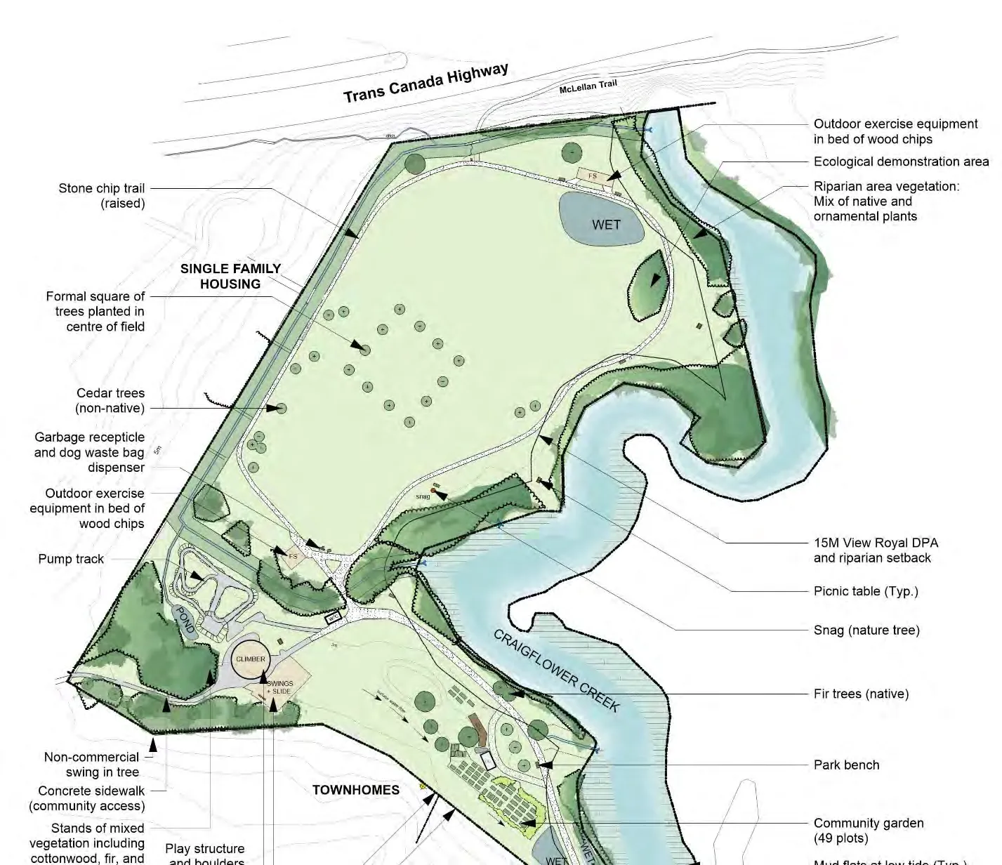
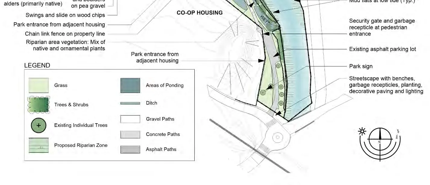
Map 2: Existing Conditions
3.2 Soils and Hydrology
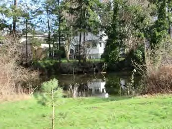
There is no available geotechnical information for this park and information about soils and hydrology is subjective. It is known that in a 1986 OCP when the CRD had jurisdiction over the park land, the park was identified as a ‘natural hazard area’ due to flooding. In the 1997 Craigflower Creek Watershed Assessment, SHIP Environmental Consulting identified the park as a floodplain and noted that it had a history of flooding, especially when precipitation combined with high winter tides and winds from offshore. SHIP also noted that modifications to the creek channel and changes to culverts as part of the Vancouver Island Highway Project (both in the mid 1990’s), altered flooding patterns, but they did not identify the new patterns. Currently, the CRD website notes that Craigflower Creek forms part of the 2,424 hectare Craigflower watershed, and that although much of the watershed remains in its natural state and/or is protected within regional parks, the CRD is concerned about the lower reaches of the creek where there is flooding, creek bank erosion and loss of summer base flows. Erosion along the creek bank in VRP appears limited to areas where there is currently pedestrian and dog access.
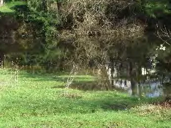
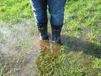
Grass areas within the park are typically wet to very wet for up to 4-5 months per year. During these times fields typically become inaccessible. In the past, portions of the trail became flooded as well. The 2018 improvements to the loop trail, have made the park accessible to walkers year-round; an improvement that was recognized and appreciated in the online survey. It is unknown what impact trail improvements have had on field drainage - site reviews after extended heavy rain in January 2020 found the field wet to very wet with sporadic ponding at the trail edge.
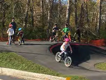
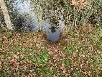
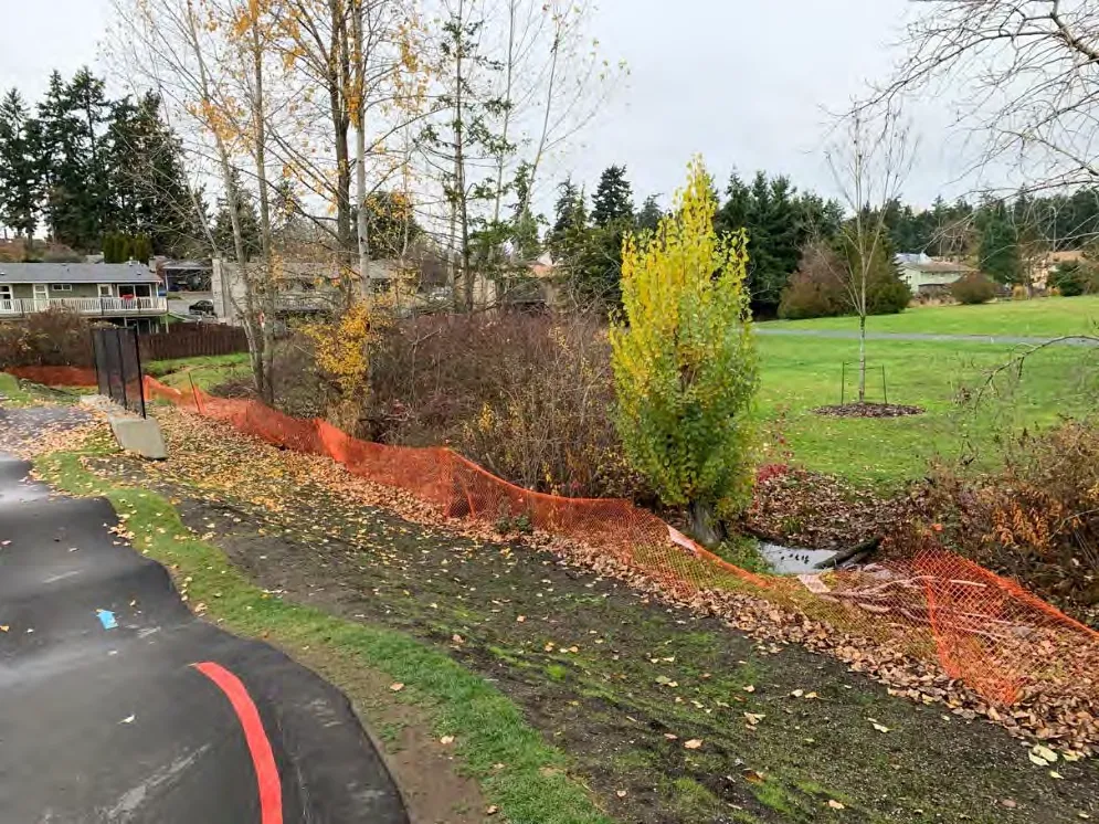
New to the park in August 2019 is the pump track, located immediately west of the drainage channel and east of the cottonwood stand in the west corner of the park. The track blocks surface flow from surrounding lands to the drainage channel, creating a winter pond between the cottonwoods and elevated track. The track also limits infiltration and although drains are incorporated into the track design, there is evidence of surface water creating its own path and causing minor erosion in some areas. The extent of impermeable surface in a previously vegetated area has increased surface flows to the adjacent channel, contributing to its swelling during periods of extended and/or heavy rains; fortunately, the channel appears to have capacity for additional water in this location, at this time. During January 2020 field reviews for this Master Plan, water could be both heard and seen bubbling from the culvert under the footbridge that separates the on and off-leash park areas. As this is the first winter with the pump track, it is unknown how long ponding east of the cottonwoods will last.
There is potential for the water in small pools, ponds and channels/ditches to become stagnant (smelly) and a breeding ground for mosquitoes. Because these pools are not proper wetlands, they have no ecological attributes to support predators of mosquito larvae. The health concern is that mosquitoes may carry and transmit West Nile Virus, a potentially fatal disease. That said, the number of mosquitoes infected with West Nile Virus in British Columbia is very small and, according to the BC Centre for Disease Control, the risk of WNV infection in people in BC is considered low.

As in 2010, there are likely several reasons for flooding: the combination of high precipitation mixed with high tides and offshore winds as noted by SHIP Consulting, high groundwater conditions, non-porous soils, low elevation, sub surface flow, high surface run-off from adjacent higher lands (especially after development), and surface flow impediments (e.g. pump track). Additionally, the effects of climate change – rising sea levels, higher tides and more intense periods of rain - will contribute to increased flooding in years ahead.
Research indicates that the local sea level has been static for 2200 years with some evidence of a tsunami event approximately 1000 years ago. However, it is expected that flooding will increase as the average ocean level rises due to global climate change. The Provincial Government estimates Victoria could experience a range in sea level increases by 2100, from a low of 4-18cm to a high of 89-103cm.
Strategies for mitigating drainage issues in the park are dependant on understanding the underlying causes of the problem and preparing for the anticipated impacts of climate change. Further hydrological investigation is required and should be completed prior to detail design or construction of park improvements. As noted in Section 3.1, VRP is in a floodplain with a history of flooding, and Sea Level Rise (SLR) Planning for the park is encouraged. The ability of the park to serve as a floodplain must be maintained (no obstructions or capacity reduction) and the Flood Construction Level (FLC) confirmed by a suitably qualified Engineer.
4.0 Existing Site Features
4.1 Community Gardens, Playground & Structures
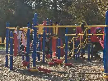
There have been several updates since 2010. A 30-plot community garden with gardener’s shed was introduced in 2013 and expanded in 2015, 2016 and 2018. Today there are 49 plots, shed and designated compost /soil area comprising an area of approximately 10,000 square metres, not including the access path that serves the garden. Fitness stations, one at each end of the loop trail in the off-leash field, were installed in 2015 and the playground was improved in 2018 with new and more challenging components added to the original climbing structure. The older stand-alone swings and slide have been retained for younger children; all play areas and the fitness stations have an engineered bark safety surface. Most significantly, an asphalt pump track that has proven to be very popular and has significantly increased park usage by non-View Royal residents opened in 2019. It has made VRP a destination park for many CRD families. A temporary washroom (port-a-potty) was installed at the same time.
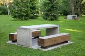
The pump track includes 3 viewing benches, increasing the 2010 bench inventory of wood benches with backs to 11. Other site furniture inventory remains the same: 2 concrete picnic tables, 6 garbage receptacles and 3 dog bag dispensers (in only 2 locations).
4.2 Trails, Parking and Signage
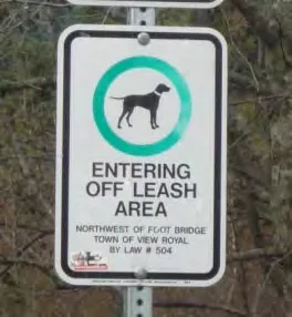
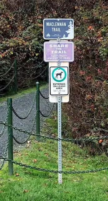
Signage for the park is the same as in 2010. Significant park entry signs are located at the Pheasant Lane entrance, near Helmcken Road (sign is now rotting) and at the Paddock Place entrance near the playground. Simple metal park signs on posts are located at the MacLennan Trail and Peacock Place entrances. Signs describing off-leash areas are located at the gate off Pheasant Lane and at the south side of the pedestrian footbridge. One sign providing information on park hours is located at the north end of the parking lot.
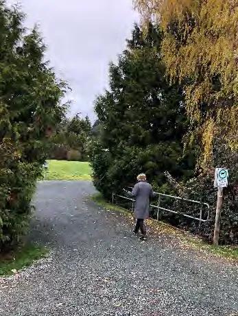
In 2018 the loop trail around the north field was upgraded from a 1.2-1.5m (4’-5’) wide road base granular material trail to a 2m ( 6.5’) wide ‘pathway mix’, trail; pathway mix is also a granular material but finer, and widely used throughout the CRD region including on the Galloping Goose. Trail improvements also including regrading and ensuring the trail lay slightly higher than the inner field, ensuring trail dryness during rainy seasons. The loop trail is approximately 650 metres long. Total length of all trails/paths in the park is approximately 1032 metres); all but a section that connects the play area to the adjacent residential community and the designated entry to the pump track are granular.
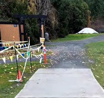
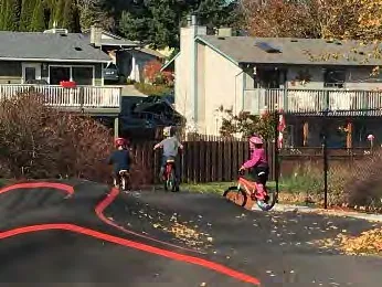
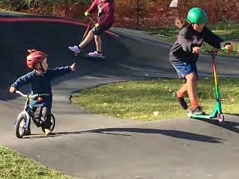
Of special interest is the concrete path connecting the play area to the adjacent residential community - its most eastern stretch is frequently used as a training slope for young children wanting to use the pump track but somewhat unsure of how to brake. From observation during site reviews for this Master Plan, it became evident that the transition from hard surface to granular can be hard to navigate and many cyclists crossing from the concrete path to the granular trail, and from the asphalt pump track entry path to the granular trail, lose control to lesser and greater degrees. The material change in that location is not ideal!
What in 2010 was a gravel parking area and entry drive off Pheasant Lane is now paved with curbs and intermittent wheel stops that allow surface water to flow from the parking surface through to the riparian area. The lot accommodates 13 vehicles and remains within View Royal’s Natural Watercourses and Shoreline Development Permit Area.
Recent survey respondents expressed high demand for expanded and improved parking facilities; this aligns with the pump track popularity and its use by many park users from outside the neighbourhood and municipality.
5.0 Zoning, Bylaws and Development Restrictions
5.1 Zoning
As in 2010, View Royal Park is zoned P-3, Park and Recreational, and is in the Helmcken Neighbourhood (previously called Local Planning Area / OCP 2011). In the Town of View Royal Zoning Bylaw 2014 No. 900, principal uses permitted in this zone are identified as golf course, park, community gardens, open space, indoor and outdoor recreational facilities.
Permitted accessory uses are identified as cafe, office, full-service restaurant and retail store. Accessory uses must not exceed 25% of the floor area of the principal uses on the lot. Note that buildings and structures for storage of parks maintenance equipment and materials are no longer acceptable.
View Royal’s OCP, updated in 2011, cites View Royal Park as a Town Park: a large park with a variety of recreational facilities that serve the entire population of the municipality, and that also provide passive recreation areas, often with special natural features.
OCP Policy PR4.1 supports the redevelopment of View Royal Park as the primary Town Park and indicates that in addition to providing for a range of recreational activities that will attract a broad section of the community, the park should provide sufficient space and amenities to facilitate large community gatherings such as festivals and group picnics.
View Royal’s Natural Watercourses and Shoreline Development Permit Area, a component of View Royal Environmental Regulations, calls for a 15m setback for buildings and structures from the natural boundary (high water mark) of freshwater streams and the shoreline of Esquimalt Harbour, Portage Inlet, and the estuaries of Millstream and Craigflower creeks. Further, the Department of Fisheries and Oceans (DFO) must approve any development below the natural boundary.
5.2 Bylaws
View Royal Animal Control Bylaw 614, consolidated to January 2017, states, among other things, that:
- all dogs when in public must be accompanied by and under the effective control of a competent person by means of a leash except for in off-leash areas provided that the dog is accompanied by and under the control of a competent person.
- The off-leash area in VRP is defined as the full area northwest of the footbridge.
- Dog owners must immediately remove their dog’s excrement from any property they do not own (does not apply to a person with a disability accompanied by a guide animal as defined in the Guide Animal Act).
- The owner of a female dog must not permit their dog while in heat to be in any place where there could be contact with another dog.
- Every dog owner must ensure that a valid dog license tag is always displayed on the dog.
5.3 Development Restrictions
Development within 15m of Craigflower Creek, such as expanded parking or construction of a viewing platform, will require a View Royal Development Permit and, if construction is proposed to extend below the natural boundary (high water mark), approval from the Department of Fisheries and Oceans (DFO) to ensure that creek flow, fish migration and/or existing riparian vegetation will not be impacted. DFO recommends, but does not legislate, a 15m invasive species free vegetated buffer on marine areas and encourages providing controlled access to the water’s edge through creation of strategically placed and elevated viewpoints, and removal of rogue trails.
6.0 Health and Safety
View Royal Park continues to be considered a very safe place by the West Shore RCMP detachment. For both 2018 and 2019 there were only 4 police reports specific to the park. The RCMP advise they are unaware of other concerns in or linked to the park.
Since the pump track opened in August 2019, the Fire Department (First Responders) have been called to help injured cyclists 3 times.
7.0 The 2020 Plan
7.1 Design Foundation
The 2020 Master Plan responds directly to input received from the community through the online survey, in-person questionnaires and public open house, and to clear directives provided by Council on July 21, 2020. The Master Plan focuses on maintaining the current character of View Royal Park, the balance between programmed and non-programmed space, the much-loved walking trail, and a designated off-leash north field. It provides opportunities for increased recreational activities (not organized sport), and for protection of the Craigflower Creek foreshore while addressing anticipated climate change and long-term maintenance, understanding that that TVR has no in-house capacity for park maintenance. As in 2010, there are no recommendations for grand ornamental gardening schemes or for areas of intensive development. The 2020 Master Plan is inspired by the vision of current park users and Council’s ecological prioritizing; it draws attention to existing ecosystems, celebrates diverse community activities, and balances areas of potential vitality with areas of calm.
Recommendations in this Plan are based on directives from Council in response to questions raised at the public open house, and items identified as high priorities or areas of high concern by survey respondents. The recommendations focus on:
A: Directives from Council
- North field to be dog priority area incorporating paths for dogs on and off leash
- Craigflower Creek foreshore to be protected and restored; dog access prohibited
- Increased parking demand to be addressed through negotiation with school; do not add or relocate parking within the park
B: Community priorities
- improved/expanded picnic opportunities and supportive amenities
- tree planting, and protection and restoration of riparian and naturalized vegetation areas (Environmental Stewardship)
- retained large off-leash dog area in north field
Summary of aligned 2010 and 2020 survey responses that are addressed in the 2020 Plan:
- Protecting and restoring riparian and naturalized vegetation areas; recommended as an organizing principle and key component in the 2010 plan it is a high priority in the 2020 plan.
- Proposed new limits to the off-leash area are proposed in both plans.
- Completing vegetation inventories and hydrological and soil studies are recommended in both plans. (the On-Site Drainage/Stormwater Management section is similar in both plans).
- On-leash trails complete with benches, garbage receptacles, distance markers, interpretive signs and drinking fountain are proposed in both plans. (fitness stations have been installed since 2010, albeit not separated from dogs).
- Proposed signage for wayfinding/communication is recommended in both plans.
- Creating picnic and group use opportunities in the park was recommended in 2010; it is now a priority.
- Grass area management recommendations remain the same. The loop trail was raised and upgraded in 2018, a recommendation in the Grass Areas section of the 2010 report.
- Managing vegetation in the park is a high priority in 2020; vegetation management recommendations, and recommended wetland and riparian species remain the same as in 2010.
- Recommendations for service updates are substantially similar in both plans. Water has been provided to the community gardens and a temporary washroom (port-a-potty) was installed in August 2019 and has yet to be removed.
Notable differences between 2010 and 2020 survey responses and proposed action:
- Parking improvement/expansion was of no concern in 2010 but identified in 2020 as a priority. At the 2020 public open house, discussion around how to address expanded parking was contentious and the consultant team, through the Director of Development Services, asked Council to provide direction. As per a July 21, 2020, Council directive, parking will not be expanded on the park property at this time. Staff have been directed to explore the opportunity to use the View Royal Elementary School parking lot outside of school hours, when there is likely to be the highest demand for parking in the park.
- Desire for a permanent washroom was minimally mentioned in 2010 but identified as a priority in 2020; a washroom is included in the plan.
- Additional walking paths continue to be of interest and, as per a July 21, 2020 directive from Council, an off-leash path will be added to the north field. Additional paths are not identified in the Plan but may be introduced at any time if they do not impact riparian zones or drainage or disrupt designated activity spaces.
- Proposed boundaries of a dedicated off-leash area are proposed in the 2020 plan and include most of the north field inside the current perimeter pathway. This is included in the July 21st directive from Council noted above. The proposed boundaries in the 2010 plan were not implemented.
- In the 2020 plan proposed elevated viewing platforms are reduced from 3 to 1.
- The bridge proposed in the 2010 plan has been removed in the 2020 plan.
- There are no playground improvement recommendations in the 2020 plan. Improvements were made in 2018 albeit not as suggested in the 2010 plan.
- There are no community garden recommendations the 2020 plan. Since 2010, 49 garden plots, a shed and a soil/compost area have been constructed.
7.2 Primary Design Concepts
7.2.1 Parking
Today, approximately 30% of park users come by car and parking availability is insufficient to meet their demands; this in turn contributes to non-resident parking concerns along Pheasant Lane and Paddock Place. Additionally, current parking falls within View Royal’s Natural Watercourses and Shoreline Development Permit Area and encroaches onto the western neighbour’s property.
Two schematic layouts for expanded parking were prepared by the consultant team and presented at the public open house where they received a strong negative response from the neighbouring community. As a result, the consultant team, through the Director of Development Services, asked Council to provide parking direction.
On July 21, 2020, Council directed the consultants to delete additional parking from the 2020 Master Plan, and directed staff to explore the opportunity to use the View Royal Elementary School parking lot outside of school hours, when there is likely to be the highest demand for parking in the park.
Map 4: 15 Year Vision

Replacing the granular trail between the playground and pump track with a hard surface was proposed as an ‘add on’ action for completion during the originally proposed and now obsolete parking expansion. Addressing this portion of pedestrian trail is still important and remains in the 2020 Plan. The current transition is poorly located at the base of a slope and hazardous to cyclists, especially the youngest. If a permanent washroom is to be installed, it may be useful to extend the hard surface even further.
7.2.2 Picnic Areas, Off-leash Areas, Seating & Creek Views
Survey respondents were clear in their desire for designated picnic areas and picnic shelter with adjacent or nearby open space for dog free unprogrammed play – frisbee, catch, group games, potato sack races, etc. These requests were frequently linked to requests for more trees, a permanent washroom facility, fenced off-leash areas, additional benches/seating areas, and creek viewing opportunities.
Picnic areas with supportive amenities are a traditional feature of large municipal parks. Given that VRP is intended to be the primary focal point of View Royal’s park system (2017 VR Parks Master Plan), and expected to provide sufficient space and amenities to facilitate large community gatherings such as festivals and group picnics (OCP Policy PR4.1), as well as provide passive recreation areas, often with special natural features (OCP), upgrading for picnics and related activity is fitting and might even be considered past due.
Fenced Off-Leash Dog Area A large fenced off-leash dog area is proposed for the north field. This is an amenity over 30% of View Royal survey respondents asked for. A 1.2m height, vinyl clad chain link fence with four gates, and bag dispensers/garbage receptacles at each gate, defines the edge of the off leash area. A 2m wide loop trail is provided within the off-leash area and the existing loop trail outside the off-leash area is redefined as on-leash. The proposed off-leash area is a significant size - approximately 19,340 square metres. In comparison, a football field is 5351 square metres.
The dog field should be maintained with excellent drainage and dog resistant grass/groundcover. Current grass is holding up reasonably well, but spear grass concerns arise from time to time. Spear grass, which can be harmful to dogs, can be addressed through improved maintenance.
Introducing a fenced off-leash area creates opportunities for on and off leash trails in the north field, removes dogs from riparian areas and mitigates interference with fitness stations (concerns identified in the survey). Moving forward the Town may decide to add a fenced small dog area, secondary off-leash walking trails, and/or a dog agility course; these features are not included in the current proposal.
To encourage and stimulate community use of the non-programmed open space, View Royal should consider participating in to the ‘Live 5-2-1-0’ initiative of BC Children’s Hospital. The initiative is about community partnering to locate industrial metal jobsite boxes wrapped with colourful vinyl graphics and filled with equipment for active play in community parks and has been embraced by at least one municipality in the CRD already. The boxes are secured with combination locks with the access code freely accessible to families through community websites and/or recreation centres. The intention is to provide children and their families with easier access to games and sports equipment to reduce barriers and encourage outdoor active play. Playboxes help to make environments healthier, foster social connectedness, and promote shared community ownership. To learn more, go to www.live5210.ca.
It is recommended that an accessible drinking fountain with dog bowl be installed near the footbridge. This limits the distance of servicing as the community gardens already have water, the proposed picnic shelter should have water and the proposed washroom must have water.
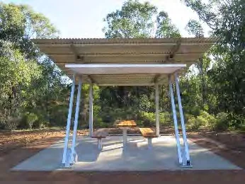
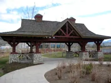
Picnic Shelter Picnic shelters are best located close to parking, play features, open space, and services. In VRP the ideal location is just north of the community gardens, near the pedestrian trail and open but hilly western lawn, and in view of the playground. Additional picnic tables should be placed in the vicinity of the picnic shelter to allow for multiple picnickers at the same time. Garbage receptacles are required in all picnic areas.
It is important that the picnic shelter be serviced, although its installation should not be delayed if servicing is not immediately available. Water supply currently piped to the community gardens should be extended to the shelter, and any future electrical supply should allow for servicing the shelter. The shelter should be designed to accommodate a variety of functions – picnics, receptions, small musical events, birthday parties, etc. As it has the potential to become a significant hub in the park, which is used year-round, its design must be carefully considered.
This bears further consideration: to avoid a sense of visual disorganization and chaos, and to celebrate VRP as the focal point in View Royal’s park system, VRP would benefit from Site Furniture Guidelines that articulate styles, materials, colours, textures, etc. of site amenities. It would provide design/selection direction for benches, picnic shelter, tables, fences, signs, lights, paving, etc.
Establishing site furniture guidelines is a project unto itself and if possible should begin immediately for completion before VRP park development continues. Moving forward without guidelines has the potential to seriously diminish the park’s overall cohesiveness.
Seating / Benches A request for additional benches and seating opportunities recurred throughout the survey - more than half of View Royal respondents (53%) identified additional benches/seating as an important addition to the park and several respondents noted that additional benches, especially under trees, would improve comfort and accessibility options for people with mobility challenges. Benches were also highly rated as a favourite aspect of the park.
In this Plan additional benches are shown around the existing loop trail, and within the fenced off-leash area. Six new benches, including four within the off-leash area, are recommended as a minimum for initial installation. Planting trees for shade adjacent these benches is also recommended. Additional locations to be considered are near the playground and pump track for viewing and social interaction. The VRP site furniture vocabulary as described in ‘Picnic Shelter’ above should guide bench design/selection if possible. If not possible, benches should match those already in the park.
Viewing Platforms Access into the riparian area adjacent Craigflower Creek is to be restricted to one elevated and universally accessible viewing platform or dock located in an open are with minimal riparian vegetation opposite the community gardens. This is supported by the July 21, 2020, Council directive to protect and restore the Craigflower Creek foreshore. Restricting access is fundamental to improving fish, wildlife and bird habitat and the riparian environment.
The Department of Fisheries and Oceans (DFO) encourages the use of raised viewing platforms as a means of limiting or eliminating impacts to existing fish habitats and sensitive marine environments, including riparian and estuary vegetation, tidal meadows and tidal marshes. The platform must be constructed in such a way as to not interfere with creek flow or require removal of existing riparian vegetation. Approval from the DFO is required prior to construction of a viewing platform if it involves construction below the high-water mark (which it likely will). Approval from View Royal will also be required, as the platform falls within a View Royal DPA area.
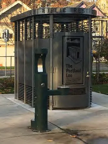
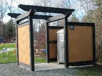
Washroom After planting more trees, installation of a permanent washroom in the park is rated as the most desired amenity by View Royal residents and it is the most desired amenity by park users from outside the municipality. The port-a-potty installed in 2019 has been used by approximately 50% of survey respondents and has proven so popular that the contract for its November 2019 removal has been cancelled.
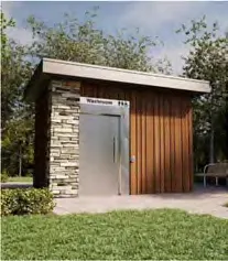
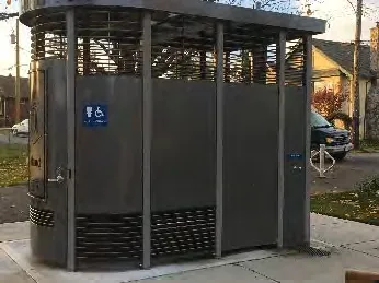
Installation of a permanent washroom, specifically, a Portland Loo or similar, in the same location as the port-a-potty, is recommended. Both the City of Victoria and the Township of Esquimalt have installed the ‘Portland Loo’ and highly recommend it as an attractive, durable, easy to maintain and reasonably inexpensive solution to public washroom demands. The Loos were specifically designed to prevent problems that are commonly experienced with public toilets and include one universally accessible stall, graffiti- proof wall panels and open louver grating on top and bottom. The louver grating creates an interior environment that offers complete visual privacy while remaining connected with the outside. The louvers are angled in such a way that doesn’t compromise privacy but lets light out and allows law enforcement (& others) the ability to observe the number of users inside.
The Portland Loo comes as a complete unit and includes a secure mechanical/janitorial closet and exterior handwashing station. It requires minimal utilities and can operate on solar or low-level volt power. Rick Daykin, Esquimalt Manager of Parks and Facilities, advised that the Portland Loo in Esquimalt’s Cenotaph Park cost approximately $150,000 to install, including delivery, taxes etc. The Loos in Esquimalt are designed to lock and open automatically on a timer. They are hosed down once a week; the only hands-on cleaning is the toilet. Graffiti wipes off easily. For more information see: www.portlandloo.com
7.2.3 Protection & Restoration of Riparian & Naturalized Areas + Planting Trees (Environmental Stewardship)
Given the community support as evidenced in recent survey responses, this would be a strategic time for View Royal to showcase VRP as an example of how Best Management Practices can be used to protect and restore sensitive ecosystems and meet the Guidelines for the Natural Watercourse and Shoreline Development Permit Area. Forty-five% of View Royal survey respondents identified planting trees as the most important feature to address over the next ten years. This is the highest support shown for any amenity/activity category and was followed closely by the desire for care of riparian and naturalized areas. Respondents even suggested they would participate in a ‘Friends of ‘or similar volunteer group to help with invasive species removal. While riparian and naturalization management (Environmental Stewardship) was an important consideration in the 2010 Plan, it did not receive the significant park user support and attention it is receiving today.
The recommendation from 2010 to expand the riparian zone and provide rainwater management facilities (constructed wetlands and vegetated swales), is becoming an even more urgent environmental protection measure, to provide ecological adaptive capabilities to manage the landscape for climate change. As we see increased sea level rise (including in tidal areas), and increased precipitation, the water level in the tidal area of Craigflower Creek is likely to have an increased influence on the riparian vegetation, and vegetation that is less salt and inundation tolerant (e.g. shoreline trees and shrubs), may start to exhibit signs of poor health and mortality. Widening the native riparian zone now, will give space for a vegetation community transition to occur, and still provide habitat for birds, wildlife, and fish for example:
- salt marshes may expand
- tree and shrub line may move landward from the existing edge
Planting native riparian vegetation in a wider zone along the creek now, will give time for the vegetation community further from the creek to mature and provide the future riparian habitat, if the existing vegetation along the banks changes from the tree and shrub habitat to a salt marsh habitat, over the long term.
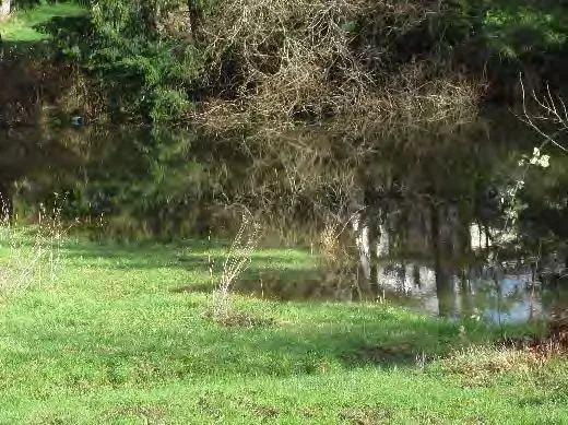
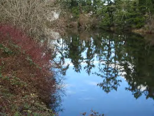
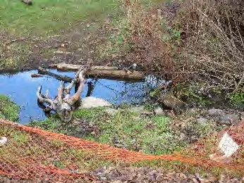
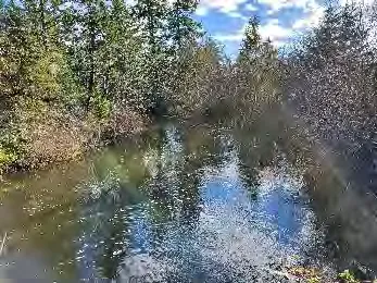
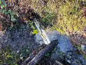
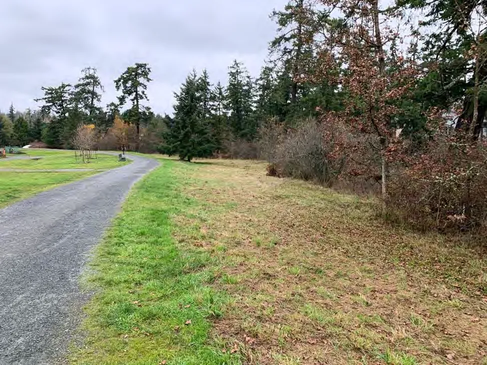
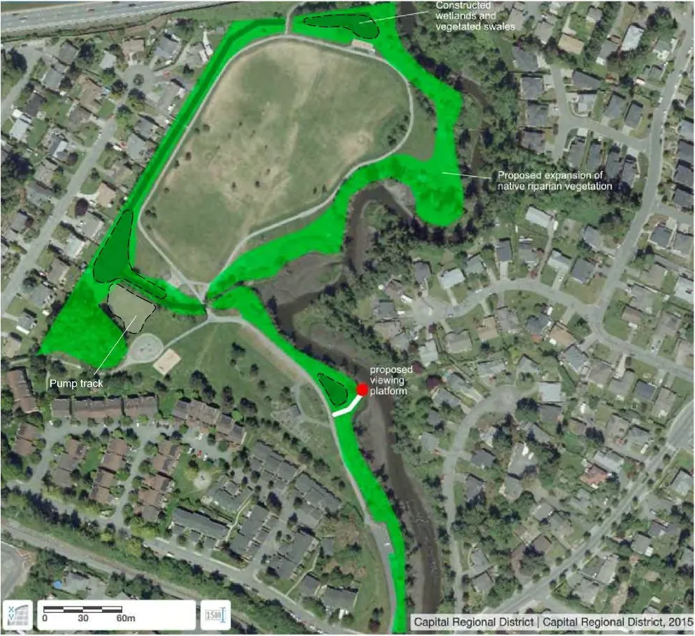
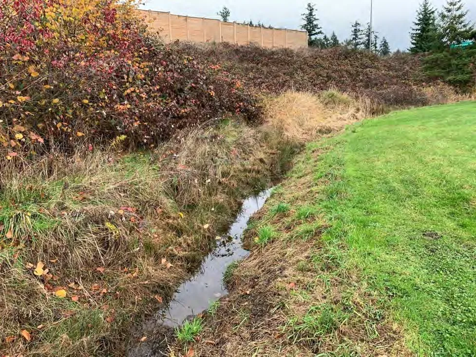
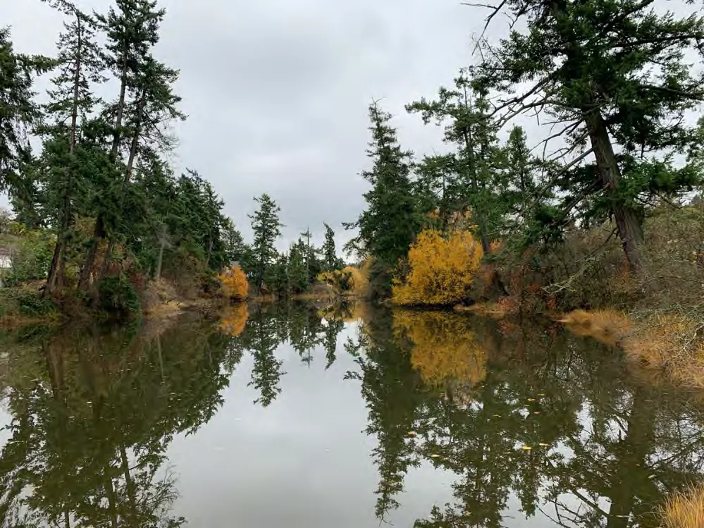
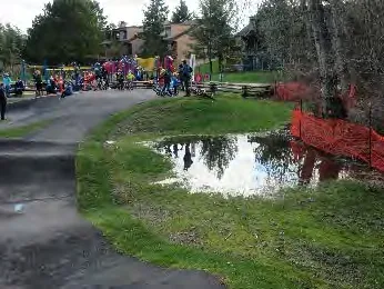
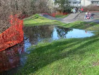
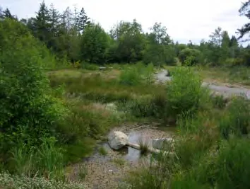
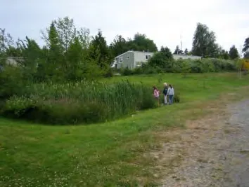
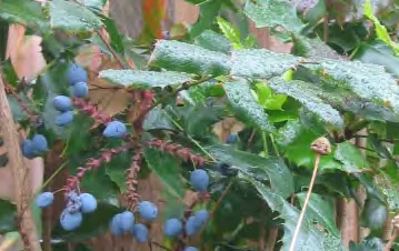
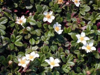
It is recommended that the existing riparian vegetation be expanded to create a 15m wide tidal riparian zone adjacent Craigflower Creek and a 5m wide freshwater riparian zone on either side of the drainage channel north of the play area and along the west and north edge of the park. These dedicated riparian zones comprise the bulk of the proposed Environmental Stewardship Area (ESA) that was proposed in 2010. New vegetated swales (transformed existing grass ditches), 3 proposed wetland eco-systems and the existing cottonwood grove make up the remainder of the ESA. Wetland ecosystems should be constructed in both the north and south halves of the park, and near the south-west corner of the loop trail. See Map 5 and Photos 1-3.
The areas proposed for riparian zone expansion, constructed wetlands, vegetated swale will not reduce the existing or proposed recreational activities or other uses within the park.
Existing trees and non-invasive shrubs (both native and ornamental) currently growing within the riparian fringe should be retained and all invasive species should be removed and replaced with native species.
Non-native trees within the proposed riparian setbacks but not within the existing fringe of vegetation, i.e. non-native single trees in lawn, should be removed or, if healthy and young enough, transplanted to areas outside the ESA but within the park. All new plantings within the ESA should be native and suited to the park’s site conditions. There are no known red or blue-listed plant species within the park at this time.
The expanded riparian zone of Craigflower Creek, constructed wetlands, and vegetated swales will improve water quality, provide habitat and corridors for birds and wildlife, and improve conditions for fish in Craigflower Creek, while providing educational opportunities and an improved natural environment for park users.
See Section 8 Wetland Complex of the 2020 View Royal Park Plan for specific wetland and riparian plant recommendations.
Additional Trees and Plantings Existing conifers randomly located throughout the park, many in marginal health, should be replaced, or interplanted with a view to removal, over a period of 10 years with a mix of groupings of native or adaptive trees, and with single trees strategically located to become signature shade trees in years ahead. Existing clusters of healthy conifers should be retained.
Trees should also be planted to buffer the pump track, acoustically and visually, from adjacent single-family homes, and to provide shade for picnickers, for children on the playground, for those enjoying the loop trail and for dogs in the off-leash areas. Trees planted in the off-leash fields should not impede the ability to throw a ball across or run in a large open space; similarly, new trees in the flexible open use field should not impede with opportunities for play (e.g. frisbee) or group activities. Increasingly hotter summers are anticipated and it is critical to plant for shade now. ‘Naturescape’ principles should be applied. (see The Stewardship Series: Naturescape British Columbia - Caring for Wildlife Habitat at Home).
Map 5: Riparian Vegetation Expansion with 3 Proposed Wetlands
7.3 Relevant Excerpts from the 2010 Master Plan
7.3.1 General
There are some recommendations in the 2010 plan that did not surface as high priorities for most park users in the current survey data, but remain relevant for three reasons:
- they remain low to medium priorities for many
- they remain high priorities for few (this is especially true for amenities relating to disabilities)
- they respond to climate change
The recommendations are included here, edited as appropriate, for the 2020 Plan.
7.3.2 On-Site Drainage/Stormwater Management
On-site stormwater management remains an environmental priority, especially in this time of climate change, and is integral to Environmental Stewardship. See Section 7.2.3.
A detailed grading plan and on-site stormwater management strategy, including establishment of the 5m riparian areas and constructed wetlands, should be prepared prior to further work on site. The strategy should be informed by hydrological and soil studies and include guidelines to ensure that implementation of the Master Plan does not at any time negatively impact water flow through the park. Should recreational installations (such as the pump track), structures (such as the washroom) or trails cause damming or creation of small stagnant pools, appropriate measures must be taken to ensure water keeps flowing.
Addressing drainage/stormwater management as soon as possible is important for several reasons:
- it is sequentially logical in terms of construction phasing
- it responds to existing problematic drainage issues
- it is environmentally responsible,
- it minimizes park maintenance
- it is forward thinking.
Recommended components of the on-site stormwater management plan include:
- Plant predominantly native and adaptive trees and shrubs, which are well suited to the local climate and, consequently, require less care to survive.
- Increase Absorbent Landscape
- Minimize lawn and permeable surfaces.
- Bio-retention is an important stormwater management tool. All vegetation, but tree crowns especially, intercept anywhere between 15% and 27% of precipitation that falls on them. Trees and shrubs also detain rainfall, which in turn reduces surface flow volumes and mitigates erosion at outfalls and along the creek edge.
- When new lawns are prepared (except for the off-leash field) cultivate a minimum 8% organic material into the sod or seed bed to improve infiltration rates and increase the soil’s rainfall storage capacity. When new planting beds are being prepared, cultivate a minimum 15% organic material into the planting bed for the same reasons.
- The GVRD Stormwater Source Control Design Guidelines 2005 state that a minimum depth of 300mm growing medium for lawns is required to store 60mm of rainfall.
- Create constructed wetlands
- Construct three wetland ecosystems in the park. See Section 7.2.3. The wetlands and vegetated swales will improve the park by:
- filtering and slowing storm runoff before discharging into the creek
- increasing opportunities to interact with nature
- improving habitat for birds, small mammals, and amphibians
- reducing maintenance by deleting grass from self-sustaining wetland ecosystems
- mitigating drainage issues. Note that the wetland’s value as stormwater management tool will be dependent on the existing water table being lower than the bottom of the wetland
- The wetland design should include physical attributes to create habitat diversity including:
- Elevation variation (terracing) in the wetland excavation
- Variety of water depths (a portion to be 1.5m deep)
- Low gradient slopes (minimum 4:1)
- Habitat complexity (including large wood and rocks)
- If size allows, islands to provide inaccessible refugia
- Construct three wetland ecosystems in the park. See Section 7.2.3. The wetlands and vegetated swales will improve the park by:
See Section 8. Wetland Complex for specific wetland plant recommendations.
7.3.3 Site Lighting
Twenty-seven percent of 2020 View Royal park users identified lighting as the most important amenity needed in the park and 40% identified it as an important amenity to add at this time. Additionally, 5% of those that responded to the survey question regarding park issues and problems identified lack of lighting as a real concern; a similar number suggested pathway lighting could improve mobility.
Installation of low-level vandal resistant lighting should be considered for the southern half of the park and at major trail intersections throughout the park; lighting must be dark sky compliant and not disturb neighbours. Star gazing opportunities in the northern half of the park should be protected. The use of solar powered and/or LED lights is recommended.
The Portland Loo (see Section 7.2.2) includes both exterior low-level lighting and interior task lighting.
7.3.4 Signage
Approximately 35% of 2020 View Royal survey respondents identified signage as an important feature to add to the park There were a variety of suggestions for where &/or why it is needed: wayfinding, site history, and rules around use. Sign design should comply with the site furniture design guidelines discussed in Section 7.2.2.

7.3.5 Field Management
As per the 2010 Plan, continue to maintain grassy areas north of the pedestrian footbridge as Level 4 “Open Space/Play” areas as outlined in the Canadian Landscape Standard. Grassy areas south of the pedestrian footbridge should be maintained as Level 3 “Moderate” areas as outlined in Canadian Landscape Standard.
The Canadian Landscape Standard states that in Level 4 areas “a high standard of maintenance is neither anticipated nor required – the main objective is to maintain an orderly appearance, well adapted to play and heavy traffic”, and that in Level 3 areas “a moderate standard of maintenance is anticipated – the main objective is to maintain a generally neat and moderately groomed appearance, with some tolerance for the effects of ‘wear and tear’ “.
Understanding that there are no sure-fire dog resistant grasses, the off-leash fields could be seeded/overseeded with a low maintenance mix of white or Dutch clover (Trifolium repens), Kentucky bluegrass and perennial ryegrasses, as needed. This seed mix has proven to withstand a broad range of dog activity more than the standard seed mixes used in the Greater Victoria area.
7.3.6 Services
There are currently no services in the park (excepting water stub-out & hose to community gardens) and the lack of power and water is extremely limiting for a park of this stature.
Site services should be provided as follows:
- power and water should be provided to the proposed picnic shelter
- a people/pet drinking fountain should be installed just north of the pedestrian bridge
- water for irrigation purposes should be provided to the southern portion of the park
- irrigation should be provided to grassy areas that are to be maintained as Level 3 ‘Moderate’
- potable water is not required for irrigation
- a water source (hose bib) should be provided near the play environment for health reasons and maintenance purposes.
- a permanent washroom should be installed where the current temporary port-a-potty is.
- electrical supply for low level lighting should be provided to locations identified on a VR approved lighting plan unless solar power is used
8.0 Recommended Vegetation for Wetlands & Riparian Areas
Trees
- Acer circinatum (Vine Maple)
- Acer glabrum (Douglas Maple)
- Acer macrophyllum (Bigleaf Maple)
- Alnus rubra (Red Alder)
- Crataegus douglasii (Black Hawthorn)
- Malus fusca (Pyrus fusca) (Pacific Crab Apple)
- Prunus emerginata (Bitter Cherry)
- Pseudotsuga menziesii (Douglas Fir)
- Quercus garryana (Garry Oak)
- Thuja plicata (Western Red Cedar)

Tall Shrubs
- Amelanchier alnifolia (Saskatoon)
- Cornus stolonifera (Red-osier dogwood)
- Crataegus douglasii (Black Hawthorn)
- Holodiscus discolor (Oceanspray)
- Lonicera involucrata (Black Twinberry)
- Oemleria cerasiformis (Indian plum)
- Physocarpus capitus (Pacific Ninebark)
- Philadelphus lewisii 'Gordianus' (Mock Orange - Coastal)
- Rhamnus purshiana (Cascara)
- Rubus parviflourus (Thimbleberry)
- Rubus spectablis (Salmonberry)
- Salix hookeriana (Hooker's Willow)
- Salix lucida (lasiandra) (Pacific Willow)
- Salix scouleriana (Scouler's Willow)
- Salix sitchensis (Sitka Willow)
- Sambucus racemosa (Red Elderberry)
- Sorbus sitchensis (Sitka Mountain Ash)
Medium and Small Shrubs
- Spirea douglasii (Hardhack)
- Mahonia nervosa (Dull Oregon Grape)
- Ribes sanguineum (Red Flowering Currant)
- Rosa gymnocarpa (Baldhip Rose)
- Rosa nutkana (Nootka Rose)
- Rosa pisocarpa (Clustered Wild Rose)
- Symphoricarpos albus (Common Snowberry)
- Vaccinium membranaceum (Black Huckleberry)
Ferns
- Athyrium felix-femina (Lady Fern)
- Blechnum spicant (Deer Fern)
- Polystichum munitum (Sword Fern)
- Pteridium aquilinum (Bracken Fern)
Aquatics
- Alisma plantago-aquatica (Water-plantain)
- Carex mertensii (Merten's Sedge)
- Carex lyngbei (Lyngbei’s Sedge)
- Carex obnupta (Slough Sedge)
- Carex rostrata (Beaked Sedge)
- Carex sitchensis (Sitka Sedge)
- Carex stipata (Sawbeak Sedge)
- Eleocharis palustris (Common Spike-Rush)
- Iris missouriensis (Western Blue Flag)
- Juncus effusus (Common Rush)
- Juncus ensifolius (Dagger-leaf Rush)
- Menyanthes trifoliata (Bog or Buck Bean)
- Oenanthe samentosa (Pacific Water-parsley)
- Polygonum amphibium (Water Smartweed)
- Sagittaria latifolia (Wapato, Arrowhead)
- Scirpus acutus (Hard-stemmed Bulrush)
- Scirpus microcarpus (Small-flowered Bulrush)
- Typha latolia (Cattail)
Groundcover
- Arctostphylos uva-ursi (Kinnickinick)
- Fragaria chiloensis (Coastal Strawberry)
9.0 Implementation
9.1 Phasing
The 2020 VRP Master Plan vision does not propose significant development in the park but does, as in 2010, represent a considerable financial outlay and will need to be approached in phases. It is important that the park remain accessible during construction, and that work be carefully planned and scheduled to minimize damage to the environment and protected elements.
As in 2010, a geotechnical investigation is recommended to provide insight into grading and drainage patterns and issues, and how they might be mitigated. The pump track clearly disrupted pre-track drainage patterns, and it could be seen during heavy January 2020 rains that some culverts and directed flows were working well, and others weren’t working at all. The recommended geotechnical investigation would assist with determining the underlying causes of poor drainage and provide key information for use in a long-term on-site stormwater/flood management plan. The geotechnical (hydrology and soils) investigation and report would take approximately three weeks and the stormwater/flood management plan, prepared by a civil engineer, would take approximately another three weeks. The stormwater management plan will play an important role in land management of View Royal Park, especially in view of anticipated changes due to climate change in this region.
Once the stormwater management plan is prepared, development of, or work within, areas that do not require re-grading can be completed in any order whatsoever and as funds allow. Development in such areas must not impact drainage unless problems arising are resolved as part of the design. Areas that require regrading should be realized sequentially to avoid having to remove new development after installation.
Phase 1 (1-5 years and as budgets allow):
In terms of physical park development: Phase 1, items 2 and 3 (washroom and fenced off-leash dog field) have the highest priority, however, item 4 (picnic shelter) is significant. Items 2 addresses human comfort and could be considered a health issue. Items 1 and 5 relate to environmental stewardship and include both short- and long-term strategies, environmental health, and climate change adaptation. Item 5 relies on item 3 (fenced off-leash dog area) having been addressed.
- Complete the geotechnical investigation and topographical survey and prepare a stormwater/flood management plan that recognizes the goals of the 2020 Master Plan. The stormwater/flood management plan will be an important technical reference for short and long-term park development and land management. The advantage of completing this work as soon as possible is that it will inform further development, ensuring new development is well located and that stormwater management and environmental stewardship strategies are not compromised.
- Install a permanent washroom. With significantly increased park use in recent years, this is a critical and high priority amenity. See Section 7.2.2 Washroom. The temporary washroom in the park is appreciated but not suitable for permanent use.
- The’ Portland Loo’ is a self-contained washroom that both the District of Esquimalt and City of Victoria have experience with and recommend. The two municipalities describe the Loo as an attractive, durable, easy to maintain and relatively inexpensive solution to public washroom demands. They can operate on solar or low-level volt power and have a change table option.
- The Loos in Esquimalt are designed to lock and open automatically on a timer. They are hosed down once a week; the only hands-on cleaning is the toilet. Graffiti wipes off easily. For more information on the Portland Loo see: www.portlandloo.com
- An alternate to consider is the Canadian manufactured single stall Urben Blu Self Cleaning Restroom. There are several designs to choose from; all are vandal resistant, self cleaning and automated, and have a change table option. Urben Blu restrooms have been installed across Canada as far west as Alberta, but to date none have been installed in BC. For more information on the Urben Blu Restroom see www.urbenblu.com
- Note that VRP survey respondents asked that a change table be included.
- Extend the concrete sidewalk eastward, from between the play areas, to the main trail at the time the washroom is installed.
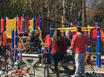
- Create a fenced off-leash dog area with internal 2m wide loop trail in the north field. This is a priority for 2019 survey respondents and residents who participated in the public open house, and a directive from Council. Creating the fenced off-leash area will mean the existing loop trail will become on-leash, fitness stations will be dog free, and riparian areas will be protected from dog trespass. It also provides riparian protection; without this, meaningful improvements in riparian areas would be limited. This one action addresses several survey respondents’ concerns, and while it can be undertaken at any time, it provides significant benefit to the park and park users. Completing it as soon as possible is recommended. See Section 7.2.2 Fenced Off-Leash Dog Area.
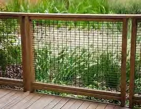
- There is sufficient space to create both an off-leash area for all dogs, and a separate off-leash area for small dogs, however, it would be financially astute to initially create one large combined area that can be divided to accommodate small dogs or an agility course as demand arises. Fencing should be a minimum of 1200mm height; vinyl coated chain link or mesh in a wood frame would be the most aesthetically pleasing. It will be important to provide seating and shade trees (duly protected from the dogs) within the fenced area so owners can sit, and both dogs and owners can find shade in the hottest weather. A dog bag dispensary and garbage receptacle are to be provided at each of the four dog park gates.
- In the long-term plan, a drinking fountain with dog bowl should be considered for installation along the existing loop trail near the south end of off-leash area. This water source would serve everybody in the north half of the park – walkers/joggers and picnickers of all ages, as well as dogs.
- Create a designated picnic area with a fully serviced picnic shelter immediately north /north-west of the community gardens. See Section 7.2.2 Picnic Shelter. Survey respondents clearly indicated they want a picnic shelter and designated picnic space area near the playground. A picnic shelter would be an amenity for all park users, a recognizable reference point or hub, a place to socialize and/or picnic with friends and family, a place to rest and a place to take refuge from rain/hail and hot sun. Providing shelter/refuge and a washroom is known to encourage some people, especially seniors, to have a more active lifestyle.
- Since VRP is the Town Park, the shelter could also serve as a stage and a place to host events from, and servicing (lighting, water, power) should allow for that. OCP Policy PR4.1 indicates that in addition to providing for a range of recreational activities that will attract a broad section of the community, VRP should provide sufficient space and amenities to facilitate large community gatherings such as festivals and group picnics.
- In addition to the shelter, 5-6 picnic tables and a minimum of 2 garbage receptacles should be located nearby in an array that does not impede unprogrammed recreational use of the open grass lawn to the west of the shelter. Proximity to the washroom should be considered (i.e. not immediately adjacent). Ideally, the picnic shelter and picnic tables will be installed after the stormwater management plan has been prepared. The picnic tables can be installed in advance of the shelter if the budget does not allow for the shelter and tables to be installed at the same time. To reduce maintenance concerns the picnic tables should be located on concrete pads. An accessible drinking fountain with dog bowl should be installed along the trail near the picnic tables as part of the picnic area (the drinking fountain is also noted in item 3 above).
- At any time during the process of installing the picnic tables or picnic shelter install a ‘Live 5-2-1-0 Playbox’ near the installed/anticipated shelter location to promote shared community ownership and foster social connectedness. Visit www.live5210.ca for more information.
- Prior to purchasing picnic tables and a park shelter it would be prudent to establish site furniture guidelines that intentionally address placemaking and the public realm in View Royal, and that provide clear direction for VRP given it is the Town Park and of special importance in View Royal’s hierarchy of parks and open space. Signature furniture is recommended.
- Address environmental stewardship and climate adaptation. See Section 7.2.3 Protection & Restoration of Riparian & Naturalized Areas + Planting Trees (Environmental Stewardship). Starting immediately and continuing as budget allows, plant young 7cm-8cm calliper long-lived shade trees where they will be needed and appreciated at maturity (an understanding of the anticipated future use of the park is required). Young trees take years to become large canopy shade trees and appropriate tree selection and planting location is critical to their longevity. Select trees that will adapt to our anticipated drier summers and stormy winters, that will contribute to habitat and biodiversity, and that support the municipality’s vision for VRP. Protect new trees from dogs, rabbits, lawn mowers and weed eaters, and any other animals or activities that may impede their healthy growth. Plant in staggered groups of 3 or more wherever possible to support a naturalized aesthetic. Note that trees cut down and disposed of have no effective carbon sequestration value. Grants for shade trees may be available.
- Priority areas for planting shade trees are near benches and picnic tables, near the play area and if possible within the pump track, and in the fenced off-leash dog area. Do not plant shade trees where they will conflict with riparian or proposed wetland areas, where they will conflict with activities in open grass lawns in the north or south halves of the park, or where they will cast shade on or otherwise interfere with the community gardens.
- In addition to planting trees for shade (which will simultaneously help with stormwater management and habitat), survey respondents indicated significant interest in and support for riparian and naturalization management (Environmental Stewardship). This included support for creation of a ‘Friends of’ volunteer group that could participate in stewardship activities. The first 2 steps noted below could be undertaken at minimal cost if a Friends of View Royal Park or similar group were engaged. Informational signage around stewardship and adaptation efforts should be installed at the start of such activities to educate park users and hopefully garner support as well. i. The first step in VRP stewardship is to identify, and stake or fence (or otherwise demarcate) the riparian and sensitive ecosystem areas (SEA’s): a 15m wide tidal riparian zone adjacent Craigflower Creek; a 5m wide freshwater riparian zone on either side of the drainage channel north of the play area and east of the pump track and adjacent new vegetated swales (transformed existing grass ditches); 3 proposed wetland eco-systems; and the existing cottonwood grove with, potentially, a fourth wetland on its east edge adjacent the pump track. Distances are measured from high tide (aka the natural boundary) or from top of bank in non-tidal areas. Allow for installation of one viewing platform east of the community gardens and where indicated on the Vision Plan. Access to the creek edge should be maintained at this location until such time as the viewing platform is constructed (not in Phase 1). ii. Step 2 is to remove all invasive species and any failing or diseased native species from within riparian and SEA’s; healthy ornamental trees surrounded by shrubs, and healthy ornamental shrubs to be retained. Non-native trees that are surrounded by lawn within the designated riparian and sensitive ecosystem area should be removed, transplanted if possible. Leave grass lawn in place until new native riparian species are available to plant. As the tidal creek rises with climate change, existing native species riparian plants that are less salt and inundation tolerant may exhibit stress - these plants could be transplanted further upland in the riparian area, if in healthy condition and easily moved with intact root systems. Areas that are cleared but not immediately planted should be well mulched (a minimum depth of 100mm of leaf mulch should be applied to unplanted areas annually). iii. Step 3 can be undertaken as funds allow, in areas where steps 1 and 2 are complete. Step 3 comprises removing all grass lawn from riparian and sensitive ecosystem areas where riparian/SEA planting is to occur (do not remove grass from areas that will be planted later). Prepare the beds and plant appropriate species in vegetation gaps throughout the riparian areas and SEA’s; plants to be selected from Section 8 Recommended Vegetation for Wetlands & Riparian Areas. New planting should be completed in the fall to take advantage of winter rains for establishment. An environmental consultant with local riparian experience should be engaged to inform and oversee this portion of work. Aside from consultant fees, and plant and possibly soil/mulch purchase, this work could be completed at minimal to no cost by volunteers.
Step 3 will repeat as steps 1 and 2 are completed in riparian and sensitive ecosystem areas throughout the park. Each time step 3 is completed, the newly planted areas will require maintenance; this, too, could be undertaken by volunteers.
The three steps noted above are the easiest and least expensive of the environmental stewardship recommendations and can be started at any time, preferably sooner than later. Ideally, the proposed wetland areas will be constructed at the same time as the riparian and SEA’s are improved, however, the wetland areas should be incorporated into a greater stormwater/flood management plan, and should be designed and detailed by consultants with constructed wetland knowledge and, preferably, experience. Plants are to be selected from Section 8 Recommended Vegetation for Wetlands & Riparian Areas. This step emphasises the need for preparation of a stormwater/flood management plan as soon as possible. In addition to stormwater management, the wetlands will contribute to the local ecosystem, expand beneficial habitat, and provide refuge for local and migrating birds – a much needed sanctuary given the ongoing depletion of wetlands and mudflats along the Pacific Flyway.
Phase 2 (6-10 years and as budgets allow):
Phase 2 items have lower priority than Phase 1 items and, ideally, should be addressed when Phase 1 items have been completed. It is understood that actions in Phase 1 item 5 will continue throughout Phase 2.
- If not already established, create site furniture guidelines that intentionally address placemaking and the public realm in View Royal, and that provide clear direction for VRP. As the Town Park, VRP has special importance in View Royal’s hierarchy of parks and open space (it is their ‘City’ park).
- Plant a mix of conifers and deciduous trees to create a vegetative screen between the pump track and adjacent neighbours to the north. This can be completed at any time, including in Phase 1; it was not included in Phase 1 as it is not, understandably, a priority for park users. Given the impact of the pump track, however, it is recommended as both a design element (for both parties) and a visual buffer for the residents. It will provide a minimal sound barrier but could have a positive psychological influence.
- More than 50% of View Royal survey respondents identified a need for more benches. Additional seating opportunities have been partially addressed in Phase 1 through introduction of a picnic shelter and additional picnic tables. Assuming VRP site furniture guidelines are now established, add benches, that meet the guidelines, in the following priority locations, and as indicated in the Vision Plan.
- 2 benches adjacent the existing loop trail: one just beyond the pedestrian bridge facing into the field and one along the long straight stretch on the west.
- If not already installed, 3-4 benches within the fenced off-leash area.
- 2 benches near parking (for pick up/drop off).
- 1 bench near the washroom (for waiting)
- 1-2 benches near the pump track but on the playground side for viewing and social interaction.
- Benches for viewing at each wetland
- Replace site furniture that does not comply with the VRP site furniture guidelines.
- Design, acquire approvals for, and construct a viewing platform east of the community gardens and where indicated on the Vision Plan. Approvals from DFO and the Town of View Royal will be required prior to construction of a viewing platform on Craigflower Creek. This work will require, at a minimum, the services of a Civil Engineer and qualified Environmental consultant.
- Prepare a Park Management Plan. This could be completed at any time, including in Phase 1, and updated as park amenities are added, and improvements completed. The Management Plan should include, but not be limited to, invasive species removal strategies (see GOERT for recommendations) and maintenance strategies for different grass and vegetation areas throughout the park.
It is recommended that grass areas west of the trail in the south half of the park be maintained as Level 3 “Moderate” areas as outlined in the Canadian Landscape Standard. Level 3 ‘Moderate’ areas require a moderate amount of maintenance – the main objective is to maintain a generally neat and moderately groomed appearance with some tolerance for the effects of ‘wear and tear’. It is recommended that all other grass areas within VRP be maintained as Level 4 “Open Space/Play” areas as outlined in the Canadian Landscape Standard. In Level 4 areas a high standard of maintenance is neither anticipated nor required – the main objective is to maintain an orderly appearance, well adapted to play and heavy traffic.
Phase 3 (10-15 years and as budgets allow):
It is understood that actions in Phase 1 item 5 will continue throughout Phase 3.
- Add wayfinding and historic information signs to the park. These should meet the VRP site furniture guidelines and be located close to pedestrian walkways where the greatest number of park users can be expected to see them.
- Review pathway desire lines within the park and consider creating secondary trails in ‘desire’ locations if they do not impede use of open grass areas. All new trails to meet materials and construction Specifications of recent loop trail upgrade (pathway mix, etc.; they may be narrower).
- Consider installation of an accessible drinking fountain with dog bowl along the loop trail, near the off-leash area, if not already installed.
- Review lighting requirements with respect to accessibility and safety, remembering that lighting should not impact the neighbours or create light pollution; keep the northern half of the park dark sky compliant. If lighting is deemed necessary, create a lighting plan and have appropriate vandal proof and site furniture guidelines compliant fixtures installed. The services of a Landscape Architect and a Civil &/or Electrical Engineer will be required.
- Review and update the play environment as appropriate; install additional benches as per demand.
- Complete installation of any recommendations or services that are included in the Vision Plan but not addressed in Phases 1 or 2.
9.2 Rough Order of Magnitude
View Royal Park Order of Magnitude Phases 1 and 2
Prepared by LADR Landscape Architects on April 16, 2020; Based on 2020 Dollars
| Item | QTY | UNITS | PRICE | EXTENSION |
|---|---|---|---|---|
| A. Consultant Services | $41,440.00 | |||
| Hydrologic Assessment (by Ryzuk Geotechnical) | 1 | ea. | $2,000.00 | $2,000.00 |
| (detailed assessment/modelling add $6000) | ||||
| Grading Design/Stormwater Mgmt. Report (by Westbrook) | 1 | ea. | $20,800.00 | $20,800.00 |
| Riparian Planting Guidance (by Swell) | 1 | ea. | $880.00 | $880.00 |
| Wetland Design and Construction Monitoring (by Swell) | 4 | ea. | $4,000.00 | $16,000.00 |
| Environmental Approvals & Monitoring Viewing Platform (by Swell) | 1 | ea. | $1,760.00 | $1,760.00 |
| B. Soft Landscape | $255,000.00 | |||
| New Plantings in Craigflower Tidal Riparian Area | $35,000.00 | |||
| New Plantings in Channel Riparian Areas | $35,000.00 | |||
| New trees throughout park (60 @ 5-7cm cal) | $25,000.00 | |||
| Wetland/Pond Excavation (Allowance for 4 @ $55/m3) | $90,000.00 | |||
| New Plantings for Wetlands/Ponds | $60,000.00 | |||
| Convert Ditches to Swales (earthwork) | $10,000.00 | |||
| C. Hard Landscape | $10,000.00 | |||
| Concrete pads for Picnic Shelter & Site Furniture | $10,000.00 | |||
| D. Site Furniture and Structures - Supplied and Installed | $357,880.80 | |||
| Picnic Shelter for 8 picnic tables (supply only) | $56,000.00 | |||
| Picnic Tables (non-custom contemporary design) | 12 | ea. | $3,600.00 | $43,200.00 |
| Benches (non-custom contemporary design. min 6) | 6 | ea. | $2,200.00 | $13,200.00 |
| Garbage Receptacle (to match bench style) | 4 | ea. | $1,500.00 | $6,000.00 |
| Bike Rack - Allowance | $2,000.00 | |||
| Portland Loo (washroom) - based on cost to Esquimalt | 1 | $150,000.00 | ||
| Viewing Platform (timber/concrete, 4mx4m, wood handrail) | 1 | $30,000.00 | ||
| Dog Fencing (1.2m ht.) | 518 | lin. m. | $65.60 | $33,980.80 |
| Drinking Fountain with Dog Bowl | 1 | ea. | $5,500.00 | $5,500.00 |
| Water/Electrical Service - Allowance | $18,000.00 | |||
| E. Signage | $8,000.00 | |||
| Educational/Wayfinding/New Entry Sign | $8,000.00 | |||
| F. Grading | $30,000.00 | |||
| Positive Drainage & Stormwater Mgmt Strategy Support | $30,000.00 | |||
| G. Invasive Species Removal | $10,000.00 | |||
| Organized Volunteer Effort Support | $10,000.00 | |||
| Total Landscape Estimate Phases 1 and 2 | $712,320.80 |
10. Key Words
Best Management Practice (BMP): A procedure for organizations, businesses and industries that promotes sustainable operations and minimizes environmental impact.
Canadian Landscape Standard: A document prepared jointly by the Canadian Society of Landscape Architects (CSLA) and the Canadian Nursery Landscape Association (CNLA). It sets guidelines and makes recommendations for all major aspects of the landscape industry across Canada.
Constructed Wetland: A shallow pond planted with uniquely adapted wetland plants. Used to slow surface flows and remove pollutants from stormwater before reaching receiving waters.
Estuary: A semi-enclosed coastal body of water that has a free connection with the open sea, and within which sea water is diluted with fresh water derived from land drainage.
Floodplain: The low-lying lands adjacent to a stream or river that are naturally subjected to flooding.
Playground: An area designed specifically to promote and support play, including Traditional, Non-traditional, and Adventure styles.
Rain Garden: A depressed garden area designed to receive and infiltrate stormwater from a surrounding area.
Riparian: The interface area between land and a natural water course, typically the bank of a creek or stream.
Rough Order of Magnitude: An approximate cost estimate made without detailed design information, produced from current average unit rates.
Vegetated Swale: A broad shallow vegetated channel designed to convey water from one place to another.
Appendix 2: Results of 2020 Web-Based Survey & Comparison to 2010 Web-Based Survey
Key 2020 Survey Responses that Differ Significantly from 2010 Responses:
- Percentage of VR residents that walk to the park decreased from 80% to 53%; those coming by car more than tripled from 0.5% to 30%.
- Pre-schooler park use has increased from 9% to 19%.
- % of respondents who oppose any park changes increased from 28% to 51%.
- Demand for more picnicking opportunities and a picnic shelter has increased from 10% to 22%; for more benches and seating from 7% to 24%.
- Desire for a permanent washroom increased from 7% to 35%.
- Interest in tree planting has significantly increased from 5% to 45%; it is currently the highest ranked recommendation for park improvement.
- Interest in a designated & fenced off-leash dog area has increased from 0-5% to 31%.
- Pump track is as popular as the off-leash park and second in popularity to the walking paths.